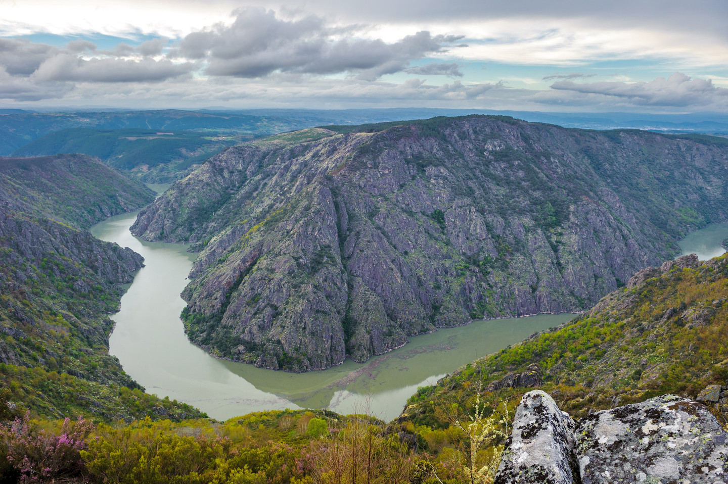
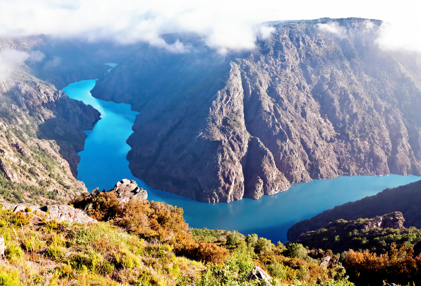
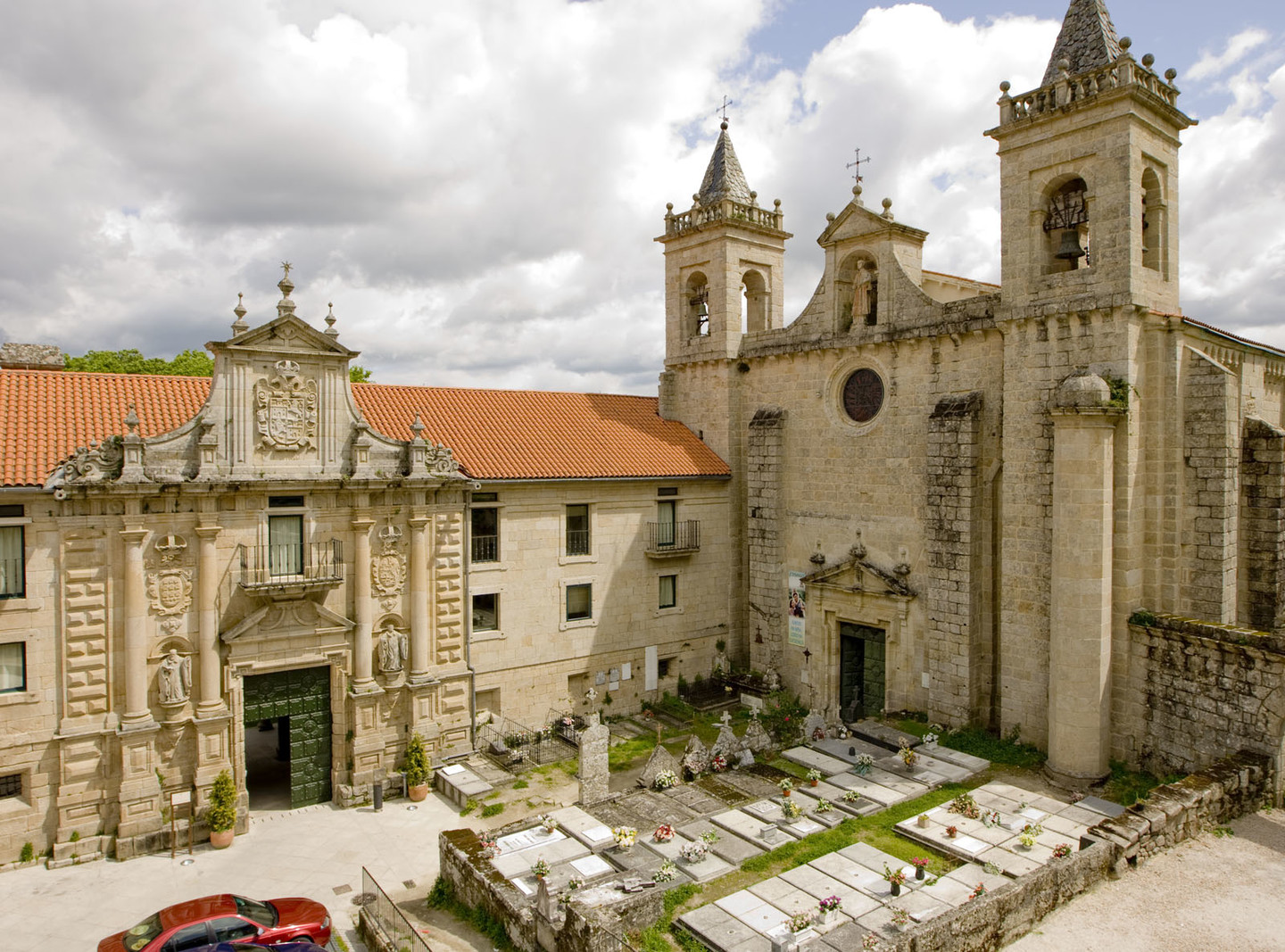
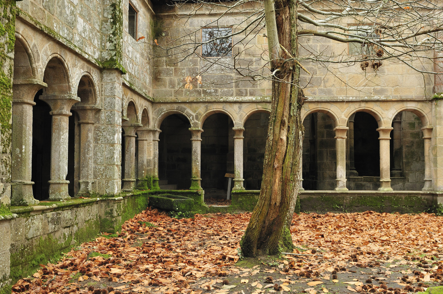
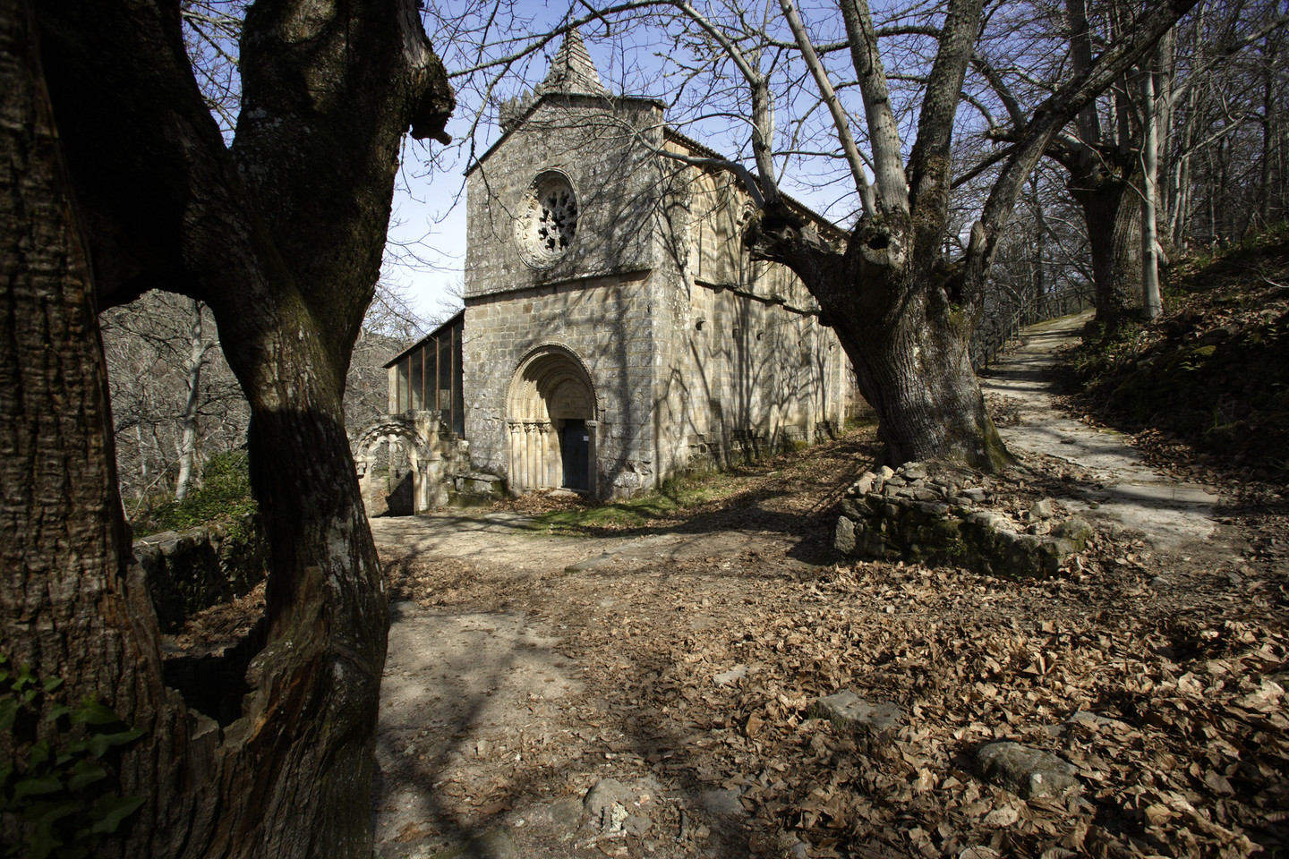
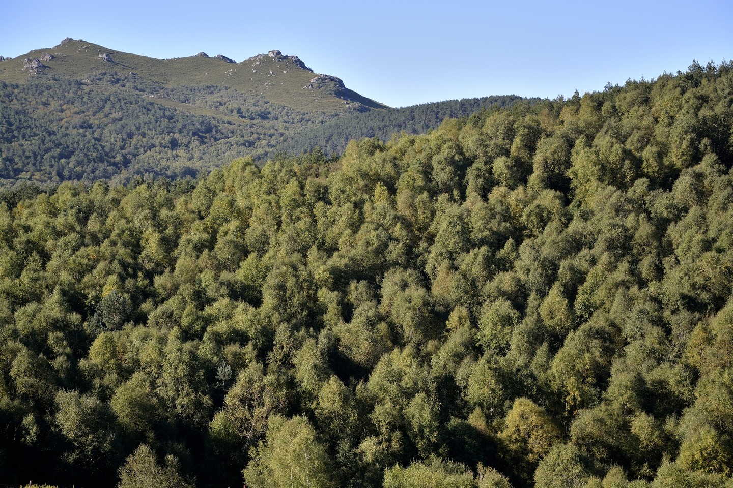
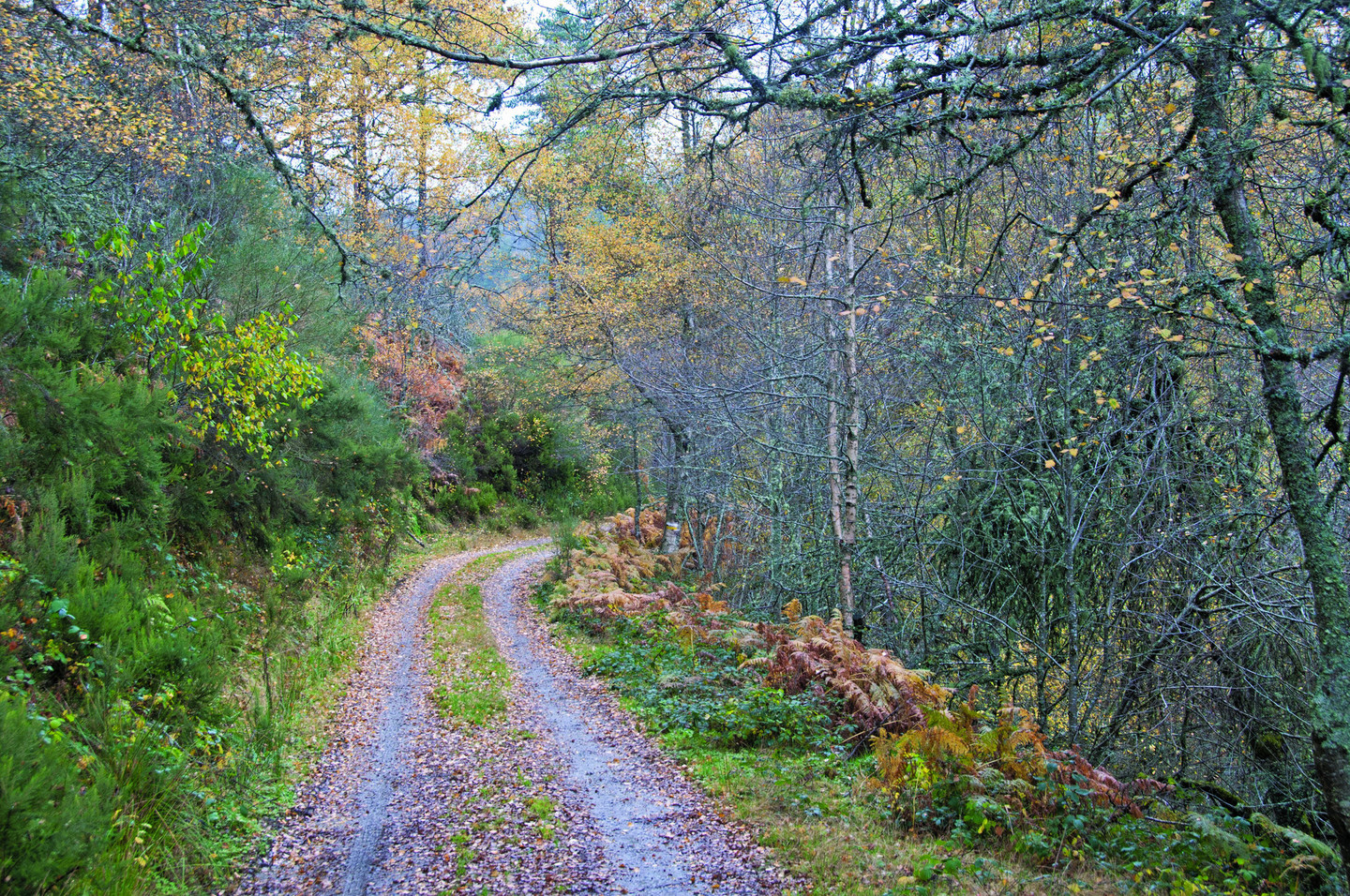
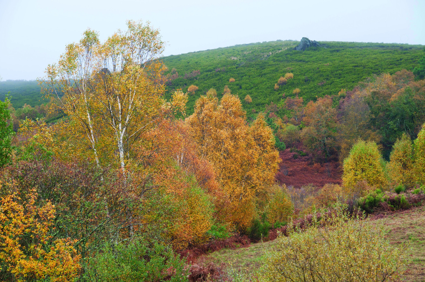
It is easy to see why hundreds of monks and hermits chose the woods of the Ribeira Sacra to erect their monasteries: the solitude, the calm, the silence… Nature, green and ochre, vineyards, peaceful waters…

It seems the ideal place to get away from the hustle and bustle of the world, to relax, find yourself and be at one with nature. The monks knew about this area and now we invite you to discover it too.

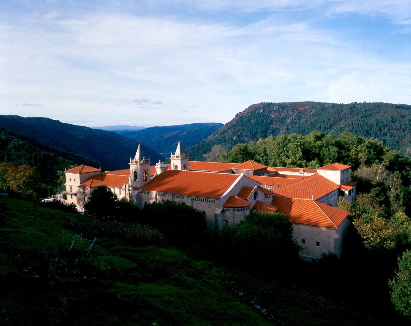
To this end, we propose three walking routes that will allow you to enjoy the natural and cultural heritage of the Ribeira Sacra in three of its most highly prized woods: the bosque benedictino de Santa Cristina de Ribas de Sil (Parada de Sil), bosque de Santo Estevo de Ribas de Sil (Nogueira de Ramuín) and Bidueiral de Montederramo (Montederramo), which is home to one of the best preserved birch groves in Galicia.

The woods of the Ribeira Sacra will lead you to follow the canyon of the River Sil along its final kilometres before it runs into the longest river in Galicia, the Miño. It will surprise you with its landscape of terraces dedicated to viticulture – remember that you are in the land of the Ribeira Sacra, a wine boasting Designation of Origen!

And you’ll discover that in this area oak and chestnut trees live alongside cork oak and strawberry trees, both of which are very unusual here in Galicia. One last piece of advice! If you come to the Ribeira Sacra region to visit these woods, don’t forget to discover its Patrimonio Oculto, or Hidden Heritage by means of the experience “Ribeira Sacra: entre viñedos y monasterios” (Ribeira Sacra: Among Vineyards and Monasteries”).

The praying woods

Sto. Estevo de Ribas de Sil

The River Sil cuts through a deep valley sheltered by riverbank woodlands in which Mediterranean vegetation lives alongside the natural progeny of the Galician fragas (mixed woodland). Above the valley, the remains of the Chapel of San Xoán offer an enclave with expansive views. And higher up again there is the monastery, which we can pick out among the oak and chestnut trees. The building that was once the Monastery of Santo Estevo de Ribas de Sil today houses a Parador de Turismo (Spanish state-owned luxury hotel).

Lovingly restored, the rooms are the former cells where the monks resided.  Sheltered by the thick woodlands, the monastery whispers its secrets to the Chapel of San Xoán. The chapel listens in a silence that occasionally gives way to words and prayers.

San Estevo de Ribas de Sil Route
Starting pointRoute typeKmEstimated time requiredTerrain difficultyOrientation difficulty
Os Peares (A Peroxa)Circular73 h.MediumMedium
PROFILE: Occasional walkers

The route we propose is circular, which means that you can start and finish it at any point. Our recommendation is that you start on the main road that runs between Os Peares to the hydraulic power station of San Pedro to then ascend the River Sil. You will begin by car on a 6 km route that will take you to a small parking area with information panels describing the route.

Woodland and history: two great reasons to take this unique, enchanting route.

Our route begins next to the river, but don’t be put off by the steep slope that welcomes you on your journey! The path ascends steeply, but you should take it easy: it is a brief stretch that will reward your efforts shortly. To catch your breath, look for the ruins of the Chapel of San Xoán, and enjoy the beautiful views of the landscape to your left.

Leave the chapel behind to pass through the breathtaking woods on a simple but beautifully winding road that combines stunning views with a great variety of trees and vegetation.

The Monastery of Santo Estevo de Ribas de Sil suddenly rises up before you when you least expect it.  At first, your walk will be watched over by the evocative woodlands. As you get nearer, the Monastery reveals its impressive lines. When you reach the parador, don’t be shy and stay by the door! Come inside and take some refreshments in the comfort of these historical and artistic surroundings.

Once you have taken a well-deserved break and discovered all the hidden corners of Santo Estevo, you can continue on your path above the Monastery thanks to the steps that you can find opposite the main entrance. Near here there is a detour off the main route that allows you to get to know how the sequieros work, the traditional drying houses used to dry chestnuts for their storage. It is a short and pleasant detour, well worth taking.

Once you are in the woods again, keep descending towards the river where you will find a truly charming waterfall, diminutive and gentle. Woods and history live side by side on this route in the chestnut trees worked by humans over the course of centuries, the crumbling drying houses and cabins, the ruins of the Chapel of San Xoán, and – of course – the Monastery of Santo Estevo.

RELATED DOCUMENTS...

RELATED DOCUMENTS...

The benedictine wood

Sta. Cristina de Ribas de Sil

Thousands of chestnut trees cover the south side of the River Sil canyon. Above the treetops we can make out the bell tower of a monastery. In the shade of the woods, the shadows of the tree trunks trick us: it seems like monks appear among the trees here and there. Is that our imagination or did we really see them? In this special, magical and beautiful place, our senses deceive us. We are in Ribeira Sacra country.

The landscape is constructed of a combination of letters that belong to code that initiates will be able to decipher.  As we get to know the area we can read into the landscape: the words that emerge are light, woods, vineyards, meanders... To soak in its beauty, you need to visit at least four times a year, exploring the area during each of the seasons. And it’s worth taking the route calmly, listening to the voice of the river, the cheerful breeze and historical dialogue that lies in each of the monastery's stones.

Santa Cristina de Ribas de Sil Route
Starting pointRoute typeKmEstimated time requiredTerrain difficultyOrientation difficulty
Praza do Barquillero (Parada de Sil)Circular18,106 h 15 min.HighLow
PROFILE: Occasional walkers

In Parada do Sil we find a route that brings together all the delights of the Ribeira Sacra. The well-signposted PR G 98 starts and finishes in plaza del Barquillero. This square owes its name to the many young people who emigrated from Parada do Sil to Madrid, where they made their living by selling barquillos or wafers in its parks and malls. In the central square of the town, which features a statue to honour those emigrants, we can find the start of our route. An information panel gives you all the information you need to ensure you get the most out of the experience.

Don’t miss it!

The route takes the shape of a figure of eight, meaning that you can choose the complete walk of some 18 km or choose from two loops: one measuring 8.5 km and the other, 10 km. We recommend the stretch that descends to the Monastery of Santa Cristina, an unmissable visit in this county.

Whether you take on the whole route or one of its loops, you will find one of the best short routes in Galicia. Apart from its beauty, the variety of landscapes and historical and cultural sites, we should add the impeccable signposting and generally good maintenance of the route, which allow you to get to know one of the most emblematic areas of the Sil canyons. 

RELATED DOCUMENTS...

On the trail of the werewolf

Bidueiral de Montederramo

This woodland, clinging to the Sierra de San Mamede in the province of Ourense bore witness to a story that moved the whole of Spain during the first half of the 19th century: that of the lobishome or werewolf, Manuel Blanco Romasanta.

The legend goes that this man would turn into a wolf, devouring his victims in the forest. This gruesome character was eventually investigated and brought to trial. He was initially condemned to death, but his sentence was commuted by Queen Isabel II. From that moment on, no-one knows anything about him. Today it is still possible to see wolves in the area, although no-one has been able to identify Romasanta among them.

This circular route allows us to visit these splendid birch woods with ease - and, of course, without having to worry about any dangerous animals leaping out at us! We will enter right into the heart of the woods: a pleasant experience that allows us to sense the mysteries of its past.
 

Bidueiral de Montederramo Route
Starting pointRoute typeKmEstimated time requiredTerrain difficultyOrientation difficulty
A Mogaínza (Montederramo)Circular18,576 h.LowHigh
PROFILE: Experienced people who have knowledge of map-reading and orientation

Bidueiral de Montederramo can be accessed at different places, since there are no marked routes as yet. We propose a direct route. Nevertheless, it is important that you plan properly, because this is a long route and not as simple as others since it is not signposted. Before venturing into the woods, we recommend that you visit the tourist office in Montederramo, where you will find information on the woods, different routes, and so on.

The option we propose begins in the village of A Mogainza. From there you take a dirt track for the first 6 km which is unsuitable for vehicles. This track will take you to the starting point of the circular path. It is essential that you take a map to avoid getting lost among the many roads and firebreaks that are scattered around the area. The path approaches the peaks of the mountain range, but always within the woodland. It passes through As Pereiras, Campo do Cabezo de Lata, Campo da Cruz and Campo da Vermella, leading you back to our starting point once more. From here you will need to walk the 6 km of dirt track again to reach A Mogainza.

Please note: the characteristics of this route, the distances involved and the low difficulty of the roads make this route ideal for mountain bikers. Enjoy!

RELATED DOCUMENTS...

Arriba
Help us improve!