Turismo de Galicia

-
Things to do
Way of St. James
Nature
Culture and heritage
Beaches and coast
Tourist trails
- Top ten: Ten unrivalled destinations
- The route of the camellia
- Tourist routes
- Pathways for discovering a country
- Walks to fall in love with
- Scenery at the wheel
- EuroVelo Galicia
- Beyond the Sunset
Gastronomy
Health tourism
PROMOTIONS TO ENJOY NOW
Cultural agenda
Will happen... View all
- Places to visit
-
Plan your trip
Build your journey
Practical information


-
A miña viaxe
A MIÑA VIAXE
- Compartir
- Correo
- Imprimir

Description
Great sea reserve
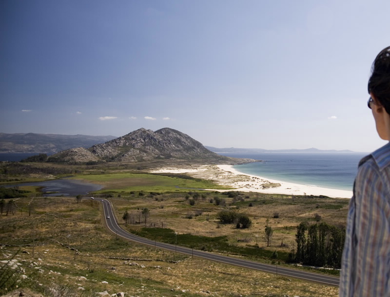
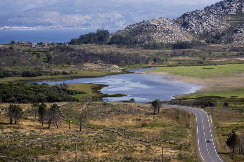
The solitary Monte Louro (241 m) rises up at the northern point of the entry to the Ría de Muros and Noia. The landscape around it has great visual impact. The Marine Reserve of Fishing Interest, promoted by the Fishermen’s Association of Lira, can be reached by sea (Carnota). By land, there is an important Point of Geological Interest in the area and a stretch open to the sea with a very pleasant lagoon, beaches, rocky areas, lighthouses and horizon.
The lagoon of As Xarfas is closed to the sea by the dunes of the Area Maior beach, better known as the Louro beach. The wetland is surrounded by a small forest liable to flooding, for when there are heavy rains the small river that feeds the area overflows and leaves it up to two metres under water. Beside the lagoon a white beach opens up to the foot of the mountain. Altogether, it makes a perfect heavenly postcard. This is followed by other sandy spot with fine sands and churning, cold waters, like that of Ancoradoiro/Lariño, with an adjacent pine grove and lighthouse. But there is also a succession of rock groups, of which the most famous is the Simprón.
Among the pioneering initiatives in Galicia is fishing tourism, aimed at revaluing artisan fishing, and the creation of marine reserves.
Access
The AC-550 Noia-Cee road limits the protected
space.
Situation
Municipalities of Carnota and Muros (A Coruña).
Area
1,160.88 hectares of which 491 hectares
consist of sea water.
Services
Accommodation: Yes.
Food: Yes.
Food: Yes.
Information and facilities
Turismo marinero Mar de Lira
Telephone: +34 981 761 252
Telephone 2: +34 636 294 796}
Further features
Bird watching
Download the coordinates for this resource...

