Turismo de Galicia

-
Things to do
Way of St. James
Nature
Culture and heritage
Beaches and coast
Tourist trails
- Top ten: Ten unrivalled destinations
- The route of the camellia
- Tourist routes
- Pathways for discovering a country
- Walks to fall in love with
- Scenery at the wheel
- EuroVelo Galicia
- Beyond the Sunset
Gastronomy
Health tourism
PROMOTIONS TO ENJOY NOW
Cultural agenda
Will happen... View all
- Places to visit
-
Plan your trip
Build your journey
Practical information


-
A miña viaxe
A MIÑA VIAXE
- Compartir
- Correo
- Imprimir

On the Way of St. James
Description
This trail is located on the boundary between the parishes of Santa Cristina and Santo Adrán de Cobres.
We begin our journey in the vicinity of the Riomaior Cultural Centre, where we find the sign identifying this pathway.
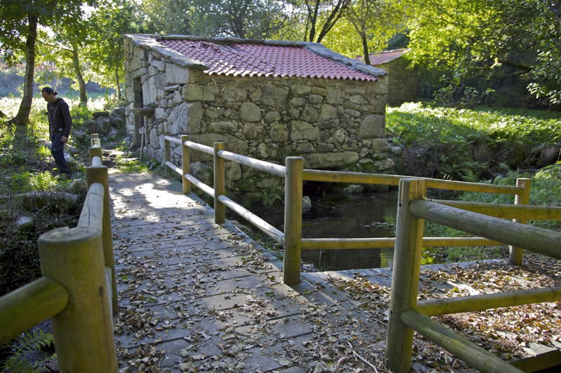
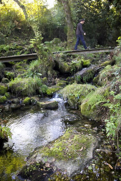
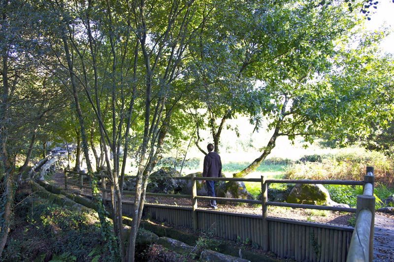
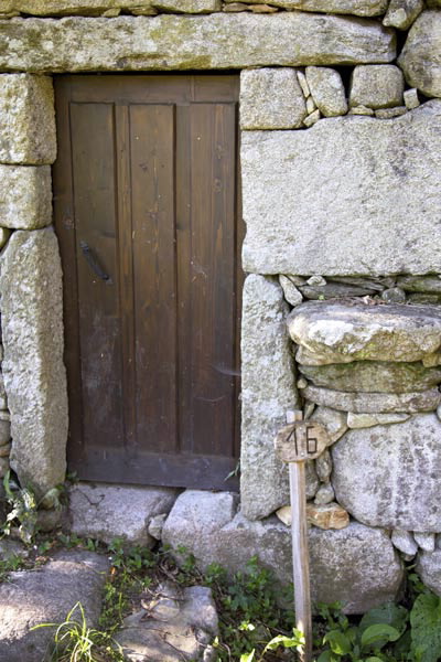
There are 34 mills altogether on the banks of the River Maior, mostly restored, which in the past ground grains such as oats, rye and especially corn. A little pathway by the river takes us from one mill to another; the most technical and complex zones are well-endowed with walkways, bridges and wooden steps.
The route comes to an end at the mill known as Muíño de Miguel Lois. At this point, and given the shortness of the walk, we recommend returning to the starting point along the same pathway.
We begin our journey in the vicinity of the Riomaior Cultural Centre, where we find the sign identifying this pathway.
There are 34 mills altogether on the banks of the River Maior, mostly restored, which in the past ground grains such as oats, rye and especially corn. A little pathway by the river takes us from one mill to another; the most technical and complex zones are well-endowed with walkways, bridges and wooden steps.
The route comes to an end at the mill known as Muíño de Miguel Lois. At this point, and given the shortness of the walk, we recommend returning to the starting point along the same pathway.
Access
Turn off the N-554 down the PO-0101 to Vilaboa. Take the paved track on the right to the Riomaior Cultural Centre.
The Ways of St. James
Portiguese Route
Portiguese Route by coast
Longitude
2,6 km (one way).
Point of Departure / Arrival
Point of arrival: Muíño de Miguel Lois (Vilaboa) - UTM:29T X:527031 Y:4687495
Starting point: Casa Cultura de Riomaior (Vilaboa) - UTM:29T X:528456 Y:4686020
Route
Casa da Cultura de Riomaior, molinos nº 1 al 33, Muíño
de Miguel Lois.
Difficulty
Low
Duration
1 hour 15 minutes.
Services
In Larache, Vilaboa and Cobres.
M.I.D.E.
Effort M.I.D.E.:
Itinerary M.I.D.E.:
Displacement M.I.D.E.:
Enviroment M.I.D.E.:
Bicycle access
Not suitable
Horse access
Not suitable
cartography I.G.N. (1:25:000)
185-IV Soutomaior y 223-II Redondela
Further information
Concello de Vilaboa
Tel.: 986 708 215 / 986 708 252
info@vilaboa.org
www.vilaboa.org
Tel.: 986 708 215 / 986 708 252
info@vilaboa.org
www.vilaboa.org
Kind of route
Small travel
Interest
Ethnography
Traditional architecture
Download the coordinates for this resource...
Map

Initial pickup date: 01/08/2019

