Turismo de Galicia

-
Things to do
Way of St. James
Nature
Culture and heritage
Beaches and coast
Tourist trails
- Top ten: Ten unrivalled destinations
- The route of the camellia
- Tourist routes
- Pathways for discovering a country
- Walks to fall in love with
- Scenery at the wheel
- EuroVelo Galicia
- Beyond the Sunset
Gastronomy
Health tourism
PROMOTIONS TO ENJOY NOW
Cultural agenda
Will happen... View all
- Places to visit
-
Plan your trip
Build your journey
Practical information


-
A miña viaxe
A MIÑA VIAXE
- Compartir
- Correo
- Imprimir

Description
Before finally flowing into the sea
after the Viveiro bridges, the Landro
reduces its speed in successive
meanders that, five kilometres
upstream to Landrove, are still
influenced by the tides. From the
lookout point of San Roque (375 m)
one can admire a good part of
Gándaras and the Ría de Viveiro,
with the sea and mountain as the
main attractions in an ecstasy of
greens and blues.
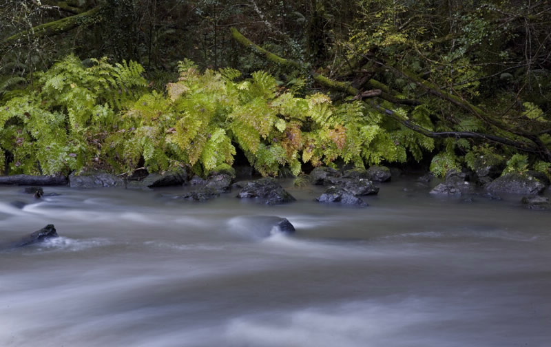
Apart from the above mentioned wetland, the river course takes in close to sixteen kilometres inland and the area around its small tributary, the river Bravos. It is listed as one of north Galicia’s best salmon rivers, and the quality of its waters even permit the existence of a viable community of river mussels. Luxuriant forests line the river banks, containing some fine eucalyptus trees, which were introduced into the area many years ago (See National Monument Souto da Retorta).
Apart from the above mentioned wetland, the river course takes in close to sixteen kilometres inland and the area around its small tributary, the river Bravos. It is listed as one of north Galicia’s best salmon rivers, and the quality of its waters even permit the existence of a viable community of river mussels. Luxuriant forests line the river banks, containing some fine eucalyptus trees, which were introduced into the area many years ago (See National Monument Souto da Retorta).
Access
From Viveiro on the LU-862 (Ferrol-San Cibrao) road.
Situation
Municipalies of Viveiro and Ourol,
in the western A Mariña, in Lugo.
Area
88.94 hectares.
Services
Accommodation: Yes.
Food: Yes.
Food: Yes.
Download the coordinates for this resource...

