


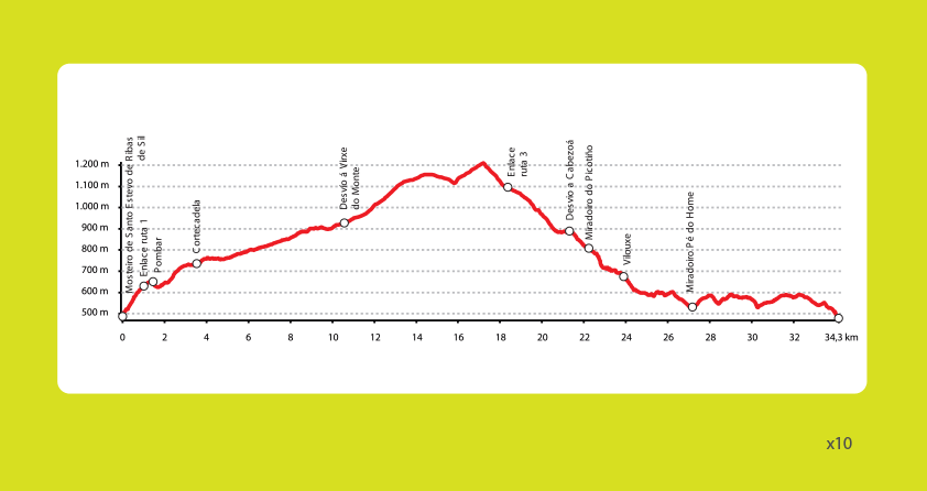
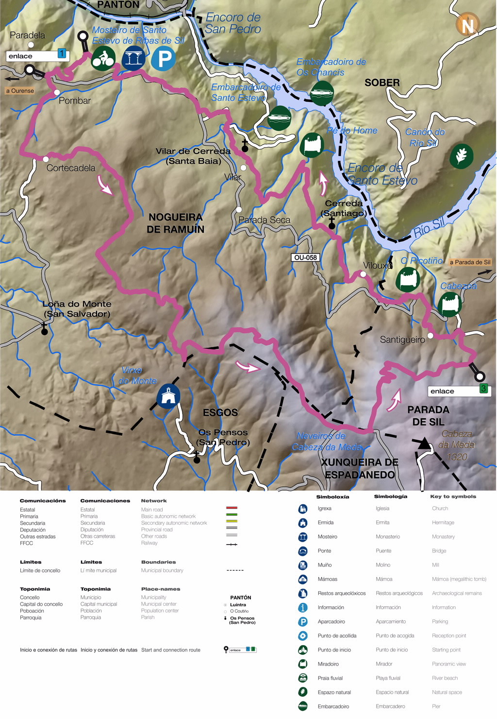
R2 - Circular de Nogueira de Ramuín
This route begins at Santo Estevo de Ribas de Sil Monastery. After covering the steep gradient on the early part of the route, we recommend visiting Litoria, a castro (pre-Roman fortified settlement) just a few metres off the path, to take in the incredible panoramic view of the monastery and Sil River Canyon.
The route continues on to Cortecadela and then follows a forest track until the turn-off for A Virxe do Monte Chapel. Accompanied by the windmills of the Sil Wind Farm, the route crosses through repopulated areas of scots pine to an altitude of 1,150 metres in the Cabeza de Meda Mountains, on the boundary between the municipalities of Esgos, Xunqueira de Espadanedo and Nogueira de Ramuín.
The trail then descends to the village of O Coutiño, sharing the final metres of this section with Route 3 - Parada de Sil Circular, which ascends in the opposite direction. At this point, you can stop at the O Picotiño and Cabezoá viewpoints, which are signed along the route. Following the Transourensán Trail, this stretch of the route includes sections of track and paved trail, passing the Pé do Home Viewpoint, the village of Vilar and Santa María Church before returning to the monastery.


