Turismo de Galicia


-
Che cosa fare
Cammino di Santiago
Natura
Cultura e Patrimonio
Mare e Costa
Itinerari
- Top Ten: Dieci luoghi unici
- Il percorso delle camelie
- Itinerari turistici
- Percorsi alla scoperta di un paese
- Percorsi di cui innamorarsi
- Scenari al volante
- Eurovelo Galicia
- Al di là del tramonto
Gastronomia
Turismo di salute
PROMOZIONI DI CUI PUOI APPROFITTARE ORA
- Che cosa visitare
-
Organizza il tuo viaggio
Costruisci il tuo viaggio
Informazioni pratiche


-
A miña viaxe
A MIÑA VIAXE
- Compartir
- Correo
- Imprimir
mailto:?subject=Contenuto da Turismo della Galizia:&body=Si consiglia di leggere le informazioni estratte dal sito del Turismo della Galizia alla pagina https://www.turismo.gal/recurso/-/detalle/160524000081/area-de-mazaricos?ctre=1000260%26tp=42

Nel Cammino di Santiago
Datos do recursos turístico
Descrizione
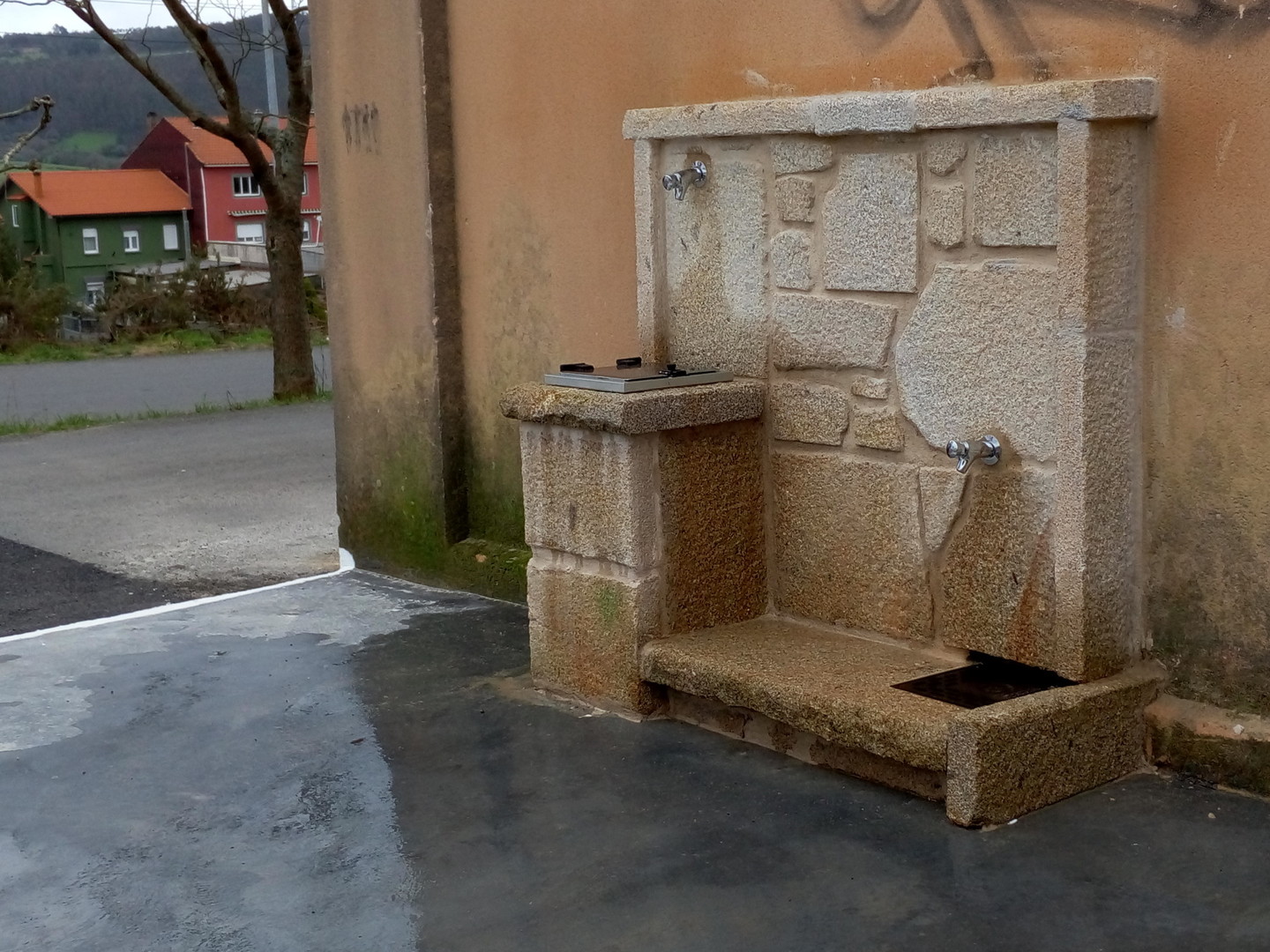
Area comunale, con 4 posti auto, situata accanto al centro benessere ea pochi metri dal centro del paese dove troveremo tutti i servizi. La stazione di servizio più vicina si trova a 4,8 km di distanza.
Il Concello Mazaricos, si trova nel nord-ovest della Galizia, nella zona sud-occidentale della provincia di La Coruña, si trova tra Negreira e Cee sulla rotta dal Camino de Santiago a Finisterre e Muxía, nella regione di Xallas. Del suo patrimonio evidenziamo numerosi castros, chiese ed eremi, mulini, colombe e fonti comuni. I granai o cabaceiros. Mazaricos offre anche molteplici possibilità di svago: nelle carballeiras come le rane Anllares, Chacín o Figueira, cascate come Santa Leocadia, Noveira, Firvado, ecc. Punti di vista come il Mirador de Aro, il Pedregal, il Pindo o il Monte Ruña di oltre 600 metri di altitudine.
Percorsi escursionistici come:
- Il percorso del serbatoio. Lascia il bacino di Fervenza e corre lungo le rive del fiume Xallas fino al bacino di Santa Uxía
- Beba River Route. Da sud a nord lungo le rive del fiume Beba, dove troviamo l'incrocio del Cirolán o la spiaggia del fiume e l'area ricreativa di A Pontenova, fino a raggiungere il fiume Xallas.
- Percorso dei pellegrini. Passeggia lungo il Cammino di Santiago attraverso Mazaricos, passando per il Monte Aro.
Cammini di Santiago
Cammino di Fisterra-Muxía
Servizos de Autocaravanas
Acqua potabile
Area gratuita
Collegamento elettrico
Possibilità di pernottamento
Svuotamento acque grigie
Svuotamento acque nere
Entidad informadora: ASOCIACION GALEGA AUTOCARAVANAS
