


mailto:?subject=Content from Tourism of Galicia: COSTA DA MORTE&body=I recommend you read the information COSTA DA MORTE extracted from the Tourism of Galicia site on page https://www.turismo.gal/recurso/-/detalle/16870/costa-da-morte?langId=en_US
COSTA DA MORTE

ZEC - natura 2000
On the Way of St. James
Datos do recursos turístico
Location
A Coruña
A Laracha | Arteixo | Cabana de Bergantiños | Camariñas | Carballo | Cee | Fisterra | Laxe | Malpica de Bergantiños | Muxía | Ponteceso | Vimianzo
Coordinates:
43º 09' 48.2" N - 9º 12' 44.3" W
Description
Land’s End in the Middle of the World
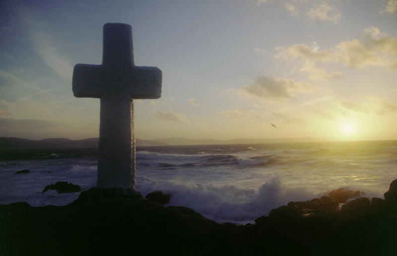
Every afternoon the evening light illuminates the crosses on the cliffs facing the sea, in memory of those who have died or disappeared. At that moment two elements are presented together, dusk and tragedies, which caused the Latin Finisterrae to be renamed Costa da Morte [Coast of Death].
Today it continues to be one of the most travelled strategic points of the intercontinental maritime routes and one of the most dangerous to navigate. The cartographical register of shipwrecks and rescue operations is full of crosses representing more than 150 ships sunk in the last century, but one loses count of the daily fears of collective memory of a sailing village, which in other respects is vital and happy.
For this reason the Costa da Morte is not a cemetery. Its 150 kilometres of sailing and marine life are the best-conserved of the European Atlantic. From north to south it embraces the area near the city of A Coruña to Cabo Fisterra. It contains the Camariñas, Corme-Laxe and Lires estuaries, which together with Fisterra, are the locations of the main ports, but not the only ones for there are others, such as Caión or Malpica which offer refuge to the open sea.
Apart from the small northern estuaries, this is mainly a rocky coast, with a succession of extensive inlets whose roughest points are to be found on Cabo Vilán, Touriñán and O Roncudo. Here we will find the wildest coastal stretches, with place for the sands drenched in the wind’s beauty: Balarés on Ponteceso; O Trece on Camariñas, Mar de Fóra on Fisterra. The areas environmental richness is completed by the wetlands of Baldaio and Razo and the Traba lagoon. Not to forget the echoing solitude of the Sisargas islands.
Access
From A Coruña to Carballo on the AG-55 or AC-
552 road which continues on to Cee, with
turnoffs to the coastal areas.
There is no passenger sea transport to the
Sisargas islands.
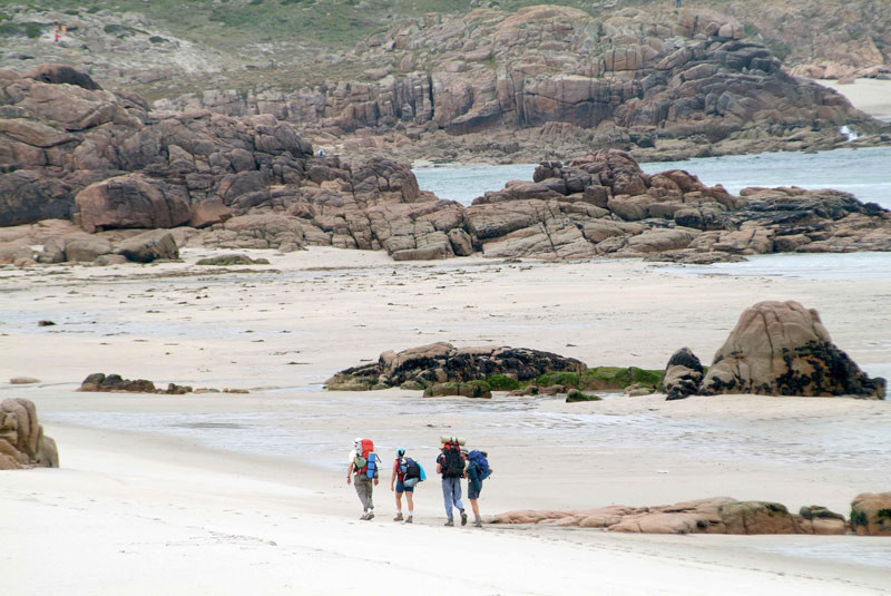
The Ways of St. James
The Fistera-Muxía Camino
Situation
A stretch of coast in the Coruña municipalities
of Arteixo, Cabana de Bergantiños, Camariñas,
Carballo, Cee, Fisterra, A Laracha, Laxe,
Malpica de Bergantiños, Muxía, Ponteceso and
Vimianzo.
Area
11.809 ha.
Services
Accommodation: Yes.
Food: Yes.
Food: Yes.
Without missing
The provincial AC-552 A Coruña-Fisterra road is the main means of communication, from which the main turnoffs go to
the coast. This protected space begins at the Alba beach, close to the better-known beach of Barrañán (Arteixo), and
slightly more to the west. In the region of Bergantiños, we will encounter the Baldaio mudflats ecosystem.
Here, the extensive sands join the tourist beach of Razo (Carballo) and forms a series of dunes behind which there is a lagoon with a narrow channel to the sea and mudflats, an important bird life refuge.
In this coastal area, the port of Malpica conserves its appearance as an ancient whaling enclave. It is also the nearest point to the Sisargas island, facing Cabo Santo Adrián. The island’s lighthouse is the only witness to the deafening nesting colonies located on the most inaccessible cliffs. On the coast, continuing the search for the beacons light, paths go to the headlands of Nariga and Roncudo, veritable figureheads facing out to sea, where gooseneck barnacle gatherers earn their living.
On one side Corme blocks the estuary which closes in the inlet of A Insua with the beautiful beach of Balarés on one side, Monte Branco in the middle, with the sands around it, and the estuary which forms the river Anllóns behind it. This seabed is protected for approximately 40 km of its winding way upriver, between Carballo and Ponteceso. A good place to get to know the river Anllóns in all its splendour is in the Verdes reserve in Coristanco.
Starting from the estuary, the coastal stretch continues through Laxe to the beach of Traba. As well as the lagoon, the whimsical rocky forms of the “Penedos de Pasarela e Traba” mountain, a Protected Landscape, are outstanding.
Further features
Bird watching
Special Protection Area
