


mailto:?subject=Envoi de contenu de Tourisme Galice : A PRAIA DAS CATEDRAIS&body=Je vous recommande de lire les informations A PRAIA DAS CATEDRAIS extraites du portail de Tourisme Galice https://www.turismo.gal/recurso/-/detalle/32008/a-praia-das-catedrais?tp=1%26ctre=5
A PRAIA DAS CATEDRAIS

Espaces naturels
Sur le Chemin de Saint Jacques
Datos do recursos turístico
Localisation
Lugo
Barreiros | Ribadeo
Coordonnées:
43º 33' 21.3" N - 7º 09' 22.8" W
Contacto para reservas
Description
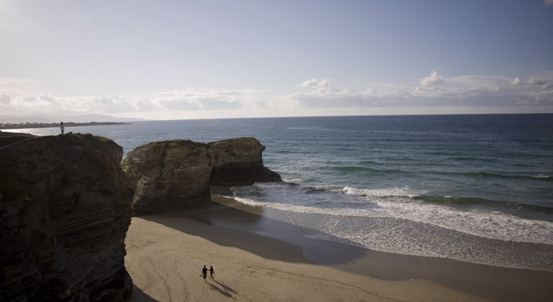
L'architecture de la mer
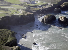
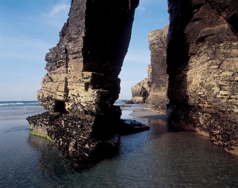
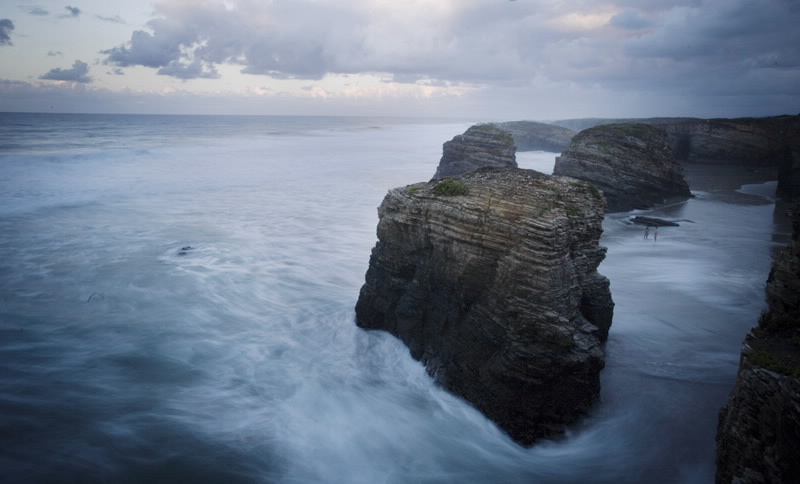
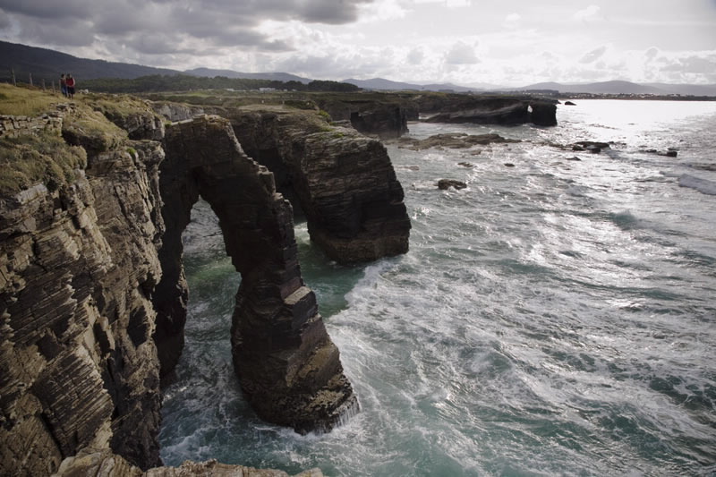
L'échelon formé par ce que l'on appelle la "rasa cantabrica" (frange de plaine entre la mer et la montagne) atteint ici la catégorie de monument géologique. La mer a sculpté sur les falaises tout un répertoire architectural d'arcs, de colonnes et de voutes qui justifient le nom touristique donné à l'espace entre les plages de sable d'Augasantas et Carricelas de Plage des Cathédrales.
L'accès en est facile. Elle compte en outre une promenade aménagée sur le bord supérieur et des panneaux d'information. Cependant, nous ne pourrons laisser nos traces de pas sur la plage qu'à marée basse. Marcher sur la surface dégagée de basse mer et pénétrer dans les grottes marines avec l'autorisation spontanée de la mer accroît la sensation d'aventure. As Catedrais conservent, au cours des dernières années, des milliers de photos, toutes porteuses d'une émotion unique et sans pareil. Chaque image est unique.
Chaque visite est différente. La mer efface toujours les empreintes précédentes, mais il reste la suite d'arcs monumentaux. De plus, l'espace protégé au sein du Réseau Natura 2000 comprend un tronçon côtier de quelque quinze kilomètres de long, au fil duquel nous pouvons trouver de très belles plages de sable comme celle d'Os Castros et le pittoresque port de Rinlo.
Accès
Par la route N-634 (A Coruña-Santander),
des déviations vers la côte sur le tronçon entre
San Miguel de Reinante et Rinlo. Des pistes
locales parallèles à la côte.
Chemins de Saint Jacques
Chemin du nord
Situation
Sur la commune de Ribadeo, dans la Mariña
orientale de la province de Lugo. Le SIC s'étend
entre les communes de Barreiros et Ribadeo.
Surface
Monument Naturel : 28,94 ha, dont 20 ha sont
des eaux marines. SIC: 304,36 ha.
Services
Hébergement et restauration dans les villes
environnantes et sur la route.
Cela peut aussi vous intéresser
-

AS CATEDRAIS
ZEC - Nature 2000
-
AS CATEDRAIS
Plage
