Turismo de Galicia


-
Things to do
Way of St. James
Nature
Culture and heritage
Beaches and coast
Tourist trails
- Top ten: Ten unrivalled destinations
- The route of the camellia
- Tourist routes
- Pathways for discovering a country
- Walks to fall in love with
- Greenways
- Scenery at the wheel
- EuroVelo Galicia
- Beyond the Sunset
Gastronomy
Health tourism
PROMOTIONS TO ENJOY NOW
Cultural agenda
Will happen... View all
- Places to visit
-
Plan your trip
Build your journey
Practical information


-
A miña viaxe
A MIÑA VIAXE
- Compartir
- Correo
- Imprimir
mailto:?subject=Content from Tourism of Galicia: PENA TREVINCA&body=I recommend you read the information PENA TREVINCA extracted from the Tourism of Galicia site on page https://www.turismo.gal/recurso/-/detalle/16755/pena-trevinca

Datos do recursos turístico
Description
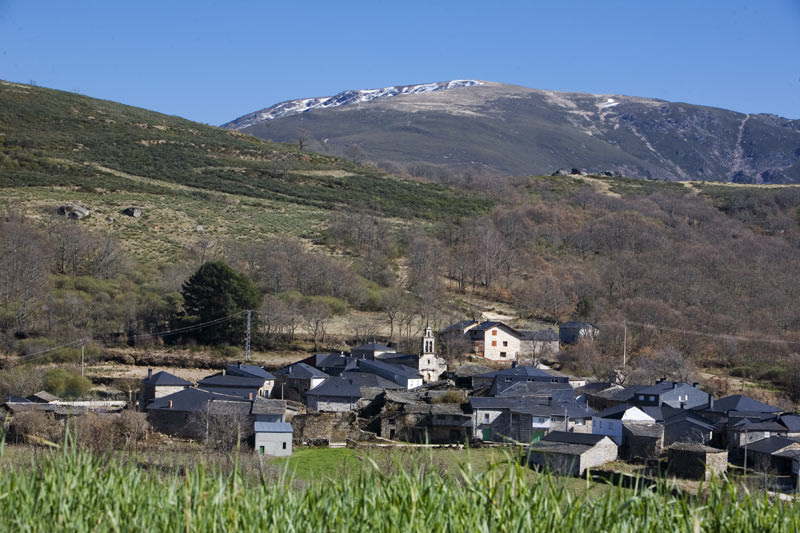
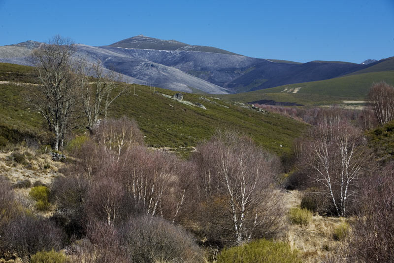
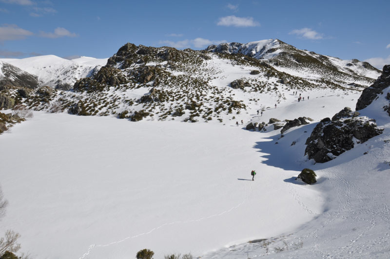
Sub-alpine landscapes, above two thousand metres, can only be seen in Galicia in the confluence of the O Eixe, Calva and Segundeira mountain ranges. The upper limit of the region is reached at the peak of the Pena Trevinca (2,127 m), Pena Negra (2,123 m) and Pena Survia (2,122 m) which crown this extensive protected space linked to the Natural Park of the Sanabria lake (Zamora).
Here, an outstanding formation of natural lakes and other elements of glacial origin can be seen. On the west Galicia slope, whose waters drain into the Sil basin, the Xares and the Bibei present beautiful pictures of high mountain rivers during a thaw.
Because of the remoteness of the region it has remained relatively isolated, although its ecological balance is also fragile. One of its increasingly well-known acts has been the conservation of the “Teixadal de Casaio” (yew forest of Casaio). This is a small group of three hundred centuries-old yew trees which form a forest which is unique in Europe. Another one is the existence of a pair of golden eagles, an important element in the region’s bird life.
Access
The Ways of St. James
Situation
Area
Services
Food: Yes.
Without missing
To the south, the road to the village of Pradorramisquedo via the winding road from Viana do Bolo takes us close to the banks of the River Bibei sculpted into the stone. From here there is an easy route to Porto, on the Zamora side.
The Teixadal of Casaio, on the other hand, is located in the extreme north of the area, in the municipality of Carballeda de Valdeorras. There is a long route on foot from the Fonte da Cova station (1,800 m).
