Turismo de Galicia

-
Things to do
Way of St. James
Nature
Culture and heritage
Beaches and coast
Tourist trails
- Top ten: Ten unrivalled destinations
- The route of the camellia
- Tourist routes
- Pathways for discovering a country
- Walks to fall in love with
- Scenery at the wheel
- EuroVelo Galicia
- Beyond the Sunset
Gastronomy
Health tourism
PROMOTIONS TO ENJOY NOW
Cultural agenda
Will happen... View all
- Places to visit
-
Plan your trip
Build your journey
Practical information


-
A miña viaxe
A MIÑA VIAXE
- Compartir
- Correo
- Imprimir

On the Way of St. James
Description
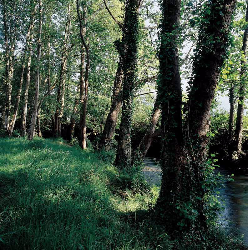
This protected area takes in two different natural
spaces. On the one hand, the stretch of the Río Grande
de Xuvia with its tributary the Castro; on the other, the
mountain range of Forgoselo.
The old flour factory and mill of the Xuvia bridge signals the mouth of the river at the back of the Ría de Ferrol, between the municipalities of Narón and Neda. In its short river course it crosses damp valleys like that of Moeche, which has a famous restored castle, and San Sadurniño where the colour green triumphs in the landscape. It also receives the contribution of the river Castro, which reflects the hill where the Naraío Tower is located.
The O Forgoselo mountain range is outstanding, with its gently undulating forms which are about 500 metres high. The orography and abundant rains favour the formation of very interesting wetlands and their typical vegetation, such as the Veiga das Lagoas.
Access
Turnoff to the river in Naraío or
Moeche on the road between
Neda and San Sadurniño.
The Ways of St. James
The English Camino
Situation
Municipalities of A Capela,
Moeche, Narón, Neda, San
Sadurniño, As Somozas and As
Pontes de García Rodríguez, in the
province of A Coruña.
Area
1.985,91 hectares
Services
Accommodation and food
nearby.
Download the coordinates for this resource...

