Turismo de Galicia

-
Things to do
Way of St. James
Nature
Culture and heritage
Beaches and coast
Tourist trails
- Top ten: Ten unrivalled destinations
- The route of the camellia
- Tourist routes
- Pathways for discovering a country
- Walks to fall in love with
- Scenery at the wheel
- EuroVelo Galicia
- Beyond the Sunset
Gastronomy
Health tourism
PROMOTIONS TO ENJOY NOW
Cultural agenda
Will happen... View all
- Places to visit
-
Plan your trip
Build your journey
Practical information


-
A miña viaxe
A MIÑA VIAXE
- Compartir
- Correo
- Imprimir

The Walk
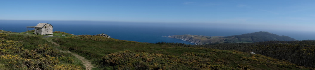
The watchtower of Facho de Maeda
Viewpoints of the Cantabrian Sea
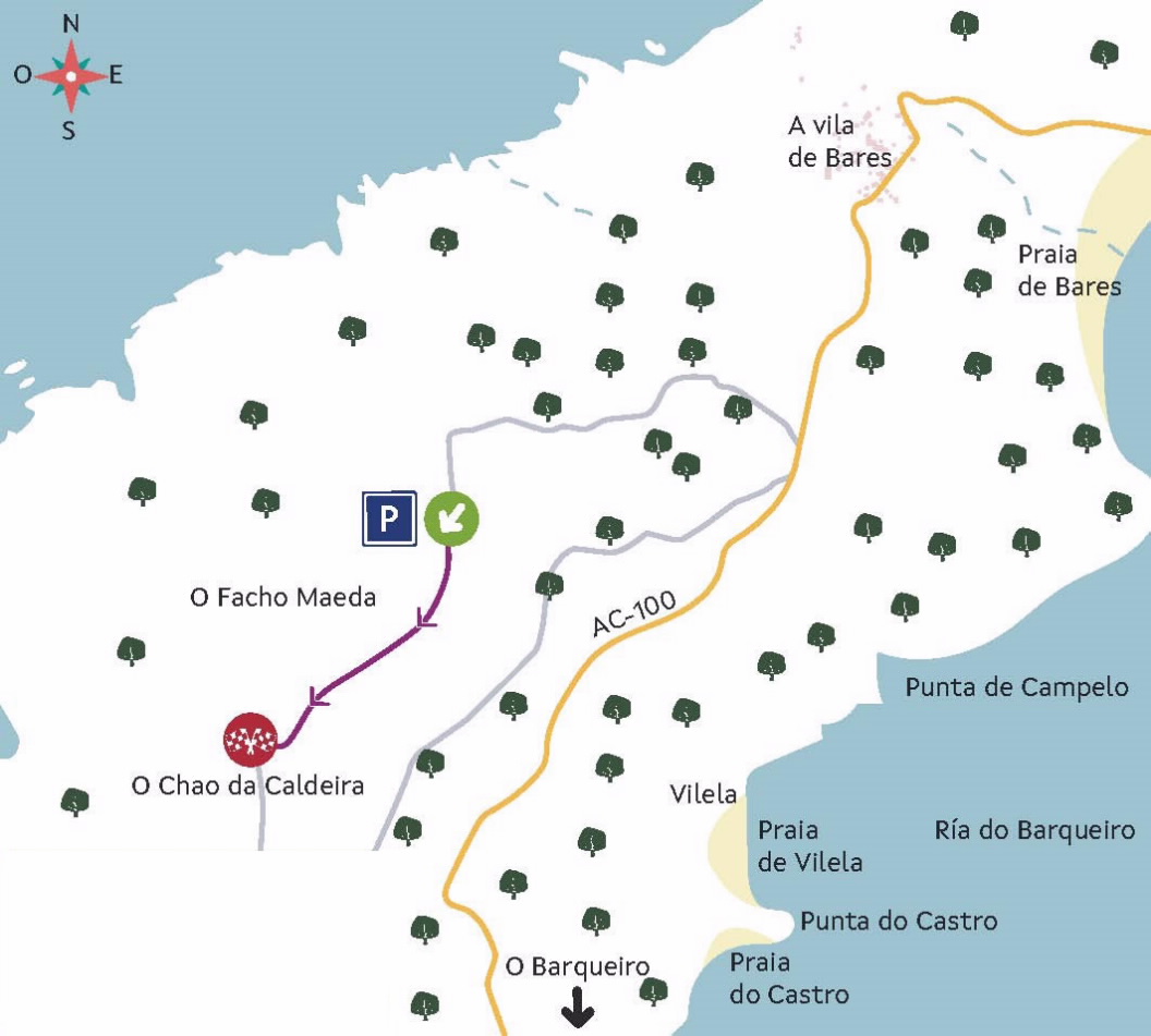
Before reaching Vila de Bares, we take an asphalted track on the left which, in just 1.4 km, takes us to an old guard booth of the coast. From here we can already glimpse part of the coastline of Lugo as well as the peninsula where Estaca de Bares is located, the northernmost point of the Iberian Peninsula, which juts out into the Cantabrian Sea.
We then take a forest path that will offer us views of the ría do Barqueiro, with several panoramic points along almost a kilometre of the route, with curious rocky shapes moulded by the wind and the rain. At the end, we have a spectacular view of the coastline of Ortigueira, which goes from the Picóns de Loiba to cabo Ortegal and A Capelada, in the municipality of Cariño.
Characteristics
Length: 0.93 km (one way)
starting point: Garita de Bares (43°45'43.90''N / 7°41'59.41''W)
End Point : O Chao da Caldeira (43°45'24.23''N / 7°42'24.21''W)
Type
Contemplating the sea
Initial pickup date: 01/01/2021

