Turismo de Galicia


-
Things to do
Way of St. James
Nature
Culture and heritage
Beaches and coast
Tourist trails
- Top ten: Ten unrivalled destinations
- The route of the camellia
- Tourist routes
- Pathways for discovering a country
- Walks to fall in love with
- Greenways
- Scenery at the wheel
- EuroVelo Galicia
- Beyond the Sunset
Gastronomy
Health tourism
PROMOTIONS TO ENJOY NOW
Cultural agenda
Will happen... View all
- Places to visit
-
Plan your trip
Build your journey
Practical information


-
A miña viaxe
A MIÑA VIAXE
- Compartir
- Correo
- Imprimir
mailto:?subject=Content from Tourism of Galicia: FERVENZA DE CASTELIGO OU DO RÍO DORELLE&body=I recommend you read the information FERVENZA DE CASTELIGO OU DO RÍO DORELLE extracted from the Tourism of Galicia site on page https://www.turismo.gal/recurso/-/detalle/211129000264/fervenza-de-casteligo-ou-do-rio-dorelle?langId=en_US%26tp=40004330

Datos do recursos turístico
Location
Parish: Casteligo (San Martiño)
Chandrexa de Queixa - Ourense
Description
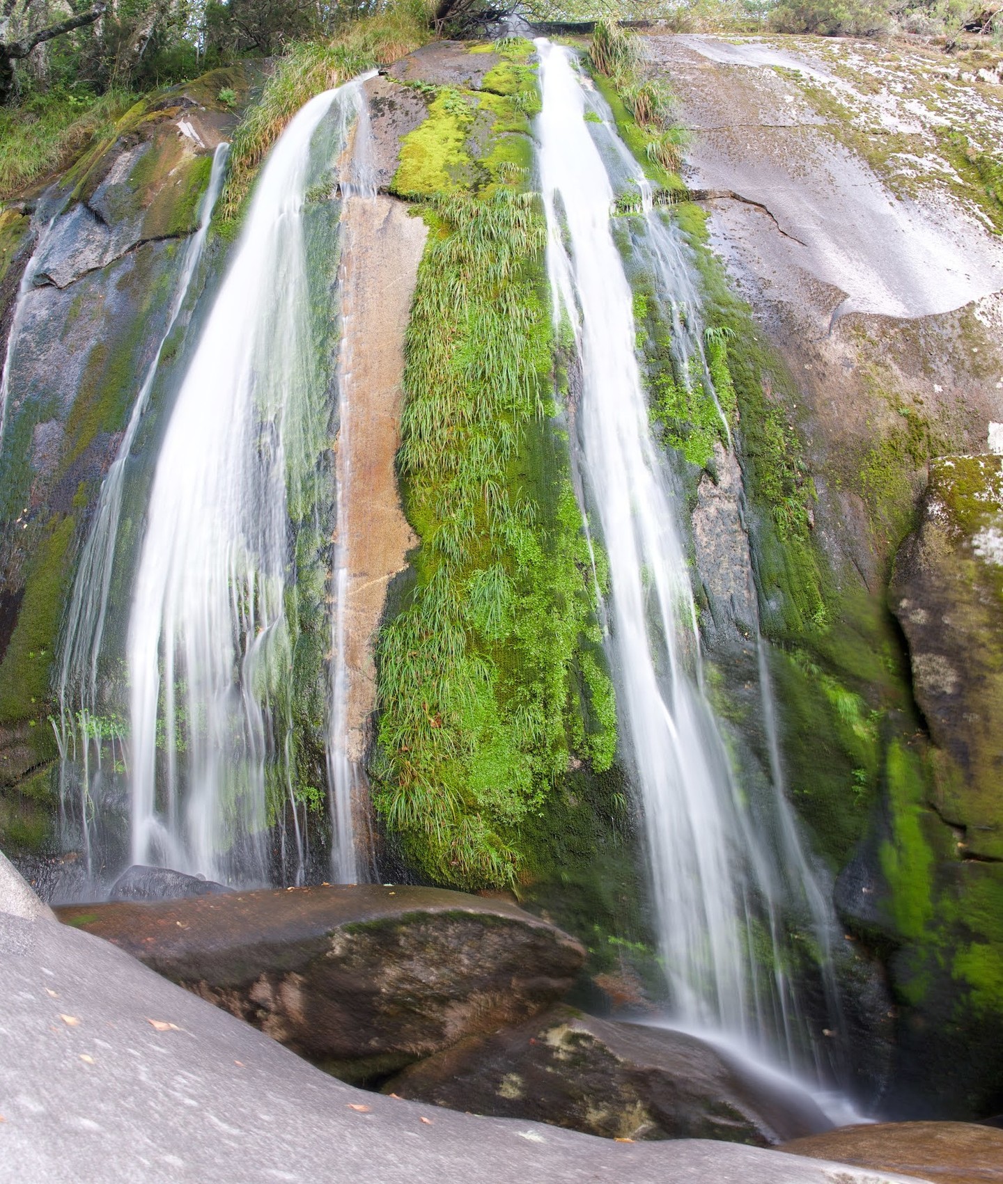
The Casteligo ravine originates from the convergence of the Regueiro dos Palleiros and the Regueiro da Corgodola, which collect water from the highest parts of the Serra da Queixa, some of them at an altitude of 1700 metres. There is a viewpoint next to the OU-0703 road between Celeiros with A Pobra de Trives, where we can leave the car and go down to take a photograph of the waterfall, which we will see springing up among the autochthonous for-est. The river Dorelle follows its course through the town of Chandrexa de Queixa and flows into the river Navea. The river is hidden among an autochthonous forest of Pyrenean oaks, willows, alders, birches and other species.
At some points a small canyon of granite rocks is formed. At 650 metres from the viewpoint, we will find a path on the left-hand side with a sign pointing to a hiking route that leads to Casteligo. To get to the foot of the waterfall, we must take a path that goes off to the left from the route but which is not signposted. We must walk there with great care, as it is full of large rocks, between which the water flows. The waterfall is about 12 metres high and it is advisable to visit it in spring, when the snow on the summits of Manzaneda begins to melt.
