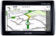
1. Navman GPS and Smart ST
Entering points of interest in GPS Navman is performed by using software, either the official, Smart ST, or a file transformation application such as GPSBabel.
Way of St. James
Nature
Culture and heritage
Beaches and coast
Tourist trails
Gastronomy
Health tourism
PROMOTIONS TO ENJOY NOW
Cultural agenda
Will happen... View all
Build your journey
Practical information
Entering points of interest in GPS Navman is performed by using software, either the official, Smart ST, or a file transformation application such as GPSBabel.
Smart ST is software that comes with the purchase of GPS Navman. This software can be updated at the Navman website.
Operating systems required: Microsoft Windows XP, Microsoft Windows 2000, Microsoft Windows Millennium Edition, Microsoft Windows 98 SE

On the Turgalicia website there are points of interest files available to download in Navman CSV format. Entering points of interest in GPS Navman devices is performed through the Smart ST application, following the procedure described below.
Load the points of interest file onto the GPS by following the instructions below:
After installing Smart St Desktop on the computer, run the application to import the previously downloaded and saved points files.
2. Before starting, it is necessary to connect the GPS to the computer using a USB cable. This will enable synchronisation. Once the GPS is synchronised, select the map option points of interest will open the Smart ST points of interest editor.
Select the open text file option or click on the toolbar icon (). Browse the directory until you find where the POI .csv files have been saved.

Select the relevant files from the list that appears (csv files).

5. Once the file option has been selected, it should be saved to the device by clicking on the icon that looks like a PDA (![]() ) .
) .

On the above screen, you can indicate whether the point of interest is active and the alert type. You can select the icon visibility level. This is done by clicking on the button that has an ellipsis and looking for the file with the .bmp extension.
Once the dialogue box is accepted you must enter the name under which the file will saved on the device.


Once the new POI are saved, you can close the application and disconnect the GPS from the computer with the USB cable.
After the points of interest are loaded, they can be quickly and easily viewed in the Navman GPS device.
The GPSBabel program allows for the conversion of more than 140 file formats so you can work with them in different programs for editing and processing geographical information and different GPS receiver models.
This portal uses own cookies or of third with analytical ends, as well as links to portals of third to be able to share content in the social networks. You can find more information in the cookie policy.
Cookie configuration
You can use these buttons to customise the services you wish to use on this portal.
Maybe some resources are not geo-referenced and they are not being displayed.
