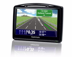
1. Tom Tom GPS
Introducing points of interest in GPS Tom Tom can be done in two ways:
Way of St. James
Nature
Culture and heritage
Beaches and coast
Tourist trails
Gastronomy
Health tourism
PROMOTIONS TO ENJOY NOW
Cultural agenda
Will happen... View all
Build your journey
Practical information
Introducing points of interest in GPS Tom Tom can be done in two ways:
In this manual, we will describe the steps for manually entering the POI in the Tom Tom folder.

To synchronise the GPS device with the computer, you must have software ActiveSync installed on the computer.
This software is used to synchronise and connect devices with Windows Mobile/ Windows CE (PDAs, GPS, mobile phones, etc.…) through USB ports, Bluetooth or infrared.
ActiveSync can only be downloaded onto computers that have an operating system earlier than XP. If the user has Vista o el Windows 7 installed, the software comes installed in the operating system.
This software can be downloaded for free from the Microsoft website:
The download version is 4.5 in various languages.
The compatible operating systems are:
Windows Server 2003; Windows Server 2003 Service Pack 1; Windows Server 2003 Service Pack 2; Windows XP; Windows XP 64-bit; Windows XP Embedded; Windows XP Embedded Service Pack 1; Windows XP Embedded Service Pack 2 ; Windows XP for Itanium-based Systems Version 2003; Windows XP Home Edition ; Windows XP Media Center Edition; Windows XP Professional 64-Bit Edition (Itanium) ; Windows XP Professional 64-Bit Edition (Itanium) 2003; Windows XP Professional Edition ; Windows XP Professional x64 Edition ; Windows XP Service Pack 1; Windows XP Service Pack 2; Windows XP Starter Edition; Windows XP Tablet PC Edition.
It must be noted that the ActiveSync installation is compatible with all Tom Tom models.
Once downloaded, the file can be executed.
To install the GPS device, take the following steps:
The first time you connect the device, it will be detected by the operating system, and ActiveSync will display the following:


It is necessary, therefore, to do a sync, both for a GPS and for a mobile device.
Entering points of interest in Tom Tom GPS, can be done in two ways:
Only for GPS devices.
You must open the file explorer to access the GPS files; enter the mobile device folder and then the Mounted Volume folder.

In Mounted Volume select the maps storage folder.

Then copy the downloaded points localisation files (.ov2 and .bmp) into the maps folder.
Once the points of interest are entered in the folder, disconnect the GPS and switch it off.
This option may be used if you have a PDA or a GPS with a memory card.
1. Open the file explorer to access the GPS files and enter the Storage Card folder.
Open the maps storage folder.

2. Copy the files: Enter the files downloaded from the Turgalicia website, .ov2 and .bmp files, and incorporate them into the map storage folder.
 .
.
The final step is to disconnect the USB cable from the GPS to then be able to quickly and easily view the POI in the receiver.
The GPSBabel program enables the conversion of more than 140 file formats so you can work with them in different programs for editing and processing geographical information and different GPS receiver models.
This portal uses own cookies or of third with analytical ends, as well as links to portals of third to be able to share content in the social networks. You can find more information in the cookie policy.
Cookie configuration
You can use these buttons to customise the services you wish to use on this portal.
Maybe some resources are not geo-referenced and they are not being displayed.
