Turismo de Galicia


-
Things to do
Way of St. James
Nature
Culture and heritage
Beaches and coast
Tourist trails
- Top ten: Ten unrivalled destinations
- The route of the camellia
- Tourist routes
- Pathways for discovering a country
- Walks to fall in love with
- Greenways
- Scenery at the wheel
- EuroVelo Galicia
- Beyond the Sunset
Gastronomy
Health tourism
PROMOTIONS TO ENJOY NOW
Cultural agenda
Will happen... View all
- Places to visit
-
Plan your trip
Build your journey
Practical information


- Start
- Things to do
-
Scenery at the wheel
- Way of St. James
- Galician Woodlands
- Experiencies in the midst of nature
- Magical Shrines
- Lighthouses and Wild Beaches
- Galicia Birding
- EuroVelo Galicia
- Hidden Heritage
- Marine Tourism
- Galicia Water Society
- Tourist routes
- The route of the camellia
- Scenery at the wheel
- Top ten: Ten unrivalled destinations
- Strolling Through Vineyards
- Pathways for discovering a country
- Walks to fall in love with
- Greenways
- Beyond the Sunset
- Galician springs
- Promotions to enjoy
- Cultural agenda
- Total Solar Eclipse
- 25 unusual routes through the best landscapes in Galicia
- Endless sea
-
From the Fisterra lighthouse to the lookout point at O Ézaro
- From Ribadeo to Pico da Frouxeira
- From O Porto de Espasante to the Estaca de Bares lighthouse
- From Cedeira to Cape Ortegal
- From the castle of A Palma to the castle of A Nogueirosa
- From the Laxe lighthouse to O Roncudo point
- Camariñas circular tour
- From the Fisterra lighthouse to the lookout point at O Ézaro
- From Corrubedo lighthouse to Monte Enxa
- From Cape Udra to Cape Home
- From Monte Cepudo to Monte Aloia
- From Baiona to Santa Trega
-
A miña viaxe
A MIÑA VIAXE
- Compartir
- Correo
- Imprimir
ENDLESS SEA
From the Fisterra lighthouse to the lookout point at O Ézaro... From the end of the world to the Celtic Olympusthe silent, fading sun
dies in the sea, like a tear.
Fisterra, Manuel María
The end of the earth.
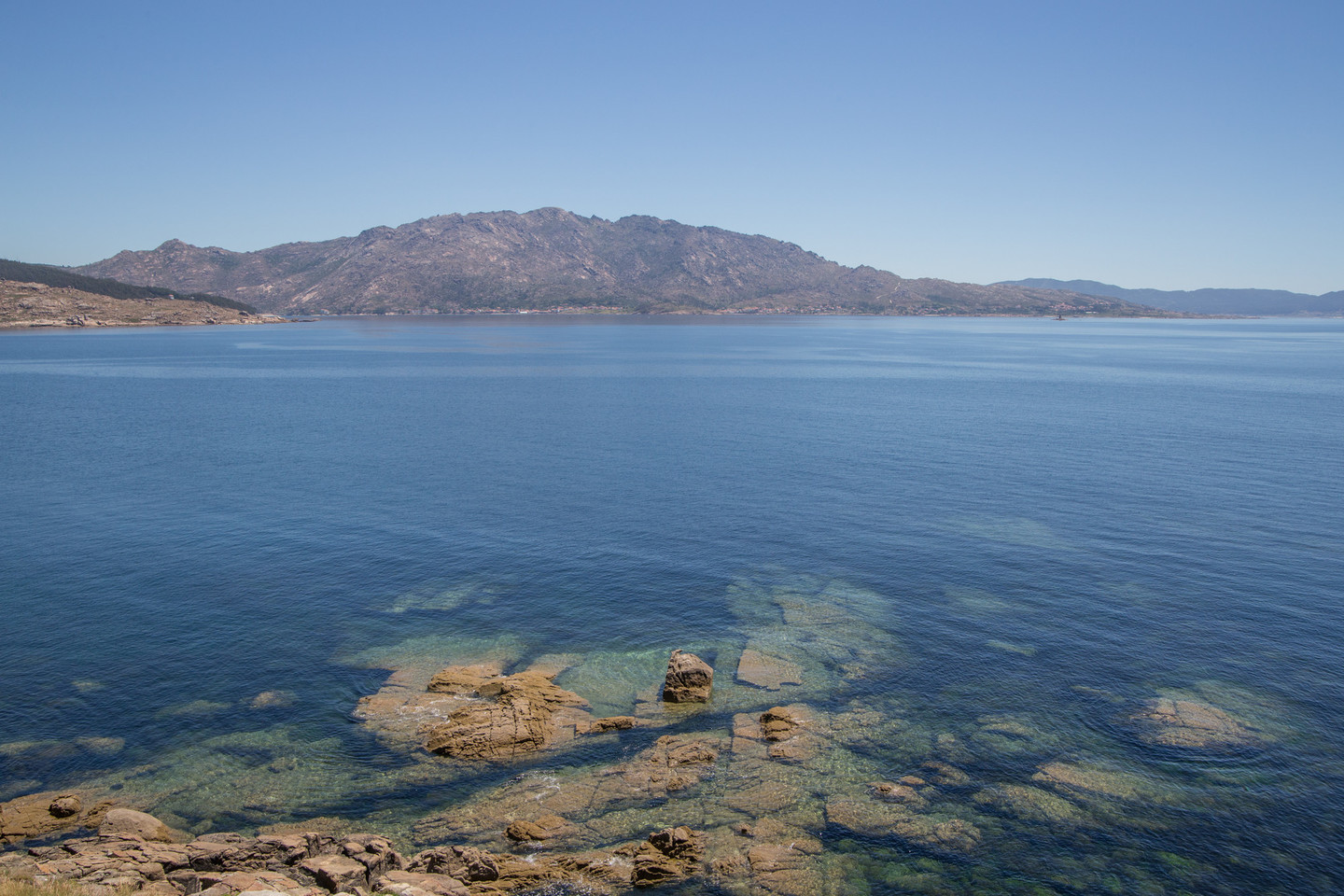
Fisterra (Finisterre in Spanish) is the remote place where the world ends. But it is also the beginning of a beautiful route that follows the shoreline, through mythical locations on the Costa da Morte: Corcubión, Cee, and the Xallas waterfall, ending at the spectacular O Ézaro lookout point, beside Monte Pindo, the sacred Olympus of the Celts.
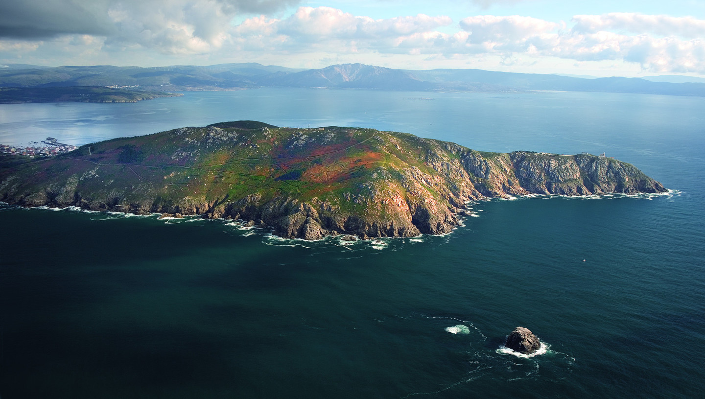 Cape Fisterra
For the Romans, finis terrae was the place where the known world ended. It features in the collective imagination of many peoples living on the shores of the Atlantic, and other “land’s ends” exist in Brittany and Cornwall.
In addition to its spectacular coastal scenery, our Finisterre is a spiritual, mythical place, as it also marks the end of the Camiño a Fisterra, a prolongation of the Saint James’ Way to Santiago. According to legend, in Roman times there was an altar to the sun (Ara Solis) here, which Saint James ordered to be destroyed because it was a site of pagan ritual. But the tradition persists and today Ara Solis is the name of a well-known square in the old quarter, near the chapel of Nosa Señora do Bo Suceso.
Geographically, Fisterra is a classic cape: a long peninsula ending in a large promontory, where a lighthouse was built in 1853. In 1888 a horn was added, which came to be known as the “Fisterra cow”, because it sounded so much like the animal mooing.
Fisterra is a key location on the Costa da Morte. Its long seafaring tradition is clearly reflected in the fish market, which has a space for visitors to watch the auctions.
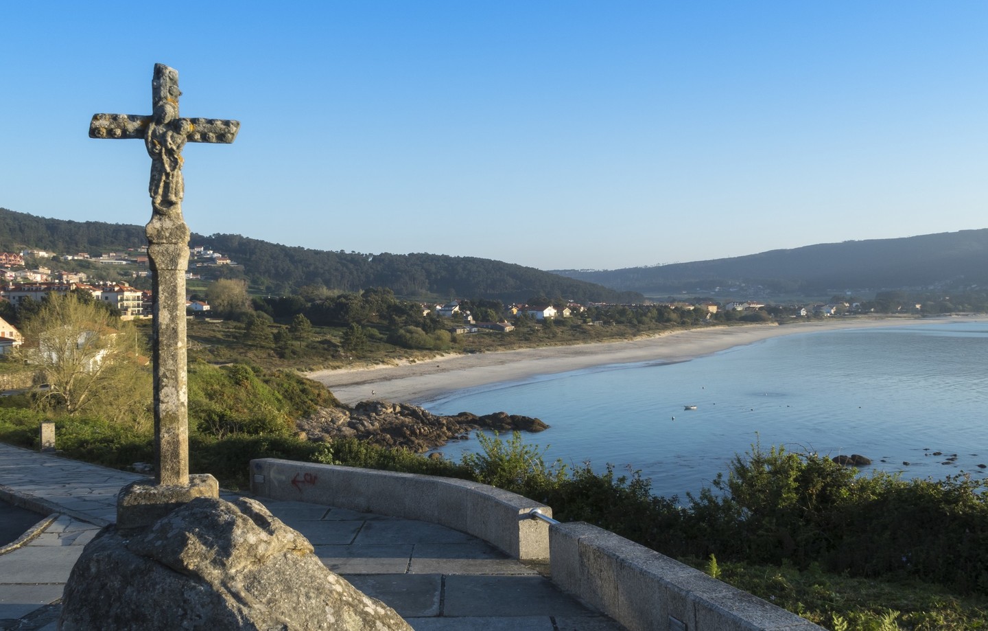 A Langosteira inlet
Leaving the village, the A Langosteira inlet contains the beach of the same name, a long strip of sand with clear waters and views of Monte Pindo in the distance. The route passes through Sardiñeiro and by other, smaller beaches, such as Restrelo and Estorde.
A side turn leads to A Redonda and Cape Cee, with beautiful views where the Faro de Cabo C lighthouse stands. Then, passing the seventeenth-century Castelo do Cardeal, we approach Corcubión.
 View of ville of Corcubión
Well worth a visit, the town was declared a Historical and Artistic Site in 1985. It contains many houses with galleries, a style characteristic of coastal towns.
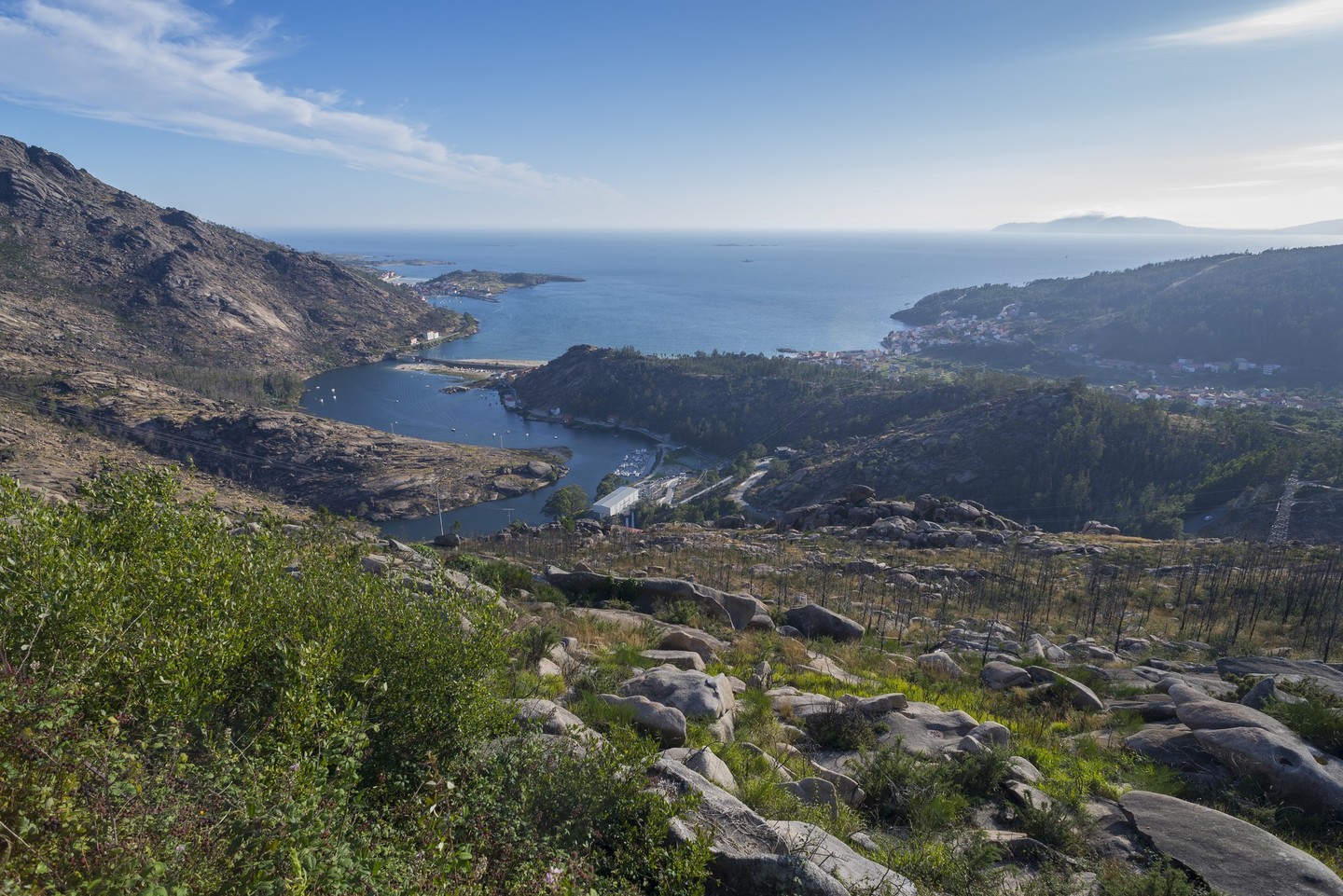
The road follows the coast to Cee, in fact it is almost imperceptible where Corcubión ends and Cee begins. Cee is the largest town in the county and is home to many of its businesses and services. In the town centre we take the turning for O Ézaro (Dumbría).
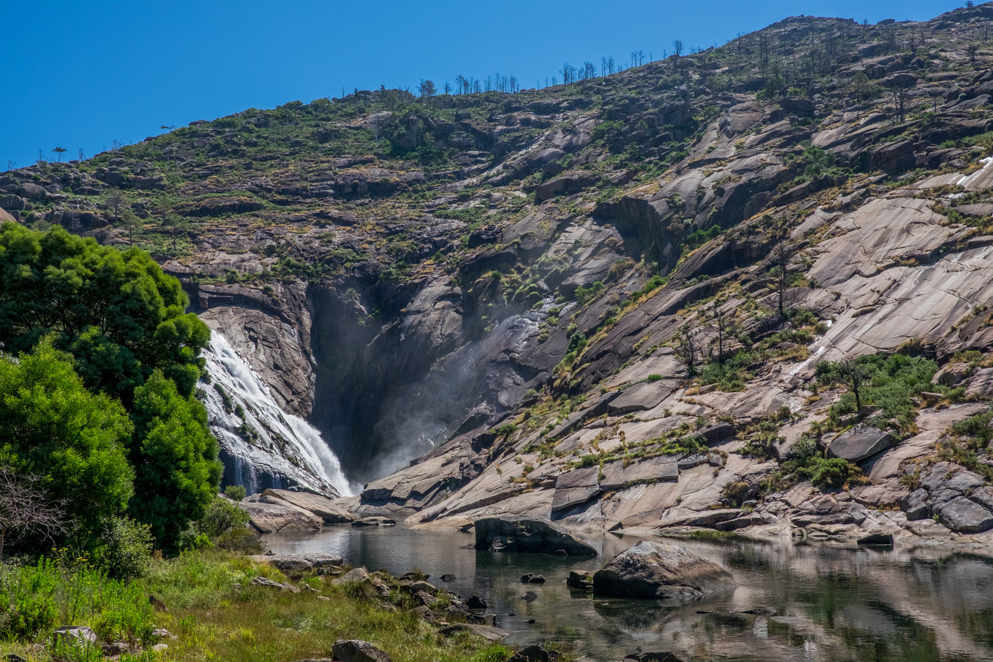 Mouth in waterfall of Xallas
Passing by beaches like Gures, the route offers a different view of our starting point, Cape Fisterra, which, from this distance appears to lie on the ocean. The granite mass of O Pindo looms on the road ahead, moving closer to us as we proceed.
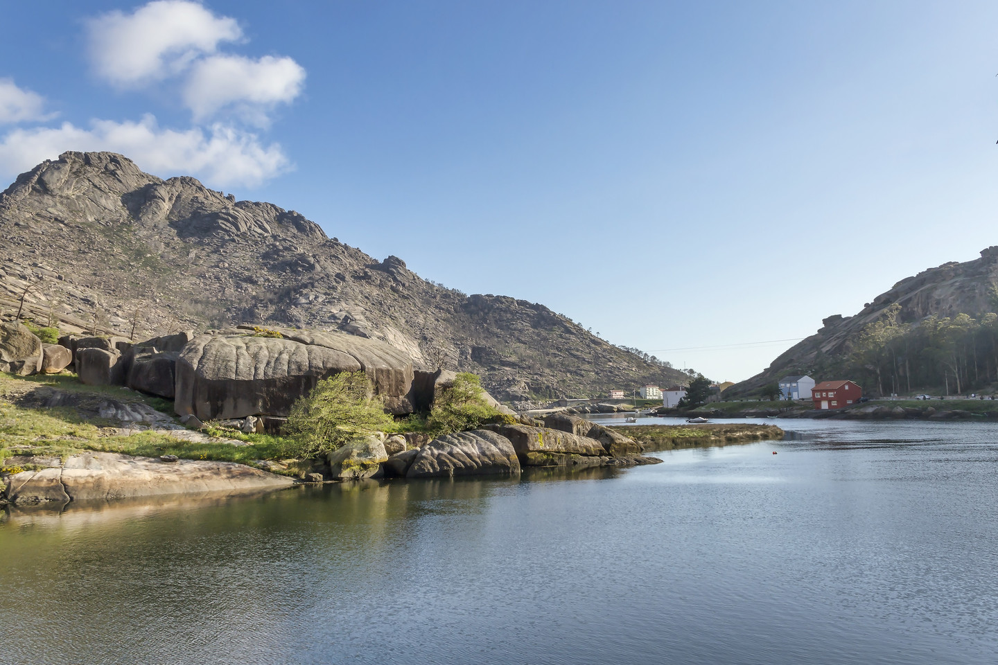
O Ézaro is a small agricultural and seafaring village. Its beaches of deep blue waters are dominated by two giants: O Pindo and Cape Fisterra on the horizon. At the O Ézaro bridge, the route branches off towards the Xallas waterfall.
The waterfall at the mouth of the medium-sized River Xallas is unique as it descends directly into the sea, tumbling over granite rocks from a height of nearly 100 metres. A path runs along the estuary to facilitate access to the falls from the Electricity Interpretation Centre, housed in the O Castrelo power station.
Pindo is an enormous granite massif of great ecological and geomorphological interest, including scrubland habitats and distinctive geological features. Formed by various hills and rocky outcrops, A Moa is the highest point at 627 metres, a considerable height for a mountain so close to the coast.
A major feature of the landscape, it is a visual reference point for much of the curved shoreline between Fisterra and Carnota. As well as being a place of exceptional natural beauty, it is a site of rich cultural heritage, both tangible and intangible. There are a number of archaeological sites and the remains of mediaeval fortifications (castle of San Xurxo and a possible fortress at Monte Penafiel) but equally interesting are the legends associated with the area to explain the curious shapes of the rocks.
The route to the top involves quite demanding walking routes and traditional paths but, once there, the visitor is rewarded by some of the finest views the Galician coast.
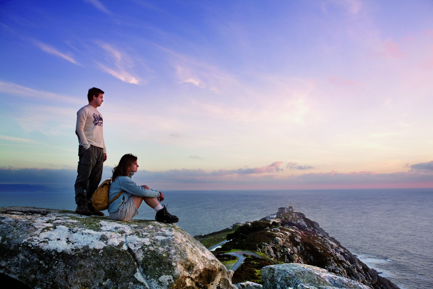
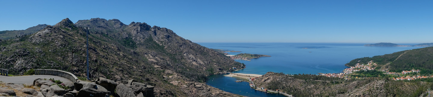 O Ézaro viewing point
The final section is spectacular. A steep trail climbs to the O Ézaro viewing point, which allows visitors to contemplate O Pindo, with its succession of granite peaks to the south and the mouth of the Xallas to the west, with its final bend in the foreground and Cape Fisterra and the vastness of the Atlantic in the distance.
The ascent to the lookout point at O Ézaro is very popular among cyclists. Both loved and feared because of its gradients, which approach 30% in places, it is a real challenge for enthusiasts. Markers along the route show the times recorded by professional cyclists during the Vuelta a España.
Don't Miss
 View of Cape C
Cape Cee or Cape Corcubión is a rocky outcrop, bordered by the Corcubión inlet to the west. It is an important reference point for shipping because of its lighthouse and its position with respect to the tiny islands of Carrumeiro Chico and Carrumeiro Vello.
Despite its small size and low altitude, its position affords continuous views of the coast at Corcubión, Cee, Dumbría, Carnota and even the northern part of the Rías Baixas. Its close-up views of Monte Pindo give a unique perspective of the mountain.
The Cape C lighthouse is known by some as the Cape Cee lighthouse and by others as the Cape Corcubión lighthouse, its curious current name suggesting an amiable compromise between the inhabitants of the two villages. The construction is a simple octagonal stonework tower. Attached to it is a small square house with a hip roof that provides accommodation for the lighthouse keepers. Although plans for the lighthouse were approved in 1847, it did not become operative until 1860. It was automated in 1934.
