


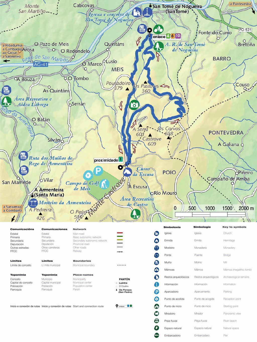
 R1 Circuíto do Monte da Escusa" class="hidden-xs img-responsive max-width padding-left-xxl width-100" />
| route | name | Km | level of difficulty |
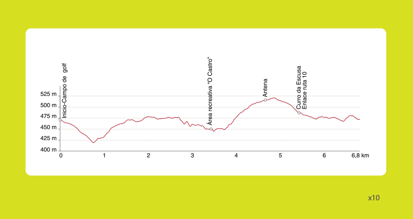
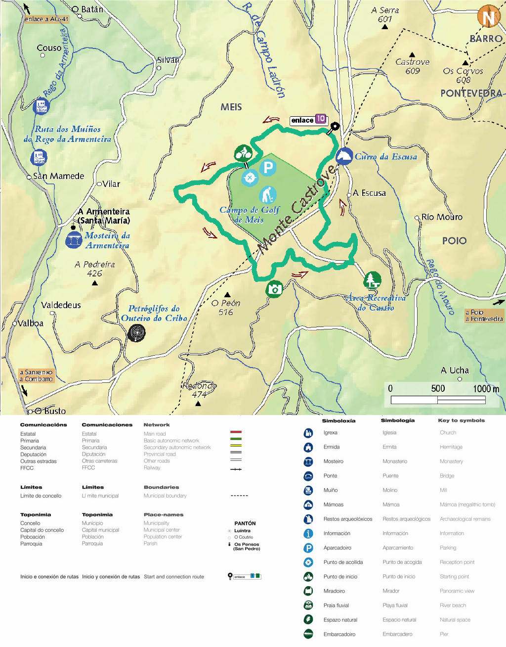
| R1 | Circuíto do MONTE DA ESCUSA | 6,8 Km |  |
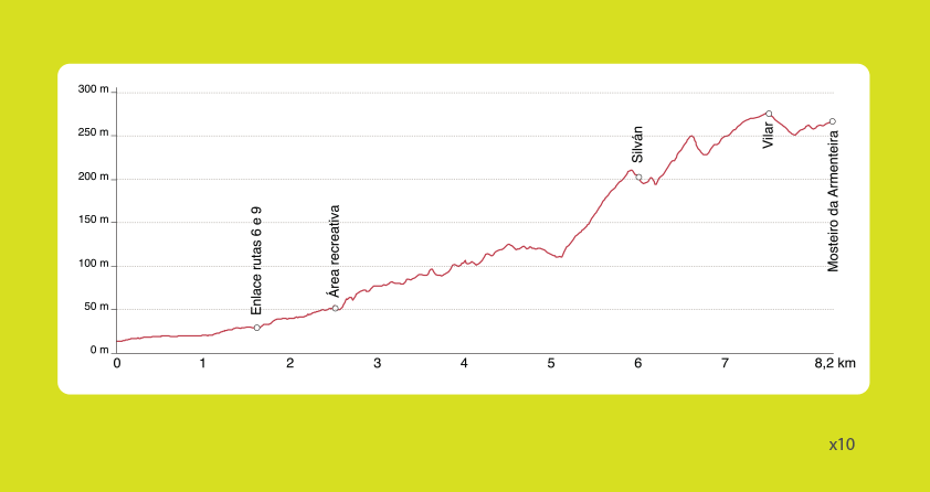
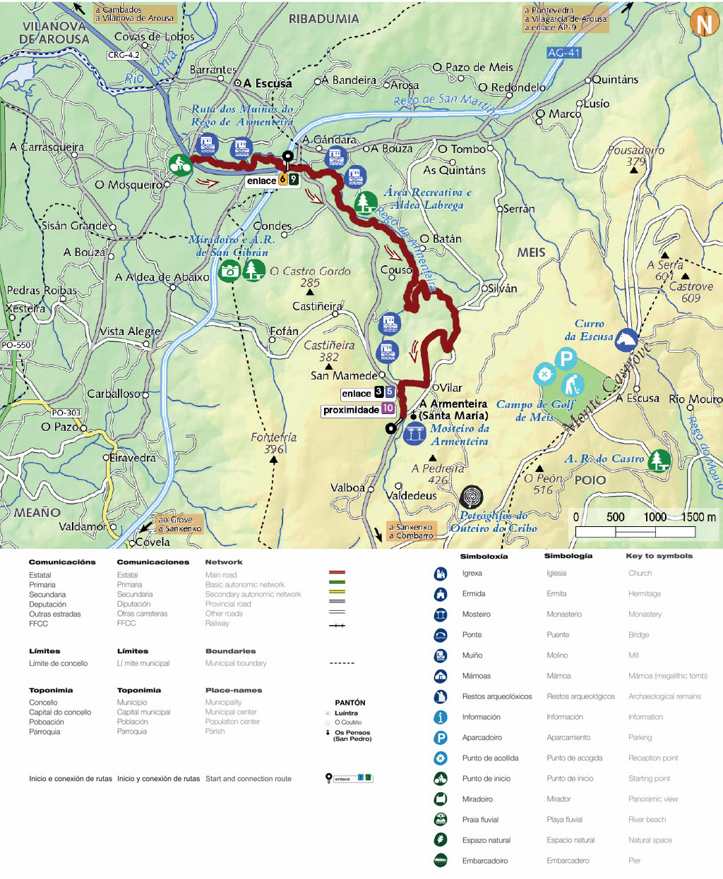
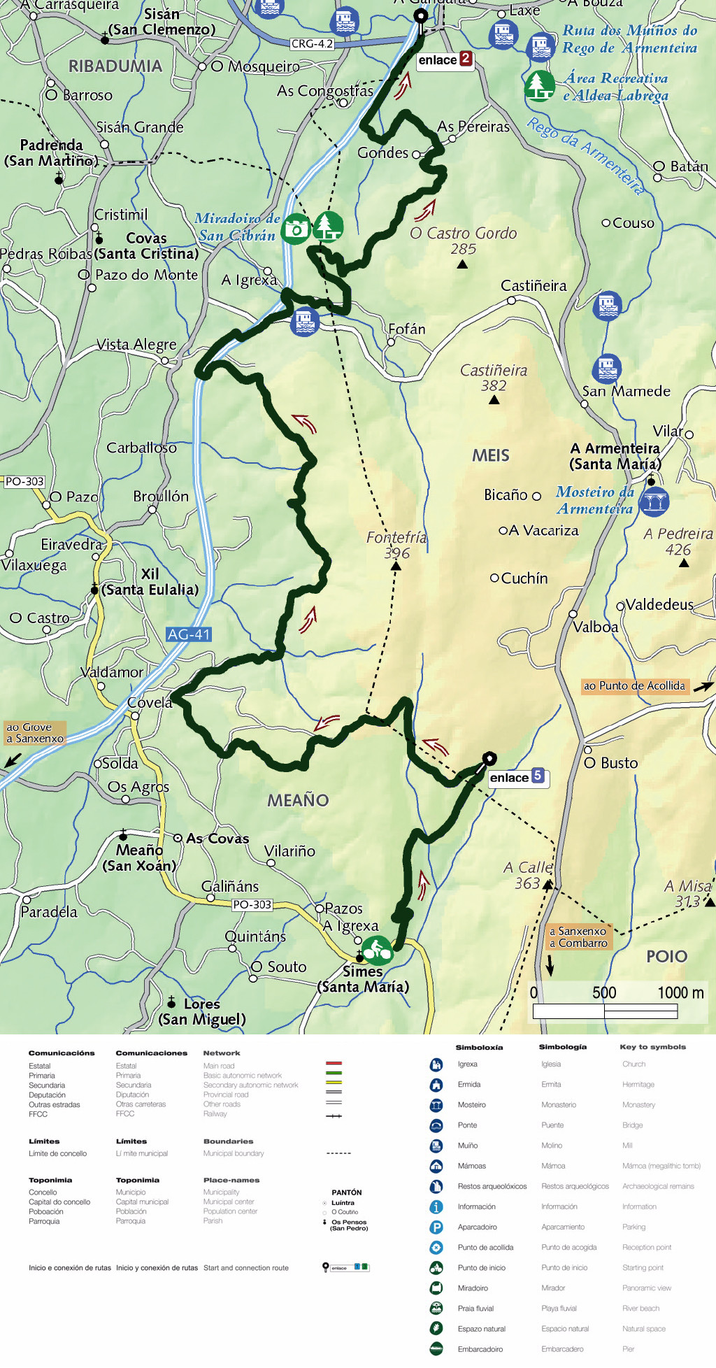
| R2 | Ruta dos MUÍÑOS DE ARMENTEIRA | 8,2 Km | |
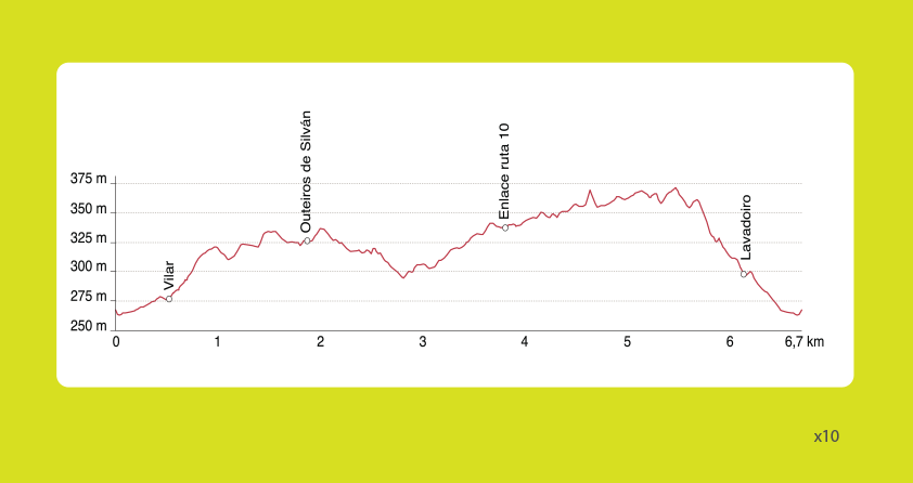
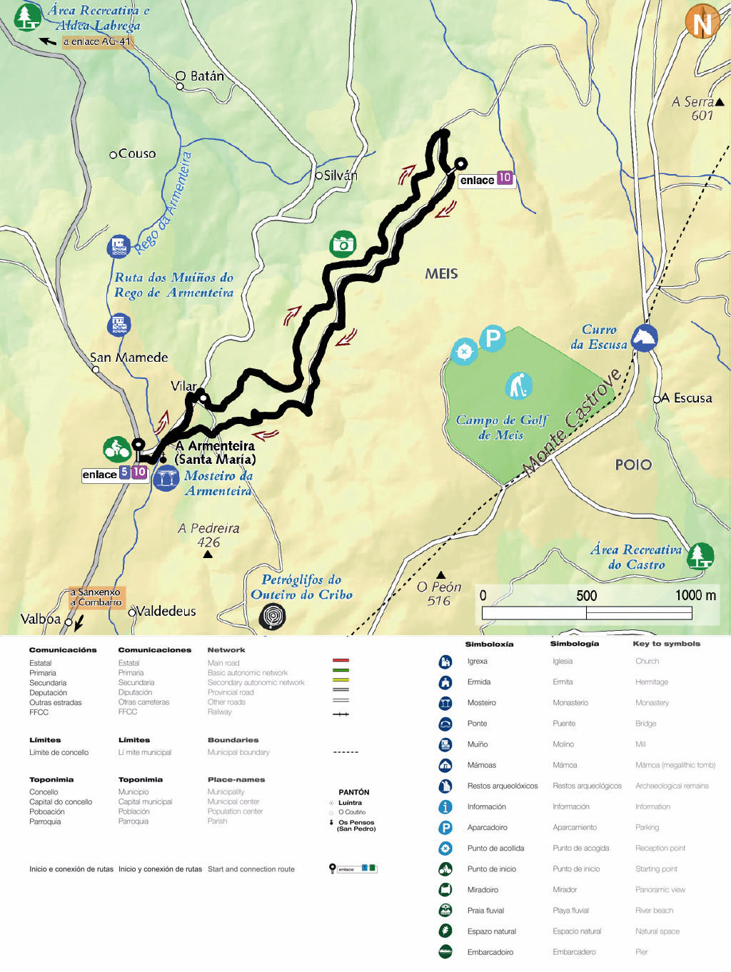
| R3 | Ruta dos OUTEIROS DE SILVÁN | 6,7 Km | |
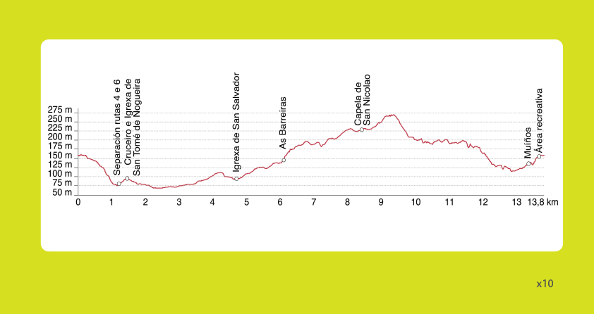
| R4 | Circuíto do VAL DE MEIS | 13,8 Km |  |
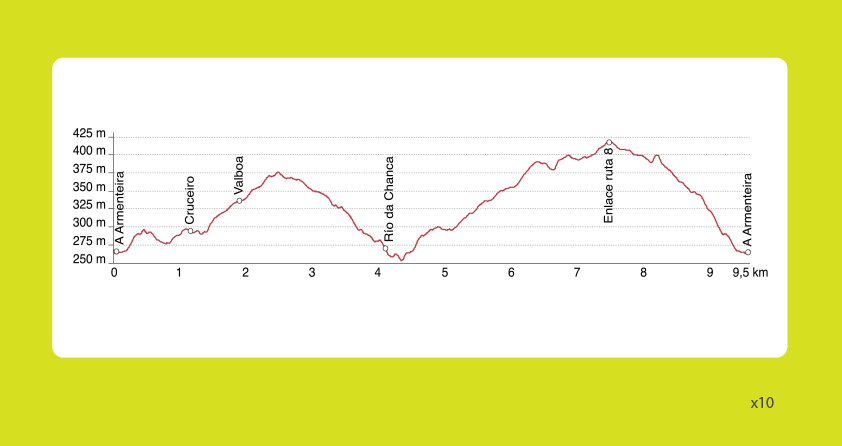
| R5 | Ruta da CHANCA | 9,5 Km | |
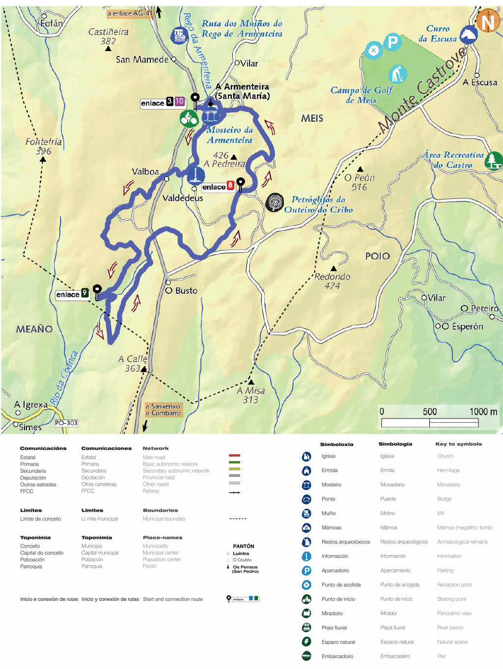
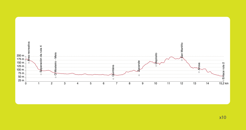
| R6 | Ruta do MONTE SAN MARTIÑO | 15,2 Km | |
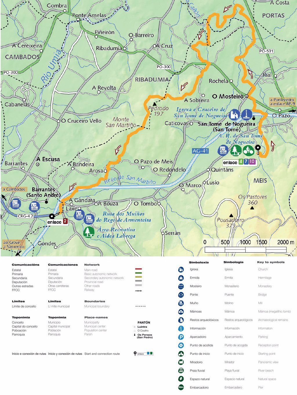
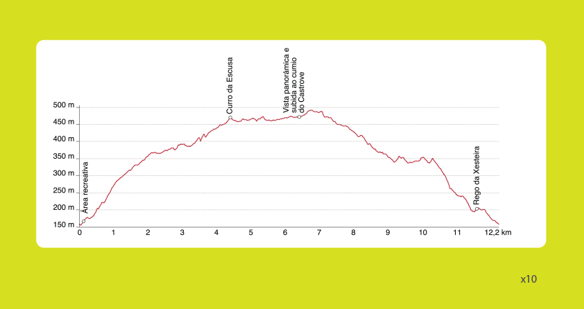
| R7 | Panorámica do MONTE CASTROVE | 12,2 Km |  |
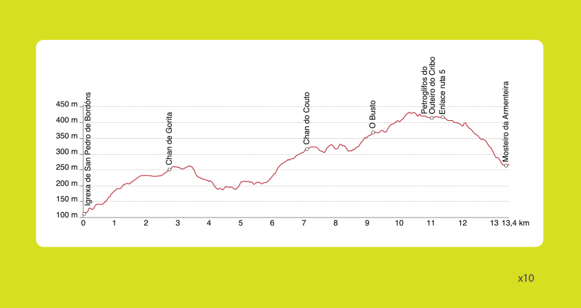
| R8 | Ruta de BORDÓNS | 13,4 Km | |
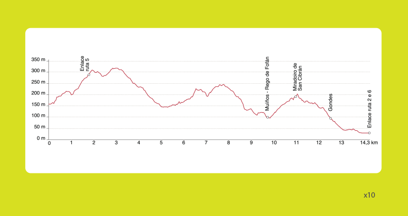
| R9 | Vistas de AROUSA | 14,3 Km | |
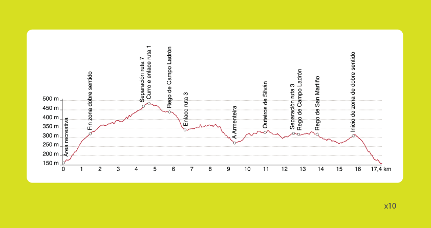
| R10 | Circuíto de CAMPO LADRÓN | 17,4 km | |
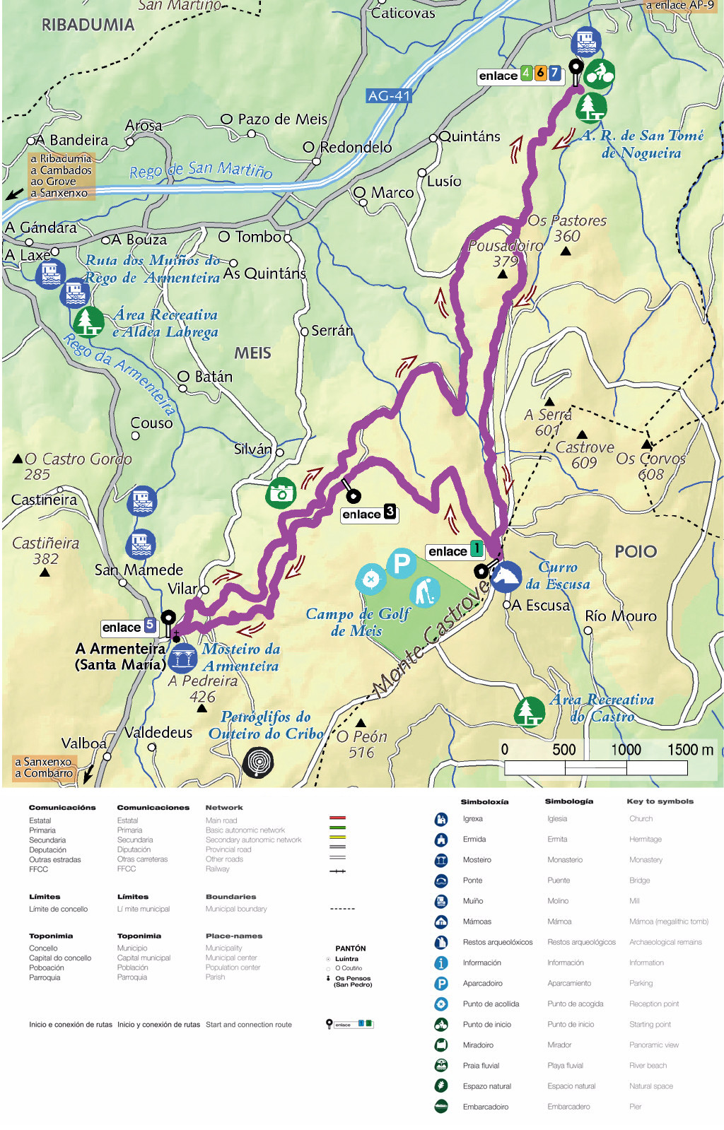
You can see the details of the different routes on a computer or GPS with GPX. and KMZ. files. The GPX co-ordinates are GPS data exchange files and need the right programme to import them into your GPS. The KMZ co-ordinates are files with geographical data that can be seen with the free programme Google Earth.
