O Baixo Miño (The Lower Miño) owes its name, its landscape and its very personality to the River Miño, Galicia's most important river. This area – located on the southwest tip of the province of Pontevedra – harmoniously melds three different types of landscape: coast, mountain and river.

This area's coastline combines beautiful beaches with rugged headlands, such as Cape Silleiro.

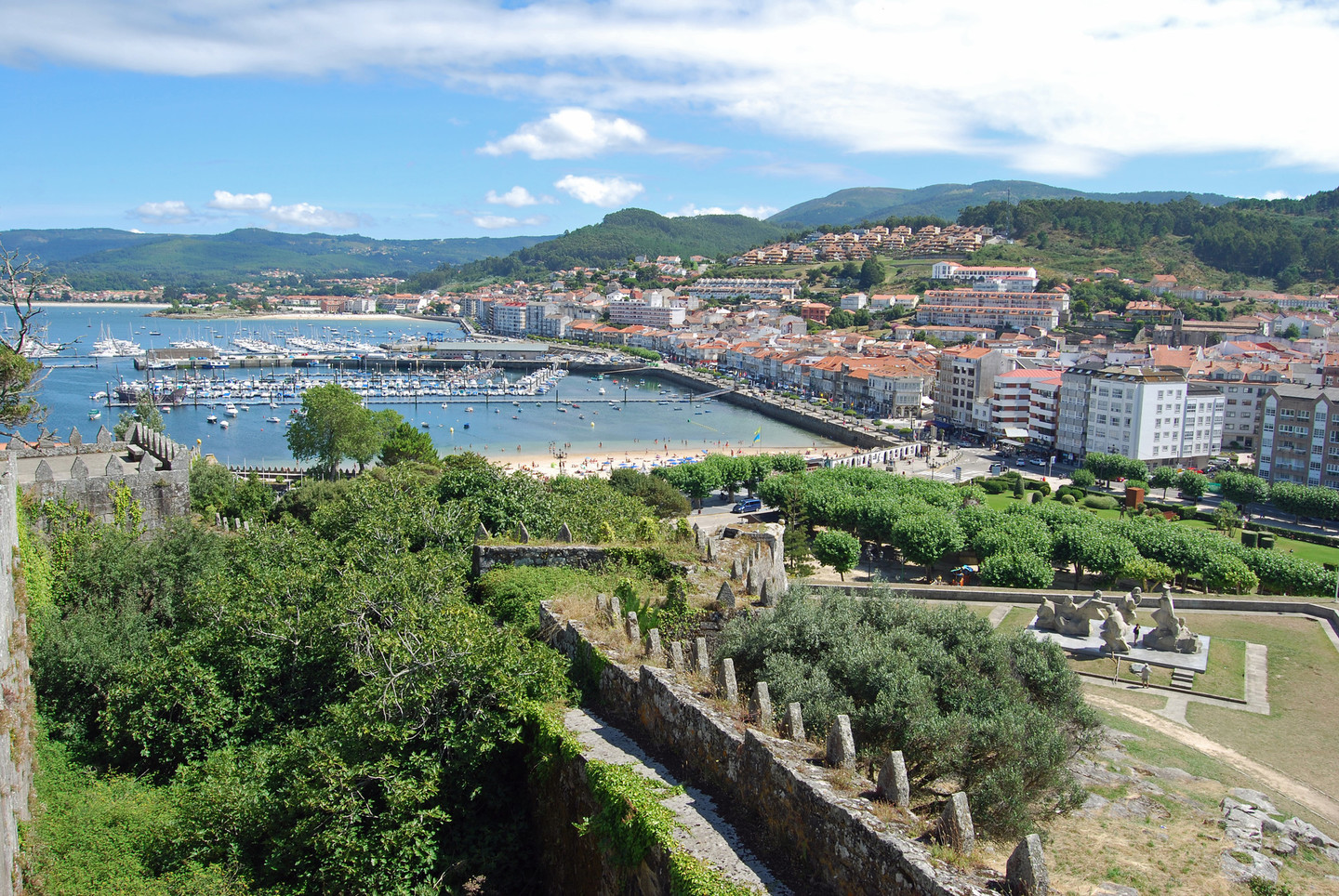
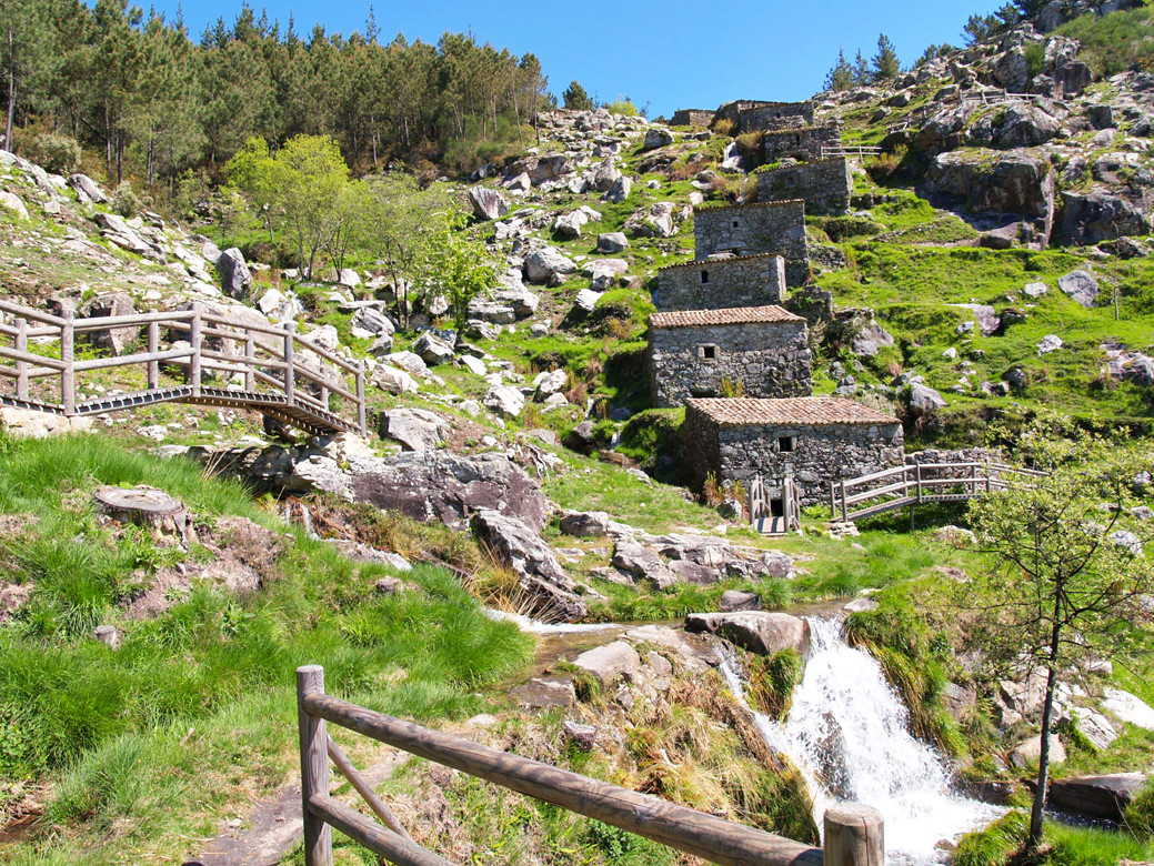
From the summit of Mount Santa Tegra, we can view the entire coastline, beginning in the north with the Vigo estuary and the Cíes Islands, and ending in the south, on the other side of the mouth of the Miño, in Portugal. Another mountain, Mount Aloia, constitutes perhaps the most valuable site in Baixo Miño from an environmental point of view, no discredit meant to the Miño estuary and Gándaras de Budiño, to mention only two other examples. Its slopes are home to numerous animal and vegetable species and the area is particularly well preserved and designed to cater for all the needs of visitors. Mount Santa Tegra and Mount Aloia, both strategically located, provide incomparable natural viewpoints to enjoy the beautiful vistas over these lands, no matter which way we look.

Apart from being its central element, the Miño forms this region's southern border.

In its final section, after leaving inland Galicia, the river begins to flow more slowly, as if preparing for its amorous rendez-vous with the Atlantic Ocean. Its riverbed – which forms the border between Galicia and Portugal – is crossed by several bridges, both modern and ancient, that connect towns in both countries.

O Baixo Miño has a wide catalogue of architectural attractions, from all ages. On the aforementioned Mount Santa Tegra there is one of the most valuable "castros" (Celtic settlements) in Galicia. Although the village dates back more than 2,000 years, this area could well have been inhabited from about 8,000 years ago. Regarding more recent periods, practically every village in Baixo Miño has a church worth visiting, most of which are Romanesque. Tui is in itself a cultural jewel, full of exceptional monuments among which the Cathedral of Santa María deserves special mention. Other villages well worth a visit are Baiona, Tomiño and A Guarda, each for their own diverse motives.

In Oia we will visit its monastery, a source of material and spiritual progress in the region for centuries. To the monastic communities that occupied it we owe, for example, the Mills of O Folón and O Picón. The monks of Oia also cultivated grapes in the O Rosal valley. Thanks to dedication, optimum natural conditions and, in more recent years, the help of wisely applied technology, today O Rosal's wines offer an excellent level of quality within the Rías Baixas designation of origen. They serve as the perfect complement for the area's gastronomy, which includes all types of fruits of the sea, meat and a wide range of desserts.

Route

The route we propose is of low difficulty with the help of a vehicle and includes short journeys on foot. It is suitable for everyone and ideal to do as a family. It takes an estimated three days. The time distribution should just be taken as an example as each person can be vary it according to preferences.

Day 1

We begin our route through the Baixo Miño in the town of Baiona, also called Baiona A Real because of the royal privileges granted by Kings Alfonso IV and John II of Castile for maritime trade.

At the entrance to Baiona we can go up a small road about 500 metres to the A Trinidade stone cross, a beautiful sculpture that is also one of the few to be found under a pyramid-shaped stone canopy. Once in Baiona, to the right we will find the Monte Real Fortress, which houses the National Tourism Parador (state-owned luxury hotel) Conde de Gondomar.

After a walk through the Old Quarter, we cannot leave without visiting the Santa María Collegiate Church and the Santa Liberata Chapel, situated one in front of the other. The former is open to the public mornings and afternoons, while the latter may only be visited at certain times.

Baiona became one of the most important sites for sports sailing in the entire Iberian Peninsula. Its port, full of colour due to the numerous vessels moored there, serves as base during the Príncipe de Asturias Regatta, which is held at the beginning of September.

As we leave Baiona, we ascend to the "Virxe da Rocha" (Virgin of the Rock), a very large stone statue built with donations from the people and created by Galician architect Antonio Palacios and sculptor Mariano Benlliure. Here we will also find numerous grills and picnic tables so that we can spend the day. Inside the statue there is a staircase that finishes in the vessel held by the Virgin, a balcony from where we can see Baiona, the peninsula on which the Monte Real Fortress stands and the Cíes Islands in all their glory. For those who want to visit the Atlantic Islands of Galicia National Park, it should not be forgotten that Bayonne is one of the ports of departure for ships going to the Cíes Islands in high season.

We leave Bayonne via the PO-552. A few kilometers further, with the sea on our right, we reach Cape Silleiro, where there is a viewpoint at the foot of the lighthouse, located 85 metres above sea level. The road follows the coastline, right next to the sea, and the views from this point are magnificent.

Along the coast between Bayonne and A Guarda, the mountain range hugs the Atlantic as closely as possible. We are talking about the mountains of A Groba – which reach 663 m –, known for their rugged terrain and for being home to the largest concentration of Galician horses in the wild.

We reach the town of Oia, 17.8 km from Baiona, where we will see the Santa María de Oia Monastery to our right. Upon reaching the monastery, we get on the left-hand lane and we go through a small tunnel that emerges along the side. The church can be visited by following the directions on the entranceway. Nowadays the monastery is private property, although it may well follow in the steps of many other such constructions in Galicia and eventually be converted into a hotel facility.

After Oia we travel towards the town of A Guarda , located 17.7 km further away. We continue along the coast, which guarantees some lovely landscape views, and in A Guarda we visit Mount Santa Tegra, walking around the area and tasting some of the numerous local gastronomic delicacies. We end our first day.

Day 2

The itinerary for the second day of our route runs along the banks of the River Miño until we reach Tui.

O Rosal has excellent climate and conditions for vine growing and wine production. By the sides of the road we see many vineyards, in most of which the Albariño grape is grown. Rosal wines are included within the Rías Baixas designation of origin. In this town we may also visit the parish church, which is open to the public during hours of worship.

Either from O Calvario – capital of the municipality of O Rosal – or returning to the PO-552 to turn left, we come to the mills of O Folón and O Picón. This group of 60 cascade mills linked by a 3.5 km approved path is of great ethnographic interest, so it was declared to be a Site Cultural Interest in 1998.

From here we return to the PO-552 road and continue our route. We arrived at the parishes of St. Xoán and San Miguel de Tabagón, where we can visit their interesting churches. Close by the Church of San Miguel, across from the school, we find one of the most singular stone crosses in the entire area. Returning to the PO-552, about 500 m to the right is the famous ordeal Tabagón, located in a viewpoint that allow us to enjoy the beautiful landscape of the estuary of the River Miño. At its base we see a map made of ceramic that show the location of each town, mountain and village that can be seen from this point.

We travel to Goián visit the fortress of the same name. A few metres further lies the Goián pier, from where the ferry leaves that joins this town with Vilanova da Cerveira, located on the other bank of the river, in Portuguese territory.

After travelling 1.5 km along the PO-552 we take a right-hand turnoff towards Figueró. There we will visit the San Campio de Lonxe Shrine, thus named due to the large distances that the pilgrims cover to reach this place of worship (lonxe: "far"). The many devotees of this saint – protector of the young people who join the army – attribute all kinds of curative powers to him.

Returning to the PO-552, and after 4.7 km, we take another turnoff to the right to visit Tomiño, whose Romanesque church is worth a special mention. From Tomiño there are 12.3 km to Tui, a town with many places worth seeing which we will visit on the third day of our route.

Día 3º

Comenzaremos nuestro recorrido por Tui visitando la catedral y el Museo Catedralicio. Después bajaremos por la Calle de la Misericordia contemplando la capilla de San Telmo, patrón de Tui. Continuaremos por la calle del Corpo Santo para subir por el pasadizo das Monxas y visitar el convento das Encerradas, donde merecen especial atención las rejas de las ventanas. No olvidemos que este convento es de clausura, razón por la que sólo podremos visitar la iglesia, abierta en horario de culto. Preguntaremos las horas concretas en el convento, puesto que varían en función de los horarios de otras capillas o iglesias.

También visitaremos la iglesia del convento de San Domingos. Este templo alberga dos hermosos retablos y sirve de escenario para distintas exposiciones. En esta iglesia se encuentra el sepulcro de don Diego de Zúñiga y Sotomaior, obispo de Ourense y Zamora en el siglo XVII.

A poca distancia de Tui, en la salida hacia Vigo, nos podemos desviar hacia la iglesia de San Bartolomeu de Rebordáns. Justo frente al templo se encuentra un crucero admirablemente tallado. Introduciremos una moneda en el aparato temporizador que encenderá las luces de la iglesia unos minutos. Si descendemos por unas escaleras accederemos a las excavaciones ubicadas bajo el templo.

La última tarde la dedicaremos a disfrutar del Parque Natural Monte Aloia. Para llegar al parque saldremos de Tui en dirección a A Guarda. A poca distancia hay un indicador a la derecha que nos señala el camino. Después de pasar la primera aldea nos encontramos ya dentro del parque. El mejor punto para comenzar nuestra visita al parque es el Centro de Interpretación de la Naturaleza - Casa Forestal Enxeñeiro Areses. Está situado en el ascenso, a mano derecha. En estas instalaciones podremos recoger guías de las distintas rutas de senderismo del parque, información sobre especies naturales y todo el necesario para conocer el valor medioambiental de este lugar. Existe la posibilidad de realizar visitas guiadas. Además, este centro sirve de recuerdo y homenaje a Rafael Areses, personaje que dedicó su vida a la defensa del patrimonio natural gallego. Aun hoy se conservan en el centro objetos que utilizó en sus paseos por los montes, como una navaja y un bastón.

El Parque Natural Monte Aloia dispone de las dotaciones necesarias para dar la bienvenida al visitante: mesas, lugares de ocio, zonas delimitadas para hacer fuego, etc. Además, existe un restaurante del lado de la ermita de San Xulián. Después de pasar la tarde en el parque bajamos a Tui y damos por finalizada nuestra ruta.

Arriba
Help us improve!