


R5 -Fábrica da Luz Route
This route has three distinguishing features: the local relief, which includes steep gradients; the Mao River Canyon, which marks the municipal boundary of A Teixeira; and the pipes leading to Regueiro Hydropower Plant, which divide the area and can only be crossed at specific points.
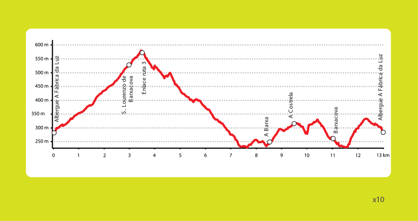
The route begins at the meeting point at A Fábrica da Luz, one of the first parts of Galicia’s hydroelectric infrastructure built in the early 20th century. It has now been converted into a hostel. The route then climbs three kilometres along a paved path to San Lourenzo, where it is possible to visit San Vítor Necropolis.
It then descends to the Sil River Canyon and continues on a good path along the riverbank to A Barxa, which marks the start of a climb up to A Costrela.
To cross the pipes that supply water to Regueiro Hydropower Plant, you will need to cross a small bridge and then port your bike a short distance between some of the area’s traditional vineyards.
The next section runs along a hillside on a path by the edge of the canyon, offering a view of the mouth of the Mao River where it flows into the Sil. From Barxacova, continue along the riverbank to a dirt track with a steep gradient, which ends at the road that leads back to the hostel at A Fábrica da Luz.
Before or after your ride, we recommend visiting the elevated wooden walkway along the Mao River Canyon that forms part of an easy hiking trail running from the car park at A Fábrica da Luz to Barxacova.

