If you were able to fly a few metres over Cape Fisterra, you could see the sinuous and challenging orography of Costa da Morte, haughtily coming in and out of the fierce Atlantic.

It warns sailors about danger with its historic lighthouses, but it also lets the force of the waves seize its beaches of fine white sand, rewarding us with one of the most captivating landscapes in Galicia.

Rocks of Pasarela
when I see you, rocks,
I sigh of love for her.
   Eduardo Pondal

The almost cruel beauty of the beaches of O Rostro and the Mar de Fóra amazes us because of the competition that the water, wind and earth seem to exercise there.

Day 1

It is said that the name of the region of Costa da Morte (Death Coast), among other theories, refers to the great number of marine disasters that took place in the past, and also in more recent times, due to the danger of the cliffs that plunge into the sea and the frequent storms. Maritime signals arose at strategic points in ancient times, and have survived down to our own days, restored and transformed into icons of a territory marked by the harshness of the ocean.

Made of pink granite from O Porriño, if you look closely you will discover three parts of a huge ship joined together, rising 50 metres above the sea. The structure is integrated into an environment of rocks eroded by wind and water, which look like zoomorphic sculptures, making up an unusual landscape that is completed by the Sisargas Islands towards the north and Cape Roncudo to the south. Do not miss the chance to try the barnacles that grow here - some say they are the best in Galicia.

Our journey continues towards Camariñas, although first we will make two stops in Laxe. Far away from the calm of the popular beach that surrounds the town are the unspoilt beaches of Soesto and Traba, which even though they are shaped like a cove, it is quite likely that they will receive you with strong wind and swell. In both cases, you will have to leave your car nearby and cross the dunes over the walkways until you reach the fine white sand which marks the limit with the open sea. Soesto extends to about 860 metres from one end to the other, while Traba surpasses 2.5 kilometres.

This is a good distance for taking a walk and observing seabirds among the reeds of the lower dunes: seagulls, kingfishers, plovers and wagtails, which all live in this great ornithological observatory. And if you raise your eye a little higher, you will doubtless see some strange stones in the distance carved by the wind, our Penedos de Traba e Pasarela, declared a Protected Landscape by the Regional Government of Galicia.

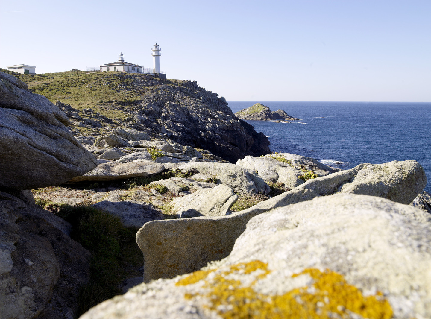
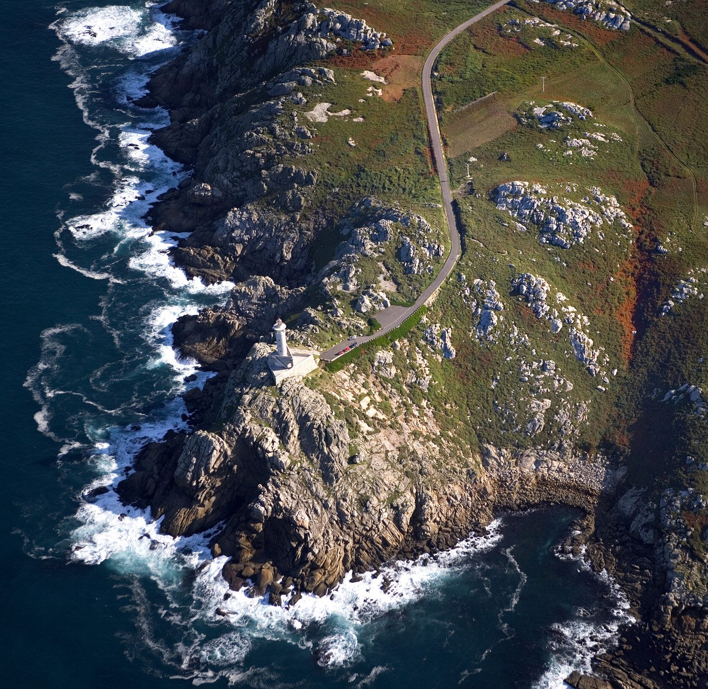
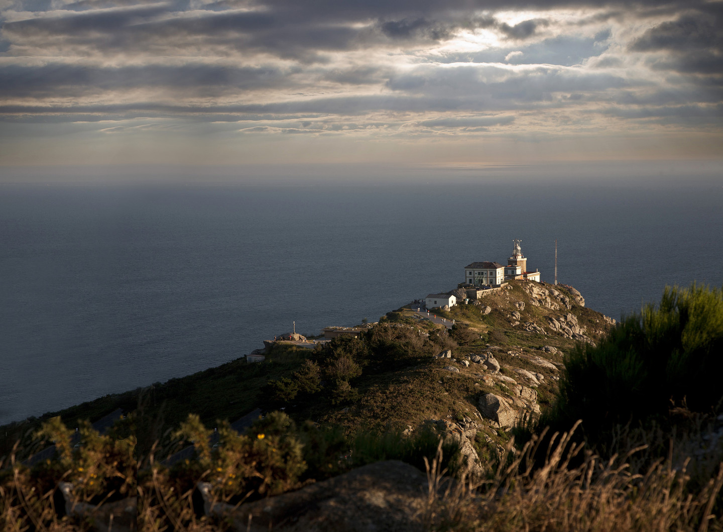
This eastern part of the mountain range of Pena Forcada extends from Traba de Laxe to the tip of Cape Vilán, our next stop in Camariñas. In this rocky, and in a way intimidating scenario, because of the force the wind erodes it with, arises another lighthouse on Costa da Morte, very well-known both for its structure and its location. It is currently home to the Museum of Shipwrecks. In the visit to the exhibition, you will get a close look at lighthouses and their secrets and will see how the beauty of the place contrasts with its extreme level of danger. Over 150 wrecks have been recorded on this stretch of coast; the best known is English navy vessel HMS Serpent, on 10 November 1890. Apart from three seriously wounded survivors who managed to reach the coast, the other 172 members of the crew are buried in the spot known as “Cemiterio dos Ingleses” (the English cemetery). Go up to the old tower, located next to the current lighthouse, built in 1896. You will see the octagonal tower of Cape Vilán from here in all its magnitude. You will also see the Cyclops of Death Coast, which rises 105 metres above sea level to launch its light signal to all the ships sailing around these waters. This was the first electric lighthouse on the Spanish coast. Another curiosity is the covered tunnel which joins the lighthouse keepers’ building with the flashlight through one of the sides of the cliff.

From the road to the lighthouse there is a path which leads to the wild Trece beach. Leave your car and keep going on foot or by bike along the path, which allows you to admire a splendid panorama: the majestic profile of Vilán, pebble beaches, the sea breaking constantly… Once again on the way, you will come to the Foxo do Lobo (Wolf’s Ditch). It is a hunting system, probably of prehistoric origin, that consisted of building converging stone walls which were used to hunt the animal it is named after, wild boars or deer.

You will also find a great biological variety here. In fact, this is the only place in Galicia, together with the Cíes islands, where the last species of camariña heather grows – it is in danger of becoming extinct and gives its name to the municipality. Also notice the docile pine trees twisted by the strength of the wind. The landscape around us makes us think about the impressive force of nature. Further on, continuing along the path, we come to the Cemiterio dos Ingleses (English cemetery), where the shipwrecked victims of the Serpent rest, almost above the sea. At the end of the path, you will find the Trece bay, watched over by the figure of a climbing dune, which seems to want to try and reach the peak of Monte Branco.

We continue southwards and come to the westernmost point in the Spanish peninsula at sunset on this first day: Cape Touriñán. This is a small peninsula that protrudes like a challenge into the sea for almost a kilometre. While you contemplate the Atlantic landscape of Costa da Morte in all its splendour, with the little lighthouse in the background, the force of the wind will push you along the path to an area of almost one thousand metres, including the wild beach of Nemiña to see how the sky turns red with warm colours during these last moments of the day. Dusk could also be a good time to go up Monte Facho to contemplate the beauty of the peninsula of Muxía. Or perhaps, enshrouded in this magical time, you might decide to join the athletes who find this beach a paradise for surfing.

Day 2

Keep the second day to go to Fisterra, the end of the known world in ancient times. Before entering the town and accompanying the last steps of some of the thousands of pilgrims from all over the world who each day find here the end of the Pilgrims’ Road to Santiago, visit two beaches of an almost cruel beauty because of the competition that the water, wind and earth seem to exercise there. The beaches are O Rostro and Mar de Fóra, open to the Atlantic and always surrounded by an apparent solitude.

Even though they do not belong to the usual area of summer swimming, as they are dangerous, they are an obligatory stop for everyone coming to Fisterra. In the surroundings of O Rostro, the beach is over two kilometres long. It is a very popular place for nature lovers and hikers. There is also a legend related to this beach, which tells how under the fine white sand lies the mythical city of Dugium, founded by the Nerians. The city succumbed under a huge wave. Mar de Fóra, closer to the town of Fisterra, enjoys the eternal company of Cape Fisterra and Cape da Nave at its ends.

Staying in Fisterra, just as with the previous stops, is an excellent excuse to try the delights of the sea - in summer time there are popular food events. The typical dishes are also the usual menu in the local premises all year round: pod razors, clams, barnacles, grilled sea bass, Galician octopus …

Make the most of the time after lunch to stroll around the town of Fisterra accompanied by the fragrance of the sea and the cosmopolitan din of visitors, especially in the proximities of the pilgrims’ hostel and the cafeterias and bars near the harbour. Go into the Castle of San Carlos, dating from 1757, now the Fishing Museum. If it is Sunday, enjoy the solemn aura of the Sanctuary of Santa María das Areas to check if the hair and nails on the almost human statue of Christ of the Golden Beard are growing, as held by tradition, but do not lose sight of the heavens ...

Just before the sun sets you should reach the surroundings of Fisterra lighthouse and sit down on one of the stones on the path that surrounds the promontory to bid farewell to the king of the heavenly bodies on this, its ancient altar, the Ara Solis of the Phoenicians. The building by the lighthouse is the Foghorn, better known as “the Cow of Fisterra” because of the strident sounds it emits on days of thick fog, reaching a distance of 25 miles (46 km). The third building in the complex is the Semáforo, located at a certain distance from the previous ones. In the past it served the navy and is now an inn, restored by architect César Portela.

The shadow of the mythical lighthouse, the bellowing foghorn, the view of the infinite and shimmering sea down below, some faraway ship, the dangerous islet of the Centolo and the stone mass of Monte Pindo on the other side of the estuary of Corcubión will be your best companions to bring this trip by a tough but calm sea, a sea of death but also of life, to an end.

Arriba
Help us improve!