Turismo de Galicia

-
Qué hacer
Camino de Santiago
Naturaleza
Cultura y patrimonio
Mar y costa
Rutas
- Top-Ten: Diez lugares únicos
- Ruta de la camelia
- Rutas turísticas
- Sendas para descubir un país
- Paseos que enamoran
- Escenarios al volante
- EuroVelo Galicia
- Más allá del ocaso
Gastronomía
Turismo de salud
PROMOCIONES PARA DISFRUTAR AHORA
Agenda cultural
Va a pasar... Ver todos
- Qué visitar
-
Planifica tu viaje


Descripción
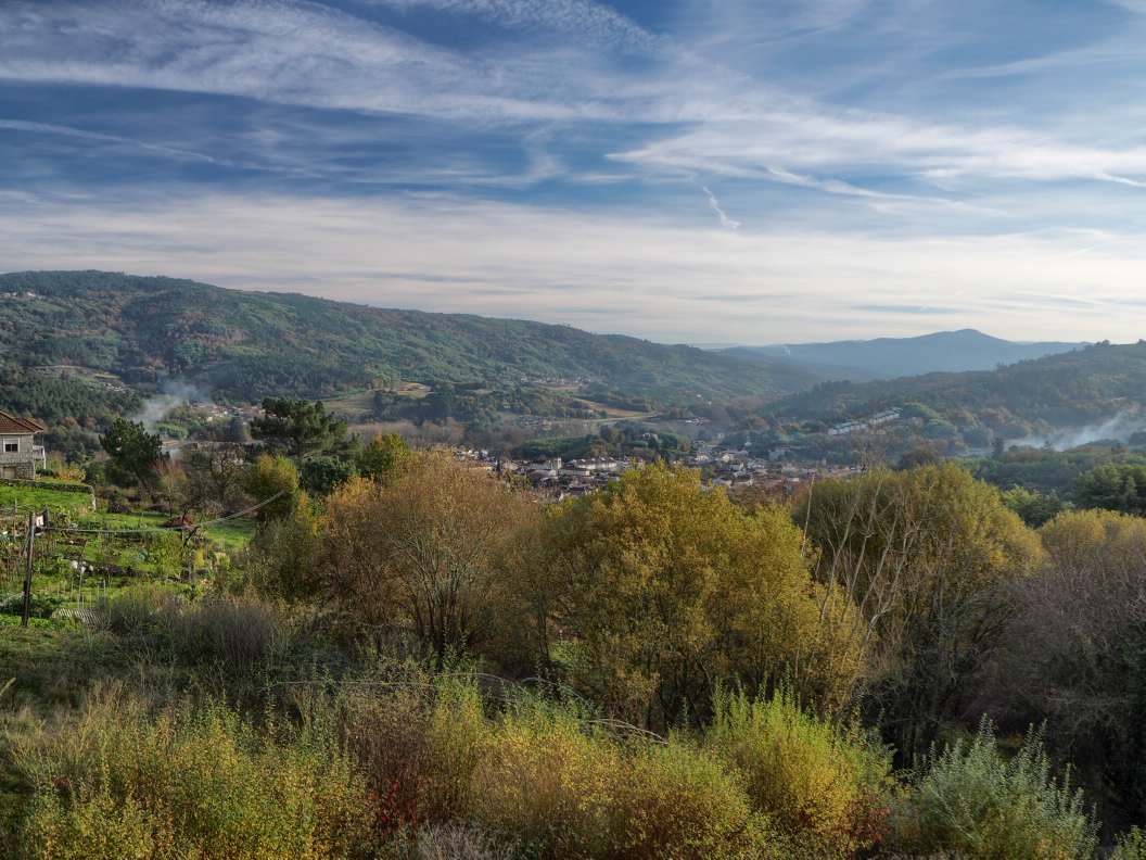
Desde la preciosa aldea de Pazos de Arenteiro, aguas arriba de las imponentes ruinas de A Ponte da Cruz, el sendero discurre en dirección sur, al igual que el cauce del río Avia. El trazado atraviesa en sus inicios un bosque reciente, donde hace años había viñedos. Los muros de los bancales y las ocultas ruinas de la desaparecida población de Viñoá demuestran que hace menos de un siglo el paisaje era muy diferente.
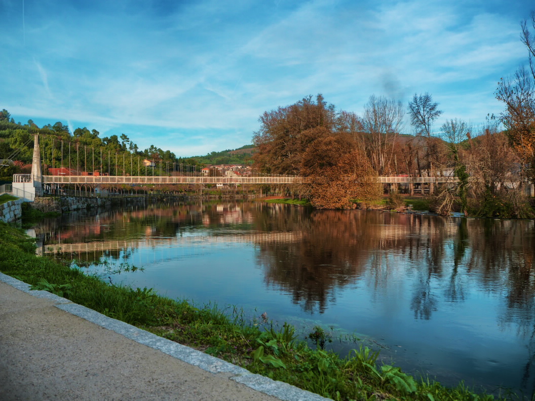
En Lebosende, la ruta desciende hacia Leiro por una antigua calzada empedrada. Luego se aproxima al río Avia y cruza al margen izquierdo por A Ponte das Poldras. Desde aquí es recomendable acercarse al monasterio de San Clodio, declarado monumento histórico artístico en 1931.
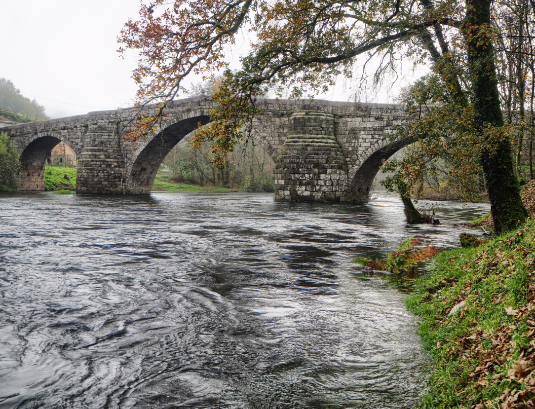
Siguiendo la ruta, se llega al magnífico puente de San Clodio. El camino prosigue por bosques de ribera y entre amplios viñedos. En A Quinza, la senda cruza al otro margen del río Avia para finalizar unos kilómetros más abajo en la amplia área recreativa de Ribadavia.
En ambos extremos del itinerario son recomendables las visitas a las poblaciones de Pazos de Arenteiro y Ribadavia, donde historia y arquitectura se unen.
En Lebosende, la ruta desciende hacia Leiro por una antigua calzada empedrada. Luego se aproxima al río Avia y cruza al margen izquierdo por A Ponte das Poldras. Desde aquí es recomendable acercarse al monasterio de San Clodio, declarado monumento histórico artístico en 1931.
Siguiendo la ruta, se llega al magnífico puente de San Clodio. El camino prosigue por bosques de ribera y entre amplios viñedos. En A Quinza, la senda cruza al otro margen del río Avia para finalizar unos kilómetros más abajo en la amplia área recreativa de Ribadavia.
En ambos extremos del itinerario son recomendables las visitas a las poblaciones de Pazos de Arenteiro y Ribadavia, donde historia y arquitectura se unen.
Acceso
A Pazos de Arenteiro por Ribadavia – Leiro o por O Carballiño. Siempre a través de la OU-504 y luego OU-0414.
Un plus
Aldea de Pazos de Arenteiro
Conjunto histórico artístico desde 1973, es una pequeña población entre los ríos Avia y Arenteiro que disfrutó de la protección de los caballeros de la Orden de Malta. Iglesia románica, puentes medievales, numerosas mansiones señoriales y su recuperación, como un importante núcleo de turismo rural, la convierten en un destino turístico de primer nivel. Es muy recomendable el paseo a pie por un bucólico paisaje de ribera hasta cualquiera de los dos puentes y el bello paraje conocido como “Pozo dos Fumes”.
Conjunto histórico artístico desde 1973, es una pequeña población entre los ríos Avia y Arenteiro que disfrutó de la protección de los caballeros de la Orden de Malta. Iglesia románica, puentes medievales, numerosas mansiones señoriales y su recuperación, como un importante núcleo de turismo rural, la convierten en un destino turístico de primer nivel. Es muy recomendable el paseo a pie por un bucólico paisaje de ribera hasta cualquiera de los dos puentes y el bello paraje conocido como “Pozo dos Fumes”.
Longitud
15,8 km.
Punto de partida/llegada
Punto de llegada: Ribadavia (Concello de Ribadavia)
Punto de partida: Pazos de Arenteiro (Concello de Boborás)
Recorrido
Pazos de Arenteiro, Viñoá (ruinas), Lebosende, Leiro, A Ponte das Poldras, A Ponte de San Clodio, A Quinza, Ribadavia.
Dificultad
Media
Duración
4 horas y 50 minutos.
Conexiones
Con los PR-G 77, 78 y 79.
Material
En invierno se recomiendan botas de montaña.
Servicios
En Pazos de Arenteiro, Leiro y Ribadavia.
M.I.D.E.
Esfuerzo M.I.D.E.:
Itinerario M.I.D.E.:
Desplazamiento M.I.D.E.:
Medio M.I.D.E.:
Acceso en bicicleta
Apto parcialmente
Acceso a caballo
Apto parcialmente
Cartografía I.G.N. (1:25:000)
187-III Maside, 225-I Ribadavia
Más información
www.terrasdoavia.es
Tipo de recorrido
Pequeño recorrido
Interés
Interés histórico
Interés naturalista
Descargue las coordenadas del recurso que le presentamos...
Plano

Fecha de recogida inicial: 01/08/2019

