


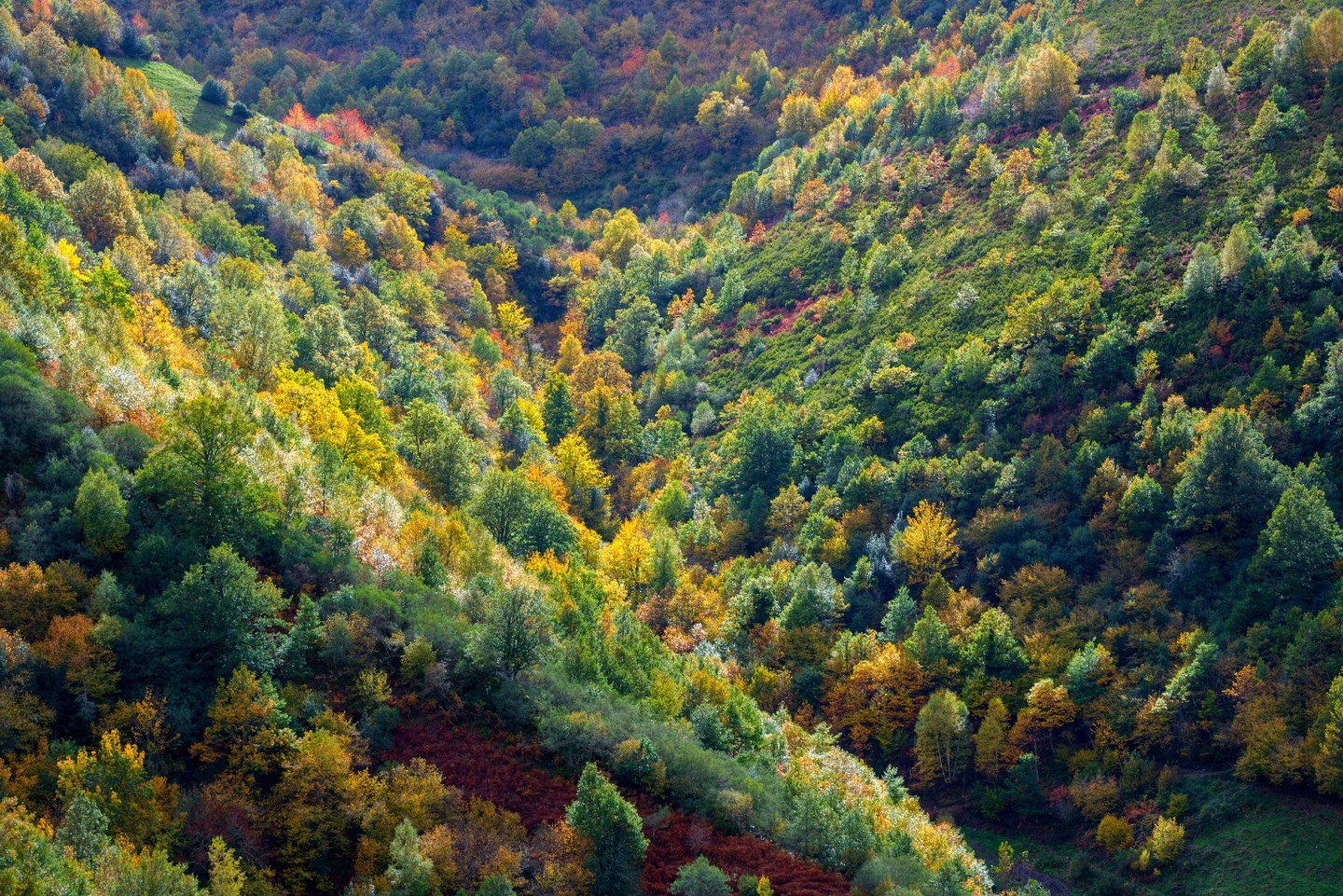
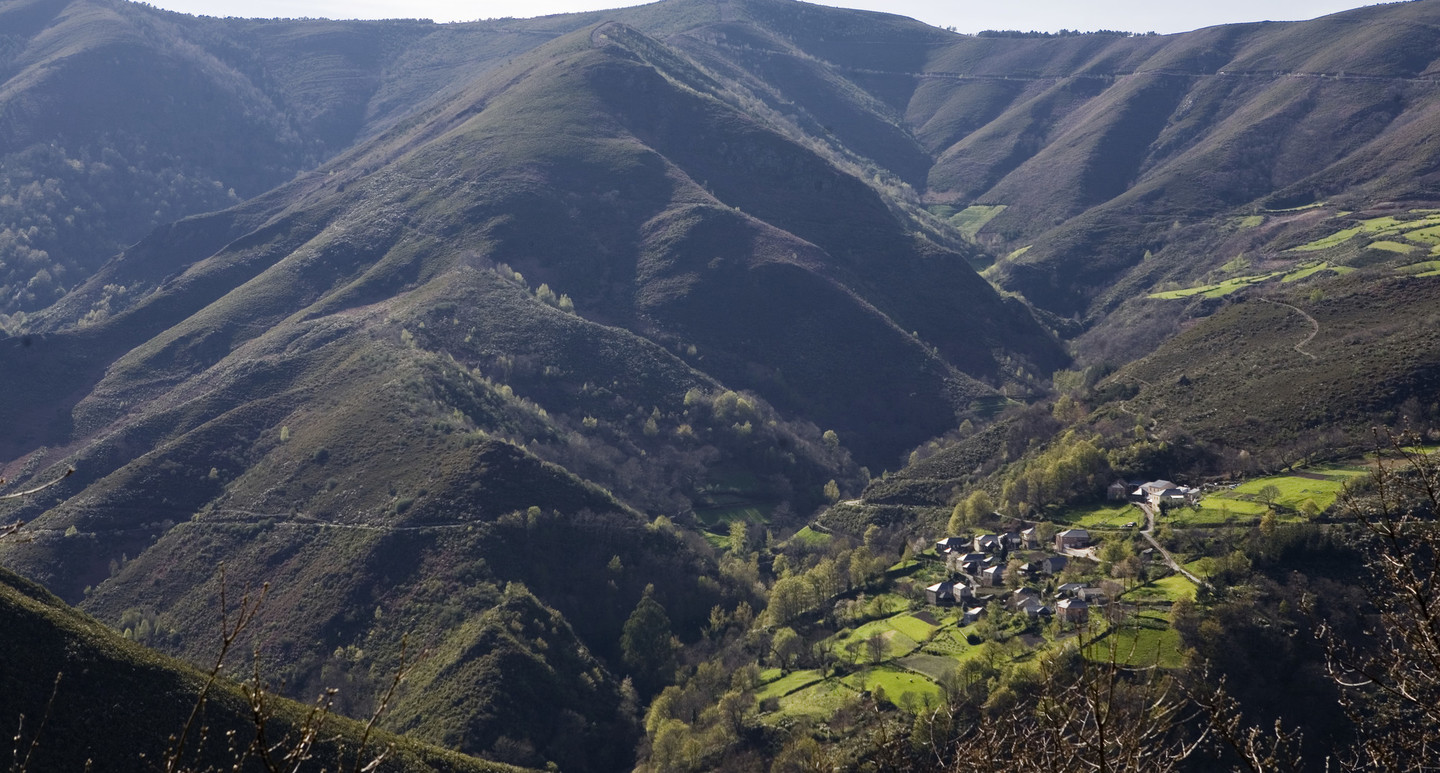
The Os Ancares mountain range is one of the places in Galicia whose beauty most surprises us. It is located in the east of the province of Lugo, on the border with the neighbouring autonomous communities of Castilla-León and the Principality of Asturias.
Tourist route
Day 1
While travelling on the LU-722 road, you will pass through Borquería until you reach Liber, where you must take the signposted turn-off towards Doiras (20 km). Crossing the river Navia, the legendary “Ponte do Demo or de Gatín” stands on your right, giving rise to the town: As Pontes de Gatín.
Continuing, you will ascend the narrow valley of the river Cervantes, later known as the Valley of the Houses, passing through villages like Lama de Rei, O Mosteiro, O Fabal or Vilanova until reaching Ponte de Doiras.
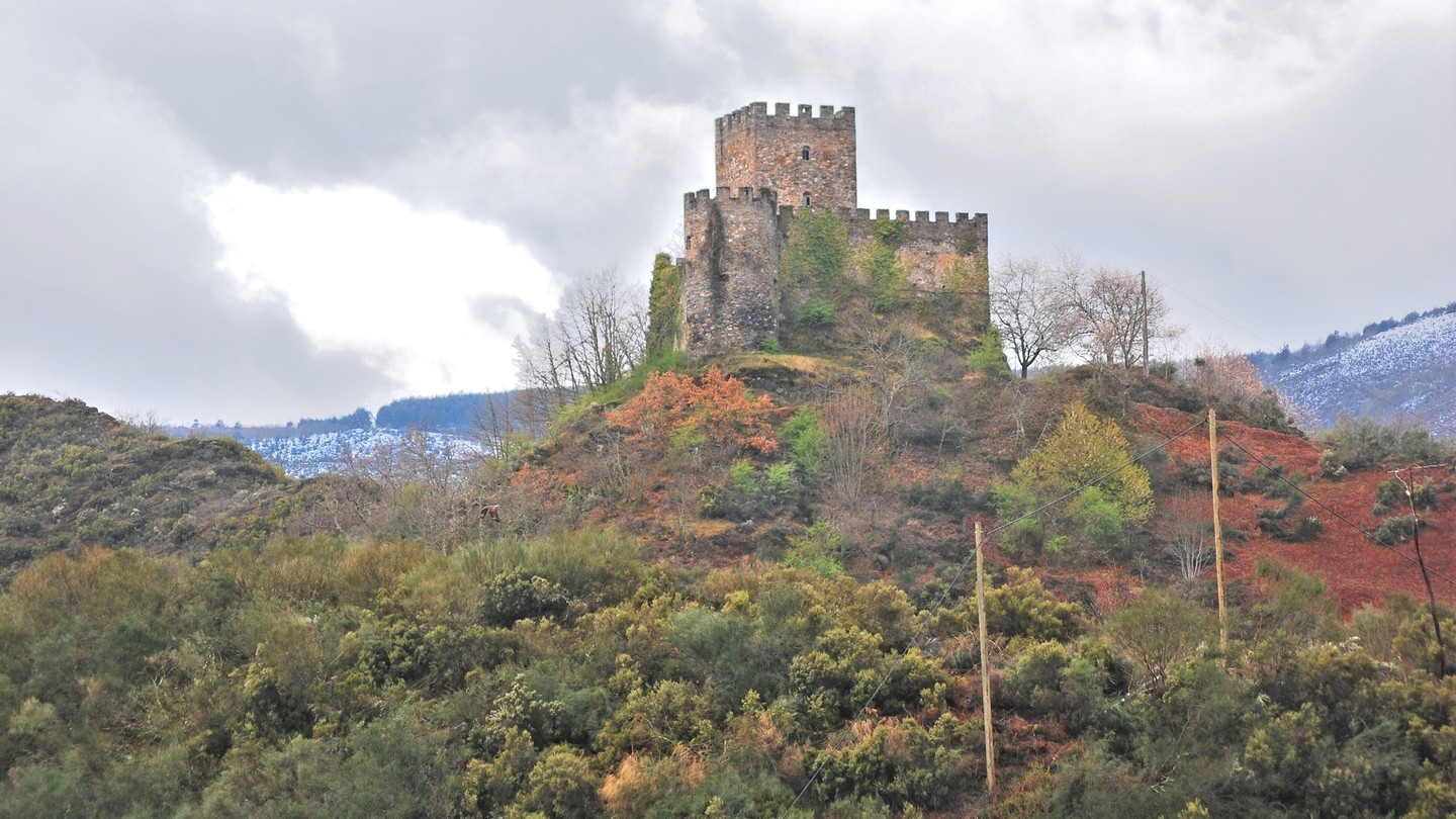
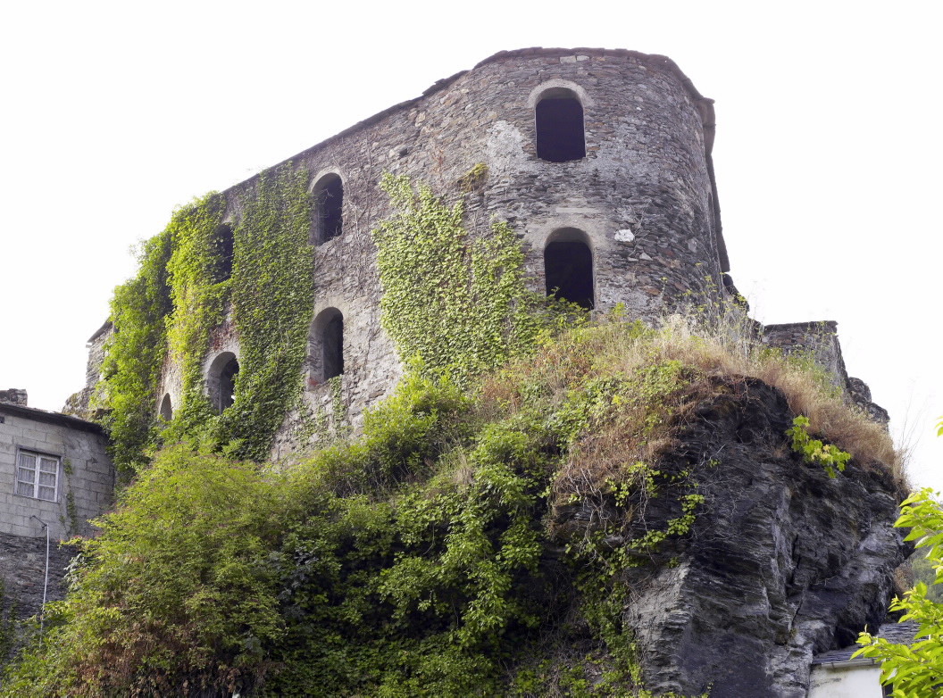
Before continuing to Donís and Piornedo, an option is to park your car here and continue cautiously on foot along the same road to visit Doiras Castle. This 15th-century fortress offers insights into its history and the legend of the white deer, along with picturesque views of the landscape.
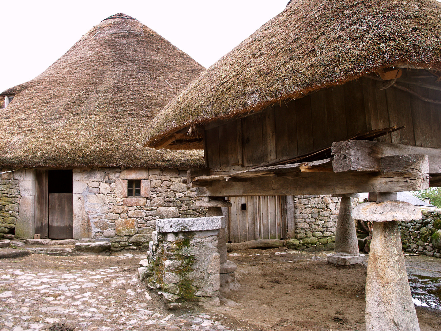
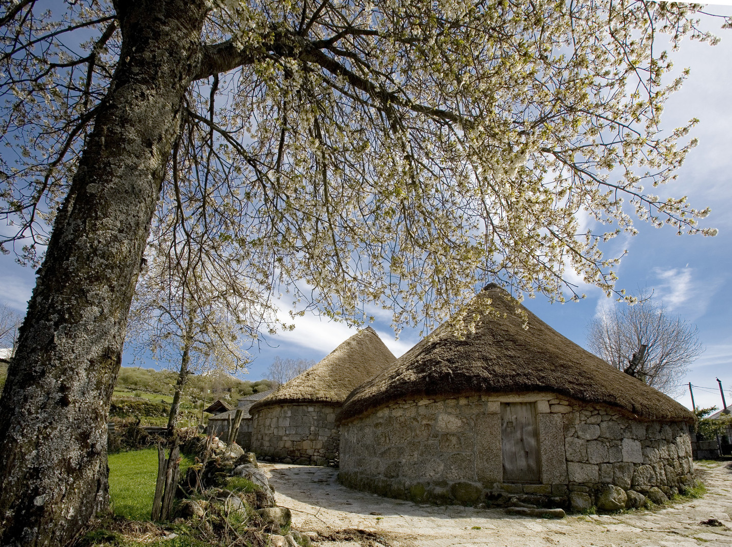
Continuing the journey, we take the provincial road towards Donís, passing by the Castle of Frades with its two Asturian-style granaries topped with green roofs. After about 11 km, you will arrive at Degrada, with its traditional thatched palloza. A short distance away lies Campa da Braña, where a right turn leads to the Ancares Hostel and the Nature Classroom. This spot marks the starting point for one of the region's classic mountaineering routes: the ascent to Pico dos Tres Bispos, nearly 1800 m high, named for its supposed historical significance as a meeting place for bishops. Here, amidst holly forests, the trees take on a stunning red hue when the female trees bear fruit.
You will continue our journey towards Piornedo along a narrow road that winds through the various valleys, passing through Cabaniños, situated in the river Ortigal valley. You'll come across an informative panel about "O Cable," a cable car built in the early 20th century for transporting wood from Los Ancares to O Portelo, and then onwards to Villafranca del Bierzo by trucks.
After leaving Donís behind to the left, just 2 km ahead, you'll find the right turn leading us to Piornedo, where you'll conclude our first day's journey.
Day 2
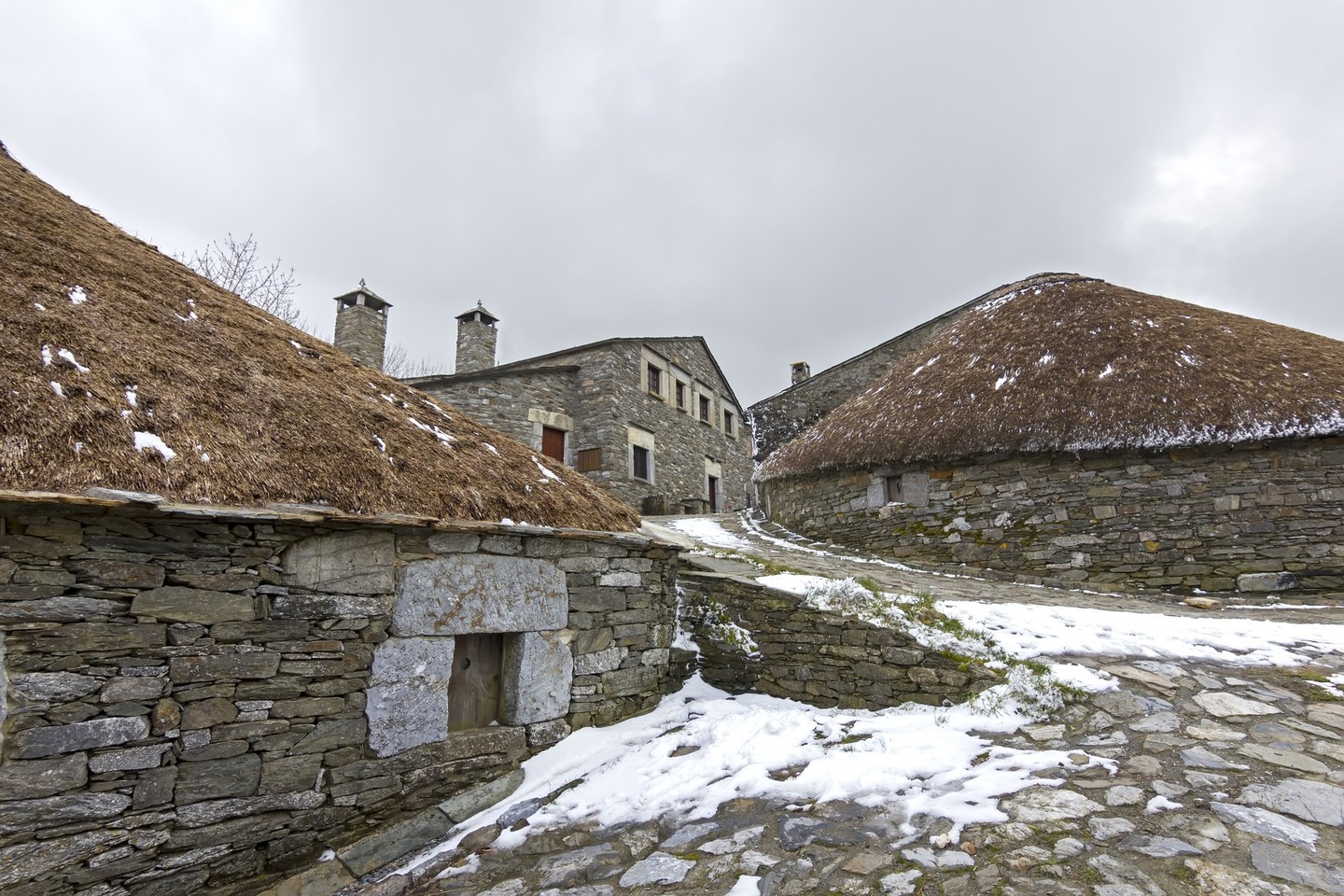
The second day of the route starts in Piornedo where you will visit the pallozas, the ethnographic site and the chapel of San Lorenzo. Right at the entrance of this place, there's a fountain, built through community contributions, bearing the inscription: "Built in 1787. Long live Piornedo". For mountain enthusiasts, this village serves as the starting point for the ascent to Mostallar, at 1935 metres above sea level. After exploring Piornedo, you'll head to the spot where this fountain is located. About a kilometre and a half later, you'll cross into the province of Leon. From the top of the mountain you'll enjoy breathtaking views of the villages of Suárbol and Balouta.
At a designated stop before heading towards Balouta, we can take two short detours from the main route. The first, towards Candín and Veiga de Valcárcel, leads us to the Ancares pass, where you'll park your cars and walk 300 metres to the Balouta viewpoint, offering splendid views of the surroundings. The second, taking the path to Suárbol, to visit Brañas de Pan do Zarco.
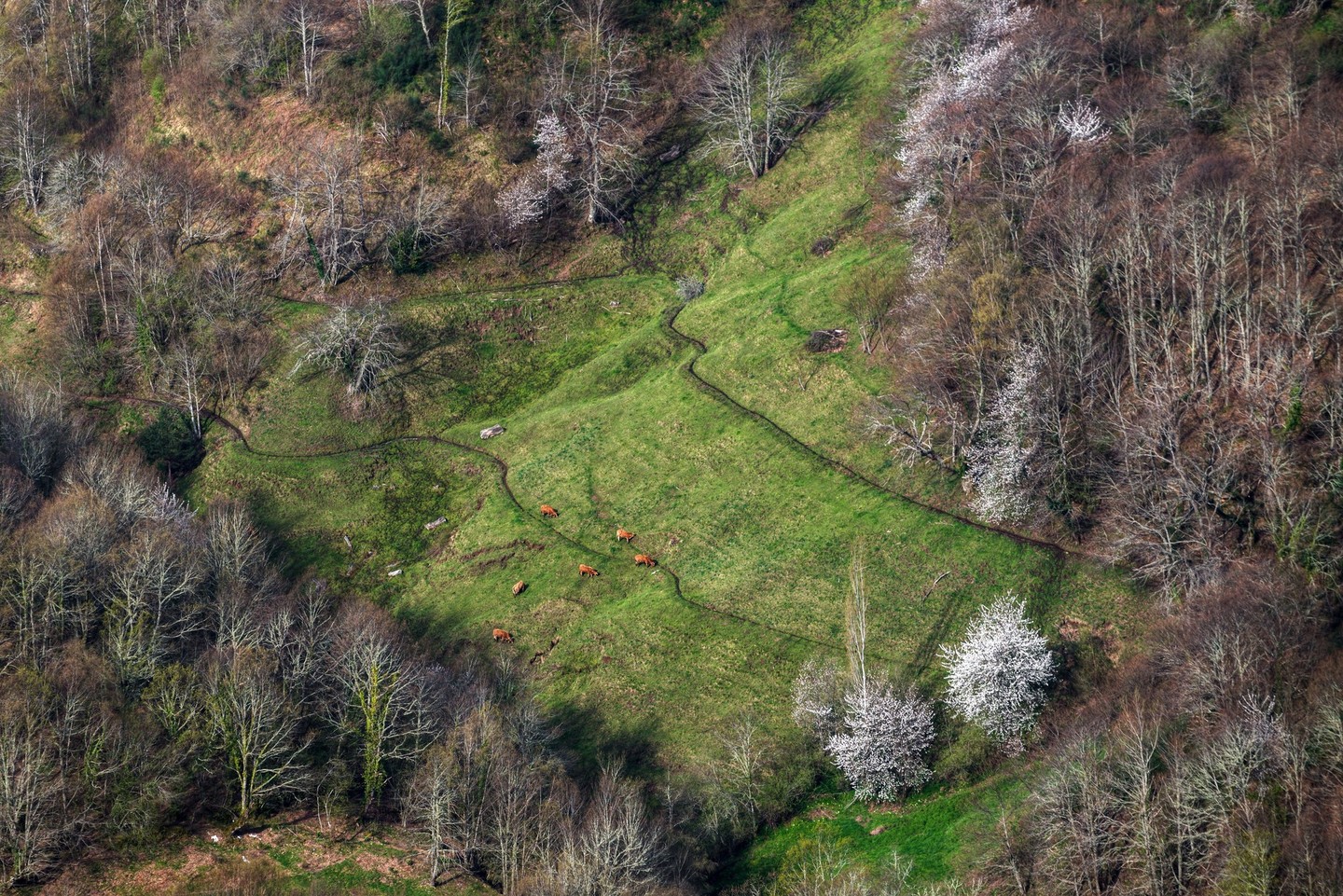
Returning to the main road, you'll pass through Balouta, where several traditional thatched houses, characteristic of the Ancares region, still stand.
From here, you'll follow the course of the river Balouta for a stretch, re-entering Galicia through a gorge. Next, you'll come across several villages such as Murias de Rao, Robledo de Rao and Rao, the latter being of great ethnographic interest. Its parish church of Santa María houses polychrome altarpieces from the 15th century.
It's also common to encounter "cortíns," the name given to beehives in this area. They are enclosed structures, usually circular, where beehives are placed to protect them from animal attacks, especially from bears, although with the near disappearance of this species, they have lost much of their functionality.
You'll continue our journey towards the parish of Proba de Navia, concluding the second day in Ancares.
Day 3
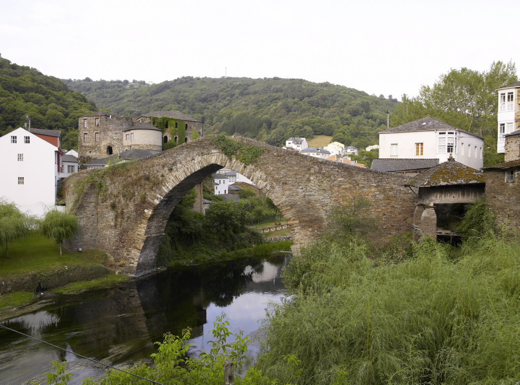
You'll start the day by visiting the village of Proba, known for its pointed arch bridge over the river Navia and the castle, existing since the 11th century, although the current building dates back to the 14th century with subsequent reforms. At Vanzado beach and recreational area, you'll find the "Múíño do Médico," an interesting exhibition of ethnographic heritage.
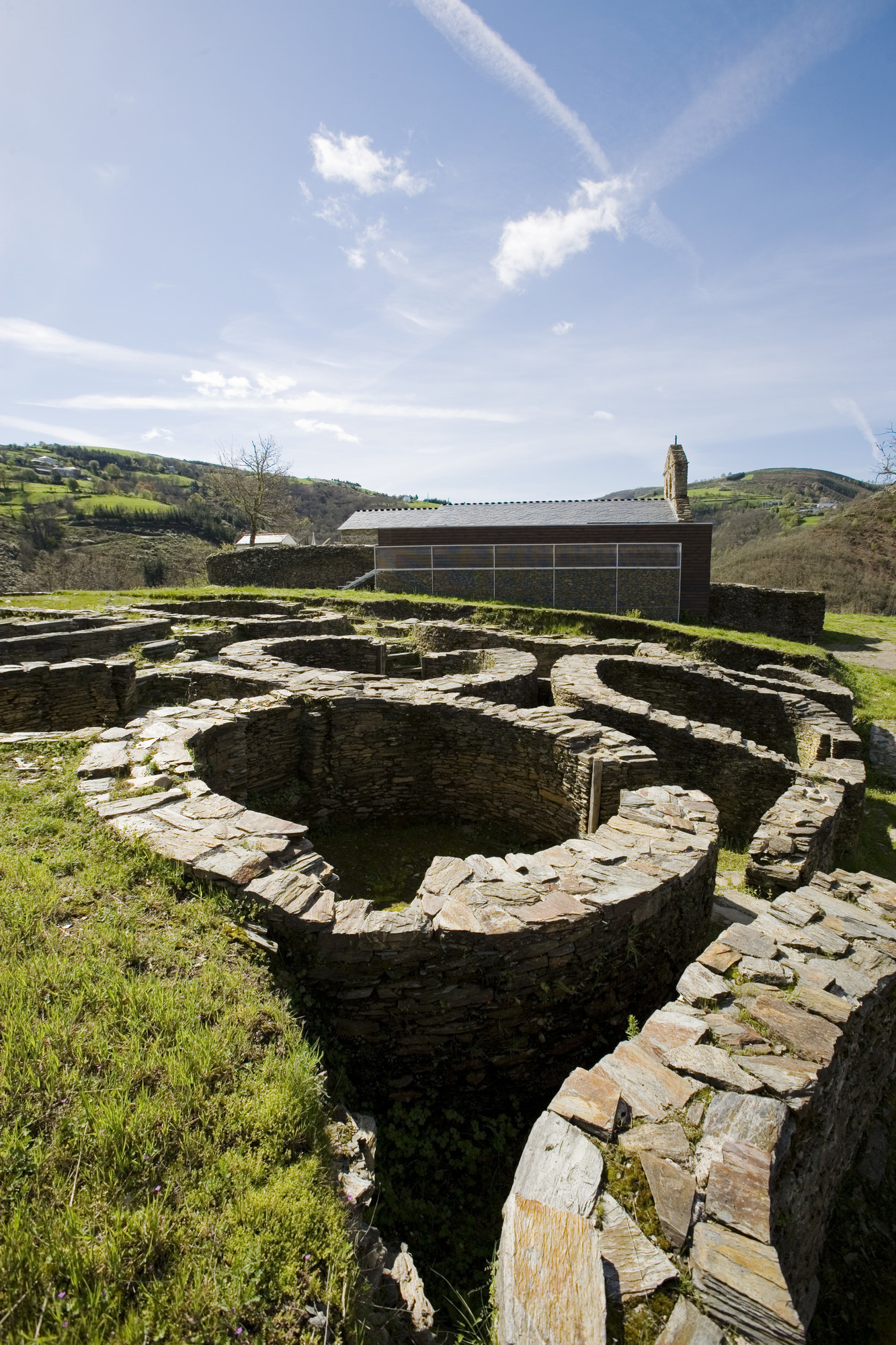
After this stroll through the village, we'll take the LU-722 road towards Becerreá, following the river until San Martín de Ribeira, where we'll turn left to travel almost 6 km and visit the castro de Santa María de Cervantes.
Located next to the parish church, it is partially excavated and bears witness to the presence of population in this territory for over two thousand years.
From here, you have two options: return to the main road we came from and head towards Becerreá, or continue along the local road towards San Román, bordering the valleys of the Castelo and Quindous rivers, passing through the villages of Río do Castro, Vilaluz and Castelo de Cais. In the capital of the Cervantes municipality, there's a reconstruction of two traditional thatched houses and a granary with a green roof, showcasing the traditional architecture of the Ancares.
Further ahead, about 4 km away, you'll reach the junction of the road coming from Navia de Suarna. Taking a left, you'll head to Becerreá, the endpoint of this third stage and our journey through the Ancares.
