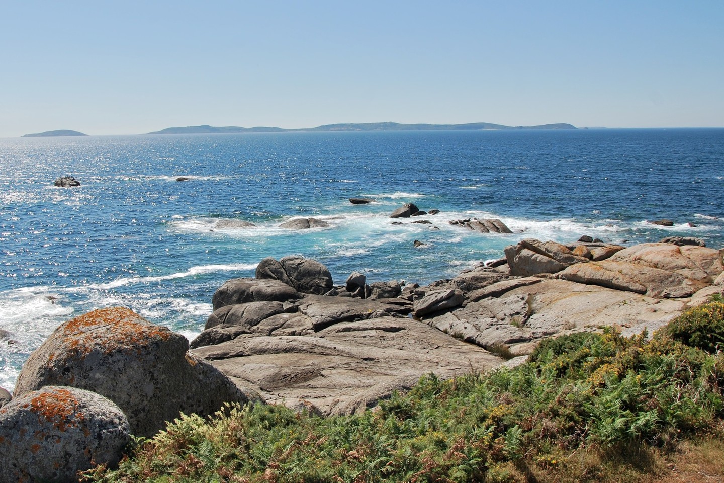
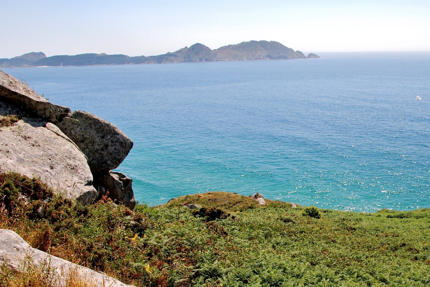
Between the Rías de Vigo and Pontevedra, on the westernmost point of the peninsula of Morrazo, lies the Costa da Vela. This is an untouched world where the sea and the pines are the owners of the landscape. The views here are spectacularly beautiful.

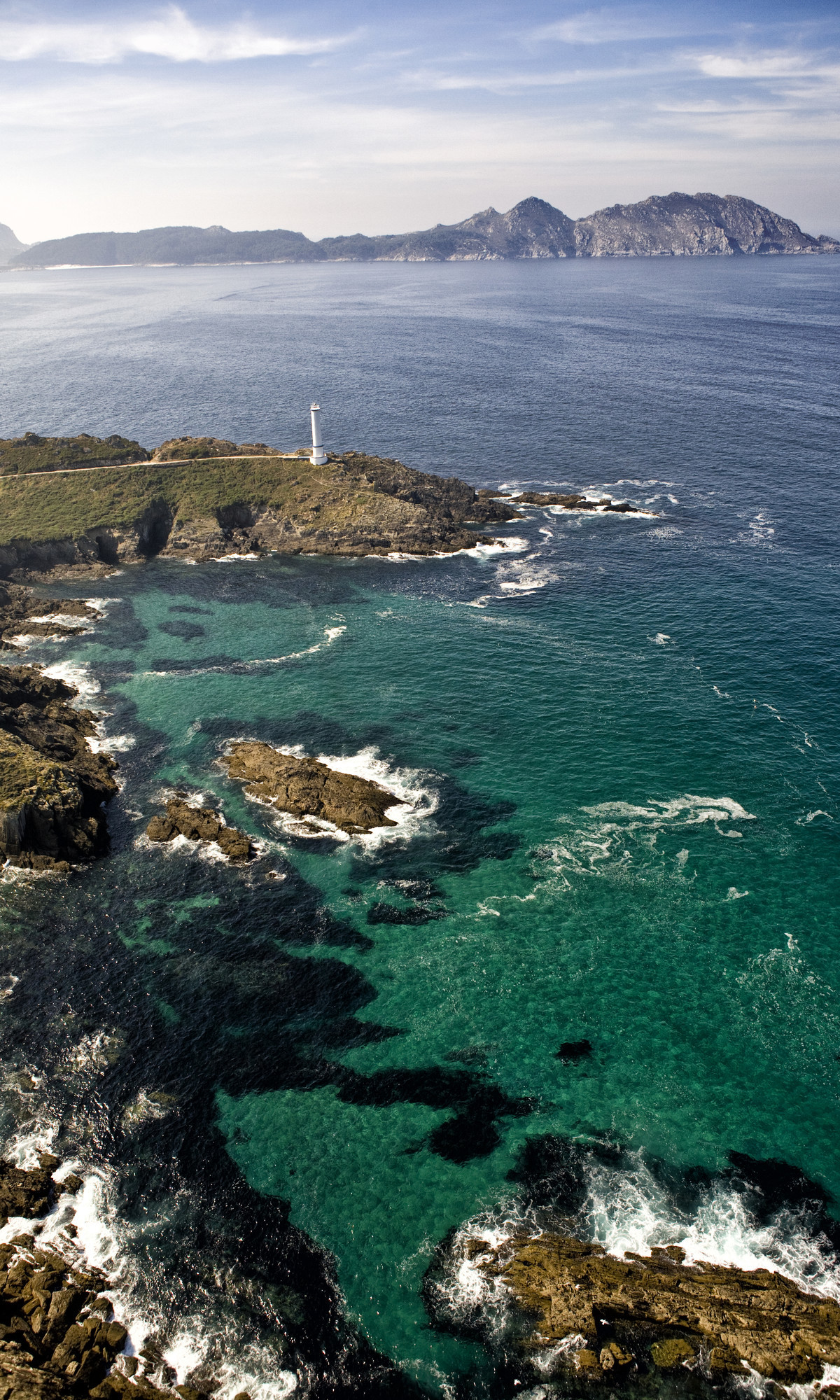
Like the sunset seen from the Faro de Cabo Home, one of the highest in Galicia. Or the cliffs of Donón, over 150 metres high and against which the sea pounds furiously. Or Melide beach – with the Cies Islands in front, almost at arm's length – and from which it is not uncommon to see dolphins playing in the water. Or, now in the estuary of Vigo, the idyllic beaches of Nerga and Barra– the latter nudist – with clear water and surrounded by pine trees that reach almost to the sand.

Dominating the sky and earth, the legendary Monte do Facho, ancient Celtic fortified town and shrine. Though only 160 metres above sea level, its location is perfect for not missing a thing, from Cabo Silleiro to Cabo Fisterra.

Description

Even in ancient times this area, rising up in spectacular cliffs 150 above sea level, was a pilgrimage site. The beauty of the marine lookout points, together with the beaches and the archaeological remains continue to be the atrraction of this excellent natural spot between the Vigo and Pontevedra estuaries.

The discoveries on the Alto de O Facho de Donón revealed a singular sanctuary, a "forest of altars" made up of almost two hundred slabs consecrated to the god Berobreo, conserved in the Municipal Museum of Vigo. In the Galician-Roman castro a total of 60 dwellings have been found up to now in an ample walled enclosure.

It is easy to get to from Donón, on a walk uphill of approximately 30 minutes. It is the central high point of the Costa da Vela, from which there are panoramic views of the mouths of the estuaries of the southern coast of Galicia, with the Illas Atlánticas National Park in first place.

In the extreme south we find Cabo Home with its three points, each with its own lighthouse. Between them they shelter a small cove containing the beach of Melide, and, inside the Ría de Vigo, they protect the succession of small beaches of Barra, Viñó and Nerga, with an uncommonly shaped dune system.

The coastal sea protection area extends to a depth of thirty metres.

Useful information

Location
Municipality of Cangas, on the western tip of the O Morrazo (Pontevedra) peninsula.

Area
1,384.81 hectares of which 1,003 hectares are sea water.

Acess
Turnoffs on the PO-551 road between Bueu and Cangas towards the north via Hío or to the south via Donón.

Services
Accommodation and food in nearby villages.

Arriba
Help us improve!