Turismo de Galicia


-
Que facer
Camiño de Santiago
Natureza
Cultura e Patrimonio
Mar e Costa
Rutas
- Top-Ten: Dez lugares únicos
- Ruta da camelia
- Rutas turísticas
- Sendas para descubir un país
- Paseos que namoran
- Vias Verdes
- Escenarios ao volante
- EuroVelo Galicia
- Alén do solpor
Gastronomía
Turismo de Saúde
Promocións para disfrutar agora
Axenda cultural
Vai pasar... Ver todos
- Que visitar
-
Planifica a túa viaxe


mailto:?subject=Envio de contido de Turismo de Galicia: AS MINAS ROMANAS DAS BORREAS&body=Recoméndoche que leas a información AS MINAS ROMANAS DAS BORREAS extraída do portal de Turismo de Galicia na páxina https://www.turismo.gal/recurso/-/detalle/210519000531/as-minas-romanas-das-borreas?tp=40004370

Datos do recursos turístico
O Paseo
As minas romanas das Borreas
A historia transformada en natureza
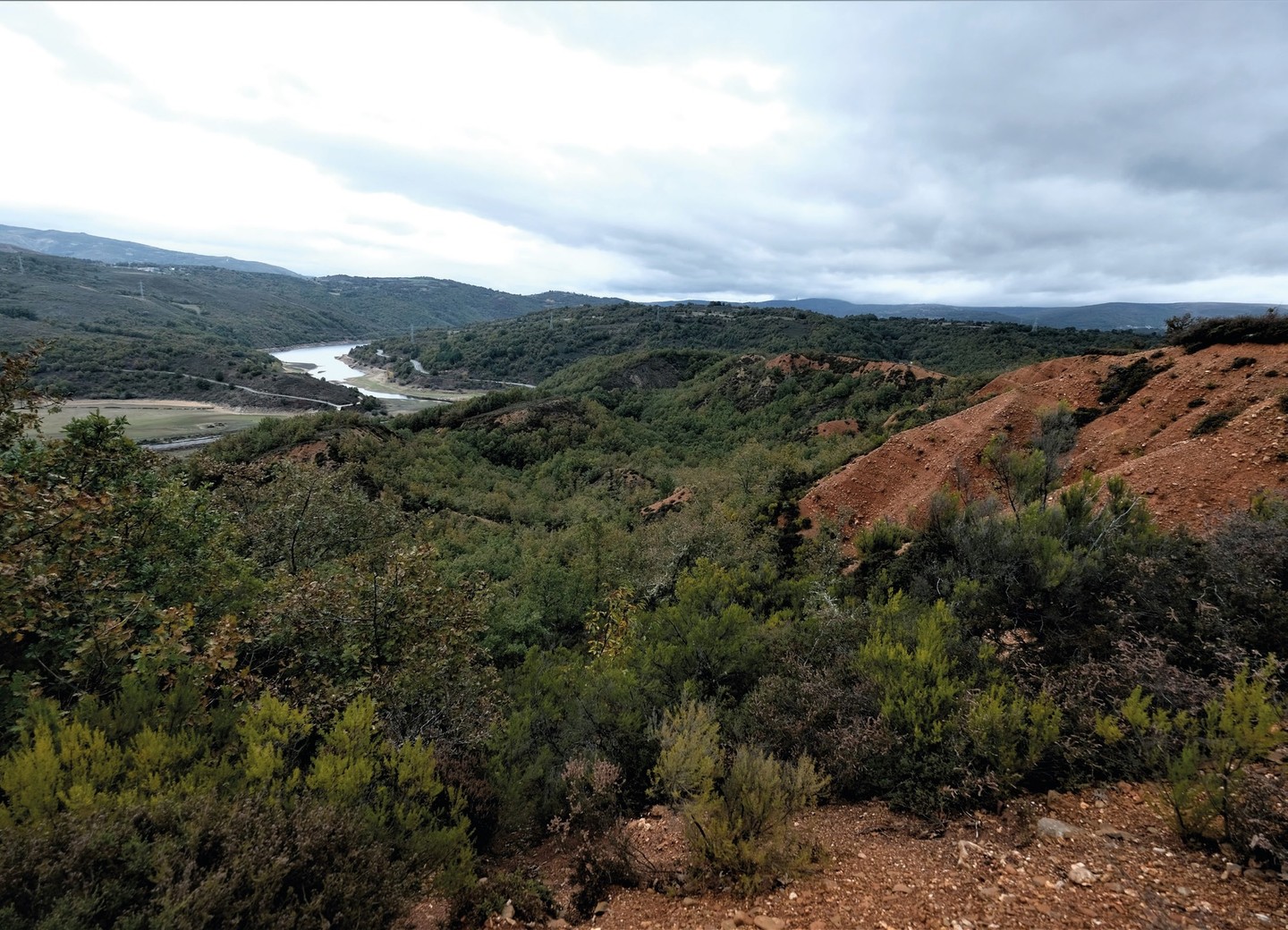
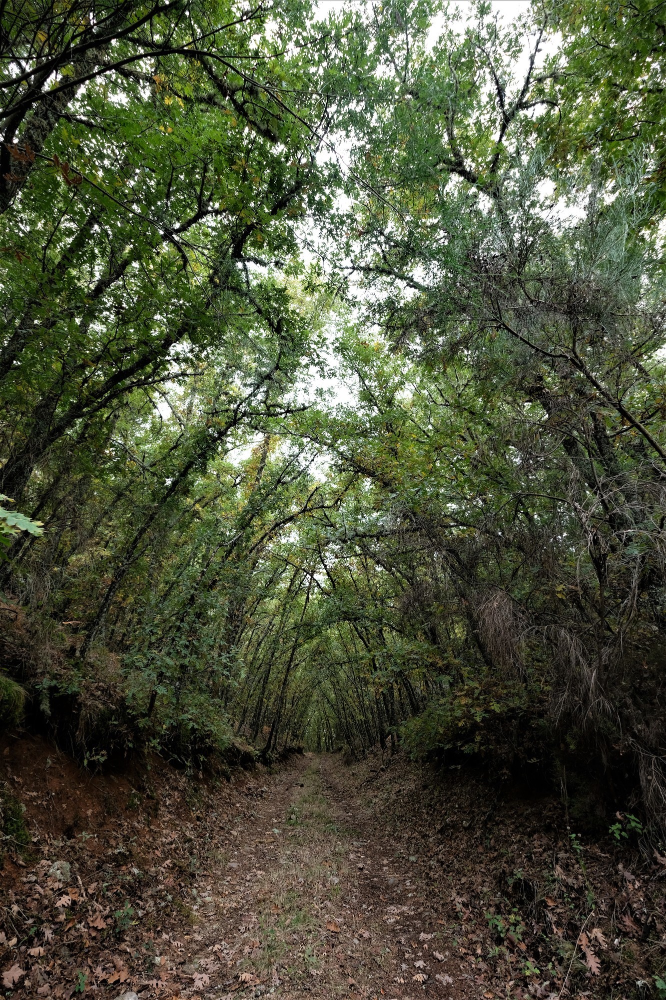
Un percorrido de apenas 3 km, en parte asfaltado, que nos levará a coñecer unha das minas que existiron no territorio da antiga Gallaecia explotadas de forma moi intensiva polos romanos a partir da súa conquista no século II a.C. Accedemos dende a estrada da Gudiña a Viana do Bolo, collendo o desvío para Caldesiños. No arranque desta pista podemos deixar o noso vehículo onde o cartel turístico indicando as minas.
Aquí podemos optar por ascender 1 km pola estrada, con pouco tráfico ou subir ata o miradoiro norte atravesando o bosque entre árbores autóctonas como castiñeiros ou carballos, para continuar ata a estrada e descender ata o aparcadoiro, cunha pequena desviación ao miradoiro sur. En ambos puntos panorámicos dispoñemos de paneis explicativos que nos facilitan a interpretación da paisaxe inmediata, resultado da acción do home.
Os romanos conseguiron extraer toneladas de ouro utilizando o sistema denominado “ruina montium”, unha técnica que combina a construción de pozos e galerías subterráneas co uso de auga para derrubar grandes masas de terreo aurífero. Dende eles albiscaremos tamén as montañas da contorna, como a serra Seca coa Cabeza Grande a máis de 1.200 m de altitude, ou a cola do encoro do Vao, no val do río Camba antes de xuntarse co Bibei en Viana do Bolo.
Características
Lonxitude: 2,88 km (circular)
Punto de Inicio:
Desvío a Caldesiños dende OU-533 PK. 14,650 (42°09'05.91''N / 7°07'15.41''O)
Punto de Fin: Desvío a Caldesiños dende OU-533 PK. 14,650 (42°09'05.91''N / 7°07'15.41''O)
Paseo Circular
Accesibilidade a ter en conta
Terreo abrupto
Tipo
Patrimonio oculto
Data de recollida inicial: 01/01/2021
