Turismo de Galicia
Menú Idiomas
-
O que fazer
Caminho de Santiago
Natureza
Cultura e património
Mar e costa
Rotas
- Top ten: Dez lugares únicos
- A rota da camélia
- Rotas turísticas
- Sendas para descubir un país
- Caminhadas que apaixonam
- Cenários ao volante
- Eurovelo Galicia
- Para além do crepúsculo
Gastronomia
Turismo de Saúde
PROMOÇÕES PARA APROVEITAR AGORA
- O que visitar
-
Planeie a sua viagem
Planifique a sua viagem
Informações práticas
-
A miña viaxe
A MIÑA VIAXE
- Compartir
- Correo
- Imprimir
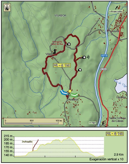
mailto:?subject=Envio de conteúdo de Turismo de Galicia: PR-G 103 SENDEIRO DOS PETROGLIFOS DE COBRES&body=Recomendo-lhe que leia a informação PR-G 103 SENDEIRO DOS PETROGLIFOS DE COBRES extraída do portal de Turismo de Galicia na página https://www.turismo.gal/recurso?cod_rec=277248467%26ctre=23
No Caminho de Santiago
Datos do recursos turístico
Caminhos de Santiago
Caminho Português
Camiño Portugués da costa
Comprimento
Dificuldade
Fácil
Duração
M.I.D.E.
Esforço M.I.D.E.:
Itinerário M.I.D.E.:
Deslocamento M.I.D.E.:
Ambiente M.I.D.E.:
Acesso de bicicleta
Apto totalmente
Acesso de cavalo
Apto totalmente
Cartografía I.G.N. (1:25:000)
185-IV Soutomaior.
Tipo de percorrido
Pequeno percurso
Interesse
Interesse geral
Descarregue as coordenadas do recurso que lhe apresentamos...
Plano

Data de recolha inicial: 01/08/2019


