Turismo de Galicia


-
Things to do
Way of St. James
Nature
Culture and heritage
Beaches and coast
Tourist trails
- Top ten: Ten unrivalled destinations
- The route of the camellia
- Tourist routes
- Pathways for discovering a country
- Walks to fall in love with
- Greenways
- Scenery at the wheel
- EuroVelo Galicia
- Beyond the Sunset
Gastronomy
Health tourism
PROMOTIONS TO ENJOY NOW
Cultural agenda
Will happen... View all
- Places to visit
-
Plan your trip
Build your journey
Practical information


-
A miña viaxe
A MIÑA VIAXE
- Compartir
- Correo
- Imprimir
mailto:?subject=Content from Tourism of Galicia: PR-G 85 RUTA DA FRAGA DE VILAPENA&body=I recommend you read the information PR-G 85 RUTA DA FRAGA DE VILAPENA extracted from the Tourism of Galicia site on page https://www.turismo.gal/recurso/-/detalle/200506000008/pr-g-85-ruta-da-fraga-de-vilapena?ctre=23%26langId=en_US%26tp=6

Datos do recursos turístico
Description
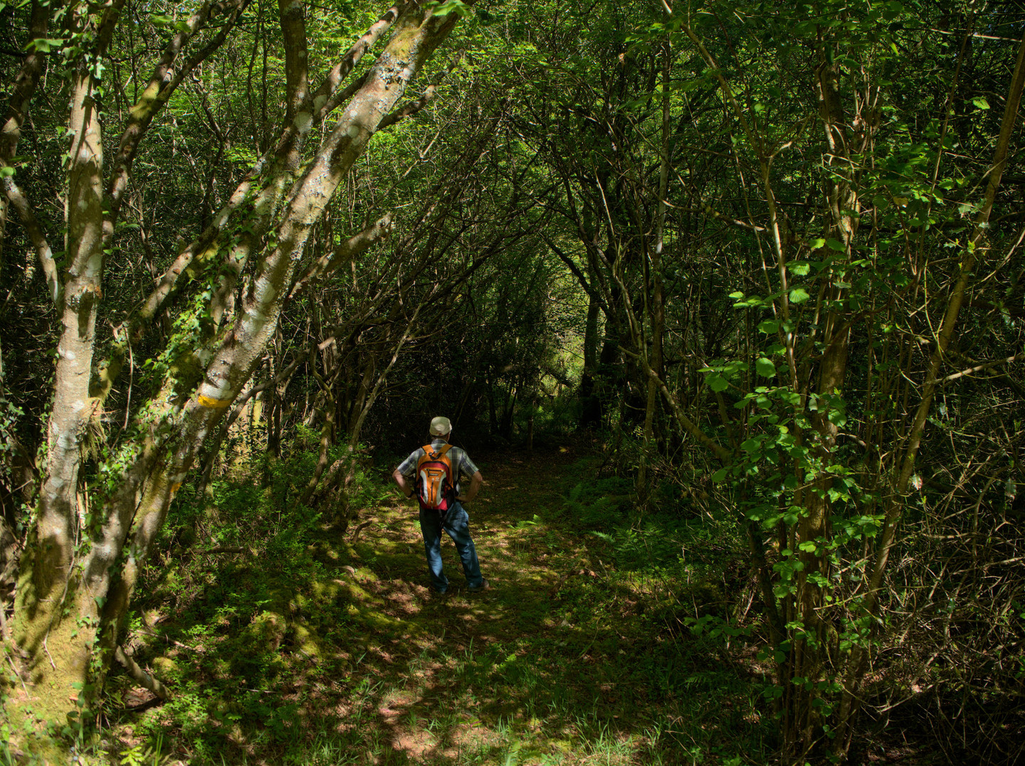
The path that
surrounds and crosses Fraga de Vilapena runs through an area of great diversity
in native vegetation. It begins before reaching the village, in a parking area
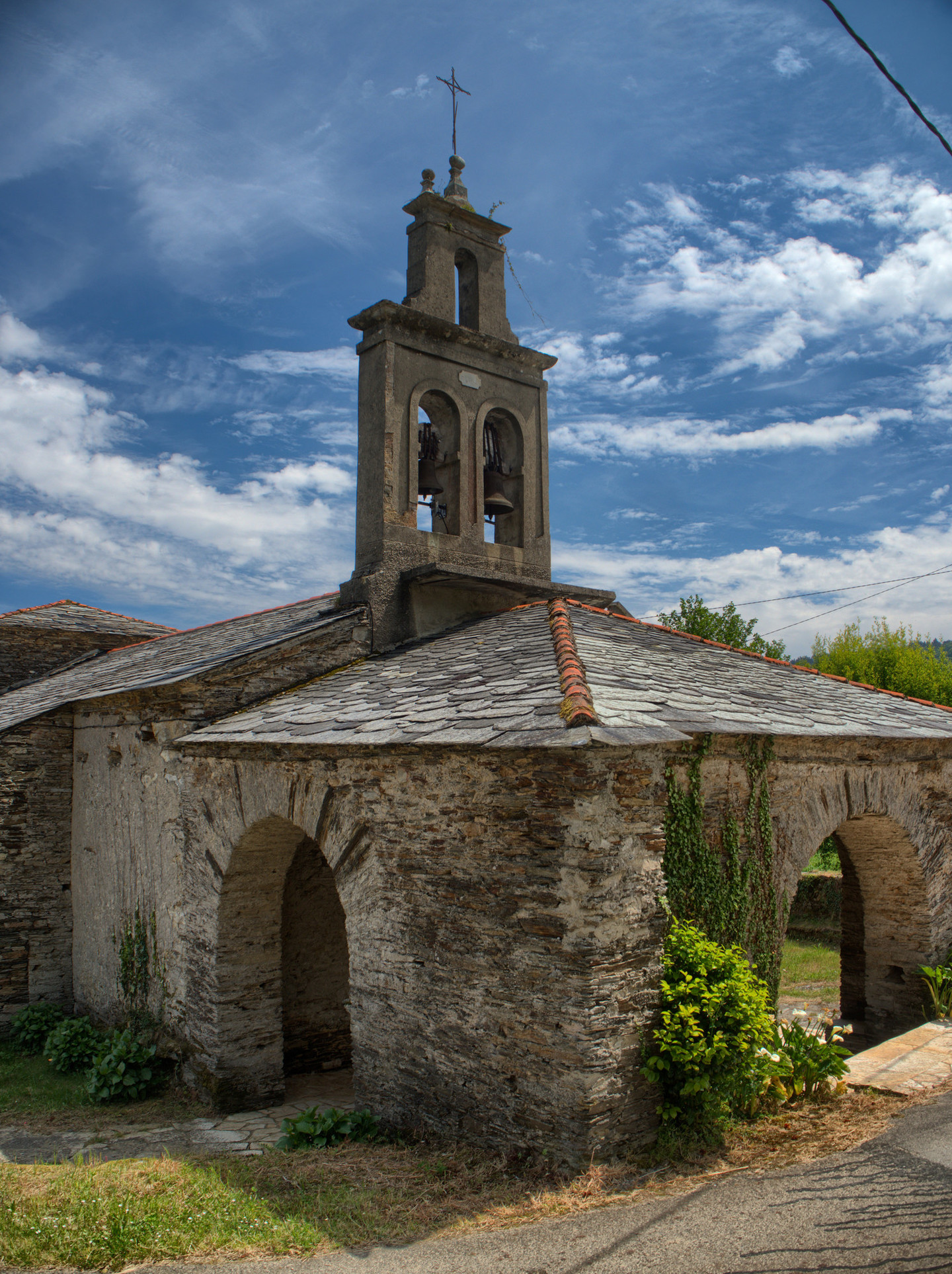
that has an informative panel. Starting the journey to Vilapena, you will walk
past the parish church, numerous granaries and old stone buildings.
The route leaves
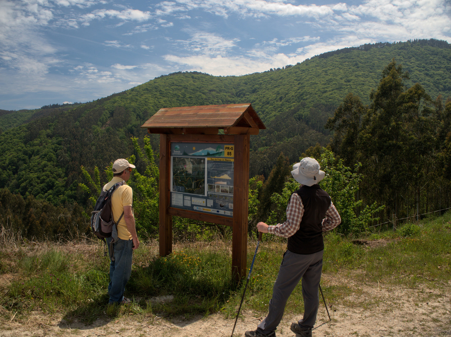
the prairies of the rural settlement and enters the forest plantations and
dense native forest, ascending towards the fork and viewpoint of Pau Pico at
486 metres above sea level. After less than a kilometre, the route joins the
PR-G 83. Going up a short hill, you will find a shelter in case of rain. The
two trails continue to share their route for a large stretch.
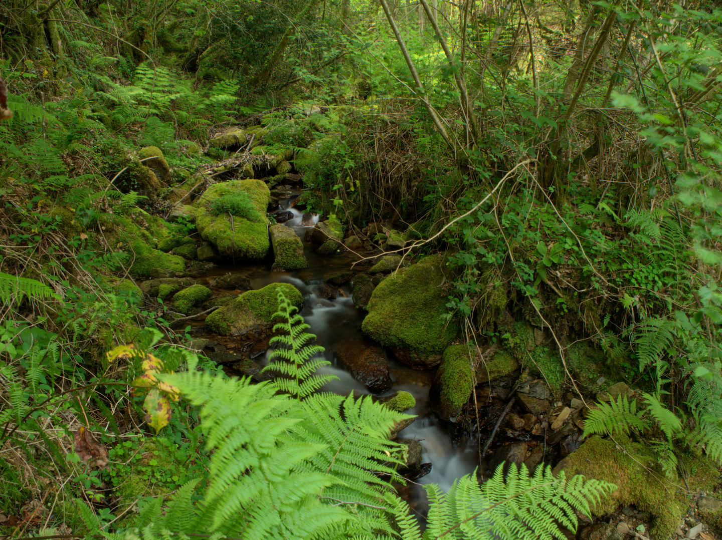
Towards the end, the path returns to Fraga de Vilapena and heads towards the Vilaformán stream, once famous for its trout. If you choose to follow the shorter route, you will enter the interior of the fraga where vestiges of old coal bunkers can be found.
Access
From the CP-55-06 from Trabada to As Rodrigas, take the turning onto a local road to Vilapena.
The Ways of St. James
Longitude
10.3 km The shorter route measures 1.9 km.
Point of Departure / Arrival
Route
Difficulty
Duration
Connections
Equipment
Hiking shoes.
Services
M.I.D.E.
Bicycle access
Horse access
cartography I.G.N. (1:25:000)
Further information
Tel.: 982 135 011
concello@trabada.es
www.trabada.es
Kind of route
Interest
Connections with other trails
-
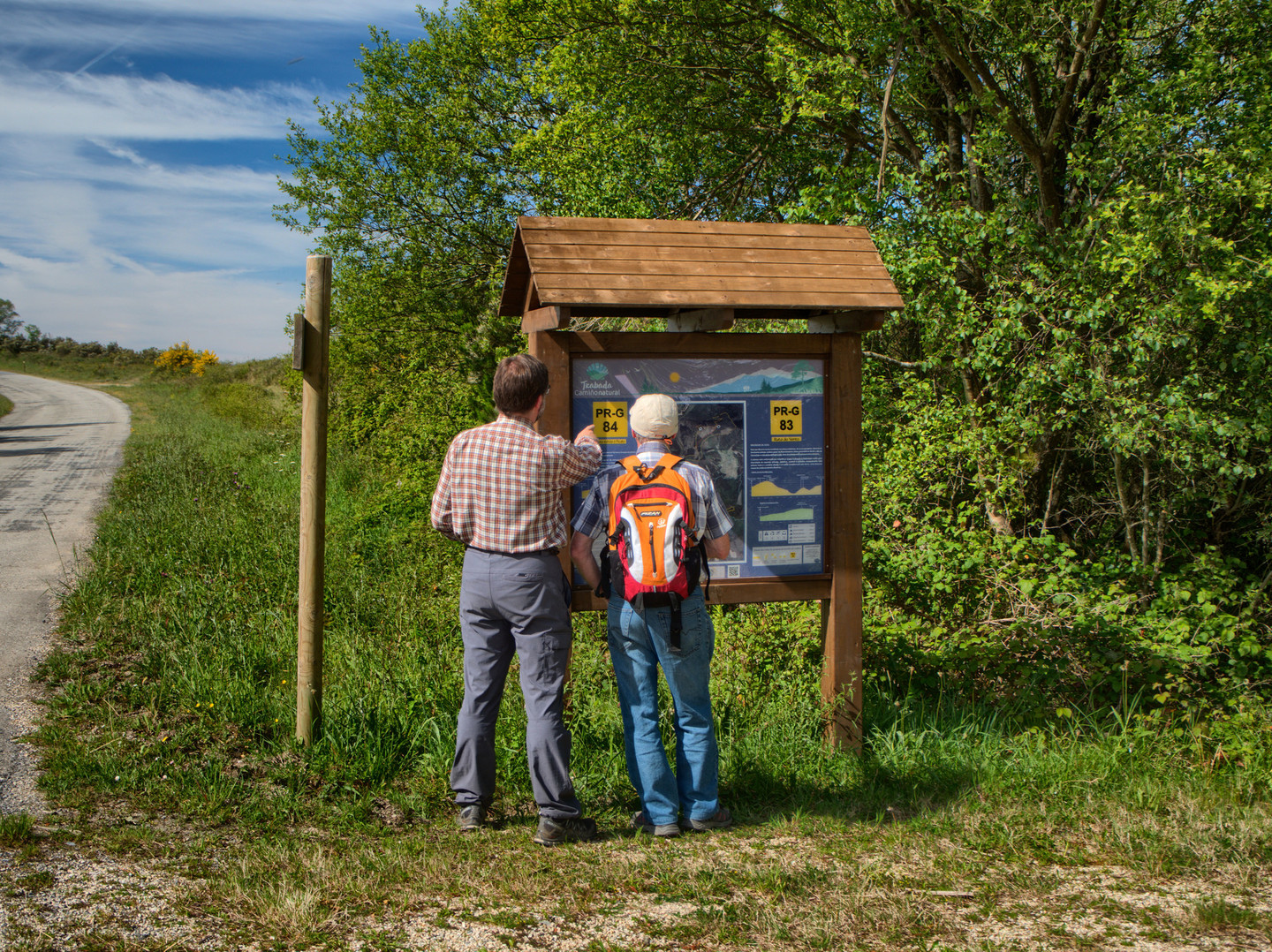
PR-G 83 RUTA DO VENTO
Paths
Map

