

Locate the trails on the map
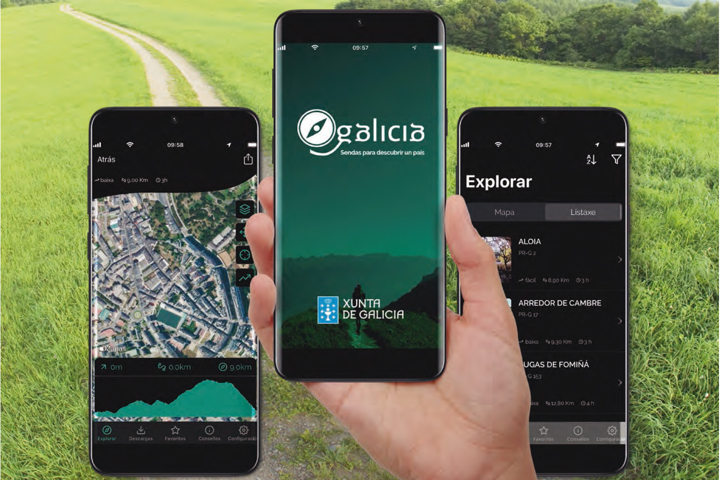
You can search by list or by map, providing information on the length of the route, the estimated time to travel it, the level of difficulty and the cartography, as well as photographs and other information of interest.


Way of St. James
Nature
Culture and heritage
Beaches and coast
Tourist trails
Gastronomy
Health tourism
PROMOTIONS TO ENJOY NOW
Cultural agenda
Will happen... View all
Build your journey
Practical information
A MIÑA VIAXE
Is a reference catalogue for pathways that fulfil the conditions for approval required by the FEDME (the Spanish Federation of Mountain Sports and Climbing) on a nationwide level and the FGM (Galician Mountaineering Federation) in the region, and that meet international standards.
With this information, we would like to bring the fascinating world of hiking to the general public and to encourage those who already love it to discover the rich natural and monumental heritage of Galician pathways.
However, before you set out, it is essential to consult other specialised publications and seek additional information from recommended institutions and associations.
You can search by list or by map, providing information on the length of the route, the estimated time to travel it, the level of difficulty and the cartography, as well as photographs and other information of interest.
Turismo de Galicia would like to promote and encourage hiking as a way of getting closer to our natural spaces as well as our ethnographic and monumental heritage.
This app will allow you to discover the officially approved trails in Galicia, with a short description of the route and its visualisation on Google Earth (with the possibility of recreating it in 3D). SENDEGAL has two modes, you can either download and save the maps on to your smartphone device ((iPhone, Android..) and use the app while being offline or simply use the on-line mode and see the maps as you go. In both cases, the GPS will indicate your position at all times and will allow you to follow the trail without difficulty. When searching for a route, you will be able to visualise them by list or by map; you may further filter your search by selecting the length of the route, the estimated time needed to complete it, its level of difficulty and the cartography, as well as be able to see photographs and other information of interest related to Galicia’s pathways.
This portal uses own cookies or of third with analytical ends, as well as links to portals of third to be able to share content in the social networks. You can find more information in the cookie policy.
Cookie configuration
You can use these buttons to customise the services you wish to use on this portal.
Maybe some resources are not geo-referenced and they are not being displayed.
