Turismo de Galicia


-
Things to do
Way of St. James
Nature
Culture and heritage
Beaches and coast
Tourist trails
- Top ten: Ten unrivalled destinations
- The route of the camellia
- Tourist routes
- Pathways for discovering a country
- Walks to fall in love with
- Greenways
- Scenery at the wheel
- EuroVelo Galicia
- Beyond the Sunset
Gastronomy
Health tourism
PROMOTIONS TO ENJOY NOW
Cultural agenda
Will happen... View all
- Places to visit
-
Plan your trip
Build your journey
Practical information


-
A miña viaxe
A MIÑA VIAXE
- Compartir
- Correo
- Imprimir
mailto:?subject=Content from Tourism of Galicia: PR-G 165 SENDEIRO DAS FRAGAS E LEVADAS DO CALVO E DEVA&body=I recommend you read the information PR-G 165 SENDEIRO DAS FRAGAS E LEVADAS DO CALVO E DEVA extracted from the Tourism of Galicia site on page https://www.turismo.gal/recurso/-/detalle/200506000011/pr-g-165-sendeiro-das-fragas-e-levadas-do-calvo-e-deva?ctre=23%26langId=en_US%26tp=6

Datos do recursos turístico
Description
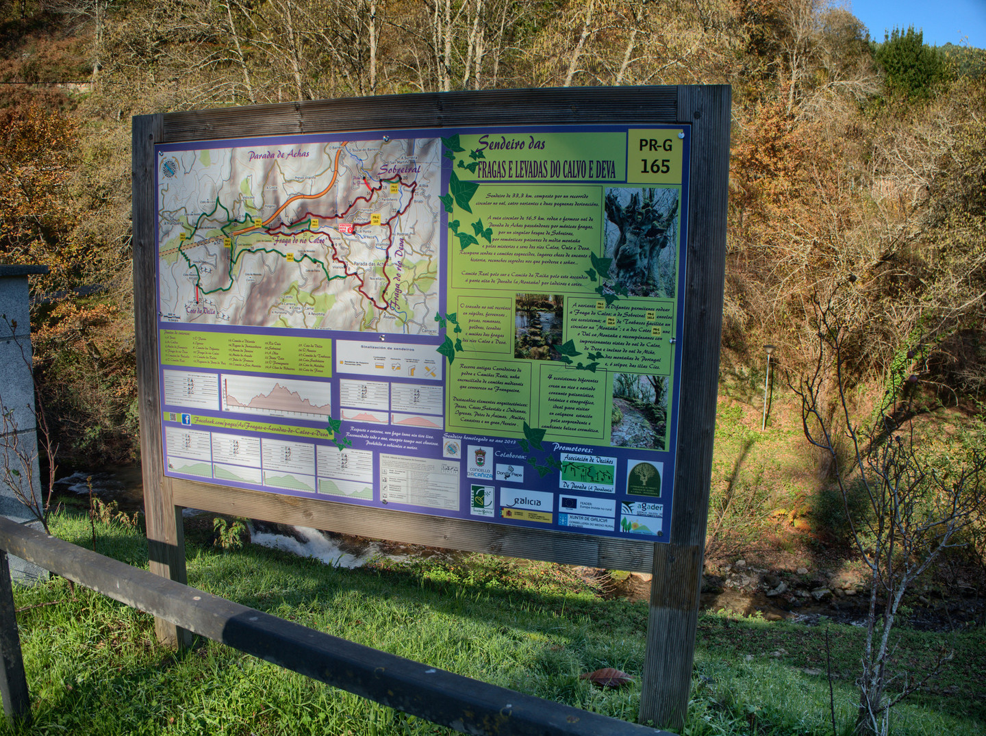
Circular path of a demanding route with a multitude of variants and deviations. It passes through places of extraordinary natural value such as the Calvo river forest, classified as a Natural Area of Local Interest.
Walking the
route clockwise, you will head towards the Deva river and descend on a cobbled
path bordered by a huge fraga (Galician for a mountainous region full of
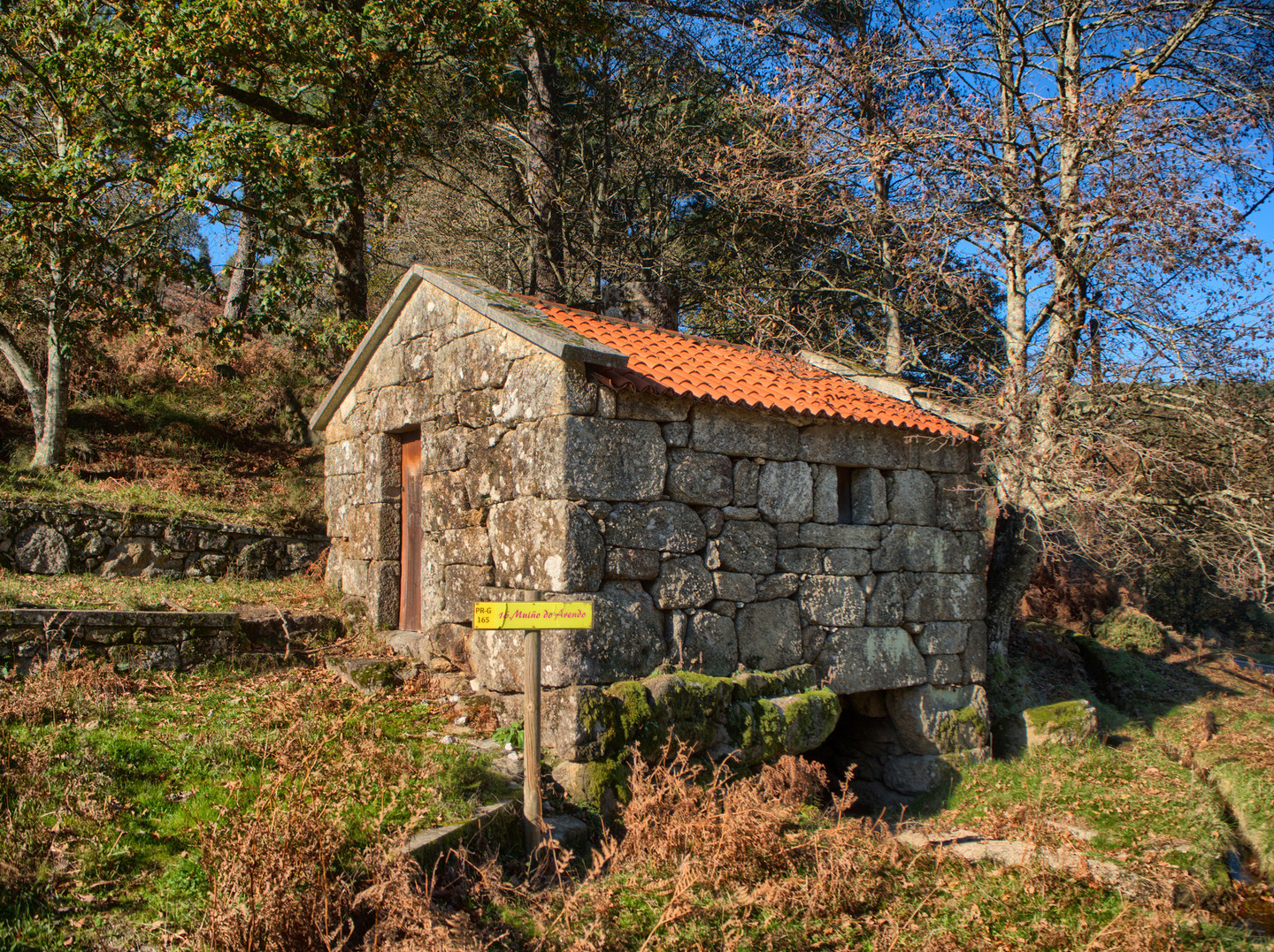
a variety of deciduous species). The unevenness of the river was used to build
mills to which the water was diverted through channels called levadas.
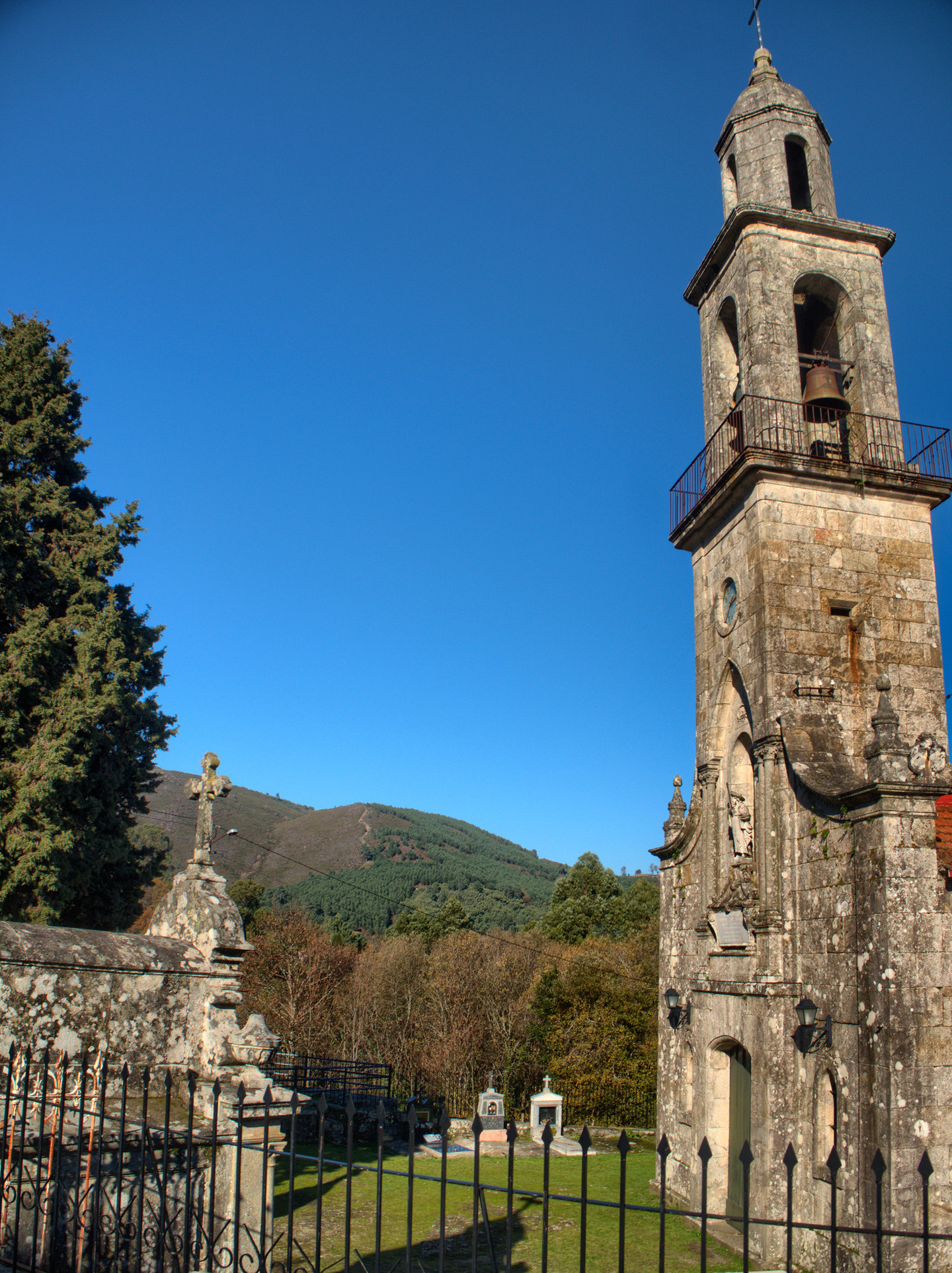
Leaving the Deva river, you will reach O Feirón and the Pazo del Conde de
Cervellón and, later, the stylised church of Santiago in Parada de Achas.
Within the
rugged Calvo river basin, shade and moisture create the perfect growing
conditions for mosses and lichens. The path is difficult at some points, so we
must exercise extreme caution, especially with wet ground.
The PR-G 165.3 variant allows us to access the Coto da Vella summit, joining the Camiño da Raíña, a very old communication route that was supposedly used by Queen Doña Urraca on her trip to A Franqueira.
Access
A plus
CAMIÑO DA RAÍÑA (CAMINO DE LA REINA)
Lady Urraca
supposedly took this route on her journey from the lands of Castilla to the
convent of A Franqueira, in order to visit her properties in Galician
territory. It was a very
important means of communication in the Middle Ages, as it served to connect
Atlantic fishing ports with inland Galicia.
A network of snowfields was created
in which snow was accumulated to help keep produce fresh in the summer. The
snowfield of A Franqueira, also known as Neveiro dos Frades, is located and can
be visited in the Coto da Vella. It is estimated that it was originally almost
six metres deep.
Longitude
16.3 km The different optional routes measure 1,000 m, 500 m, 11.9 km and 1.1 km. The deviations add a further 2 km.
Point of Departure / Arrival
Route
The main route runs through A Ponte, Lugar das Caldas, Muíño de San Paio, Fraga do Río Deva, Pazo do Conde de Cervello, Parada das Achas, Fraga do Río Calvo, Camiño da Raíña, Lugar da Ibia, A Ponte.
Difficulty
Duration
The main route takes 6 hours.
Equipment
It is recommended that you be prepared for possible inclement weather and carry hiking boots, provisions and water.
Services
M.I.D.E.
Bicycle access
Horse access
cartography I.G.N. (1:25:000)
Further information
Tel.: 986 651 000
www.caniza.org
Kind of route
Interest
Map

