Turismo de Galicia

-
Things to do
Way of St. James
Nature
Culture and heritage
Beaches and coast
Tourist trails
- Top ten: Ten unrivalled destinations
- The route of the camellia
- Tourist routes
- Pathways for discovering a country
- Walks to fall in love with
- Greenways
- Scenery at the wheel
- EuroVelo Galicia
- Beyond the Sunset
Gastronomy
Health tourism
PROMOTIONS TO ENJOY NOW
Cultural agenda
Will happen... View all
- Places to visit
-
Plan your trip


-
A miña viaxe
A MIÑA VIAXE
- Compartir
- Correo
- Imprimir
mailto:?subject=Content from Tourism of Galicia: CANO DOS MOUROS&body=I recommend you read the information CANO DOS MOUROS extracted from the Tourism of Galicia site on page https://www.turismo.gal/recurso/-/detalle/180112000099/cano-dos-mouros?langId=en_US%26tp=4%26ctre=17

Datos do recursos turístico
Location
Oia - Pontevedra
Description
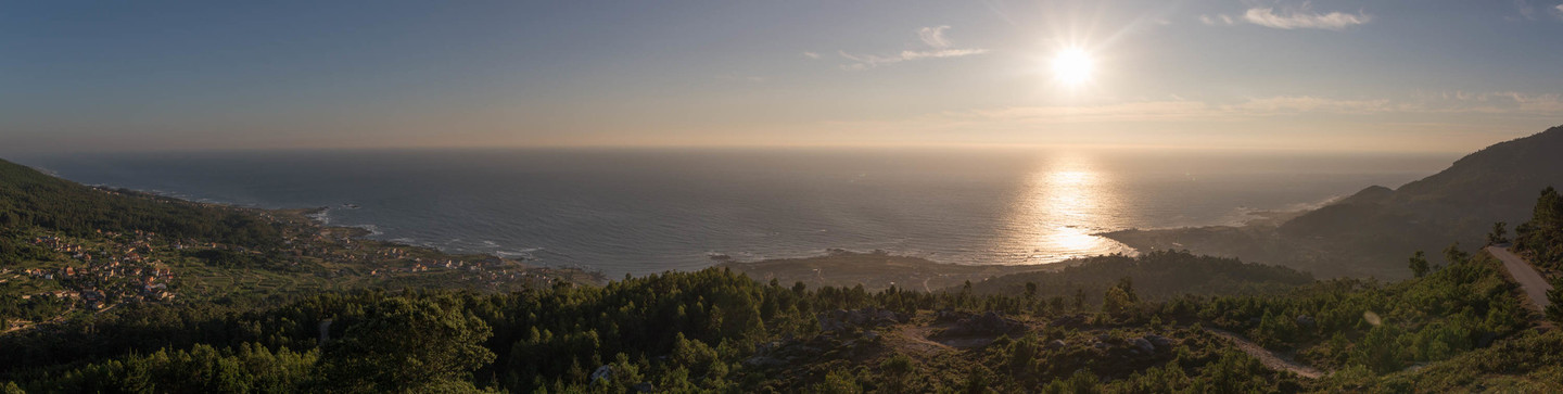
Today its defensive location on a steep hillside makes it a natural viewing point for admiring a large stretch of the Oia coastline.
With free grazing livestock, a common sight in the A Groba mountains, and the pine groves that are a feature of this landscape, the mountain vistas combined with sweeping views of the Atlantic cannot fail to impress.
