Turismo de Galicia

-
Things to do
Way of St. James
Nature
Culture and heritage
Beaches and coast
Tourist trails
- Top ten: Ten unrivalled destinations
- The route of the camellia
- Tourist routes
- Pathways for discovering a country
- Walks to fall in love with
- Greenways
- Scenery at the wheel
- EuroVelo Galicia
- Beyond the Sunset
Gastronomy
Health tourism
PROMOTIONS TO ENJOY NOW
Cultural agenda
Will happen... View all
- Places to visit
-
Plan your trip


-
A miña viaxe
A MIÑA VIAXE
- Compartir
- Correo
- Imprimir
mailto:?subject=Content from Tourism of Galicia: PR-G 208 RUTA DAS REIGADAS&body=I recommend you read the information PR-G 208 RUTA DAS REIGADAS extracted from the Tourism of Galicia site on page https://www.turismo.gal/recurso/-/detalle/200525000148/pr-g-208-ruta-das-reigadas?langId=en_US%26tp=6%26ctre=23

Datos do recursos turístico
Description
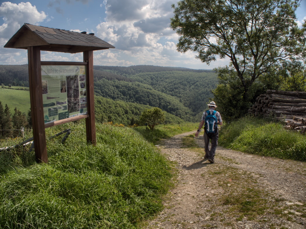
The route follows fishing paths along the Rego de Bounote, which becomes Rego das Reigadas after joining the Rego do Bidueiro stream. The route is located in the Biosphere Reserve created by Unesco in 2007.
From Barreiros, a place of wide meadows, the trail begins a steep descent to the bottom of the valley, where it runs along the Rego do Mazo de Barreiros. The forest that surrounds the area is in a very good state of conservation and contains some centuries-old specimens of oak, chestnut, holly and hazelnut trees.
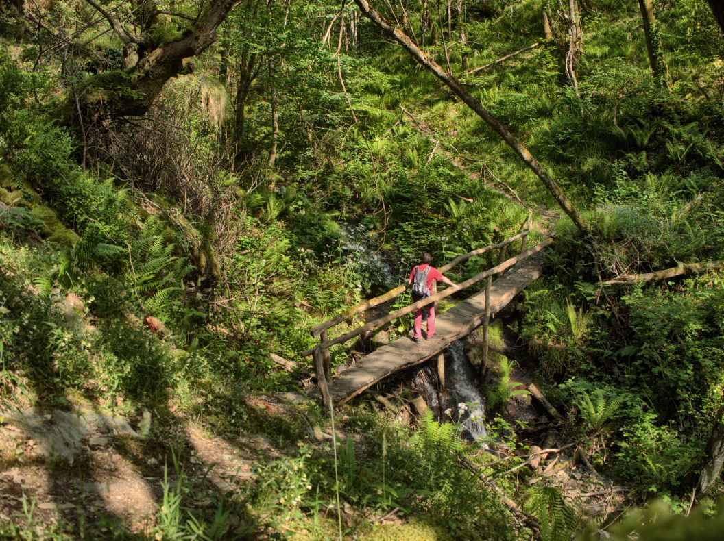
When you reach the Pozo da Chamosa waterfall, you will end up in the leafy Rego de Bounote. Going downhill, you will go past the Paradela bridge, the Encrucilladas wooden bridge and, a little further on, the As Reigadas mill and waterfall.
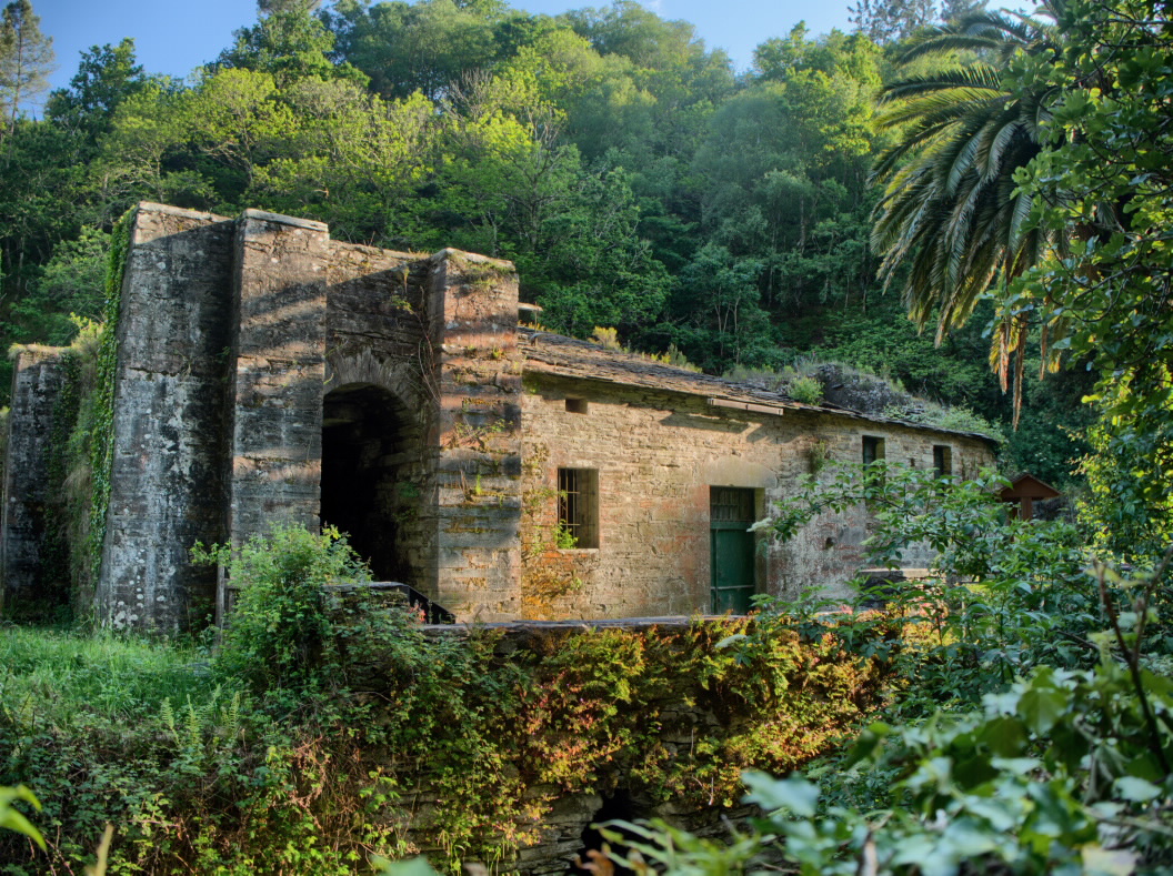
Along the route, you will see a multitude of bridges, traditional ouriceiras for storing chestnut husks and mills. The path ends next to the magnificent remains of the Bogo Ironworks.
Access
You can access the route by travelling south from A Pontenova on local roads to Barreiros.
A plus
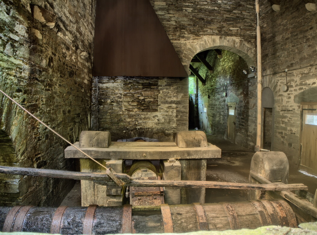
BOGO IRONWORKS
This spectacular smithy, located in the parish of San Pedro de Bogo, uses the hydraulic force of the Reigadas River. It was founded by nobleman Pedro de Miranda to take advantage of his properties’ iron wealth. It worked from 1534 until the end of the 18th century, when a fire left it ruined. It has recently been partially restored.
Longitude
Point of Departure / Arrival
Route
Difficulty
Duration
Equipment
Services
M.I.D.E.
Bicycle access
Horse access
cartography I.G.N. (1:25:000)
Further information
Tel.: 982 342 277
www.concellodapontenova.org
correo.apontenova@fegamp.gal
