Turismo de Galicia


-
Things to do
Way of St. James
Nature
Culture and heritage
Beaches and coast
Tourist trails
- Top ten: Ten unrivalled destinations
- The route of the camellia
- Tourist routes
- Pathways for discovering a country
- Walks to fall in love with
- Greenways
- Scenery at the wheel
- EuroVelo Galicia
- Beyond the Sunset
Gastronomy
Health tourism
PROMOTIONS TO ENJOY NOW
Cultural agenda
Will happen... View all
- Places to visit
-
Plan your trip
Build your journey
Practical information


-
A miña viaxe
A MIÑA VIAXE
- Compartir
- Correo
- Imprimir
mailto:?subject=Content from Tourism of Galicia: PR-G 128 RUTA DO PAN&body=I recommend you read the information PR-G 128 RUTA DO PAN extracted from the Tourism of Galicia site on page https://www.turismo.gal/recurso/-/detalle/277249684/pr-g128-rota-do-pan?langId=en_US

Datos do recursos turístico
Description
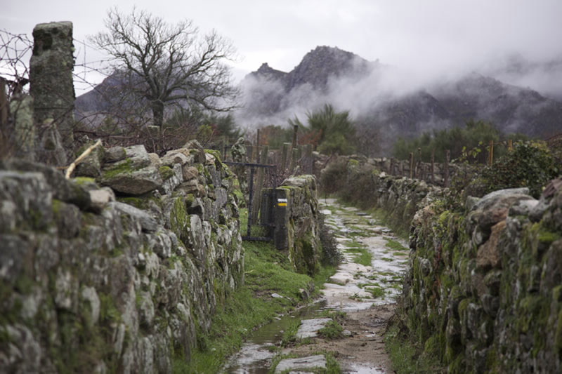
Stone has a special role on this route – we can contemplate a thorough work of paving, characteristic of the best stone laying intended to iron out slopes and fix the land.
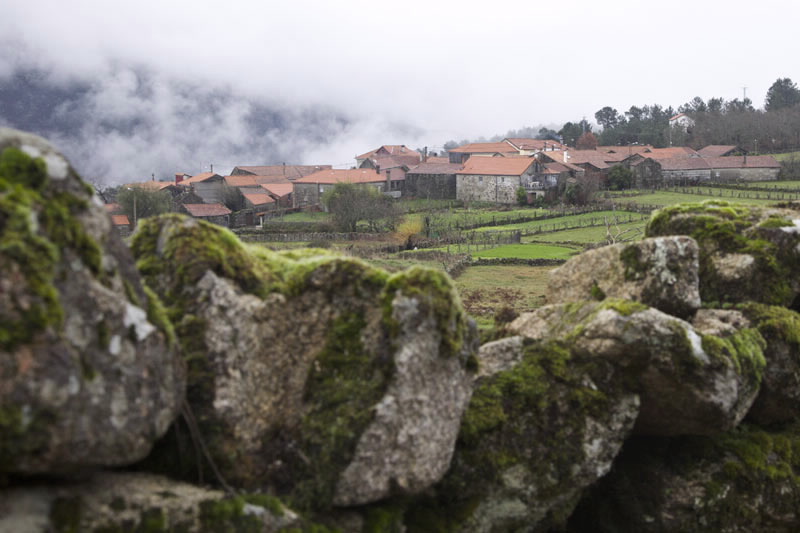
After leaving Guxinde, a first diversion invites us to visit a restored mill. Further on, a second diversion heads for the village of A Pereira. Passing the last houses in the village we rejoin the main route, and this diversion becomes almost circular.
Once back on the main route, after passing through A Gurita we come to the place known as A Casa do Frade, which marks the border with Portugal and offers us a spectacular view of the Natural Park. Two hundred metres below the viewpoint is the Casa do Frade Mill, recently restored, although the visit is not advisable as the access is dangerous.
Access
A plus
PARQUE NATURAL BAIXA LIMIA-SERRA DO XURÉS
This natural space, together with the largest in
Portugal, the National Park of Peneda-Gerês,
gives shape to one large transborder protected
area, unique in Europe. It has also been declared
a Biosphere Reserve.
It is situated in the southwest of the province
of Ourense, covering the highest areas in
the municipalities of Entrimo, Lobios and
Muíños, bordering on Portugal. One of its main
attractions is the great variety of landscapes,
with rugged mountain ranges, where granite
is the star, and little rivers which at times form
cascades and waterfalls.
A Fecha waterfall stands out as the highest in
Galicia.
On the summits scrub vegetation predominates,
while in the valleys areas of oak trees lie hidden.
Among the wildlife we could highlight the
wolf, the mountain goat and the so-called
Galician pony, undergoing reintroduction
and preservation programmes. It is also the
best place in Galicia to see the Cachena cow,
a native breed of cattle, of small size but with
large horns adapted to the harshness of the
mountain range.
Longitude
Point of Departure / Arrival
Route
Difficulty
Duration
Services
M.I.D.E.
Bicycle access
Horse access
cartography I.G.N. (1:25:000)
Further information
Concello de Entrimo
Tel.: 988 434 666
concello.entrimo@eidolocal.es
www.concelloentrimo.es
Federación Galega de Montañismo
Tel.: 986 208 758 / Fax: 986 207 407
sendeirismofgm@yahoo.es
www.fgmontanismo.com
Tel.: 626 835 030
xullotaboada@hotmail.com
Kind of route
Interest
Map

