Turismo de Galicia

-
Things to do
Way of St. James
Nature
Culture and heritage
Beaches and coast
Tourist trails
- Top ten: Ten unrivalled destinations
- The route of the camellia
- Tourist routes
- Pathways for discovering a country
- Walks to fall in love with
- Greenways
- Scenery at the wheel
- EuroVelo Galicia
- Beyond the Sunset
Gastronomy
Health tourism
PROMOTIONS TO ENJOY NOW
Cultural agenda
Will happen... View all
- Places to visit
-
Plan your trip


-
A miña viaxe
A MIÑA VIAXE
- Compartir
- Correo
- Imprimir
mailto:?subject=Content from Tourism of Galicia: RÍA DE CEDEIRA&body=I recommend you read the information RÍA DE CEDEIRA extracted from the Tourism of Galicia site on page https://www.turismo.gal/recurso/-/detalle/9760/ria-de-cedeira?langId=en_US%26tp=3%26ctre=14

Datos do recursos turístico
Description
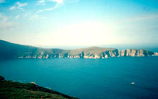
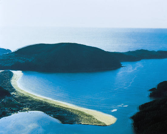
Between the Chirlateira point and the Vilarrube sandbank (a sandy double arrow where there are still beautiful dune accumulations), on the left bank, the cliffs that flank the peninsula formed by mount Burneira are a constant. Vertical in the majority, they are the chosen place for lovers of wind and waves.
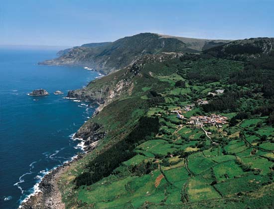
On the northern shore of the estuary, at the mouth of the river Condomiñas, is Cedeira, which lives off fishing, shellfish and tourism. The streets that climb the steep slopes lodge very good examples of the beautiful traditional architecture that dominated these lands, which takes form on balconies and galleries.
To the north of Cedeira, on the way to Montes Eixil or the Candieira and the Serra da Capelada, the littoral rises once more. Cliffs are a constant until we reach the Ortigueira estuary. Amidst this deeply rough scenery is San Andrés de Teixido, a place inseparable from Cedeira, a centre of religious and ethnographic interest of the region due to the survival of animist and pre-Christian cults.
The "herba de namorar", the cult of stones and waters are present. The sanctuary of San Andrés de Teixido is visited by thousands of pilgrims, because, according to legend "a San Andrés de Teixido, vai de morto quen non foi de vivo". The processioners placed stones on the path and gathered the grass called to bring about love.
The A Capelada range stands out not only because of its impressive cliffs (up to the 612 metres in Vixía Herbeira) but also thanks to its geological wealth. In this place we find mantle rocks, serpentinites and eclogites, very difficult to see on our planet. The area has therefore long called the attention of researchers throughout the world.
