Turismo de Galicia

-
Things to do
Way of St. James
Nature
Culture and heritage
Beaches and coast
Tourist trails
- Top ten: Ten unrivalled destinations
- The route of the camellia
- Tourist routes
- Pathways for discovering a country
- Walks to fall in love with
- Greenways
- Scenery at the wheel
- EuroVelo Galicia
- Beyond the Sunset
Gastronomy
Health tourism
PROMOTIONS TO ENJOY NOW
Cultural agenda
Will happen... View all
- Places to visit
-
Plan your trip


-
A miña viaxe
A MIÑA VIAXE
- Compartir
- Correo
- Imprimir
mailto:?subject=Content from Tourism of Galicia: A PENEDA&body=I recommend you read the information A PENEDA extracted from the Tourism of Galicia site on page https://www.turismo.gal/recurso/-/detalle/16687/a-peneda?langId=en_US%26tp=4%26ctre=17

Datos do recursos turístico
Location
Parish: Soutomaior (San Salvador)
Place: Alxán
36691 Soutomaior - Pontevedra
Description
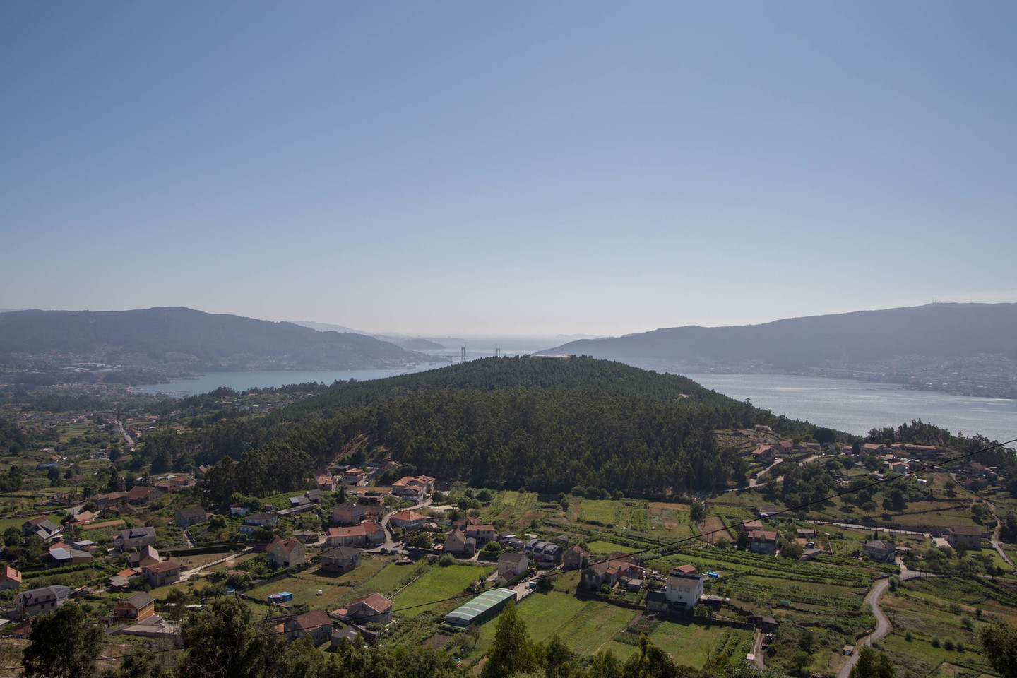
The steep-sided 329-metre peak is topped by the seventeenth-century chapel of Nosa Señora das Neves (also known as the Virxe da Peneda). The chapel is built on the site of the A Peneda castro settlement, which would have been located here due to its defensive position and wide vistas.
The entire Vigo estuary, from its starting point at the mouth of the Verdugo river to Rande, with the Cíes islands in the distance, can be observed if one stands next to the ancient cork oak at the A Peneda viewing point.
