Turismo de Galicia

-
Things to do
Way of St. James
Nature
Culture and heritage
Beaches and coast
Tourist trails
- Top ten: Ten unrivalled destinations
- The route of the camellia
- Tourist routes
- Pathways for discovering a country
- Walks to fall in love with
- Greenways
- Scenery at the wheel
- EuroVelo Galicia
- Beyond the Sunset
Gastronomy
Health tourism
PROMOTIONS TO ENJOY NOW
Cultural agenda
Will happen... View all
- Places to visit
-
Plan your trip


-
A miña viaxe
A MIÑA VIAXE
- Compartir
- Correo
- Imprimir
mailto:?subject=Content from Tourism of Galicia: O SEMÁFORO DE BARES&body=I recommend you read the information O SEMÁFORO DE BARES extracted from the Tourism of Galicia site on page https://www.turismo.gal/recurso/-/detalle/16718/o-semaforo-de-bares?langId=en_US%26tp=4%26ctre=17

Datos do recursos turístico
Location
Parish: Bares (Santa María)
Place: Semáforo de Bares
15339 Mañón - A Coruña
Description
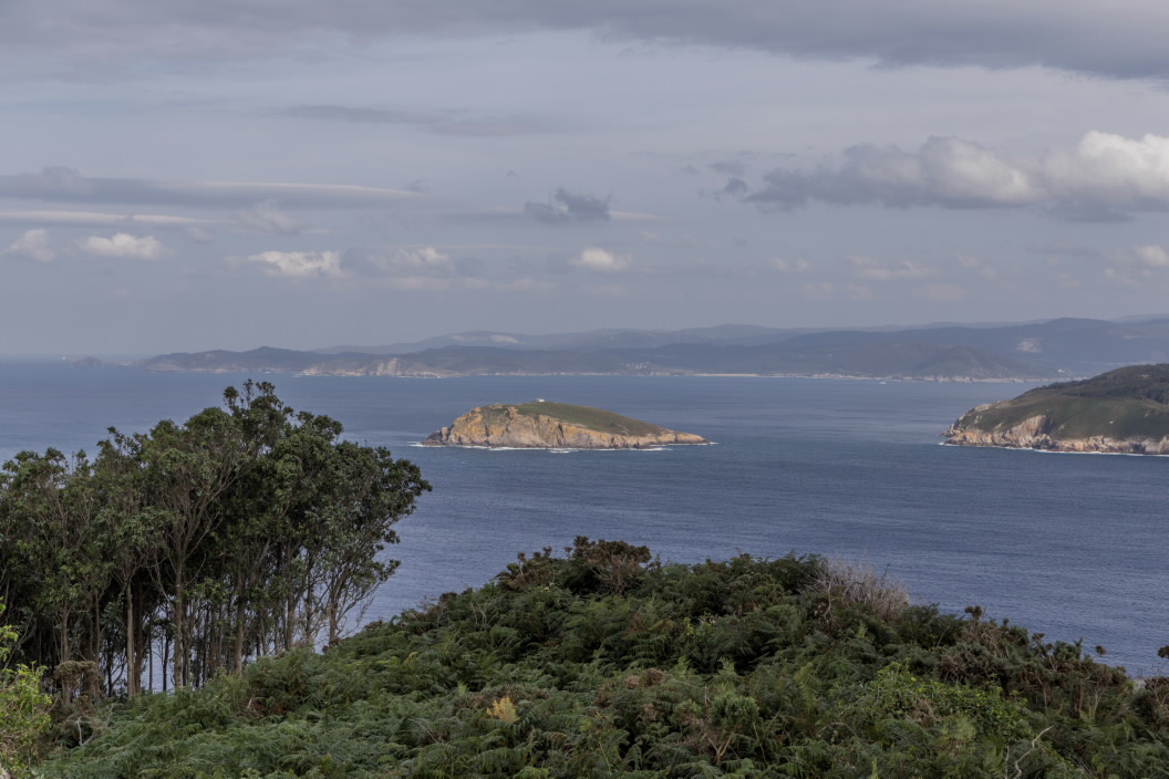
The role of this old military building was to watch the movement of ships and it also served as a communications base and weather data collection station, thanks to its location 200 metres above sea level, at a place where the Cantabrian Sea begins to show its strength.
The views of the Bares area and port, and the mysterious island of Coelleira, prove an excellent overview of this environmentally diverse and scenic stretch of coastline.
