Turismo de Galicia


-
Things to do
Way of St. James
Nature
Culture and heritage
Beaches and coast
Tourist trails
- Top ten: Ten unrivalled destinations
- The route of the camellia
- Tourist routes
- Pathways for discovering a country
- Walks to fall in love with
- Greenways
- Scenery at the wheel
- EuroVelo Galicia
- Beyond the Sunset
Gastronomy
Health tourism
PROMOTIONS TO ENJOY NOW
Cultural agenda
Will happen... View all
- Places to visit
-
Plan your trip
Build your journey
Practical information


-
A miña viaxe
A MIÑA VIAXE
- Compartir
- Correo
- Imprimir
mailto:?subject=Content from Tourism of Galicia: PR-G 196 RUTA DE CASTRO&body=I recommend you read the information PR-G 196 RUTA DE CASTRO extracted from the Tourism of Galicia site on page https://www.turismo.gal/recurso/-/detalle/200518000078/pr-g-196-ruta-de-castro?ctre=23%26langId=en_US%26tp=6

Datos do recursos turístico
Description
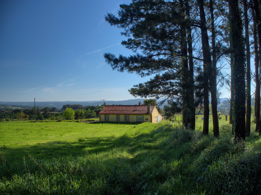
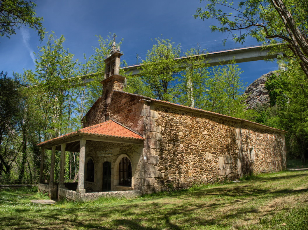
The start of the route can be found in O Seixo, next to the chapel of Nosa Señora das Angustias. The route crosses the nucleus of Prado and runs alongside a huge hórrea (more information in the next section).
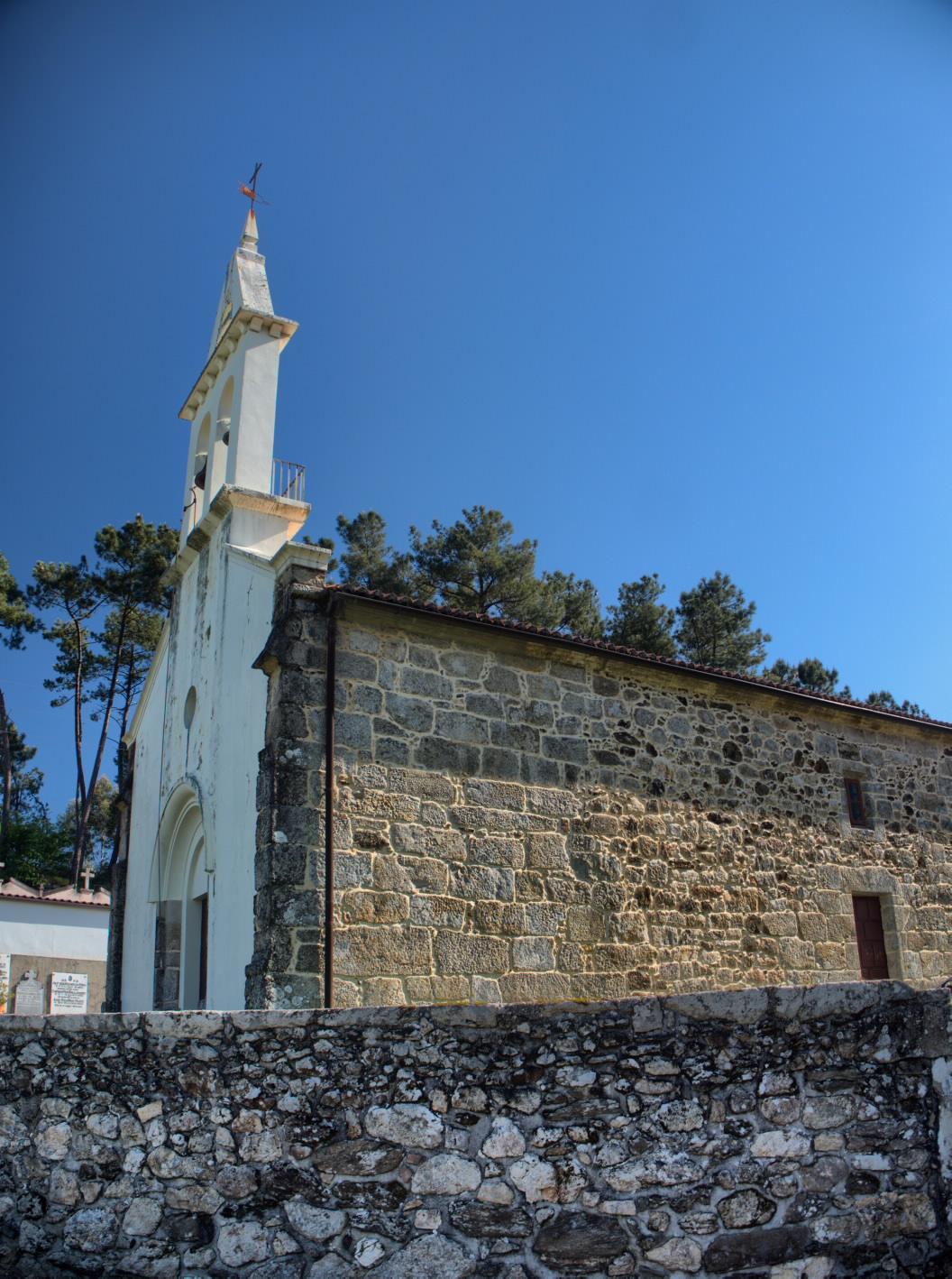
After walking through a mixed forest, you will reach San Miguel de Castro. Its church has undergone multiple interventions over the centuries, but it still retains Romanesque remains in its apse and triumphal arch dating from before 1115.
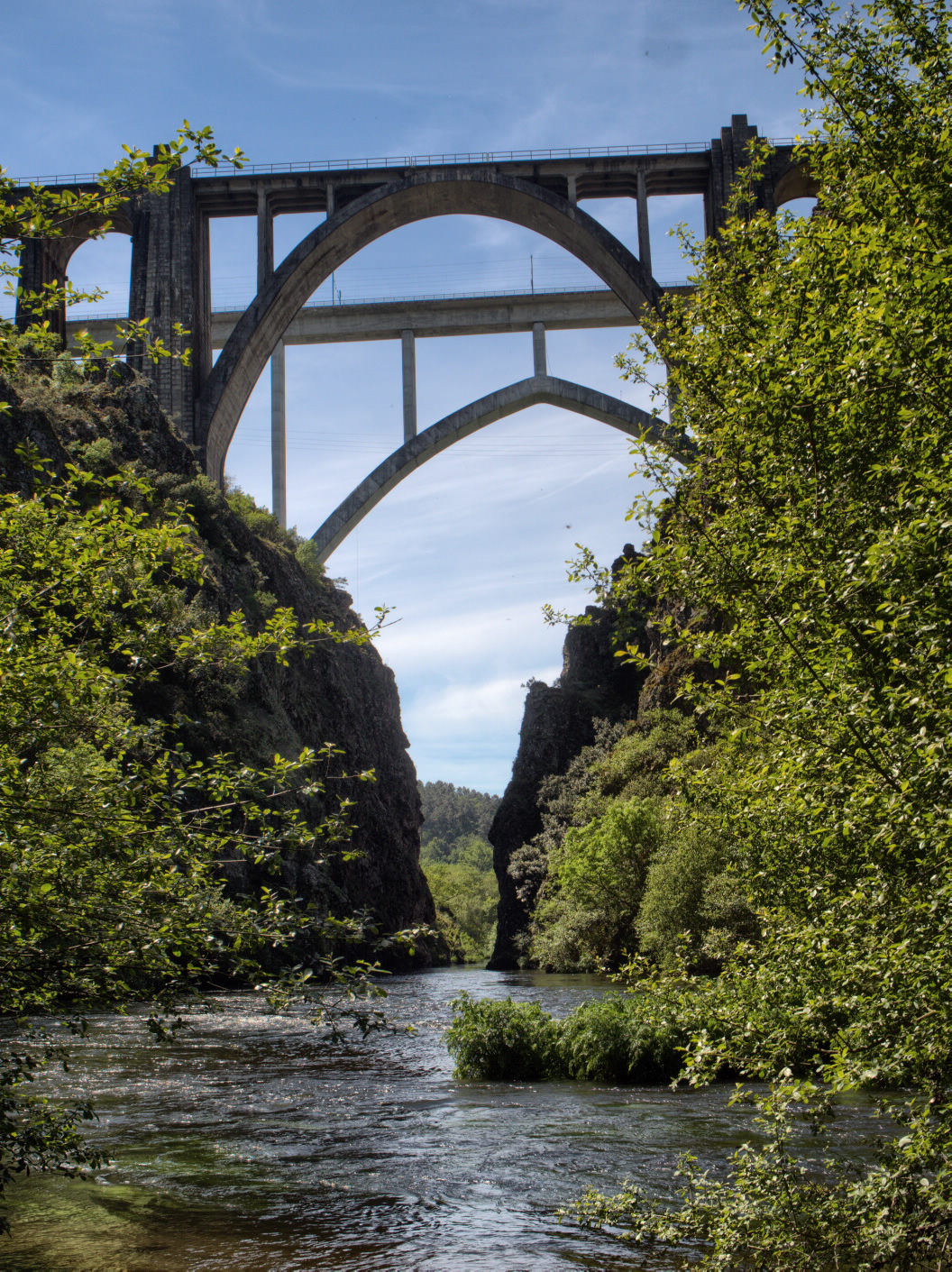
It descends to the Ulla River, running along its banks through a humid forest. Caution should be exercised in rainy seasons, since the channel may overflow onto the route itself. At a point marked clearly with an arrow, you must come off the route for 50 metres in order to enjoy an impressive view of the Gundián bridges, where the Ulla river creates a beautiful canyon.
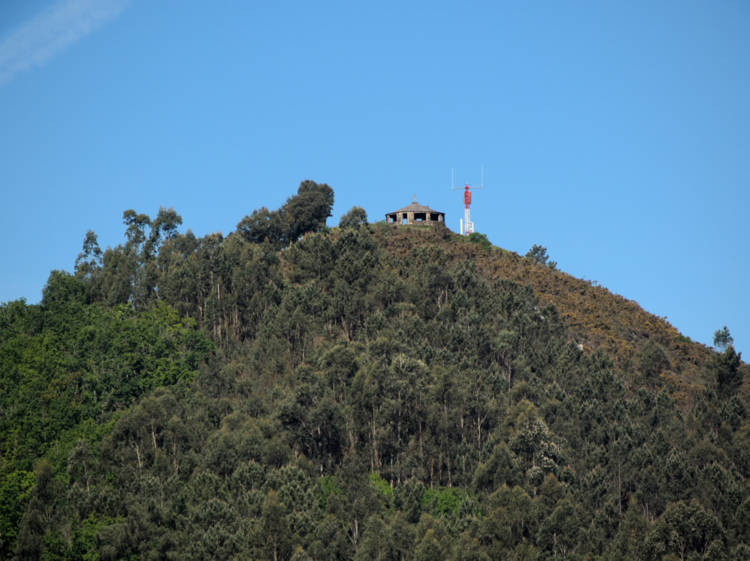
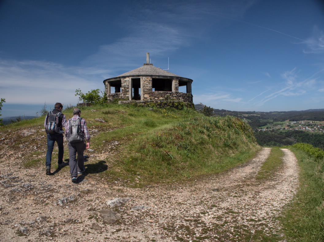
Before reaching the end of the route, it is highly recommended that you ascend to the O Castro viewpoint and enjoy the panoramic view of the Ulla river and the Gundián bridges. After your trip, you should visit to the Sanctuary of Gundián recreation area.
Access
From A Estrada, you can reach the trail via the N-640 and PO-2017 to O Seixo. From Santiago, take the N-525 and PO-2017.
The Ways of St. James
A plus
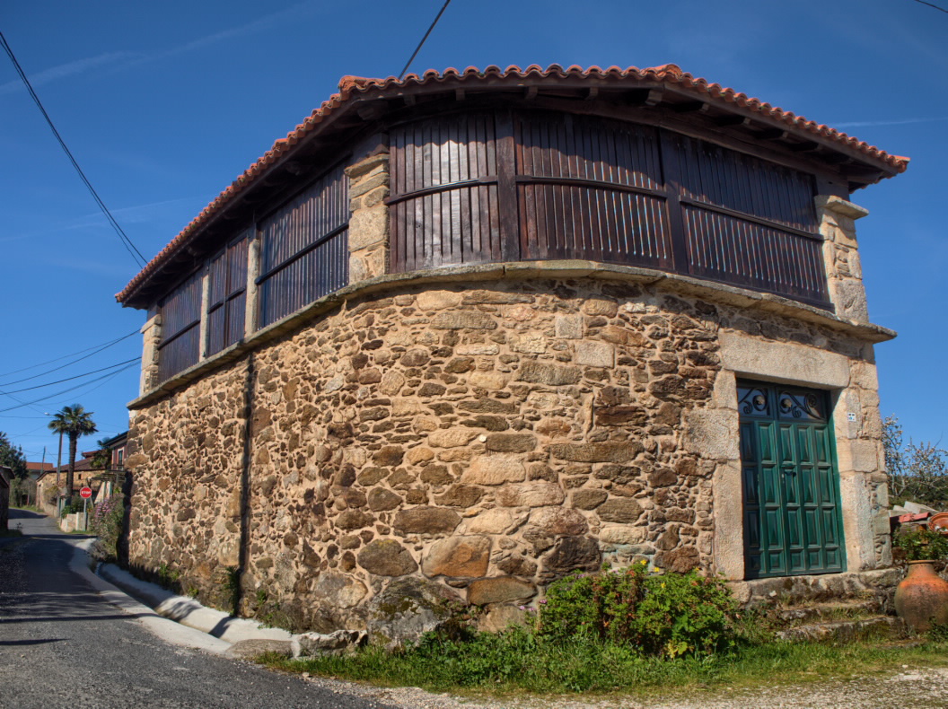
The word hórrea (‘granary’) is a local term that is not recognised by the Royal Galician Academy. It is used to define a particular type of granary. These hórreas are typical in the central regions of Galicia, on both banks of the Ulla river, and are distinguished from other granaries by their larger size, width and capacity.
Longitude
11.4 km The deviation measures 900 m there and back.
Point of Departure / Arrival
Route
Difficulty
Duration
Equipment
Hiking shoes.
Services
M.I.D.E.
Bicycle access
Horse access
cartography I.G.N. (1:25:000)
Further information
Tel.: 986 570 165
turismo.aestrada.gal
Kind of route
Interest
Map

