Turismo de Galicia

-
Things to do
Way of St. James
Nature
Culture and heritage
Beaches and coast
Tourist trails
- Top ten: Ten unrivalled destinations
- The route of the camellia
- Tourist routes
- Pathways for discovering a country
- Walks to fall in love with
- Greenways
- Scenery at the wheel
- EuroVelo Galicia
- Beyond the Sunset
Gastronomy
Health tourism
PROMOTIONS TO ENJOY NOW
Cultural agenda
Will happen... View all
- Places to visit
-
Plan your trip


-
A miña viaxe
A MIÑA VIAXE
- Compartir
- Correo
- Imprimir
mailto:?subject=Content from Tourism of Galicia: PR-G 199 RUTA PENA TREVINCA POLO SENTIL ALTO&body=I recommend you read the information PR-G 199 RUTA PENA TREVINCA POLO SENTIL ALTO extracted from the Tourism of Galicia site on page https://www.turismo.gal/recurso/-/detalle/200518000088/pr-g-199-ruta-pena-trevinca-polo-sentil-alto?langId=en_US%26tp=6%26ctre=23

Datos do recursos turístico
Description
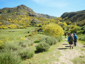
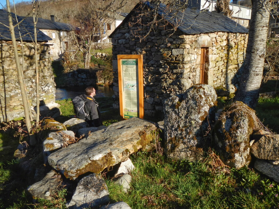
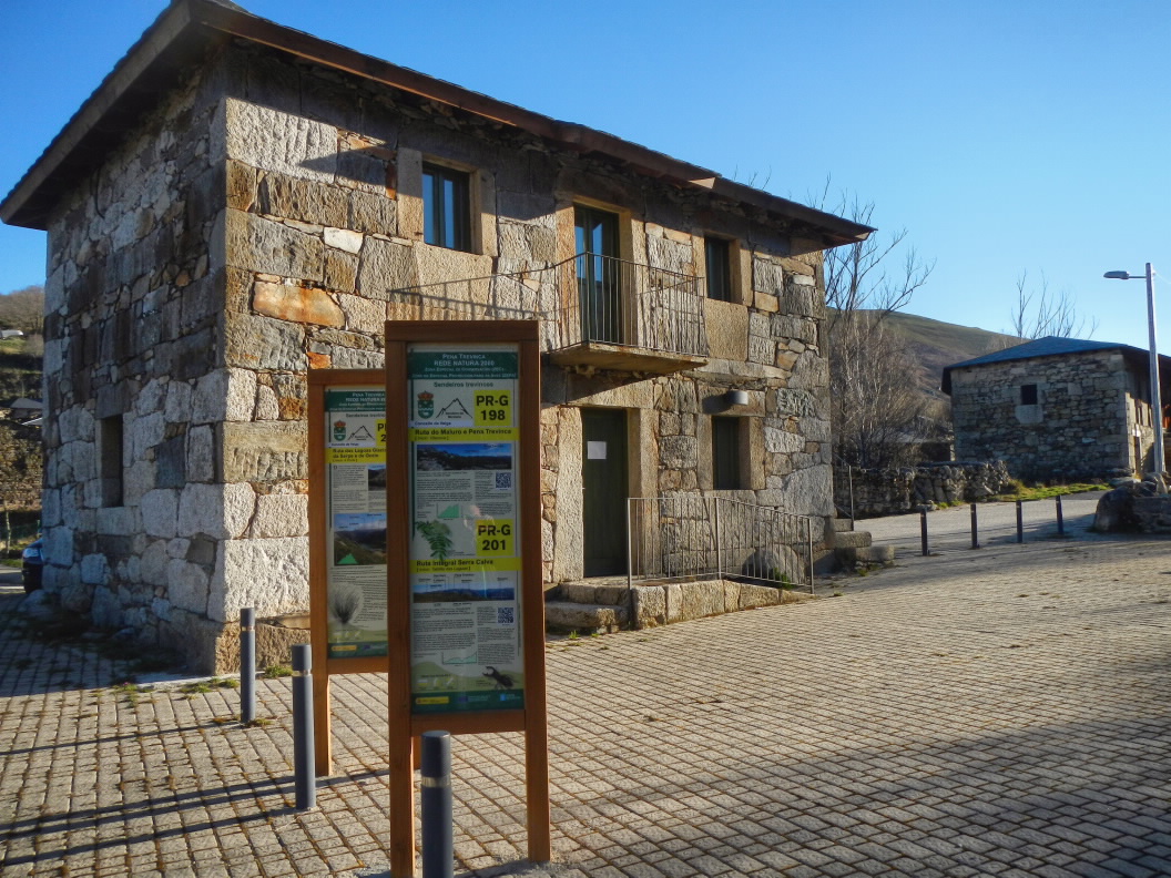
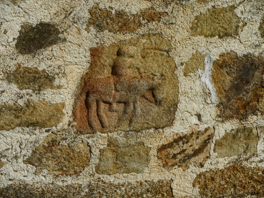
The path is linear and runs from A Ponte to Sestil Alto. The route begins in the plaza of the church of Santa María Madalena. You should not leave A Ponte without visiting the ZEC Pena Trevinca Visitor Centre or the Casa dos Vaqueiros, which has pre-Roman carvings in the stone of its exterior walls.
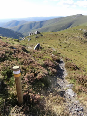
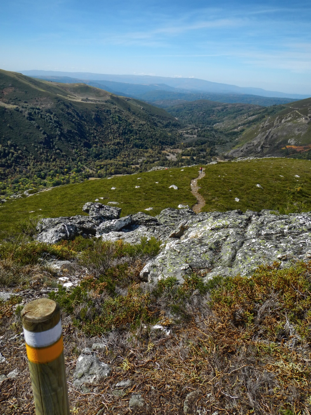
After crossing the Pontón de Pena Pausa, the route continues along a path between walls, towards the Pontón das Olgas. Before arriving there, the route ascends towards the Meladas river valley where it will briefly share its route with PR-G 198.1. Once separated from this variant and after crossing a wooden footbridge over the Meladas river, the ascent begins on the crest of Sestil Alto. From above, you can enjoy magnificent views over the glacial valley of the Xares River.
The route ends between the summit of Sestil Alto and A Valigota, where it connects to the PR-G 198. From there, you can access the summit of Pena Trevinca in just 1.8 km. You can return the way you came or via any of the connected routes.
Access
You can access the route from A Rúa or A Gudiña on the OU-533 to Alto do Covelo. Turn towards A Veiga, continue to Xares and reach A Ponte at Concello da Veiga.
Longitude
18 km (mandatory round trip). If you inlude the ascent to Pena Trevinca, the round trip is 21.6 km.
Point of Departure / Arrival
A Ponte (Concello da Veiga). The end of the route that is linked to the PR-G 198 has no vehicle access.
A Ponte (Concello da Veiga). The end of the route that is linked to the PR-G 198 has no vehicle access.
Route
A Ponte, Pontón de Pena Pausa, linked to PR-G 198.1, Meladas river, Sestil Alto, hill at the source of the A Valigota river (PR-G 198 connection). And return.
Difficulty
Duration
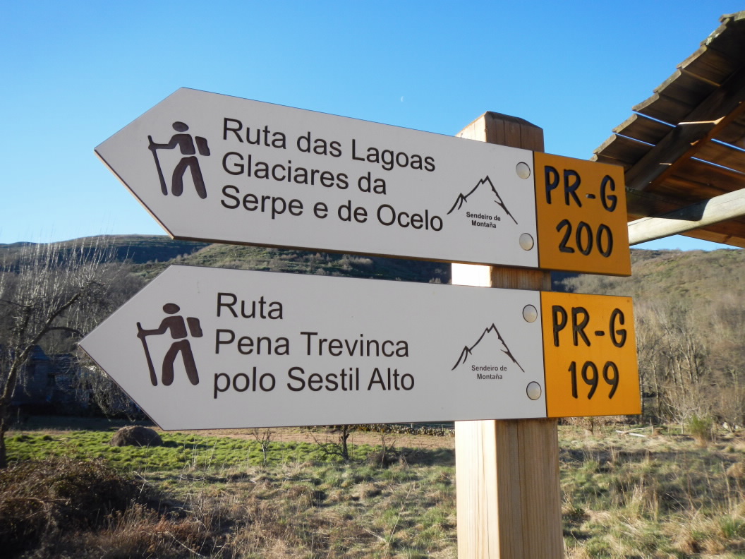
Connections
With PR-G 200, PR-G 198.1 and PR-G 198. Through 200 and 198, it also links to PR-G 201.
Equipment
Warm clothes, even in summer. Water provisions. GPS and map.
Services
M.I.D.E.
Bicycle access
Horse access
cartography I.G.N. (1:25:000)
Further information
Concello da Veiga
Tel.: 988 350 000
www.aveiga.gal
concello.aveiga@eidolocal.es
Segatur (Sendeiros de Galicia para o Turismo Rural S.L.)
Tel. 654 165 730 / 886 117 011
info@segatur.com
www.segatur.com
Kind of route
Interest
Connections with other trails
Map

