Turismo de Galicia

-
Things to do
Way of St. James
Nature
Culture and heritage
Beaches and coast
Tourist trails
- Top ten: Ten unrivalled destinations
- The route of the camellia
- Tourist routes
- Pathways for discovering a country
- Walks to fall in love with
- Greenways
- Scenery at the wheel
- EuroVelo Galicia
- Beyond the Sunset
Gastronomy
Health tourism
PROMOTIONS TO ENJOY NOW
Cultural agenda
Will happen... View all
- Places to visit
-
Plan your trip


-
A miña viaxe
A MIÑA VIAXE
- Compartir
- Correo
- Imprimir
mailto:?subject=Content from Tourism of Galicia: PR-G 225 RUTA DO FERRO&body=I recommend you read the information PR-G 225 RUTA DO FERRO extracted from the Tourism of Galicia site on page https://www.turismo.gal/recurso/-/detalle/200529000208/pr-g-225-ruta-do-ferro?langId=en_US%26tp=6%26ctre=23

Datos do recursos turístico
Description
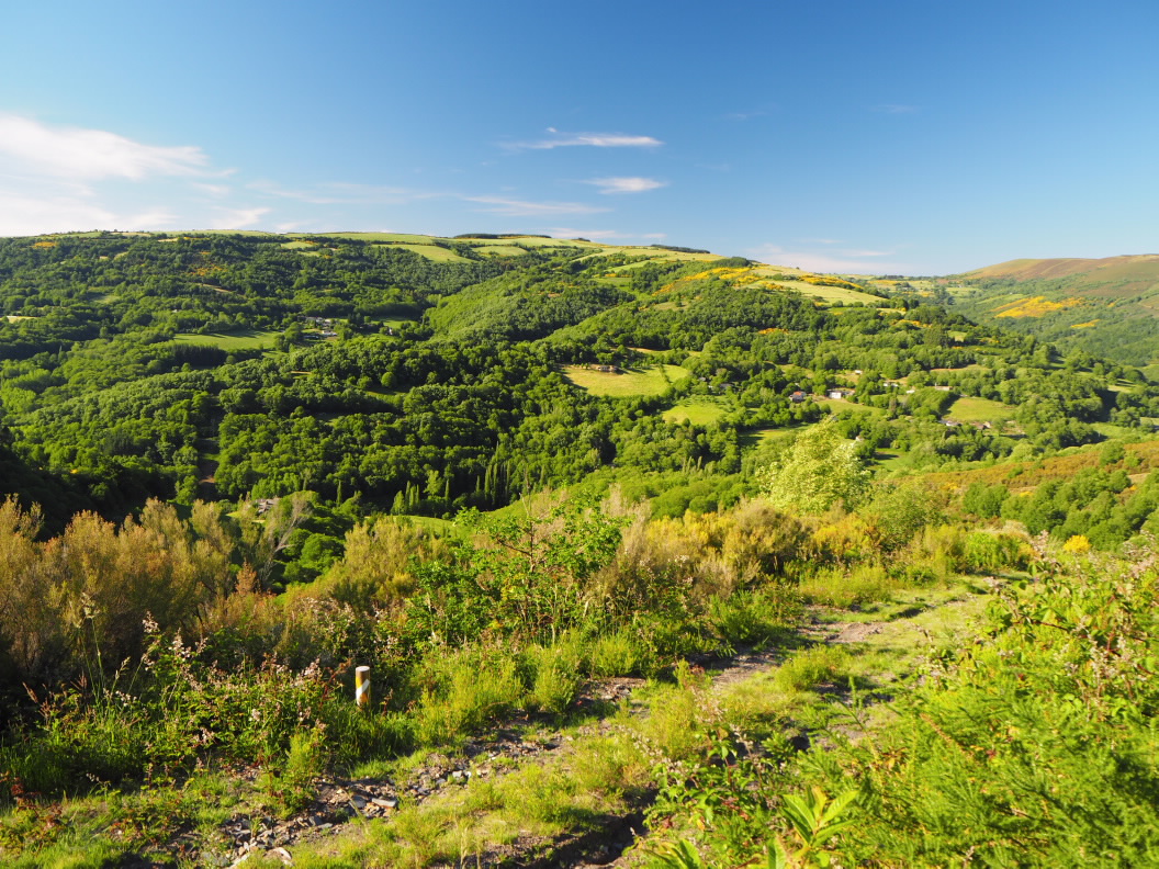
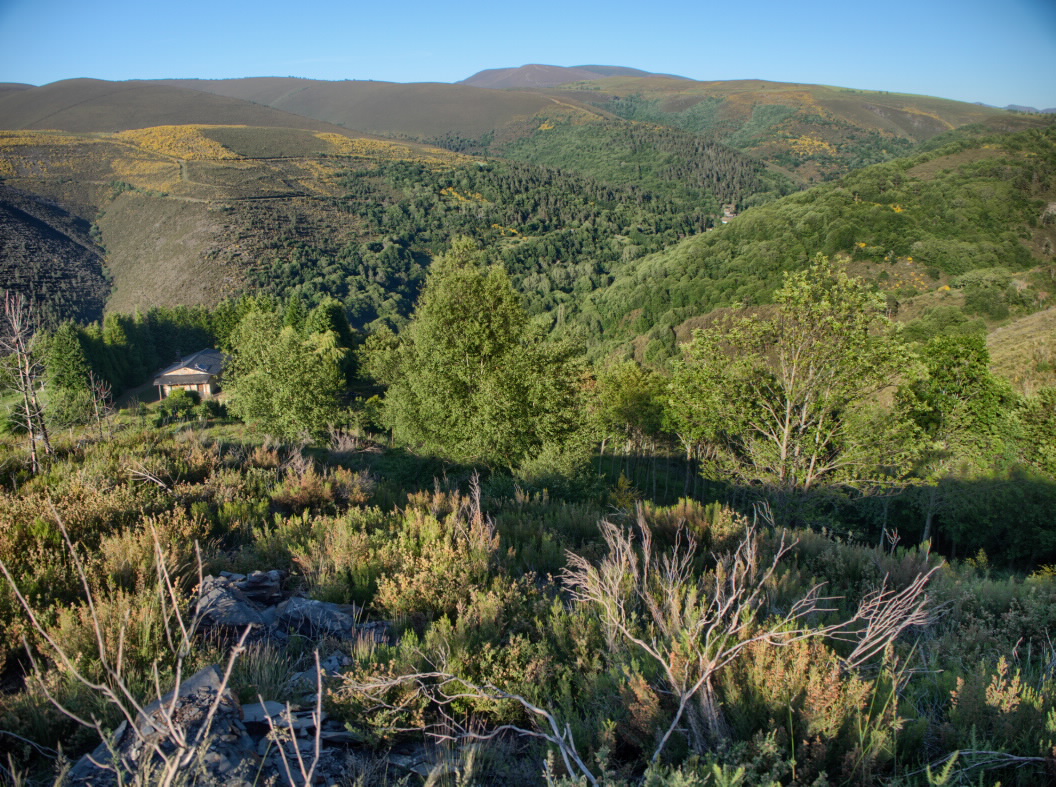
This route runs
along a track that maintains its height on the north slope of the Pico de Santa
Bárbara, A Boibela and Penedo do Campo mountains, which all stand at over 1,000
metres above sea level.
The route begins
by visiting the Pena do Chao, a rocky outcrop with a petroglyph, where there is
also a magnificent viewpoint over the valley formed by the Antigua and Cabe
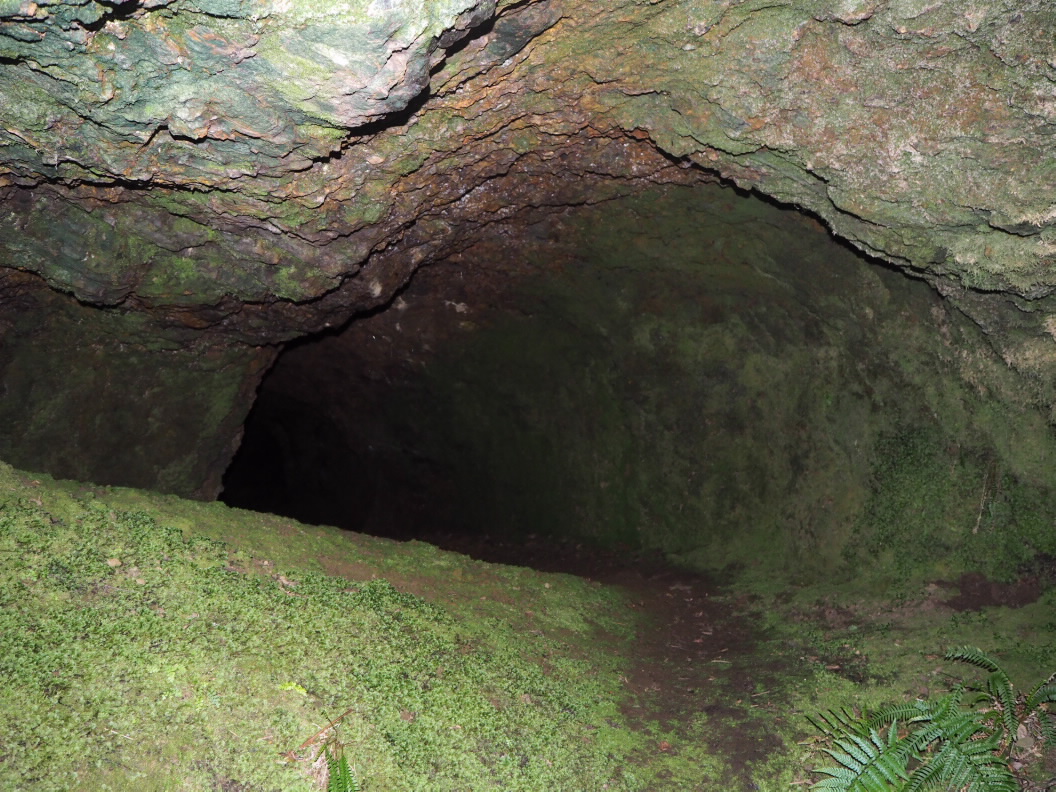
rivers. The path then approaches the mouths of several iron mines, such as the
Cova do Avión, the Cova da Tinta or the Cova do Couso. These mountains hide
small and numerous farms, some dating from the first half of the 20th century
and others from much earlier.
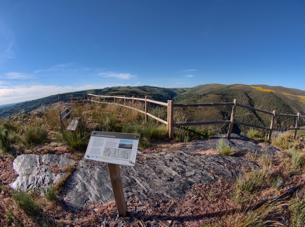
A steep slope
leads up to the Foxo de Lobos de Monteagudo, an old trap to reduce the wolf
populations that threatened the herds. Later, the route approaches another
viewpoint in Pena de San Mamede. From this point, the route continues to the
source of Balneario, a once crowded and famous spring declared to be of public
utility.
TIPS
It is recommended that you do not enter the mines.
Access
From Sarria or Monforte de Lemos, through the CG-2.2 to the LU-644 road to access A Cruz do Incio. The start in Chao de Namelas is on the road that connects the villages of San Pedro and Monteagudo, at approximately km 3.
A plus
FOXOS DE LOBOS
Wolf pits (foxos de lobos in Galician) are buildings that wolves were led towards in order to hunt them. They are generally made up of a pair of walls and a well. The walls, which are sufficiently high to prevent them being scaled by the animals, converge around a hole dug in the ground (a pit or foxo) in which the wolves were captured.
Longitude
6.1 km The main route measures 5.2 km and the variants measure around 900 meters round trip.
Point of Departure / Arrival
Balneario source close to the village of A Ferrería (Concello do Incio).
Proximities of Chao de Namelas (Concello do Incio).
Route
Difficulty
Duration
Equipment
Services
M.I.D.E.
Bicycle access
Horse access
cartography I.G.N. (1:25:000)
Further information
Tel.: 982 427 014
www.concellooincio.es
Kind of route
Interest
Map

