GERÊS - XURÉS

Natural spaces
5685

Location

Ourense

Bande | Calvos de Randín | Entrimo | Lobeira | Lobios | Muíños

Coordinates:
41º 51' 22.7" N - 8º 05' 45.7" W

Description

Granite horizons
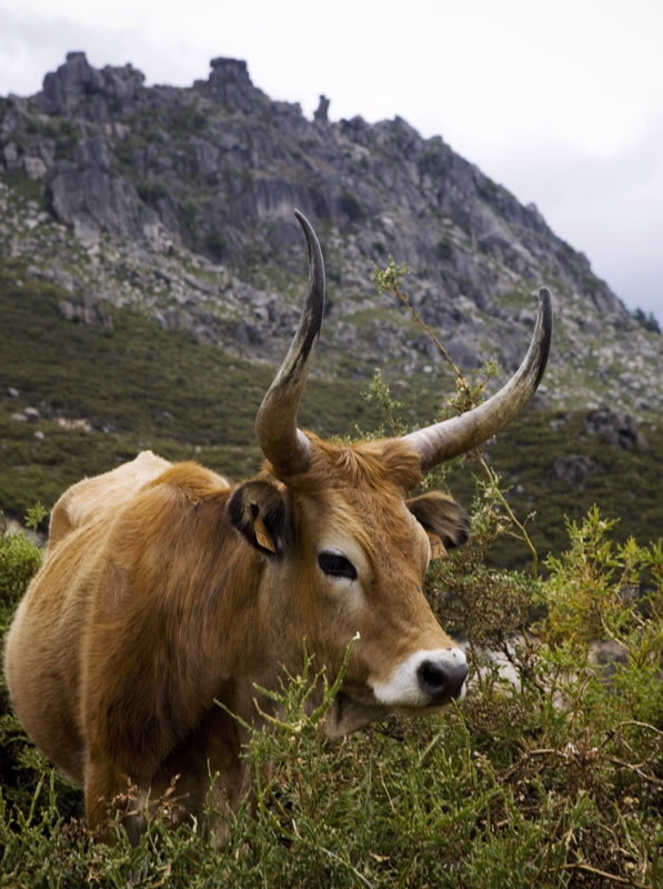
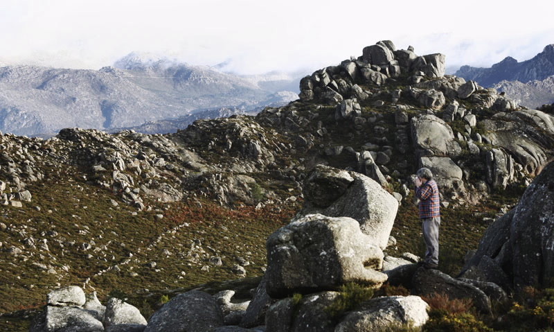
The mountain range, with its granite colours, stands out against the heavenly blue of the horizon where the borders of Galicia and Portugal meet. Around this range, with its peaks which have been eroded over the centuries, lies an immense forest, Atlantic in its humidity, Mediterranean in temperature and semi-alpine in altitude. It is one of the greatest cross-border reserves in the EU. It has recently been recognized as a Biosphere Reserve by the UNESCO “for the variety of its forests and peat bogs ecosystems, as well as for its many endemic species under the joint influence of an oceanic and Mediterranean climate”.
Access to the Albergaría, do Cabril, do Beredo and Ramiscal thickets is limited in the Portuguese Natural Park. They are listed as some of the best peninsular forests, as is the forest of A Barxa, in the Galician Natural Park.

Access

From Ourense, in the direction of Celanova and Portugal, on the OU-540 road. From Xinzo de Limia on the OU-301 local road to Bande. There are several accesses by road in Portugal. Inside the Portuguese Natural Park there are car restrictions on some routes.

Situation

There are a total of eleven municipalities included in the Biosphere Reserve. Six are in Galicia: Lobios, Entrimo, Muíños, Lobeira, Calvos de Randín and Bande, and five are in Portugal: Melgaço, Arcos de Valdevez, Ponte da Barca, Terra de Bouro and Montalegre.

Area

259,496 hectares (62,916 hectares in Galicia and 205,580 hectares in Portugal).

Services

Accommodation: Yes.
Food: Yes.

Without missing

It isn’t difficult to find place names for almost all the origins and villages in this region, as well as the monumental and artistic remains that they left us. The culture of the pre-Roman settlements is represented by the impressive dolmens scattered around the area. There are important Latin monuments such as the Roman camp of Aquis Querquernis, visible and open for visits when the level of the waters of the reservoir of As Conchas goes down. But there are installations open all year round which clearly explain the process of Romanisation, by force of arms and words, of this outpost of the Roman Empire. The church of Santa Comba de Bande, a famous example of the Visigoth architectural style, is also close by. For examples of baroque architecture, the town of Entrimo offers the magnificent façade of the church of Santa María la Real. In every corner, folk constructions like the mills, alvarizas, chivanas (shepherds’ shelters in the mountain), canastros in the Galician of the region and espigueiros in Portuguese (raised granaries), fountains, crosses, roads and walls whose stone structures are examples of the profound and rich folk creativity. On the Portuguese slope, the most important point of folk pilgrimage is the shrine of A Peneda and its famous waterfall, especially impressive in the rainy season, in the district of Melgaço. Possible access routes go from the Miño side or crossing the raia from Entrimo, and also from the interesting hill-fort of Laboreiro.

Information and facilities

Sede del Parque Natural Baixa Limia-Serra do Xurés
Telephone: +34 988 448 048
Centro de Interpretación del Parque Natural
Telephone: +34 988 448 048
Telephone 2: +34 988 448 181}
Address: Lobios
Centro de Interpretación Arqueológica Aquae Querquennae - Via Nova
Telephone: +34 988 444 401
Telephone 2: +34 988 448 181}
Address: Porto Quintela (Bande)

Map

Nature Natural spaces Biosphere Reserve
Arriba
Help us improve!