Turismo de Galicia

-
Things to do
Way of St. James
Nature
Culture and heritage
Beaches and coast
Tourist trails
- Top ten: Ten unrivalled destinations
- The route of the camellia
- Tourist routes
- Pathways for discovering a country
- Walks to fall in love with
- Greenways
- Scenery at the wheel
- EuroVelo Galicia
- Beyond the Sunset
Gastronomy
Health tourism
PROMOTIONS TO ENJOY NOW
Cultural agenda
Will happen... View all
- Places to visit
-
Plan your trip


-
A miña viaxe
A MIÑA VIAXE
- Compartir
- Correo
- Imprimir
mailto:?subject=Content from Tourism of Galicia: PR-G 107 SENDEIRO DE PEDRA MIRANDA&body=I recommend you read the information PR-G 107 SENDEIRO DE PEDRA MIRANDA extracted from the Tourism of Galicia site on page https://www.turismo.gal/recurso/-/detalle/277248483/pr-g-107-sendeiro-de-pedra-miranda?langId=en_US%26tp=6%26ctre=23

Datos do recursos turístico
Description
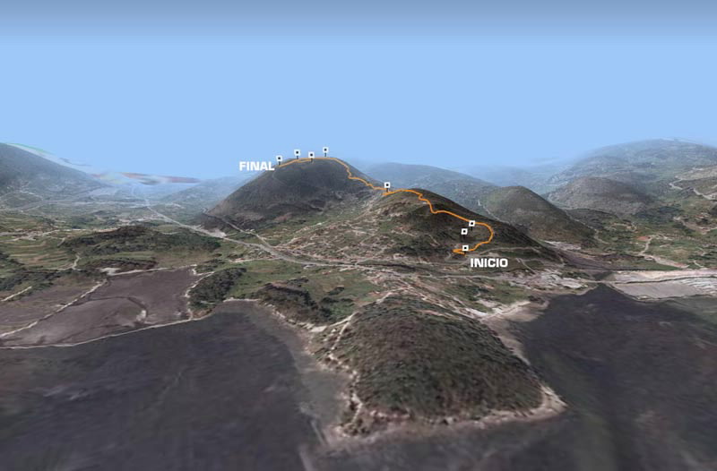
At the start of this route we come across a lagoon in the former quarry of A Lapa. From here head upwards past the old quarry and after passing a water tank, we follow a path bordered by tall pine trees, and come to Alto da Lapa.
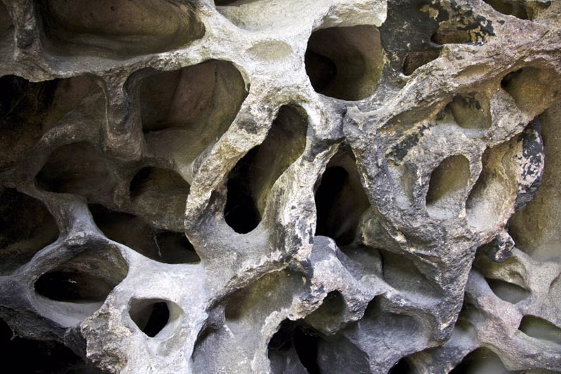
We continue to go upwards, leaving behind the chapel of San Amaro in Cacheiro, reaching the highest point of the route, which is easily identifiable by the rock formation shaped like a cave, known as Pedra Miranda.
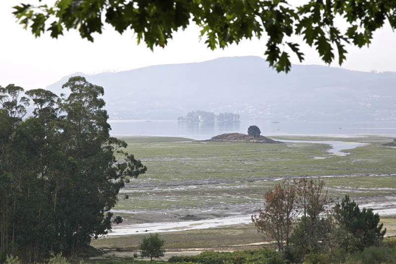
At the end of the route is a natural viewpoint from where you can admire the bays of San Simón and Rande.
Access
The Ways of St. James
Longitude
Point of Departure / Arrival
Route
Difficulty
Duration
Services
M.I.D.E.
Bicycle access
Horse access
cartography I.G.N. (1:25:000)
Further information
Tel.: 986 708 215 - 986 708 252
info@vilaboa.org
www.vilaboa.org
Kind of route
Interest
Map

