Turismo de Galicia

-
Things to do
Way of St. James
Nature
Culture and heritage
Beaches and coast
Tourist trails
- Top ten: Ten unrivalled destinations
- The route of the camellia
- Tourist routes
- Pathways for discovering a country
- Walks to fall in love with
- Greenways
- Scenery at the wheel
- EuroVelo Galicia
- Beyond the Sunset
Gastronomy
Health tourism
PROMOTIONS TO ENJOY NOW
- Places to visit
-
Plan your trip
Build your journey
Practical information


-
A miña viaxe
A MIÑA VIAXE
- Compartir
- Correo
- Imprimir
mailto:?subject=Content from Tourism of Galicia: RÍA DE RIBADEO&body=I recommend you read the information RÍA DE RIBADEO extracted from the Tourism of Galicia site on page https://www.turismo.gal/recurso/-/detalle/9808/ria-de-ribadeo?langId=en_US

Datos do recursos turístico
Description
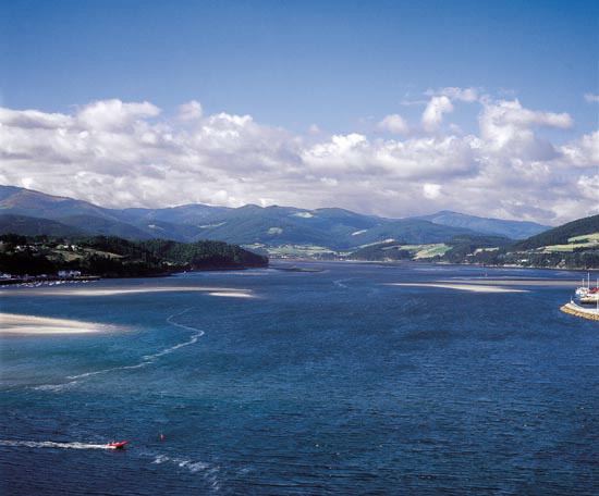
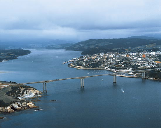
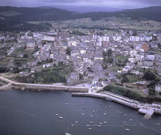
The Ría de Ribadeo, washed by the waters of the river Eo, is the easternmost of the estuaries of Galicia, which joins it to, more than separating it from, Asturias. It has a long shape stretching from north to south and enters Ribadeo on the western shore and Castropol on the eastern.
The towns of Figueras, Castropol and Vegadeo, on the Asturian shore, and Ribadeo on the Galician shore, centralise the life of the regions of the Eo. It is here that the commercial and fishing activities are concentrated.
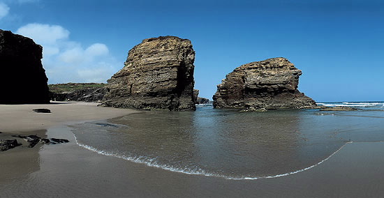
Ribadeo is a compendium of history from medieval times to our days. A bishops centre of the dioceses of Mondoñedo in the Middle Ages, in the 18th century, the powerful middle class left its urban print on the town. The palace of the first Marques of Sargadelos, a powerful industrialist, is today the town hall. The Sailing School was set up in the Casa do Patín in the 19th century. Today, the town is the most important commercial centre in the north. Among its magnificent beaches is the Playa de As Catedrais, thus named from the structure of the cliffs like gothic buttresses.
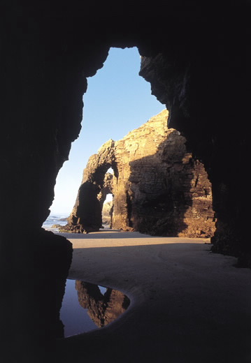
Behind a first impression of uniformity, the place hides the most spectacular series of sea furnas (caves) in Galicia. Vertical cliffs join up with stone columns that serve as a lobby to a rosary of caves, sometimes connected by deep passages. A place well worth a visit and which serves as an exceptional porch or epilogue for any visitors who comes to Galicia or bids farewell.
The towns of Figueras, Castropol and Vegadeo, on the Asturian shore, and Ribadeo on the Galician shore, centralise the life of the regions of the Eo. It is here that the commercial and fishing activities are concentrated.
Ribadeo is a compendium of history from medieval times to our days. A bishops centre of the dioceses of Mondoñedo in the Middle Ages, in the 18th century, the powerful middle class left its urban print on the town. The palace of the first Marques of Sargadelos, a powerful industrialist, is today the town hall. The Sailing School was set up in the Casa do Patín in the 19th century. Today, the town is the most important commercial centre in the north. Among its magnificent beaches is the Playa de As Catedrais, thus named from the structure of the cliffs like gothic buttresses.
Behind a first impression of uniformity, the place hides the most spectacular series of sea furnas (caves) in Galicia. Vertical cliffs join up with stone columns that serve as a lobby to a rosary of caves, sometimes connected by deep passages. A place well worth a visit and which serves as an exceptional porch or epilogue for any visitors who comes to Galicia or bids farewell.
Download the coordinates for this resource...
