


 R1 Parque Forestal Outeiro de Cela" class="hidden-xs img-responsive max-width padding-left-xxl width-100" />
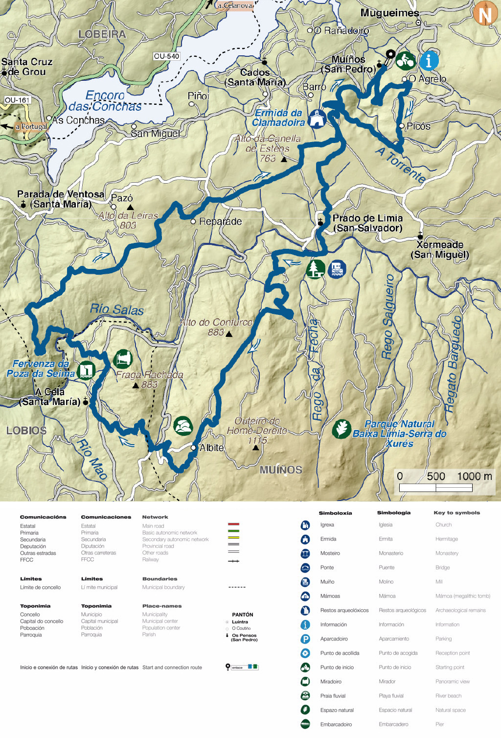
| route | name | Km | level of difficulty |
| R1 | ruta PARQUE FORESTAL OUTEIRO DA CELA | 5,7 Km |  |
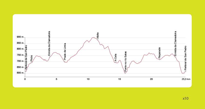
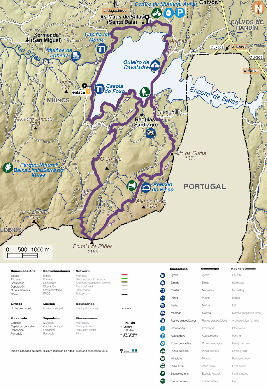
| R2 | ruta TRAVESÍA DO XURÉS | 25,5 Km |  |
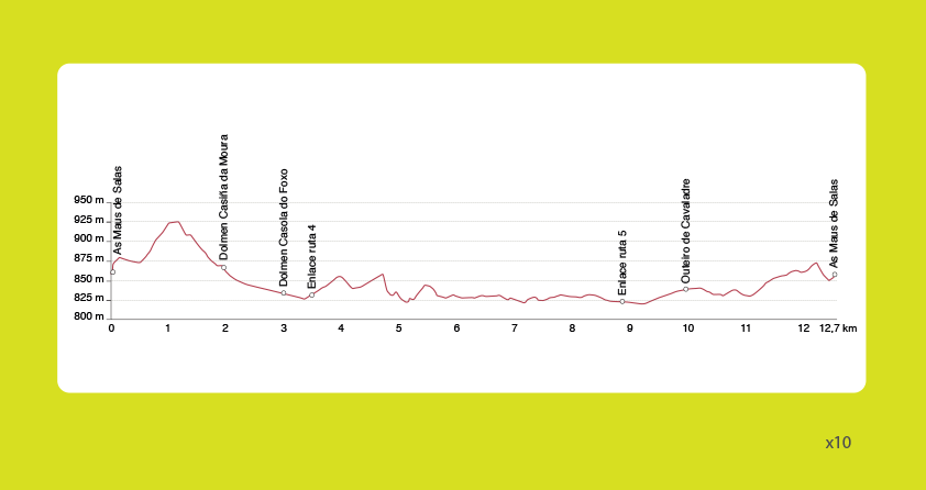
| R3 | ruta MEGALÍTICA | 12,7 Km | |
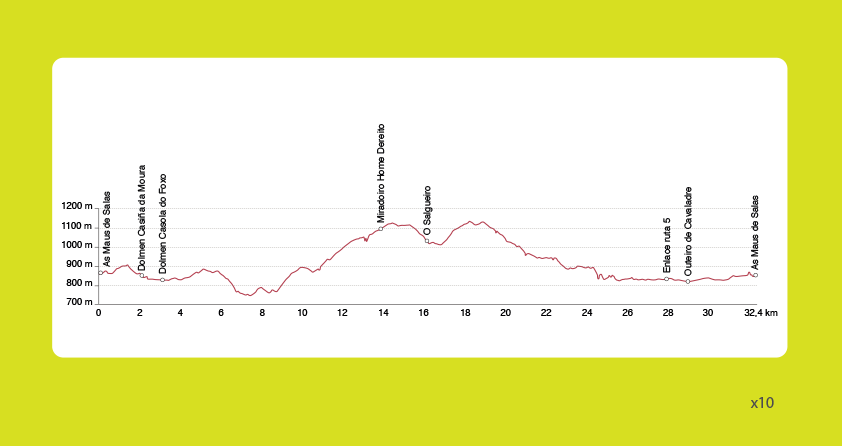
| R4 | ruta PICOS DE FONTEFRÍA | 32,4 Km | |
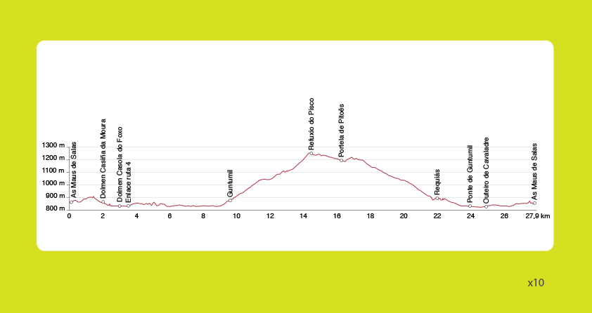
| R5 | ruta SERRA DO PISCO | 27,9 Km |  |
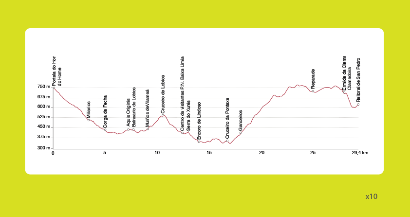
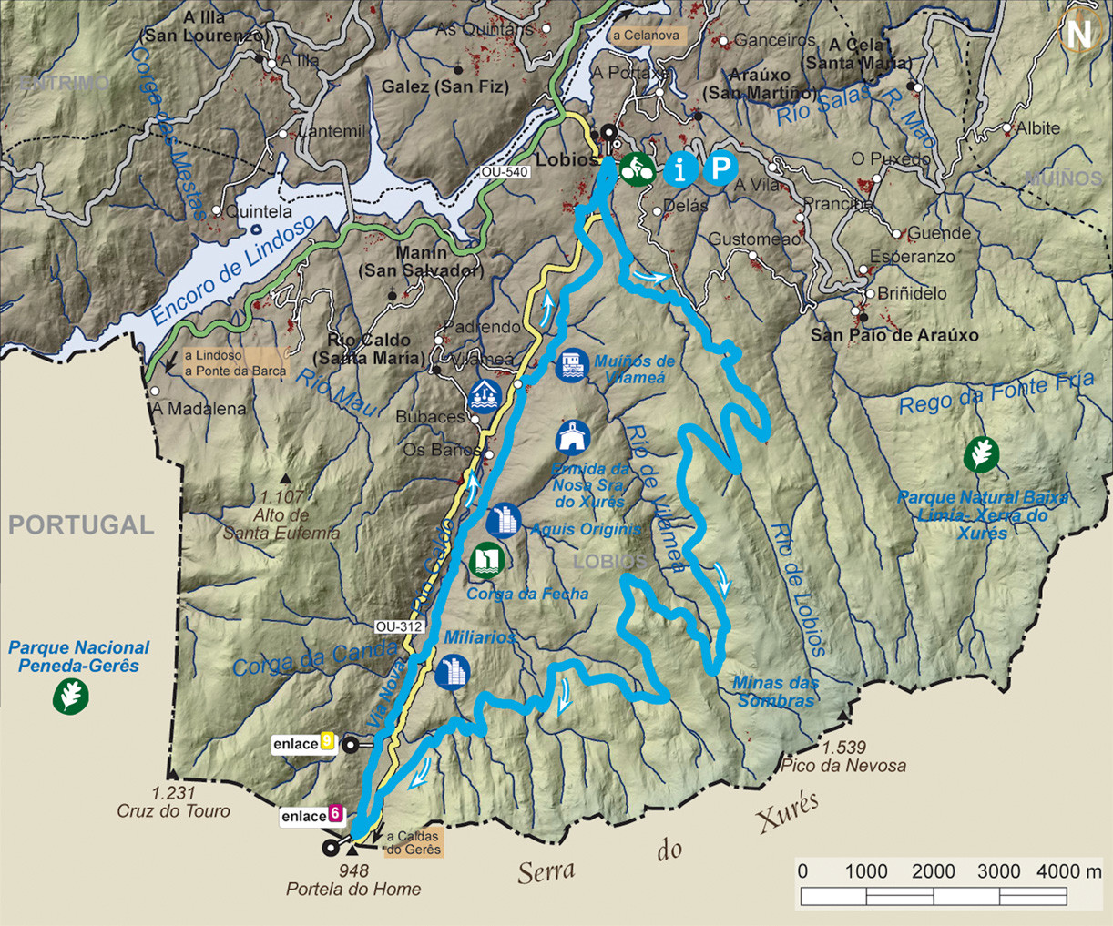
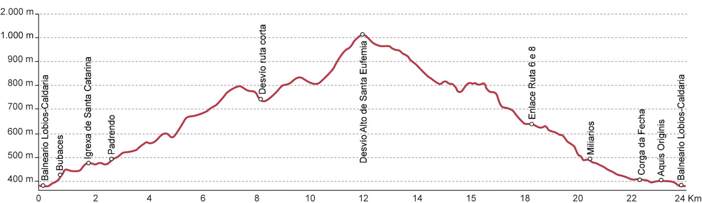
| R6 | ruta VÍA NOVA | 29,4 Km | |
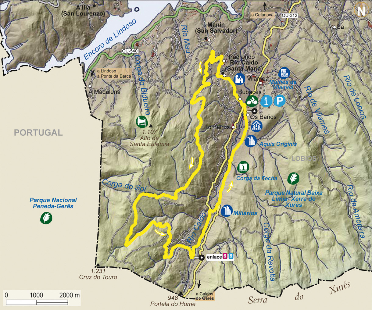
| R7 | ruta CIRCULAR DE LOBIOS | 27,4 km | |
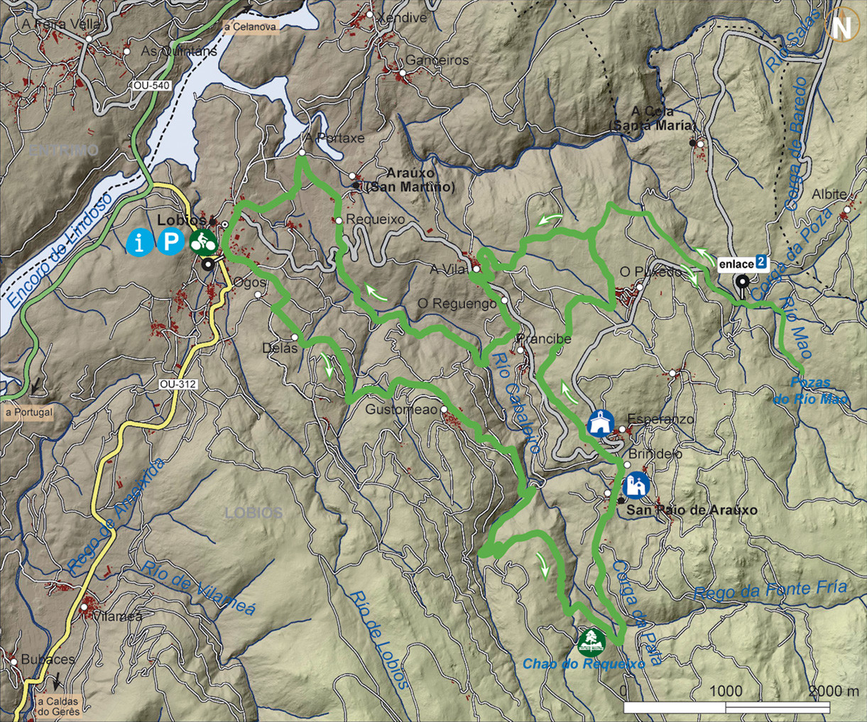
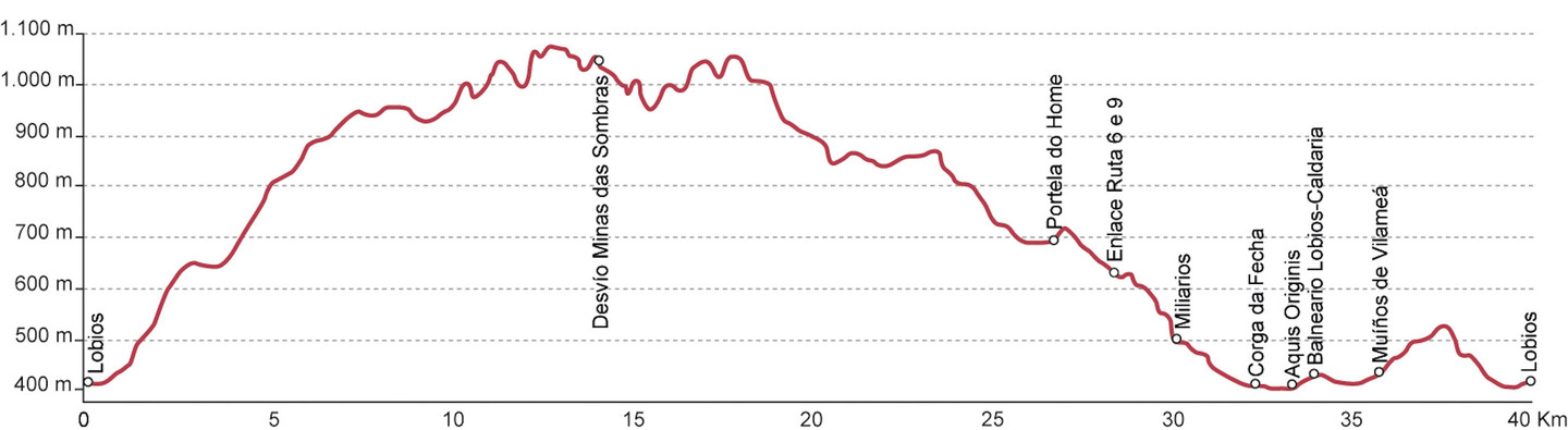
| R8 | ruta MINAS DAS SOMBRAS | 40,2 km | |
| R9 | ruta ALTO DE SANTA EUFEMIA | 24,2 km | |
You can see the details of the different routes on a computer or GPS with GPX. and KMZ. files. The GPX co-ordinates are GPS data exchange files and need the right programme to import them into your GPS. The KMZ co-ordinates are files with geographical data that can be seen with the free programme Google Earth.
