Turismo de Galicia


-
Things to do
Way of St. James
Nature
Culture and heritage
Beaches and coast
Tourist trails
- Top ten: Ten unrivalled destinations
- The route of the camellia
- Tourist routes
- Pathways for discovering a country
- Walks to fall in love with
- Greenways
- Scenery at the wheel
- EuroVelo Galicia
- Beyond the Sunset
Gastronomy
Health tourism
PROMOTIONS TO ENJOY NOW
Cultural agenda
Will happen... View all
- Places to visit
-
Plan your trip
Build your journey
Practical information


- Start
- Things to do
-
Scenery at the wheel
- Way of St. James
- Galician Woodlands
- Experiencies in the midst of nature
- Magical Shrines
- Lighthouses and Wild Beaches
- Galicia Birding
- EuroVelo Galicia
- Hidden Heritage
- Marine Tourism
- Galicia Water Society
- Tourist routes
- The route of the camellia
- Scenery at the wheel
- Top ten: Ten unrivalled destinations
- Strolling Through Vineyards
- Pathways for discovering a country
- Walks to fall in love with
- Greenways
- Beyond the Sunset
- Galician springs
- Promotions to enjoy
- Cultural agenda
- Total Solar Eclipse
- 25 unusual routes through the best landscapes in Galicia
- Endless sea
-
From Corrubedo lighthouse to Monte Enxa
- From Ribadeo to Pico da Frouxeira
- From O Porto de Espasante to the Estaca de Bares lighthouse
- From Cedeira to Cape Ortegal
- From the castle of A Palma to the castle of A Nogueirosa
- From the Laxe lighthouse to O Roncudo point
- Camariñas circular tour
- From the Fisterra lighthouse to the lookout point at O Ézaro
- From Corrubedo lighthouse to Monte Enxa
- From Cape Udra to Cape Home
- From Monte Cepudo to Monte Aloia
- From Baiona to Santa Trega
-
A miña viaxe
A MIÑA VIAXE
- Compartir
- Correo
- Imprimir
ENDLESS SEA
From Corrubedo lighthouse to Monte Enxa... the dunes at Corrubedo, the sandbanks at Porto do SonWith its far-reaching eye,
Oh my love, I am afraid
Triadas no mar e na noite, Fermín Bouza Brey
The area round Corrubedo, famous for its distinctive dunes, has a great deal to offer the visitor. This untamed shore is one of the best conserved stretches of coast in Galicia, with extensive sandbanks and dunes and nearby hills with views of mile after mile of unspoilt Atlantic beauty.
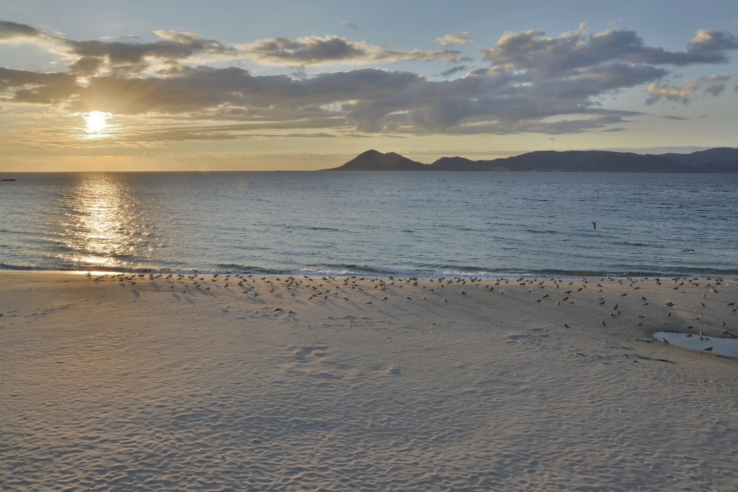
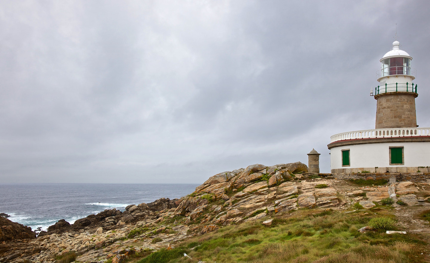 Corrubedo lighthouse
Cape Corrubedo is a flat rocky formation closing the inlet of the same name. Although it is near the peaceful Rías Baixas, it is exposed to the open sea, with the vast ocean on one side and the rocky Serra do Barbanza on the other.
At just a few metres above sea level, The Corrubedo lighthouse withstands the assaults of the wind from the sea with no protection. It is a cylindrical brickwork tower whose white dome can, from a distance, appear like the white crest of a great breaking wave. Surrounded by crags and tiny islands, the lower reaches of this coast are dangerous, making the lighthouse indispensable. Occasionally on foggy nights it has been taken for the lighthouse on the island of Sálvora.
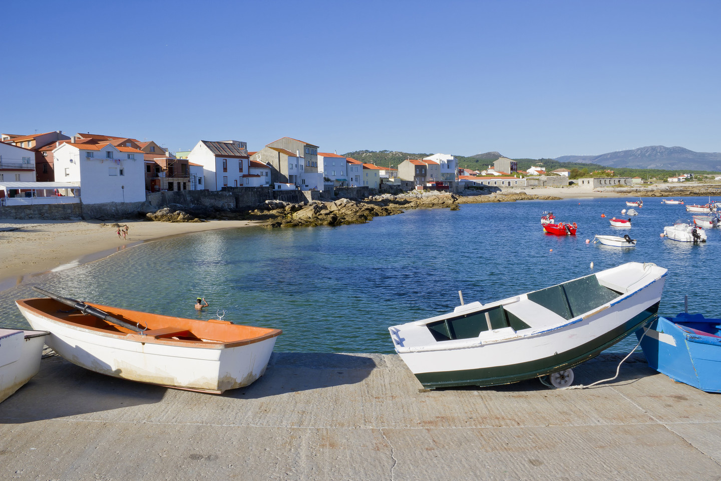 Port of Corrubedo
A long straight road, a rarity in Galicia, runs to and from the lighthouse. To the north the Balieiros or Furna dos Portiños beach is a popular wind-surfing site. The beaches often form grottoes, “large natural cavities in the rocks, produced by the action of the sea”, evidence of the violent impact of the waves on this shore.
Corrubedo is a peaceful location with pleasant temperatures in summer, although it is windy in winter. The inlet is not as large as a ría but it provides sufficient protection for boats in the busy harbour. The small houses almost touch the sand, or the sand touches the houses, according to how you see it. It is a pleasure to wander through the maze of streets in the village. From the harbour, a large white expanse can be seen in the middle distance: the great dune of Corrubedo.
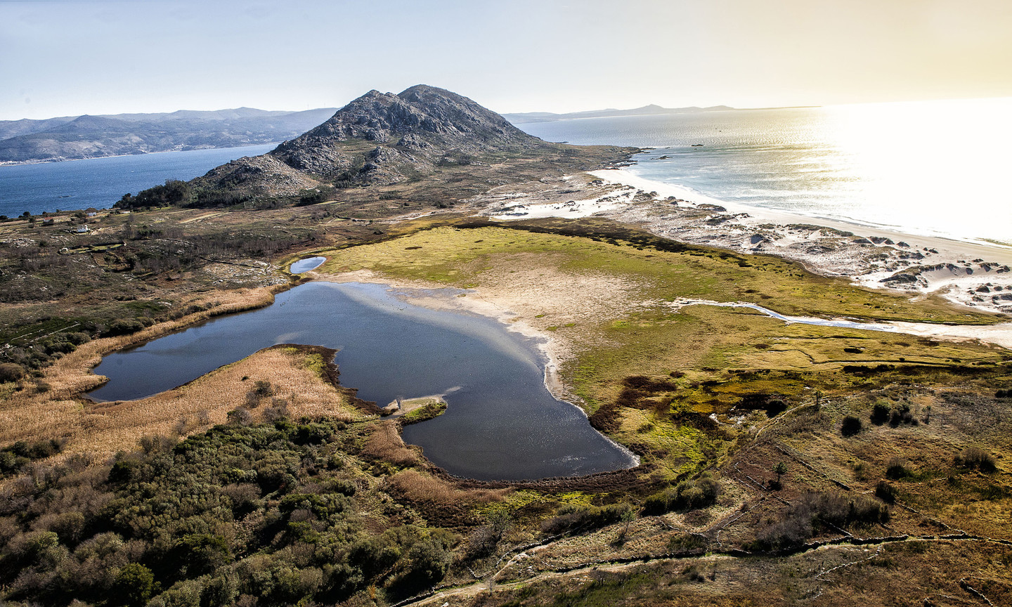
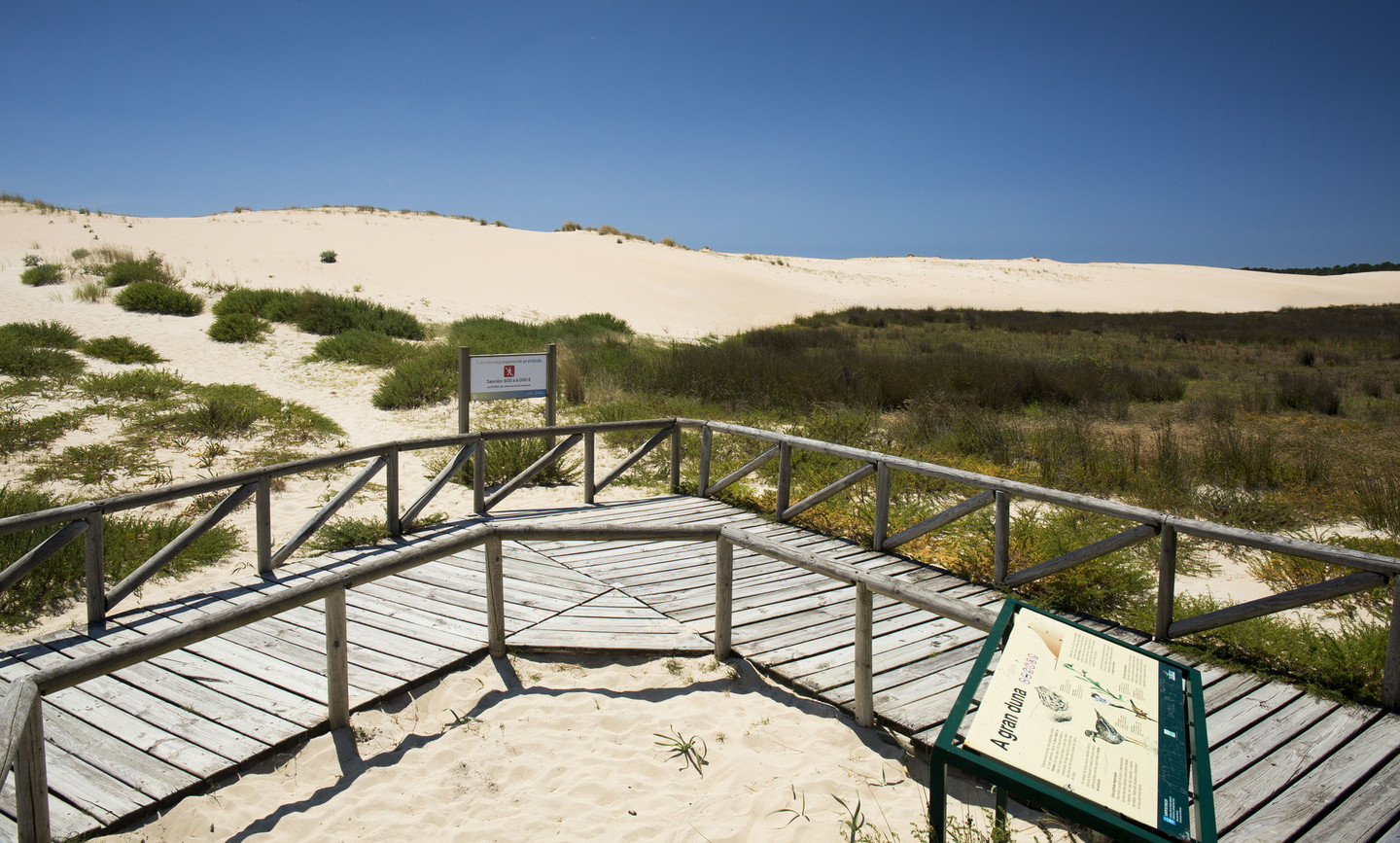 Complexo dunar de Corrubedo and lagoas de Carregal e Vixán Natural Park
The route passes the Complexo dunar de Corrubedo and lagoas de Carregal e Vixán Natural Park, which deserves a leisurely, respectful visit because of its sensitive environmental conditions.
A side turn heads towards Santa Clara de Novás, with a detour to Monte Tahume, one of the finest panoramic lookout points on the Galician coast.
The great dunes at Corrubedo are the feature that defines this protected area. The dunes are moving and are around one kilometre long, reaching a height of nearly 20 metres. The park receives thousands of visitors each year and a designated route has been established to prevent damage to the site.
The wetland area is vital for this ecosystem. The presence of salt water in the Carregal lagoon and fresh water in the Vixán lagoon permits a diverse range of habitats which are home to numerous species of birds, including teals, ducks, dunlins, scorpions, Kentish plovers, herons and Montagu’s harrier. Other species include oystercatchers, sanderlings and turnstones.
There is a reception centre and a range of facilities for visitors, including the Castrocidá lookout point and informative itineraries of interest to tourists, especially bird spotters.
 Lagoas de San Pedro
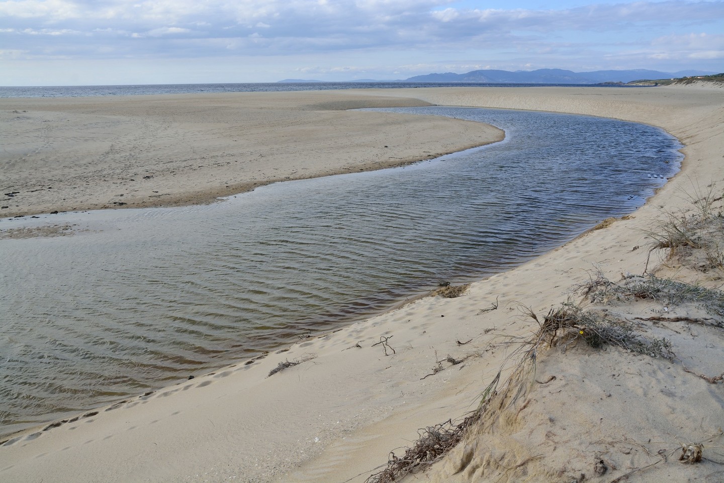
Returning to our route we come to the Lagoas de San Pedro e Xuño Interpretation Centre, where visitors can learn about phenomena in the intertidal zone. At this point the coast becomes a continuous beach which changes its name as one proceeds: Areas Longas, Xuño, Furnas, etc.
Joining the new road at Xuño, we enter a more densely populated area with smallholdings between Caamaño and Tarela. Looking towards the sea, we can see Monte Louro in the distance; we shall be seeing it again later.
 Arnela beach
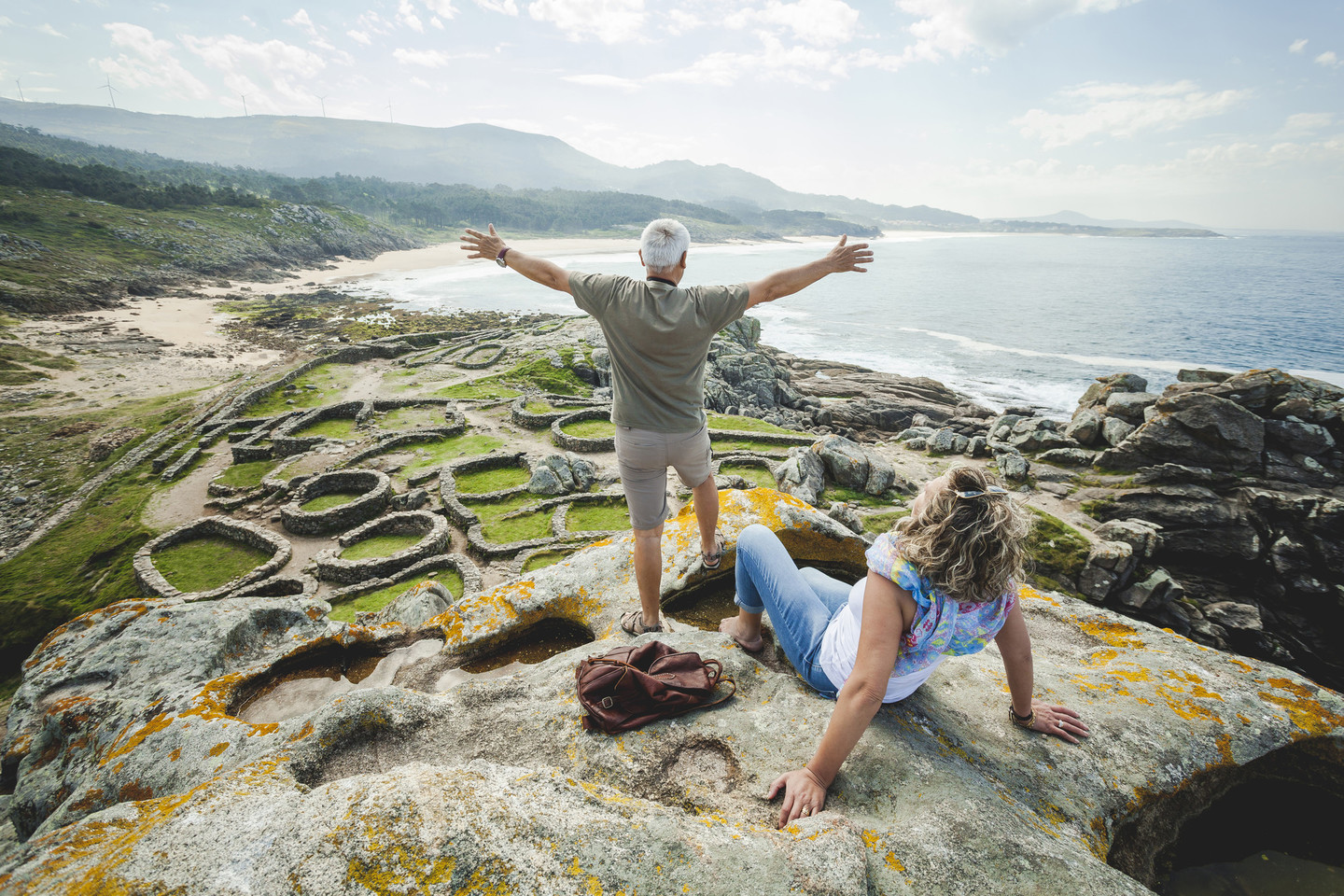
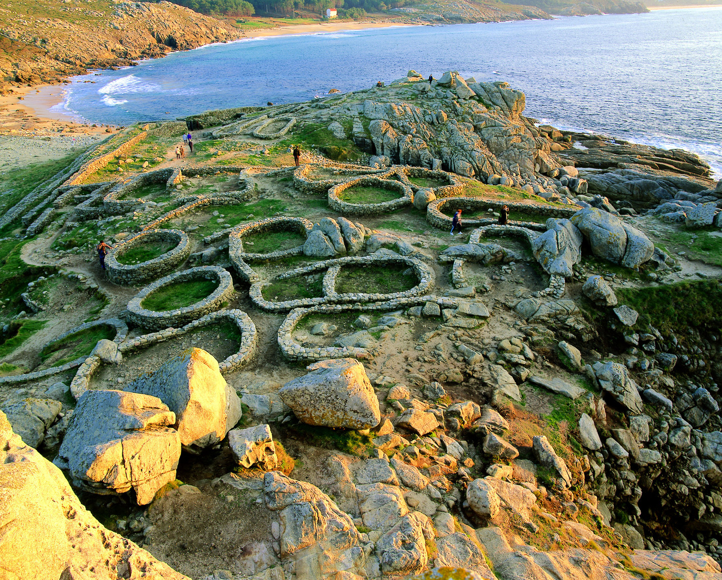
Baroña is a compulsory stop. The castro here is a coastal settlement dating from between the first century BC and the first century AD, located on a small isthmus overlooking the Arealonga beach.
At the A Arnela beach the road appears to merge with the sea. Monte Louro can be seen on the horizon, an impressive sight that will reappear with every turn in the road.
The Castro de Baroña is an Iron Age settlement located on the coast at Porto do Son. The formation of stable communities led to a civilisation known as the Castro culture, with daily life centred around fortified settlements.
Located on a small peninsula, Baroña is a maritime castro in which different areas have been conserved, including the outer fosse, defensive walls and various circular buildings.
The fine sandy beach and sweeping views of the Atlantic provide a perfect setting for this magnificent heritage site.
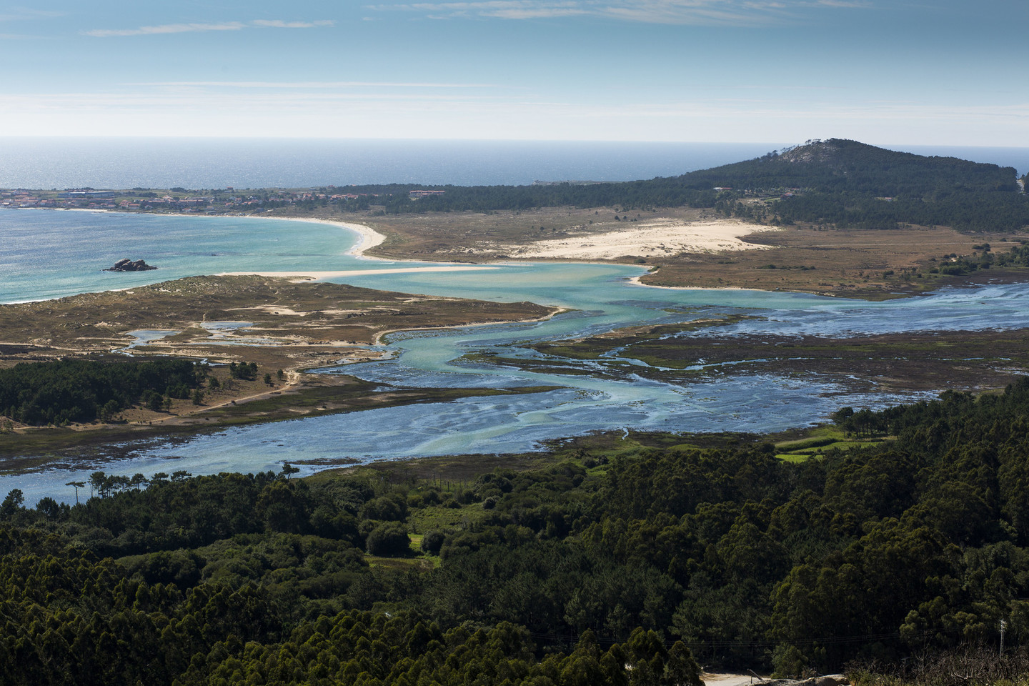
 Monte Louro and Lagoa de Louro
Before we reach the town of Porto do Son, a side turn takes us towards Monte Enxa (539 metres), the end of our route. From this extraordinary natural lookout point there are sweeping views over the Ría de Muros e Noia, closed off to the north by Monte Louro, with its unmistakeable outline.
Monte Enxa is a great place from which to observe the different uses for the land: crags and scrubland in the immediate vicinity, livestock and forestry in the middle distance, and urban development on the edges of the ría. Above all, however, it allows us to contemplate a fascinating section of the Galician coast, between the Arousa and Muros e Noia rías.
Don´t miss
 Monte Tahume is a superb natural lookout point
Monte Tahume is a superb natural lookout point, located in the last section of O Barbanza mountain range, similar in shape and texture to other peaks in the range.
At 227 metres high, it affords views of the whole coastline between Rías Baixas and Costa da Morte. In the foreground the whole of the Complexo dunar de Corrubedo e lagoas de Carregal e Vixán Natural Park can be seen. There are also fine views of Cape Corrubedo with its lighthouse and the islands of Sálvora and Ons, the latter in the Ría de Pontevedra.
An asphalted track goes to the top of the hill, where parking space is available beside the telecommunications masts. The paths on the upper part of the crags lead to a cross at the top, where splendid views are to be found, although there are sweeping views from anywhere on the way up.
