Turismo de Galicia


-
Things to do
Way of St. James
Nature
Culture and heritage
Beaches and coast
Tourist trails
- Top ten: Ten unrivalled destinations
- The route of the camellia
- Tourist routes
- Pathways for discovering a country
- Walks to fall in love with
- Greenways
- Scenery at the wheel
- EuroVelo Galicia
- Beyond the Sunset
Gastronomy
Health tourism
PROMOTIONS TO ENJOY NOW
Cultural agenda
Will happen... View all
- Places to visit
-
Plan your trip
Build your journey
Practical information


- Start
- Things to do
-
Scenery at the wheel
- Way of St. James
- Galician Woodlands
- Experiencies in the midst of nature
- Magical Shrines
- Lighthouses and Wild Beaches
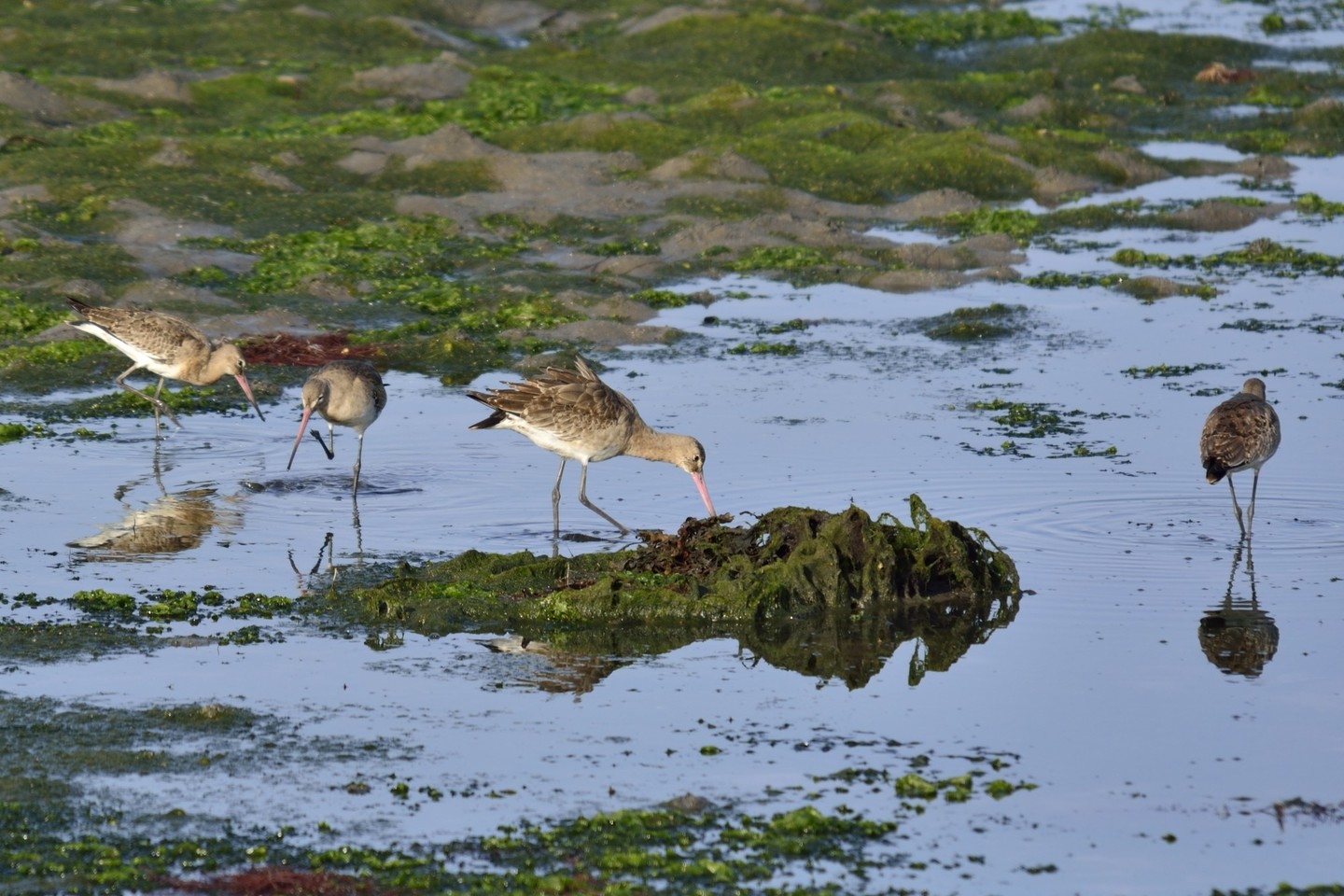
- Galicia Birding
- EuroVelo Galicia
- Hidden Heritage
- Marine Tourism
- Galicia Water Society
- Tourist routes
- The route of the camellia
- Scenery at the wheel
- Top ten: Ten unrivalled destinations
- Strolling Through Vineyards
- Pathways for discovering a country
- Walks to fall in love with
- Greenways
- Beyond the Sunset
- Galician springs
- Promotions to enjoy
- Cultural agenda
- Total Solar Eclipse
- 25 unusual routes through the best landscapes in Galicia
- Endless sea
-
From Ribadeo to Pico da Frouxeira
- From Ribadeo to Pico da Frouxeira
- From O Porto de Espasante to the Estaca de Bares lighthouse
- From Cedeira to Cape Ortegal
- From the castle of A Palma to the castle of A Nogueirosa
- From the Laxe lighthouse to O Roncudo point
- Camariñas circular tour
- From the Fisterra lighthouse to the lookout point at O Ézaro
- From Corrubedo lighthouse to Monte Enxa
- From Cape Udra to Cape Home
- From Monte Cepudo to Monte Aloia
- From Baiona to Santa Trega
-
A miña viaxe
A MIÑA VIAXE
- Compartir
- Correo
- Imprimir
ENDLESS SEA
Via “the cathedrals” of the Cantabrian SeaWhen O Mondigo is covered in cloud, all the old women tremble
Popular saying
This route runs mainly along the Ribadeo and Barreiros shore, between gently rolling dunes and interestingly shaped cliffs. But the beauty of the coast is not the only attraction of this route, as it also takes in rich heritage and unique towns such as Rinlo and Ribadeo.
 Lugo’s Mariña Oriental
Lugo’s Mariña Oriental has one of the most distinctive coastlines in Galicia. The wide coastal plain forms an area containing towns and villages, farmland and open country. The open views of the Cantabrian Sea reveal a succession of beaches, the most notable example being at As Catedrais.
With its feet in Galicia but its eyes on Asturias, Ribadeo stands on the left bank of the Ría de Ribadeo. The river marks the border between the two communities, linked physically and symbolically by Os Santos bridge. Modern and functional, the bridge has run from one bank to the other since 1987, with a chapel at each end (San Román in Castropol, San Miguel in Ribadeo, the saints referred to in the name of the bridge).
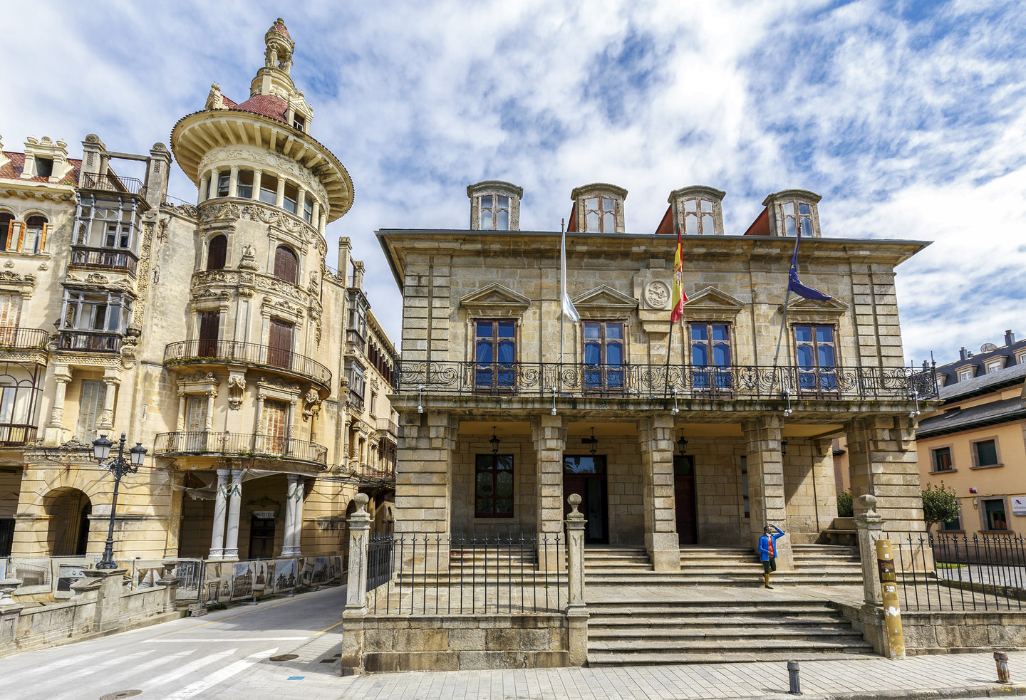 Ribadeo
Ribadeo is a major town. Its architectural heritage features a unique, incomparable style strongly influenced by the Galicians returning from the Americas in the nineteenth and twentieth centuries. The Torre dos Moreno (1915) is an outstanding example of this cross-cultural exchange.
The route keeps the sea in sight from the starting point at pier of Porcillán, beside the marina in Ribadeo. After passing under Os Santos bridge, the road to the lighthouse soon brings us to our first compulsory stop: the castle of San Damián and the Cargadoiro. The former is an eighteenth-century fort that protected the Ría de Ribadeo and was declared a Cultural Heritage Site in 1994. The latter is an old loading wharf built in the early twentieth century for shipping iron from the mines at Vilaodriz, which was brought to the site by train.
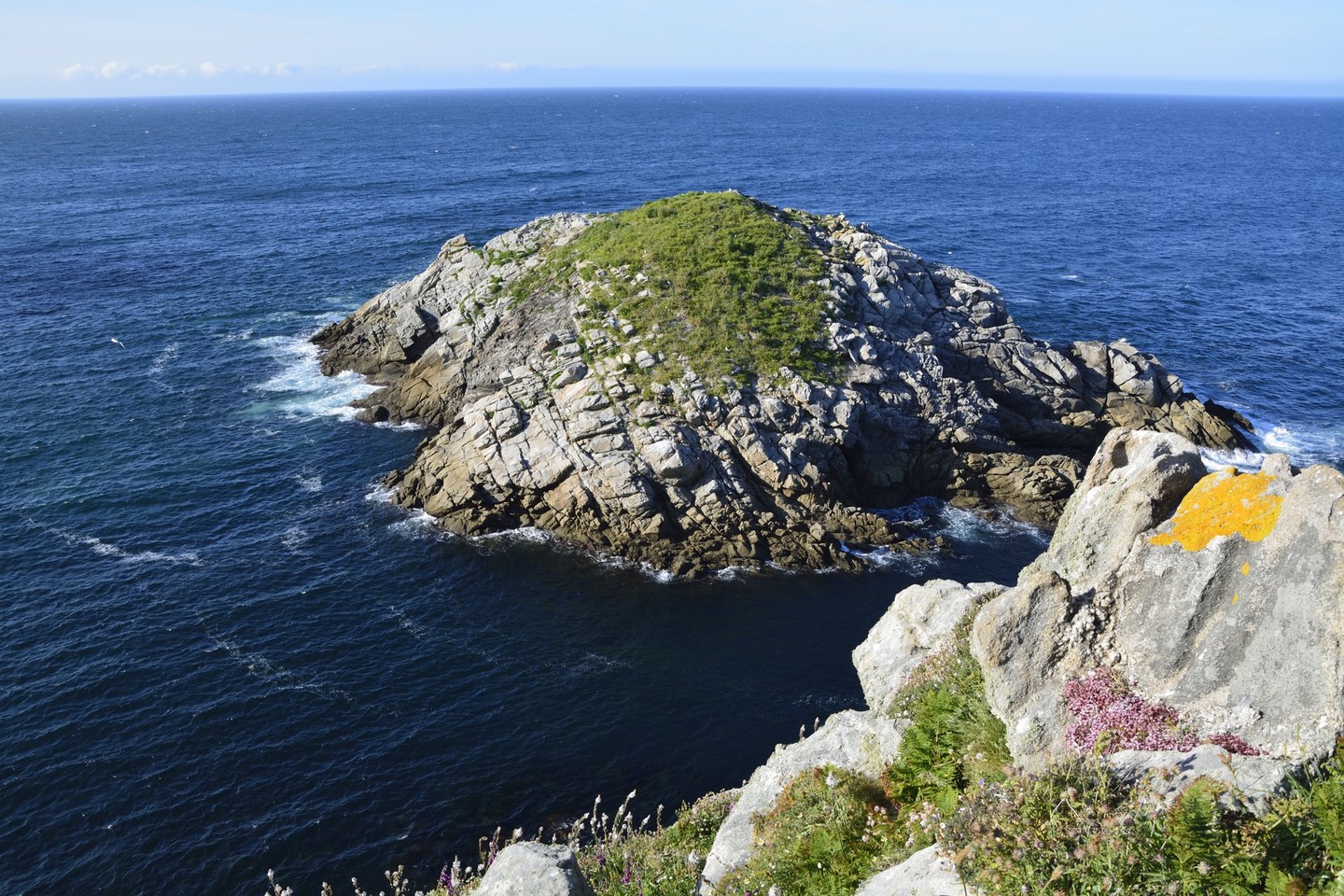
 The old Illa Pancha lighthouse
Following the coast the route soon reaches the old Illa Pancha lighthouse, built in 1857.
This delightful small island is bathed by the turquoise blue waters of the Cantabrian, contrasting with the bright colours of the brushwood near the coastline and the cliffs.
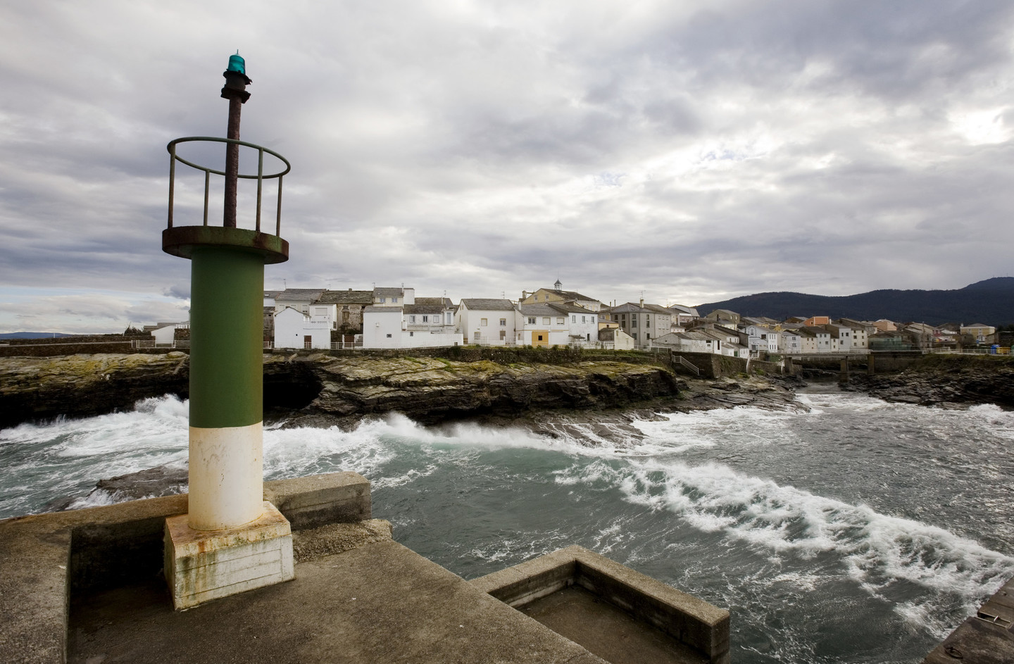 Rinlo
RinloThe route continues through the fields on the coastal plain as far as Rinlo, one of the Galician coast’s most distinctive towns.
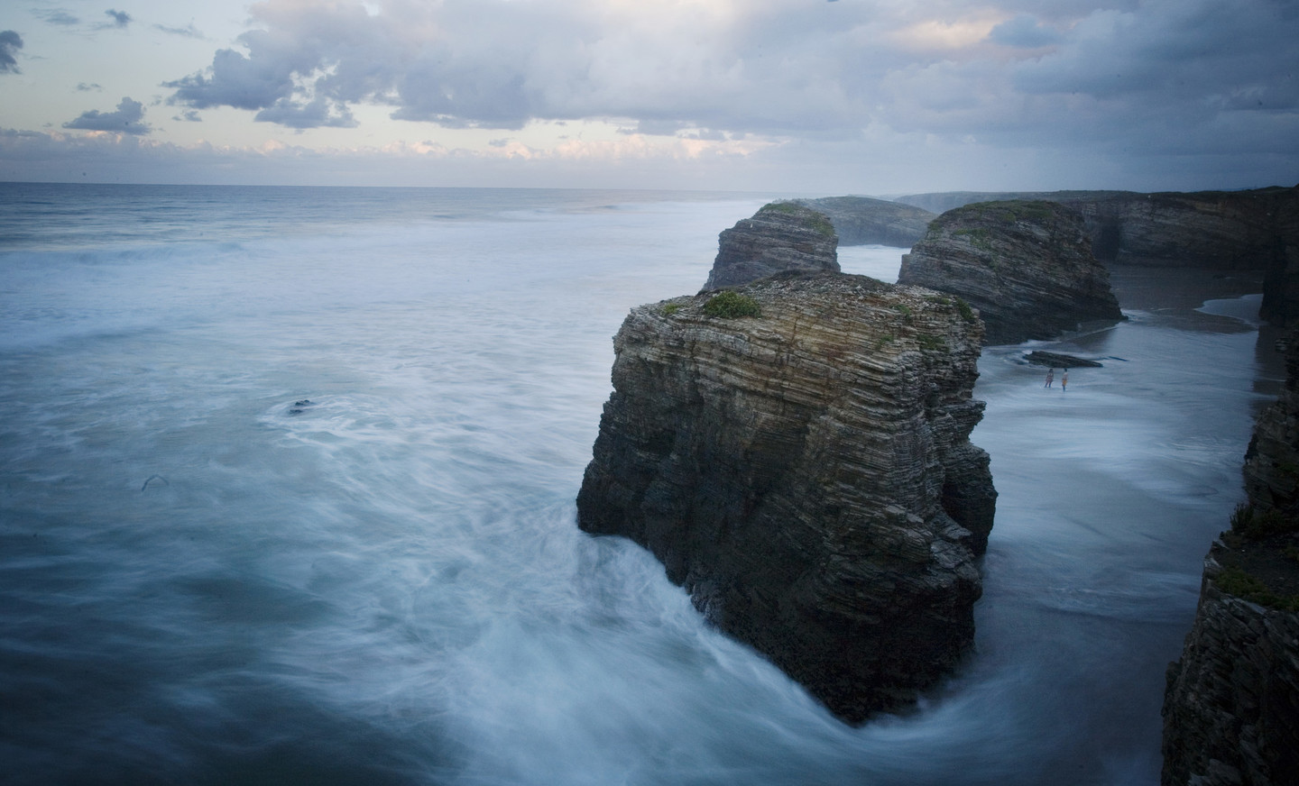
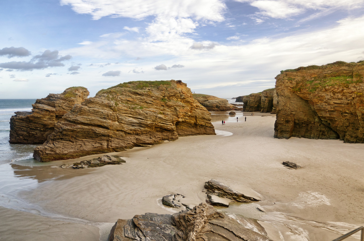
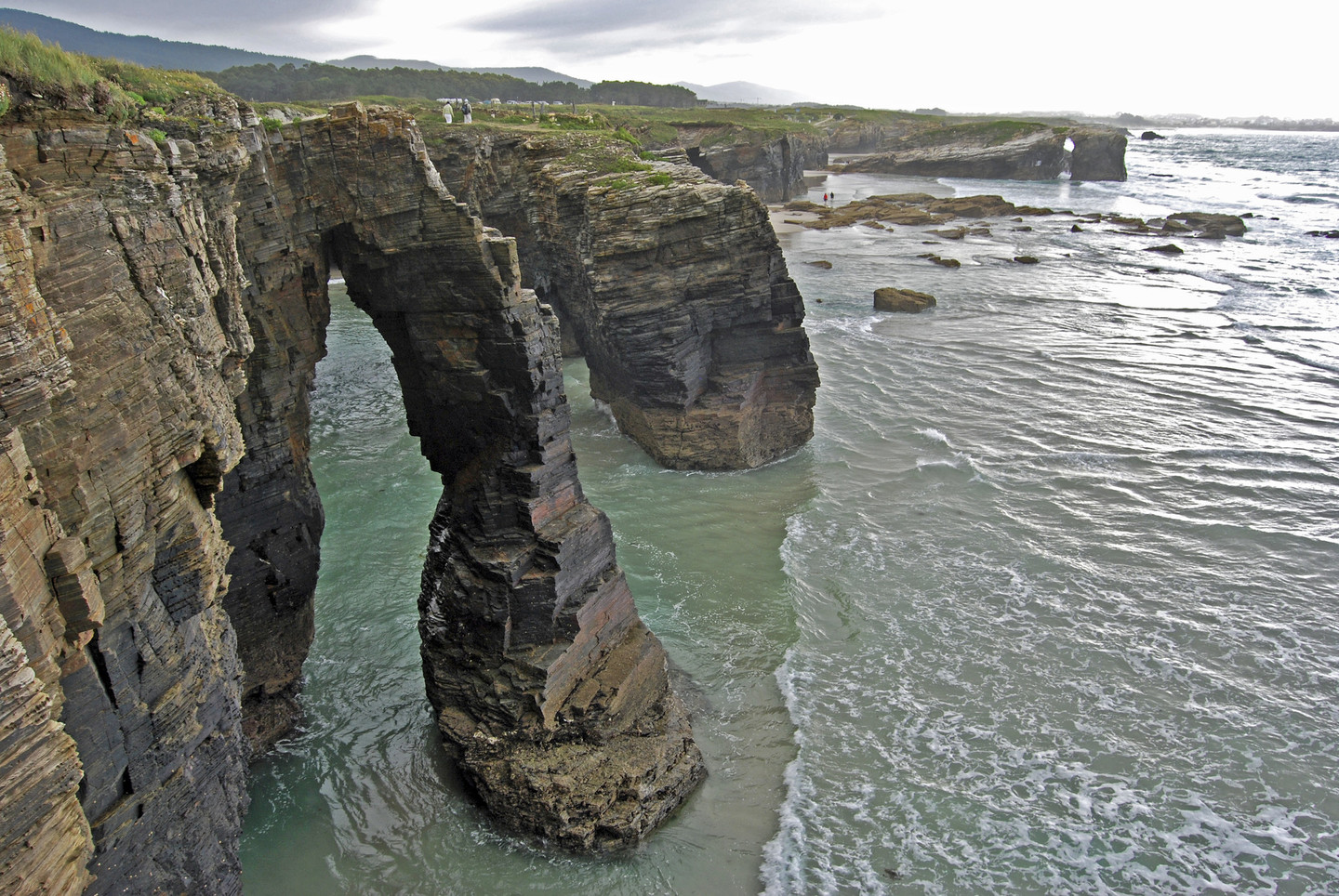 As Catedrais beach
Following the coastline, we then come to the beaches at Os Castros, As Illas and Esteiro and then, the most outstanding of all, As Catedrais, with its famous stone arches.
The succession of beaches continues through Barreiros: Arealonga, Lángara, Benquerencia, Remior, etc. Between them we find some interesting examples of archaeological heritage with sites including Punta do Castro and the anthropomorphic mediaeval tomb at the O Coto beach.
With its impressive rock formations, the beach at Augasantas is known as As Catedrais (The Cathedrals). The succession of cliffs and rock arches forms a wall that resembles the finest Galician Gothic architecture. Arches, grottoes, etc.: stone rising from the sea and supporting the land, like a modern feat of engineering. Rising and falling sea levels over the ages, tectonic movements and erosion by the waves gradually modelled the slate and quartzite formations, creating an authentic natural monument, the site being officially awarded Natural Monument status in 2005.
In view of the area's outstanding natural features, As Catedrais has been designated a Special Area of Conservation (SAC), mainly because of the presence of exceptional vegetation on the coast (in particular sea lavender) and a wide range of birds. As it is a protected area, visitors must ask for permission to access página, via the Xunta de Galicia Consellería de Medio Ambiente Department of the Environment’s website.
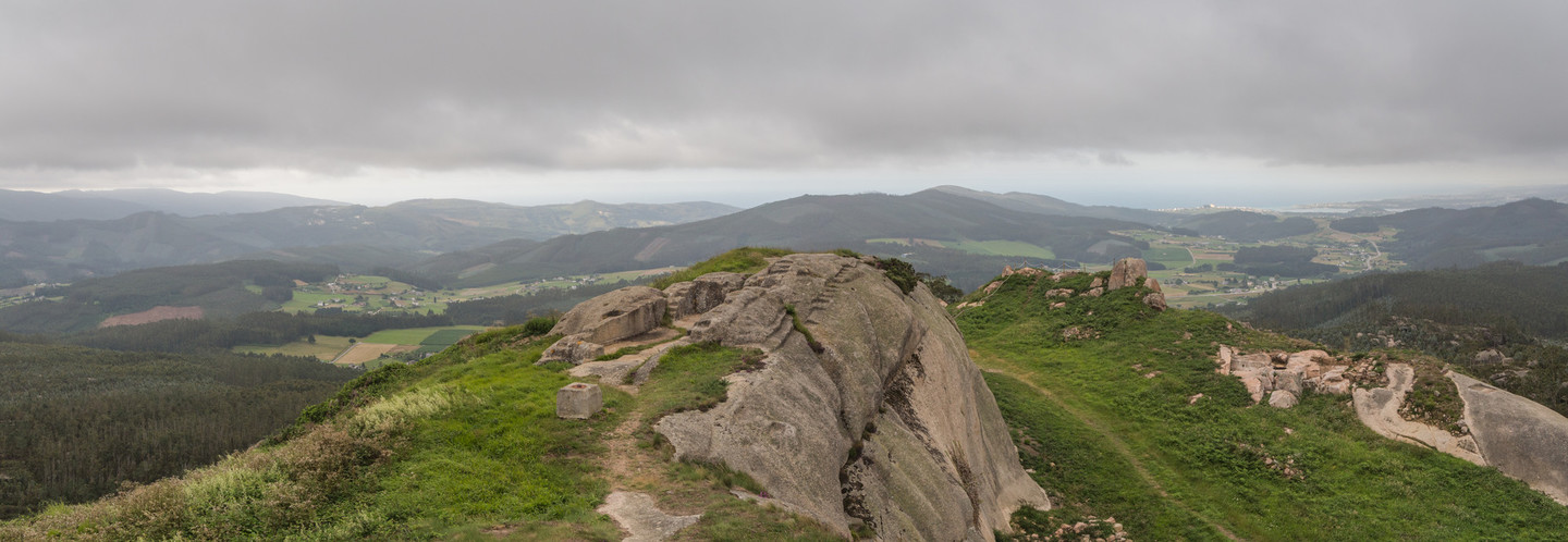 Lookout in the Pico da Frouxeira
The final section, in the municipality of Foz, takes us along the estuary of the River Masma and then turns towards our final destination, the Pico da Frouxeira.
On this 427-metre high rock once stood a late mediaeval fortress which may have belonged to Pardo de Cela, a fifteenth-century marshal who fought the Catholic Monarchs. The main structure of the building is all that remains of the fortress, which overlooked the Ría de Foz and the inland areas of Alfoz and O Valadouro.
Don't miss
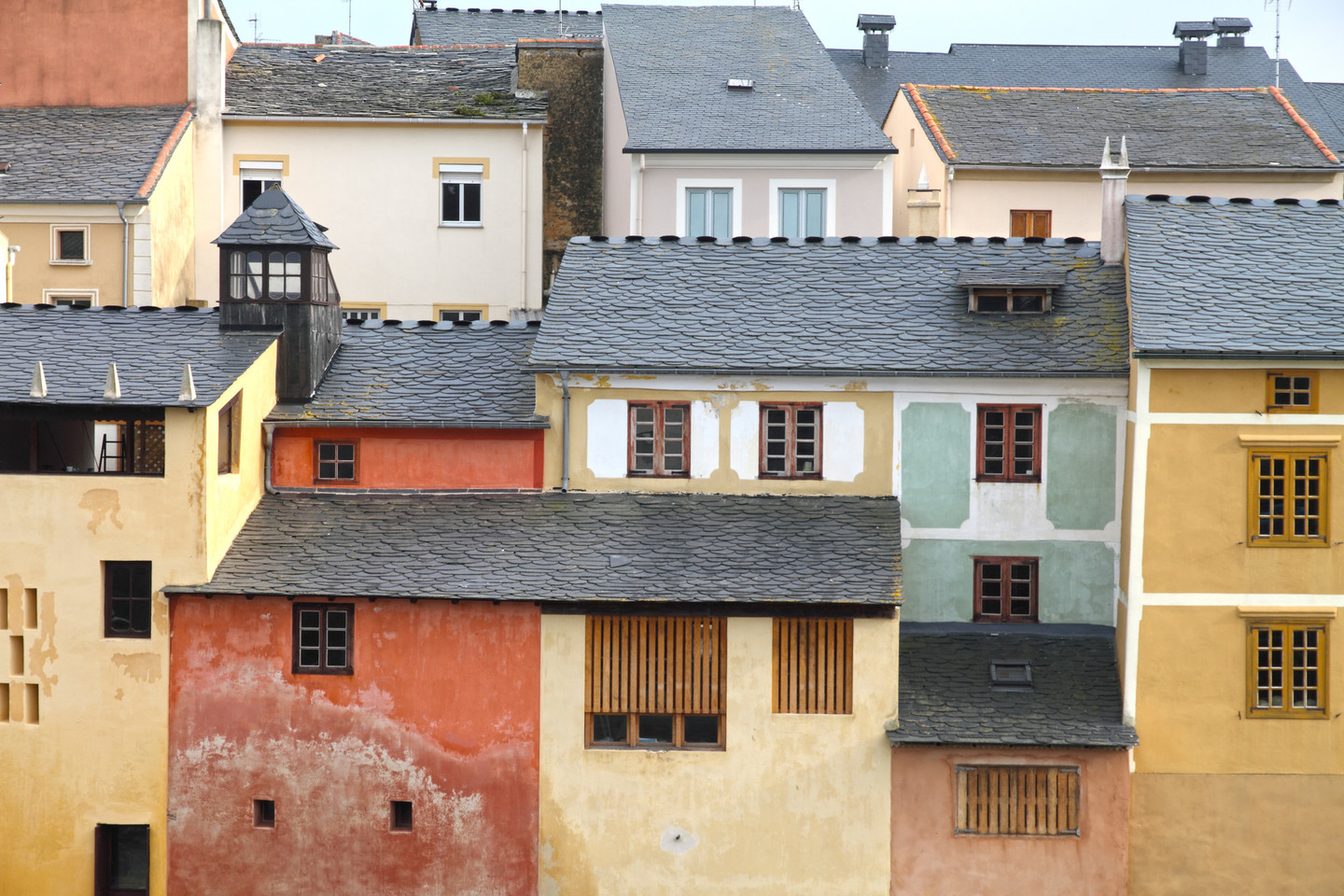 Rinlo's maritime town
Rinlo conserves all the charm of a maritime town that time seems to have forgotten. Its buildings were constructed on the coastal cliffs, a series of homes facing the sea, on which the residents depended for their livelihood.
The small inlet on which it stands was a natural harbour for fishermen, even when they captured whales. The traditional layout of the town centre is unchanged, with irregular, narrow streets that lead to the sea in places. The landscape retains a traditional appearance with small plots producing crops that complement fishing.
Rinlo’s houses fit together perfectly, sheltering each other from stormy weather and they produce a distinctive image with their slate-covered gable roofs and neat shapes. The traditional shellfish nurseries, built near the town in the early twentieth century, are the basis of its gastronomy, of which arroz caldoso (soupy rice) with lobster is a notable local speciality.
