Turismo de Galicia


-
Things to do
Way of St. James
Nature
Culture and heritage
Beaches and coast
Tourist trails
- Top ten: Ten unrivalled destinations
- The route of the camellia
- Tourist routes
- Pathways for discovering a country
- Walks to fall in love with
- Greenways
- Scenery at the wheel
- EuroVelo Galicia
- Beyond the Sunset
Gastronomy
Health tourism
PROMOTIONS TO ENJOY NOW
- Places to visit
-
Plan your trip
Build your journey
Practical information


- Start
- Things to do
-
Scenery at the wheel
- Way of St. James
- Galician Woodlands
- Experiencies in the midst of nature
- Magical Shrines
- Lighthouses and Wild Beaches
- Galicia Birding
- EuroVelo Galicia
- Hidden Heritage
- Marine Tourism
- Galicia Water Society
- Tourist routes
- The route of the camellia
- Scenery at the wheel
- Top ten: Ten unrivalled destinations
- Strolling Through Vineyards
- Pathways for discovering a country
- Walks to fall in love with
- Greenways
- Beyond the Sunset
- Galician springs
- Promotions to enjoy
- Cultural agenda
- Total Solar Eclipse
- 25 unusual routes through the best landscapes in Galicia
- Endless sea
-
From O Porto de Espasante to the Estaca de Bares lighthouse
- From Ribadeo to Pico da Frouxeira
- From O Porto de Espasante to the Estaca de Bares lighthouse
- From Cedeira to Cape Ortegal
- From the castle of A Palma to the castle of A Nogueirosa
- From the Laxe lighthouse to O Roncudo point
- Camariñas circular tour
- From the Fisterra lighthouse to the lookout point at O Ézaro
- From Corrubedo lighthouse to Monte Enxa
- From Cape Udra to Cape Home
- From Monte Cepudo to Monte Aloia
- From Baiona to Santa Trega
-
A miña viaxe
A MIÑA VIAXE
- Compartir
- Correo
- Imprimir
ENDLESS SEA
From O Porto de Espasante to the Estaca de Bares lighthouse...cliffs, harbours and light
and the music of black fagots descending
the mythical mountain.
Na ribeira da ría, Laureano Álvarez (poet from Ortigueira)
The Ortigueira and Mañón coast features some of Galicia’s most impressive cliffs. The steep coastline is broken by sheltered harbours containing pleasant towns. Passing through the distinctive landscape of the north of Galicia, this route takes in open beaches, natural lookout points, historic sites and charming towns.
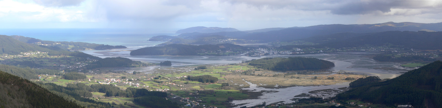 View of the estuary of Ortigueira
This route along a fascinating stretch of coast starts at O Porto de Espasante.
A hub of maritime activity, its harbour accounts for a substantial part of the fishing activity in Ortigueira. The isthmus, running between the A Concha and San Antonio beaches, ends at Punta dos Prados, the site of a strategically located prehistoric maritime settlement (castro). The nearby early eighteenth century Garita da Vela was a lookout post from which the Espasante inlet and access to the Ría de Ortigueira could be monitored. Aligned with A Garita de Herbeira and O Semáforo de Bares, A Vela formed part of an extensive system for signalling and watching these dangerous coasts.
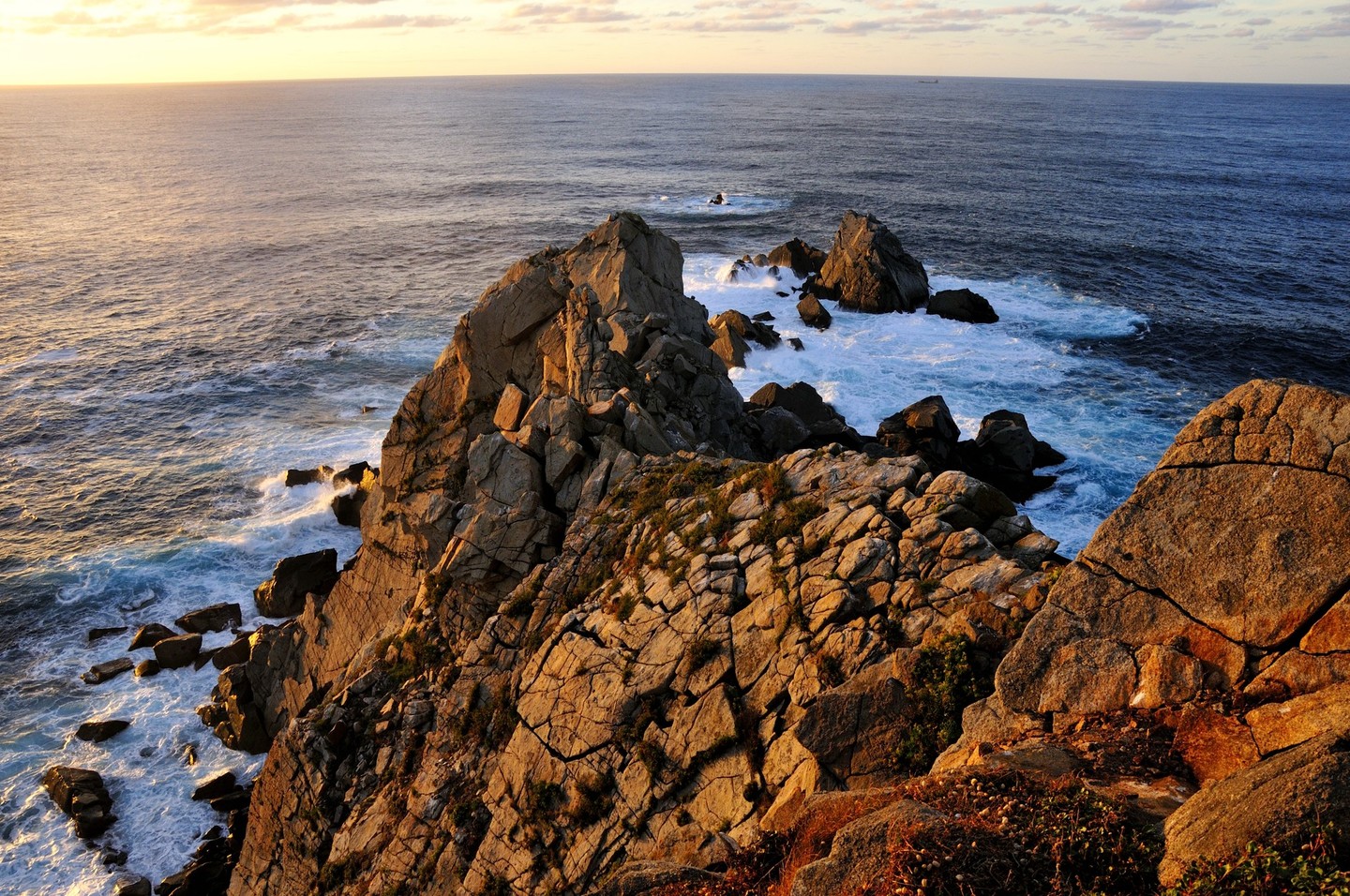
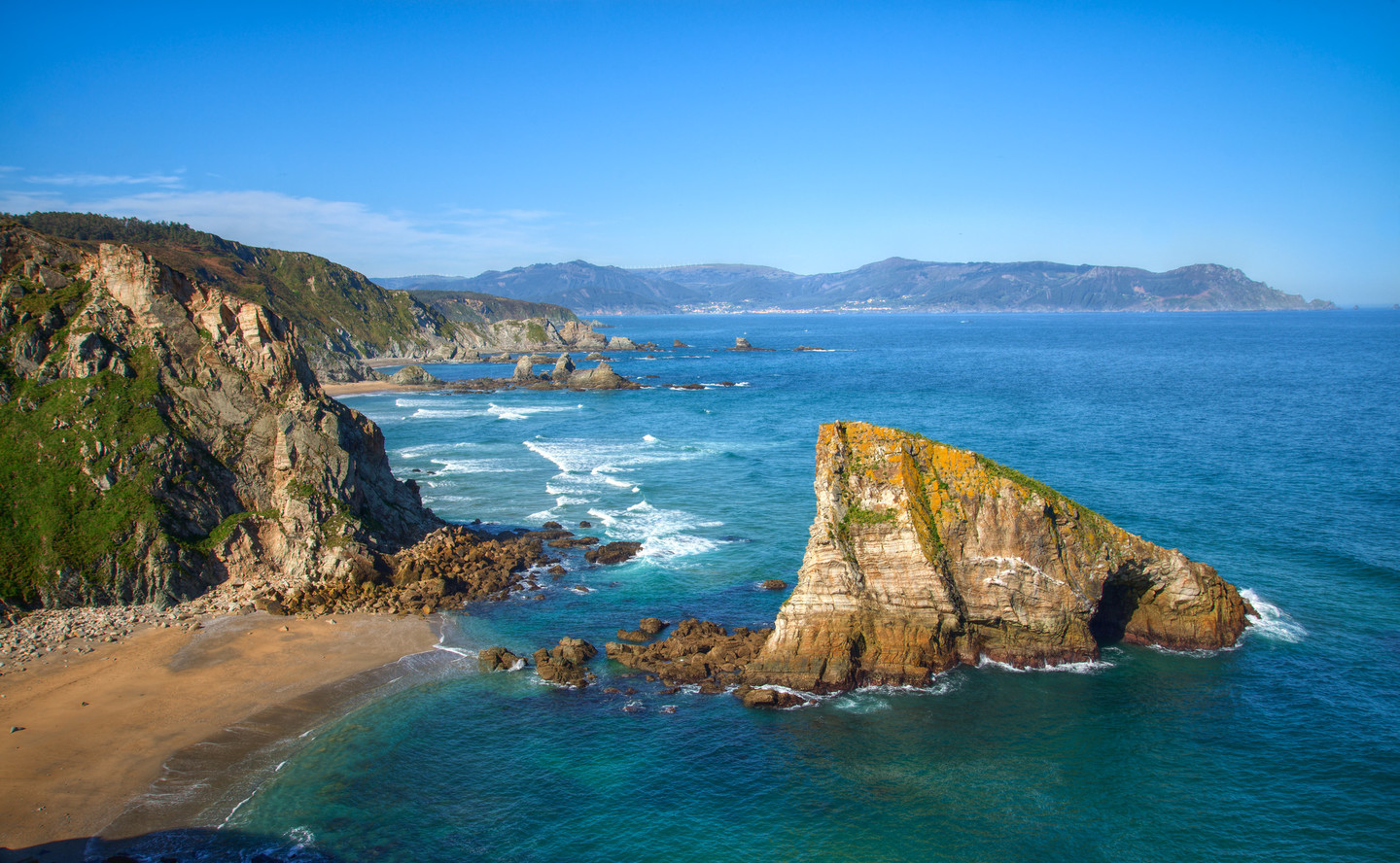 The Roca do Coitelo, Loiba´s cliffs
The route continues via Espasante and Céltigos, until a side turning towards Loiba and its impressive cliffs, where there is a bench often referred to as “the best bench in the world” because of its spectacular views.
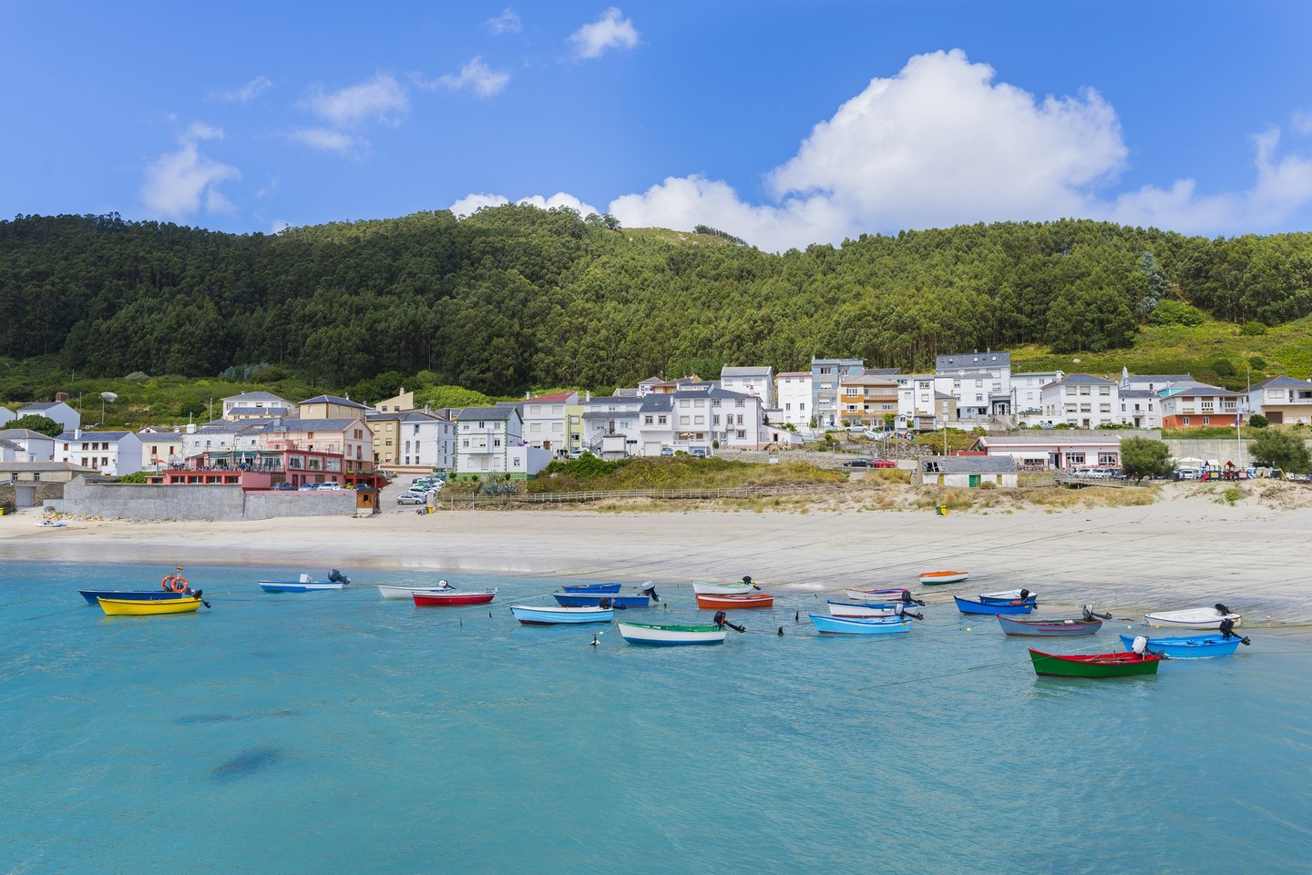
Back on the road, the route leads through villages and woodland towards O Porto do Barqueiro. Hidden at the end of the ría in the beautiful Sor estuary, it is a delightful example of a coastal village, its narrow streets crowded with small, slate-roofed houses. The small harbour is home to a busy fishing community. Located in a fantastic enclave facing the appropriately named Arealonga beach, which falls within O Vicedo.
 Vila de Bares
The route now turns towards Bares. The Vila de Bares is a traditional hamlet with crop fields, enclosures and hórreos (raised granaries), all gazing towards the sea. The wide, sandy Bares beach, which forms a delightful curve, leads us to O Porto de Bares.
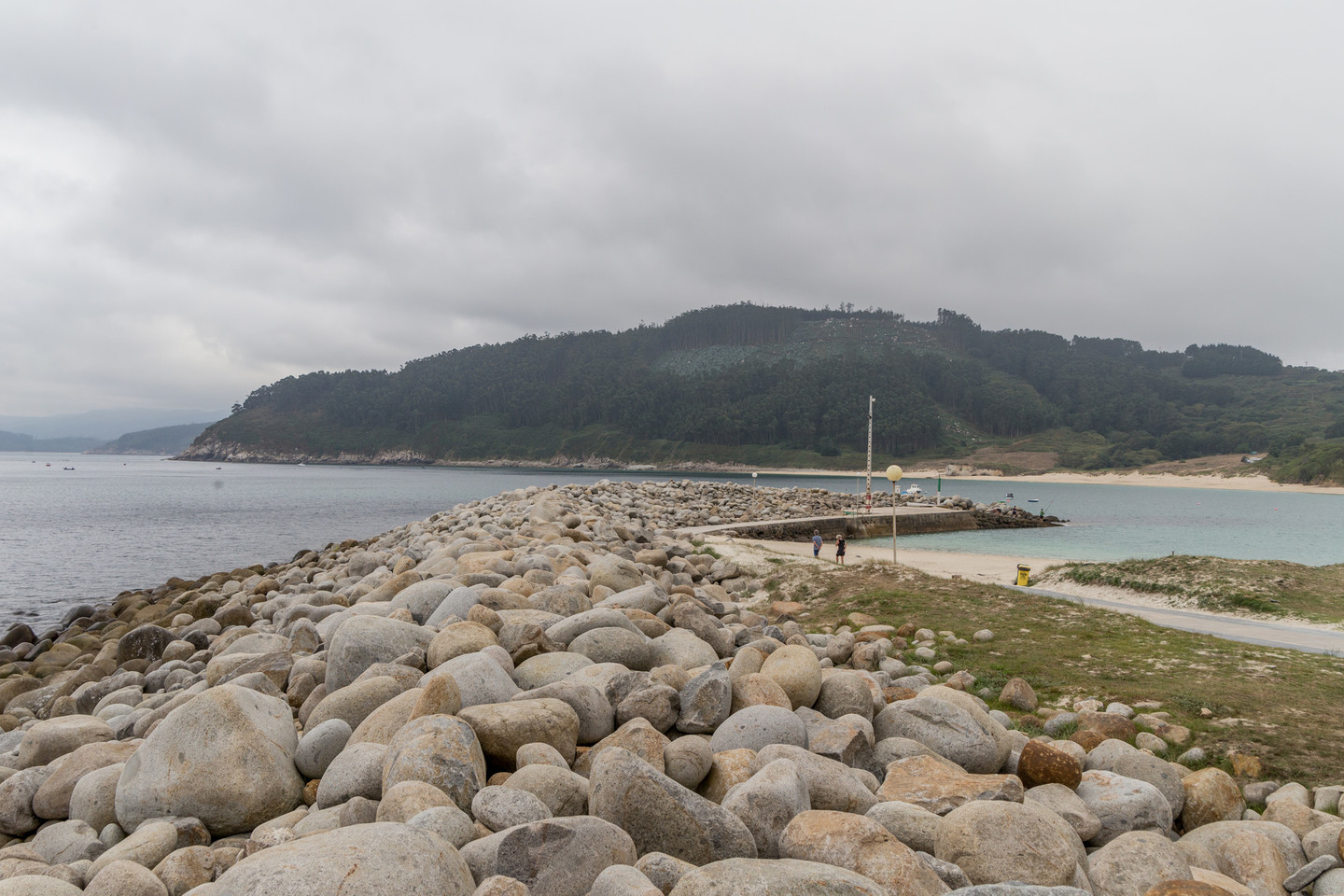
A Vila and O Porto are very similar, the agricultural and maritime versions of traditional Galician villages. In O Porto, the houses stand close to the beach and huddle together for protection from the strong winds that blow through the area. At the end of the beach is the distinctive O Coído quay.
The quay in Bares, known as O Coído, is a 300-metre long accumulation of stones. Attributed to the Phoenicians, it may be of Roman origin, given the numerous Roman remains in the surroundings.
The accumulation of stones was probably natural in origin and it was then used as a harbour. Its height reaches 7-8 metres, showing the impressive dimensions it may once have had.
O Porto de Bares is Spain’s most northerly town and has been a key point for the passage of ships since ancient times.
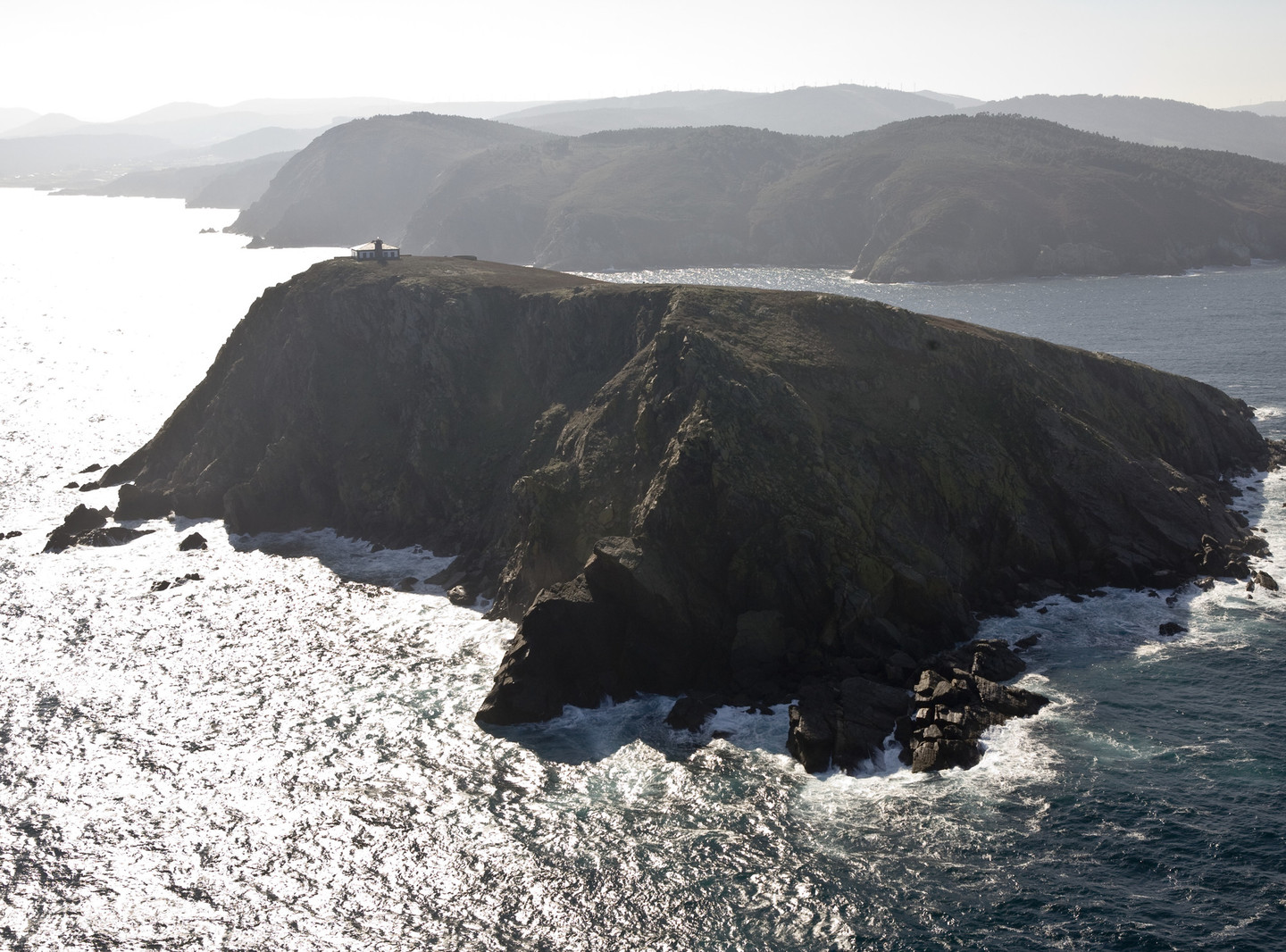
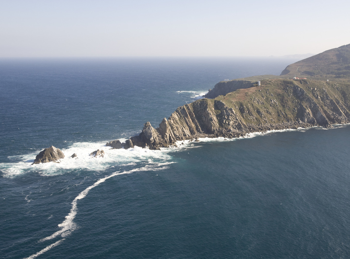 The Bares lighthouse
The ascent to the Semáforo de Bares offers views of the inlet and Coelleira Island, which contains the remains of an old mediaeval monastery about which there are many legends. The Semáforo is a nineteenth-century maritime observation point from which signals could be sent to ships using flags and lights. It was also used as a military facility and for weather forecasting and communications.
Located 200 metres above sea level, it offers stunning views. There is an ornithological centre on the way to the Bares lighthouse, evidence of the importance of this coast for migrating birds and a vital bird observation point, especially in the main periods of migration. The cliffside area forms part of the Estaca de Bares SCI.
The strategic importance of the site is shown by the presence of a former US Marines base, abandoned in 1991.
Here we find the most northerly point in the Iberian Peninsula. Lit by the lighthouse built in 1850, it is constantly lashed by the heavy rain and strong winds coming from the sea.
Coelleira island has its secrets. According to oral tradition, the monks in San Miguel Benedictine monastery sailed to Viveiro in boats made of leather to say mass. The legend says that, when the island was retaken by the Knights Templar, the monks were all killed except one, who escaped without his habit and took refuge in a house in O Vicedo which is known today as “Casa do Paisano.
Don´t miss
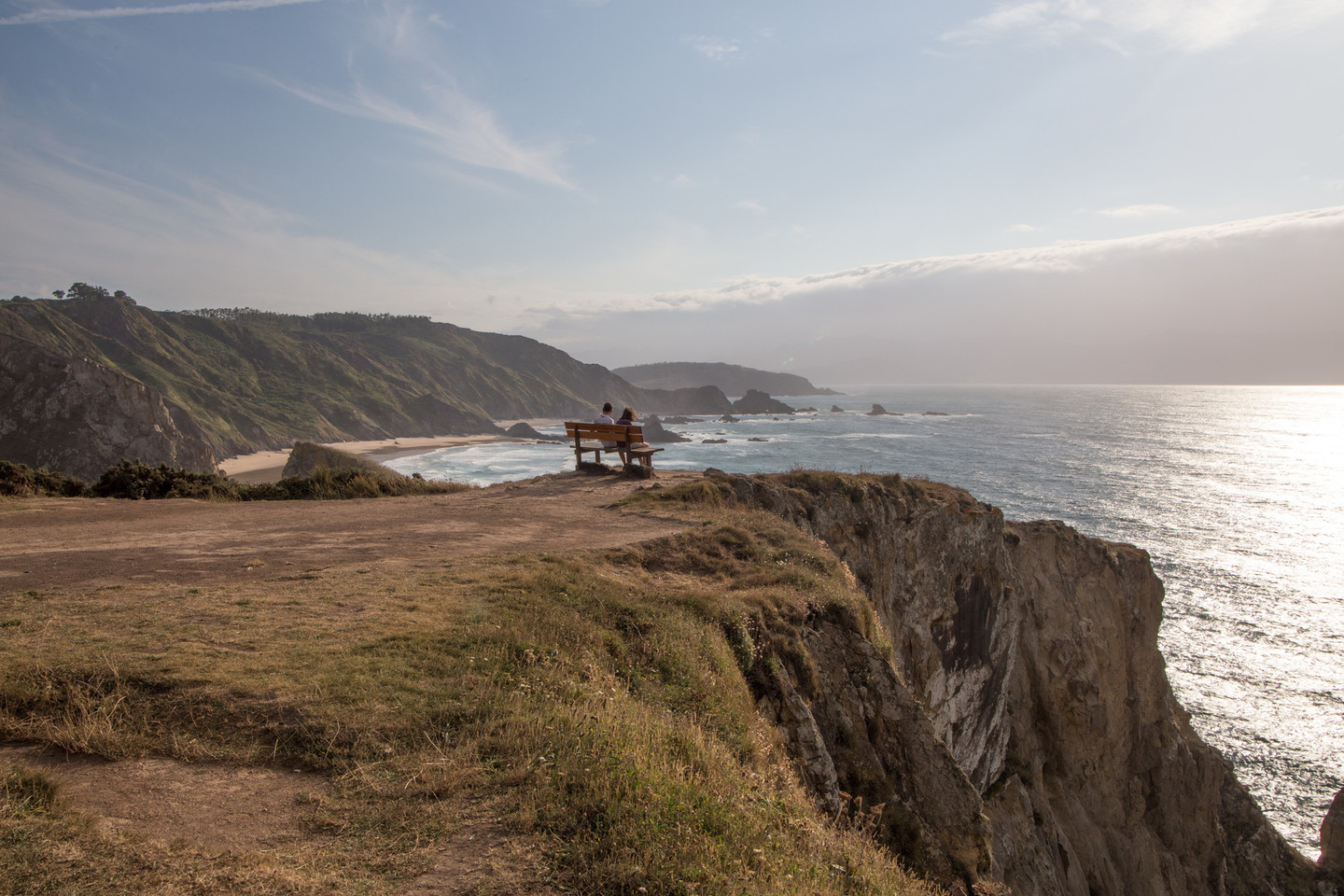 Loiba bench, "The best bench in the world"
Loiba boasts a cliff-top bench from which there are stunning panoramic views of this section of the coast. The cliffs at Loiba, in the municipality of Ortigueira, reach heights of over 100 metres in places. The presence of tiny islands, grottoes and caves demonstrates the geomorphological forces at work along this part of the coast. Access to the beaches is not easy as it involves going down steep winding paths.
The village of O Picón occupies an outstanding position on the coast and is of considerable ethnographical interest with hórreos typical of the area, a windmill and various buildings in traditional popular style. The scenery is beautiful and spectacular, with rocky outcrops like the Pena Furada point, eroded into a series of extraordinary forms. To the west, on the horizon, we can see the imposing form of Cabo Ortegal.
