BAIXA LIMIA - SERRA DO XURÉS NATURAL PARK
Granite border landscape

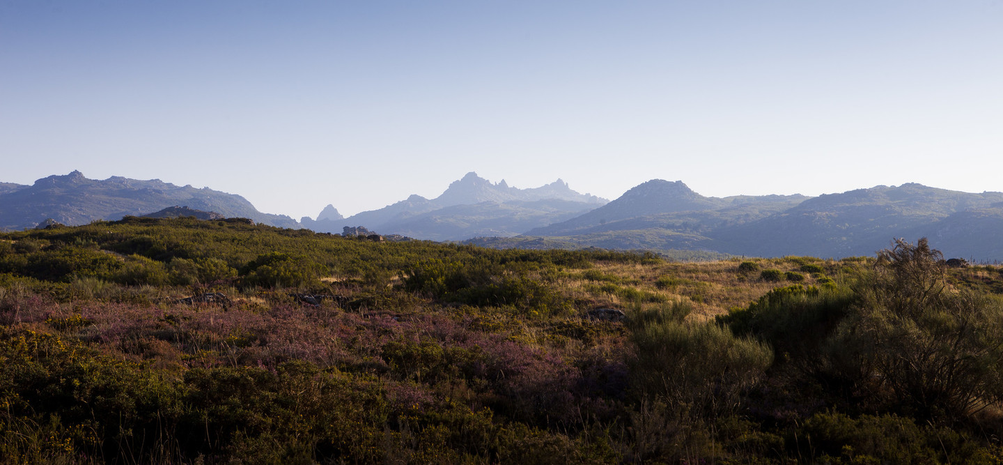
We find ourselves in a territory which combines rugged mountain ranges with softer landscapes
The Baixa Limia-Serra do Xurés Natural Park and the Peneda-Gerês National Park are joined at the border between Portugal and Galicia, forming a unique 267,958 ha cross-border area, formally declared Transboundary Biosphere Reserve Gerês-Xurés in 2009.
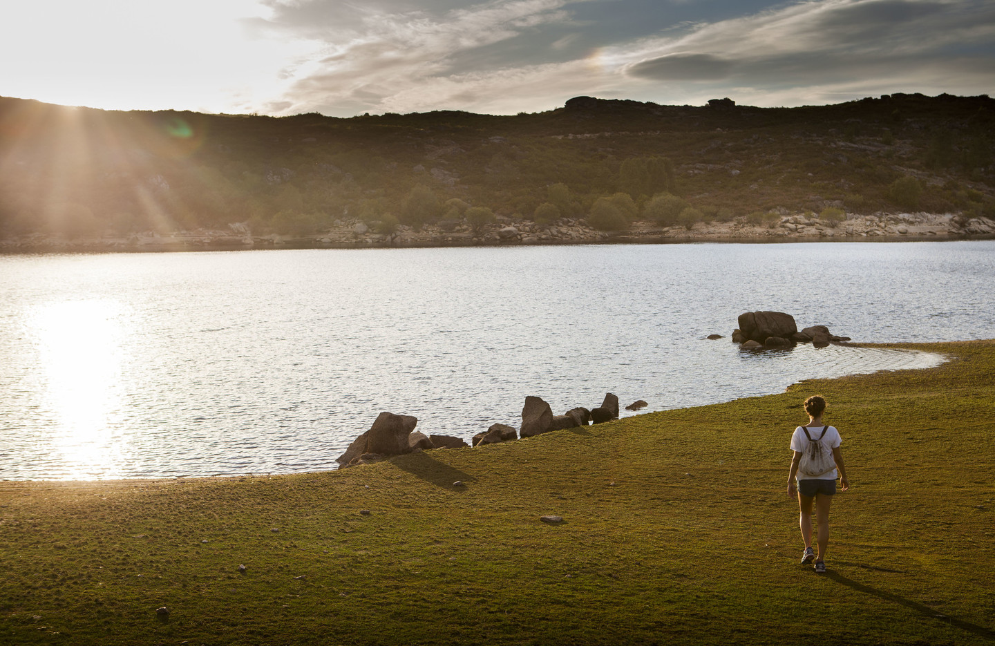
We find ourselves in a territory which combines rugged mountain ranges with softer landscapes; where thick woodland contrasts with granite mountain landscapes; where boulders form unique shapes and water is ever-present in the form of rivers, pools, natural waterfalls and even reservoirs, where visitors can row on tranquil waters in the heart of O Xurés.
Here we can discover one of the greatest attractions the Park has to offer: its huge variety of flora, with more than 807 species, 117 of which are endemic, such as the Xurés iris. It is also home to a huge diversity of fauna, with around 150 species of birds and unique species such as the autochthonous cattle breed known as the “cachena” cow.
 The Baixa Limia-Serra do Xurés Natural Park and the Peneda-Gerês National Park are joined formally declared Transboundary Biosphere Reserve Gerês-Xurés
 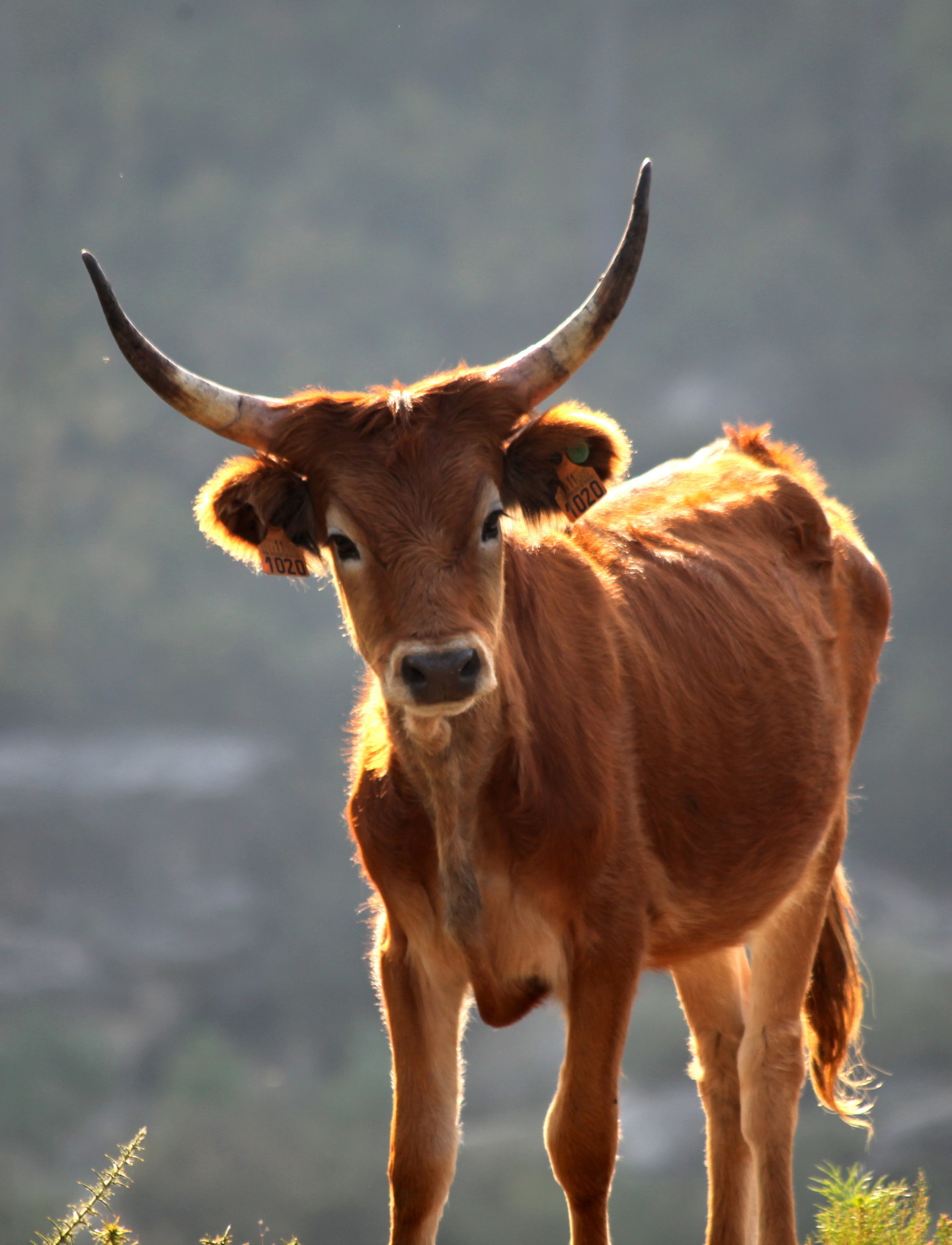 Autochthonous cattle breed known as the “cachena” cow
 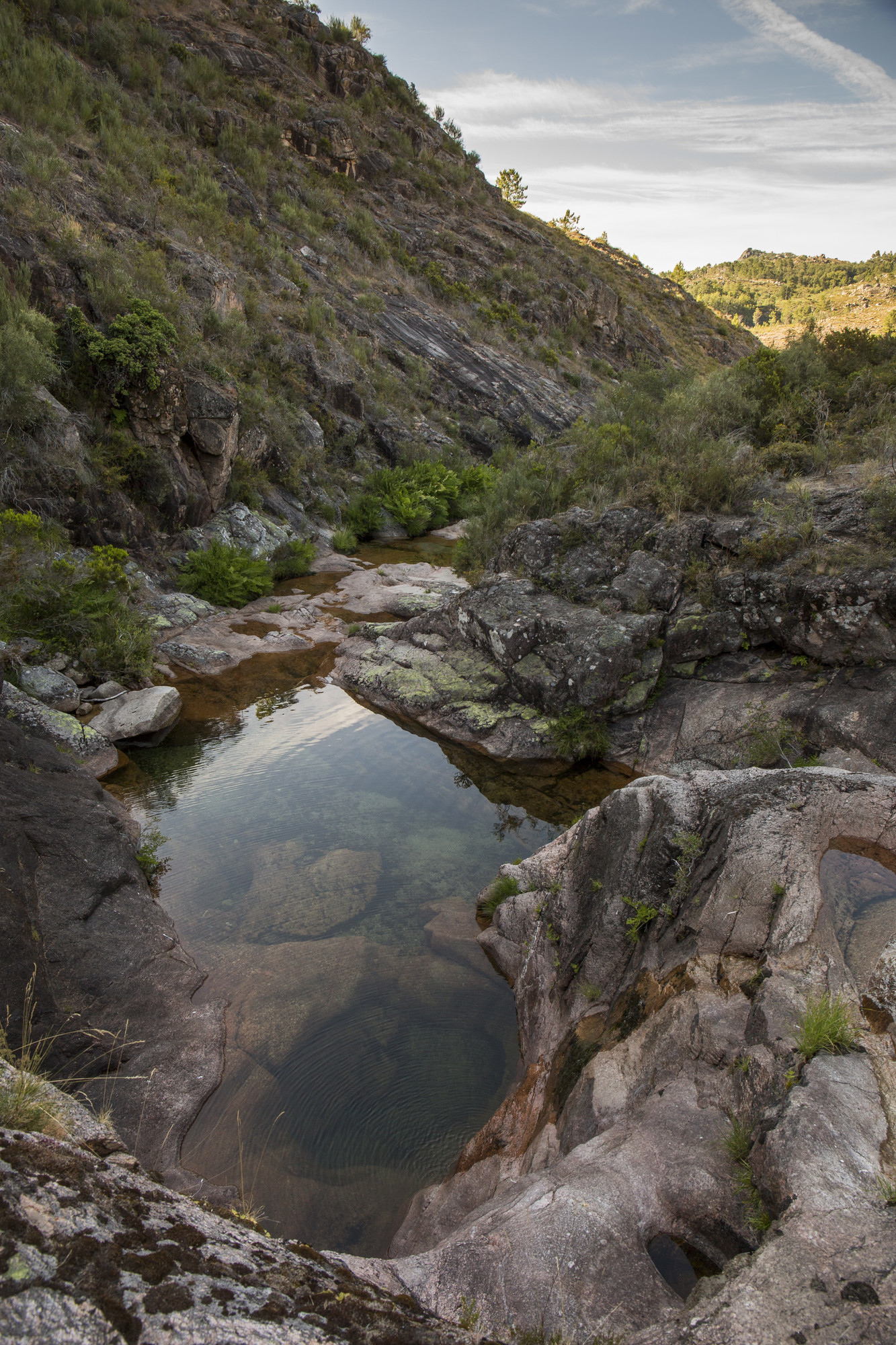 Water is ever-present in the form of rivers, pools, natural waterfalls and even reservoirs
 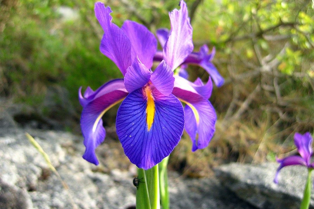 117 species of flora are endemic, such as the Xurés iris
A journey through the history of O Xurés
We find ourselves in a privileged location in which to find remnants of our ancestors. One of the most important concentrations of burial mounds, or mamoas, in Europe is to be found here in the O Laboreiro mountain range, and it is well worth visiting the Maus de Salas and Val do Salas dólmens.
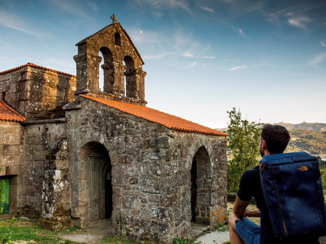
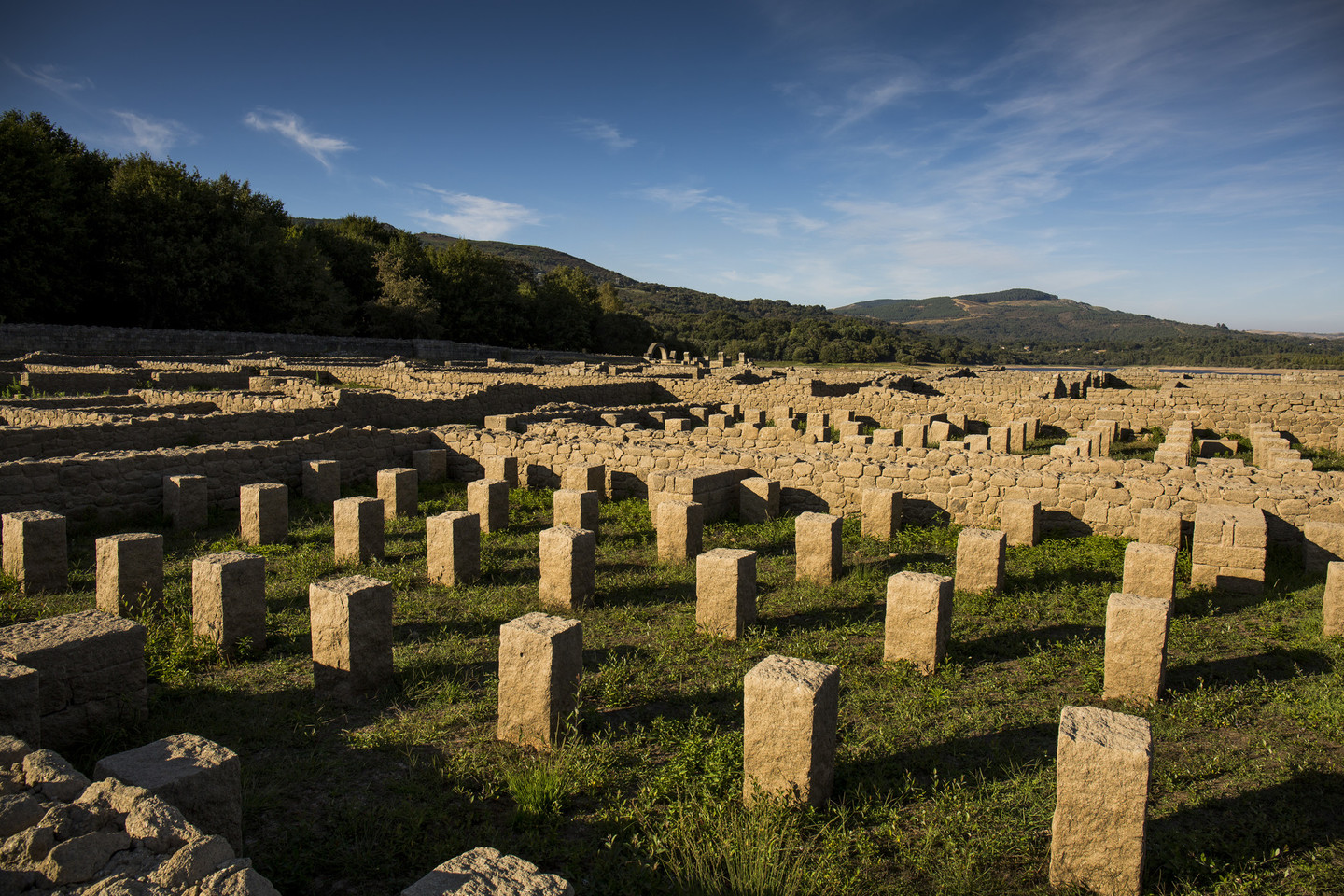
During the Romanisation period, the Via Nova was built on these lands, linking Braga and Astorga and creating the establishment of civil buildings such as the Aquis Querquennis military camp, in Bande, or the Roman villa which acted as wayside lodgings and a thermal spa, Aquis Originis, near the Riocaldo thermal springs in Lobios. Another unmissable visit is to the 7th Century Visigothic Santa Comba de Bande Church in Bande, the only building that remains of an ancient monastery.
The village of Cela, in Lobios, with its buildings on granite boulders, and As Cortes da Carballeira, in Entrimo, are two examples of popular architecture well worth visiting.
Interpretation Centre of the Natural Park Estrada de Portugal, 34
32870 Lobios
T. T. 988 788 755
Aquae Querquennae - Via Nova Interpretation Centre Via Nova Porto Quintela. 32840 Bande
T. 988 444 401
 Download here the brochure in PDF format
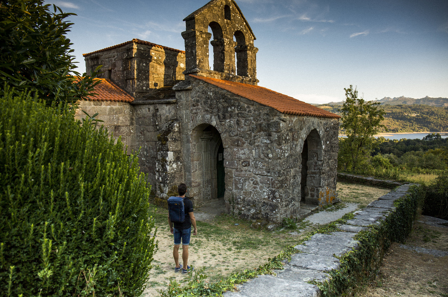 An unmissable visit: the 7th Century Visigothic Santa Comba Church in Bande
 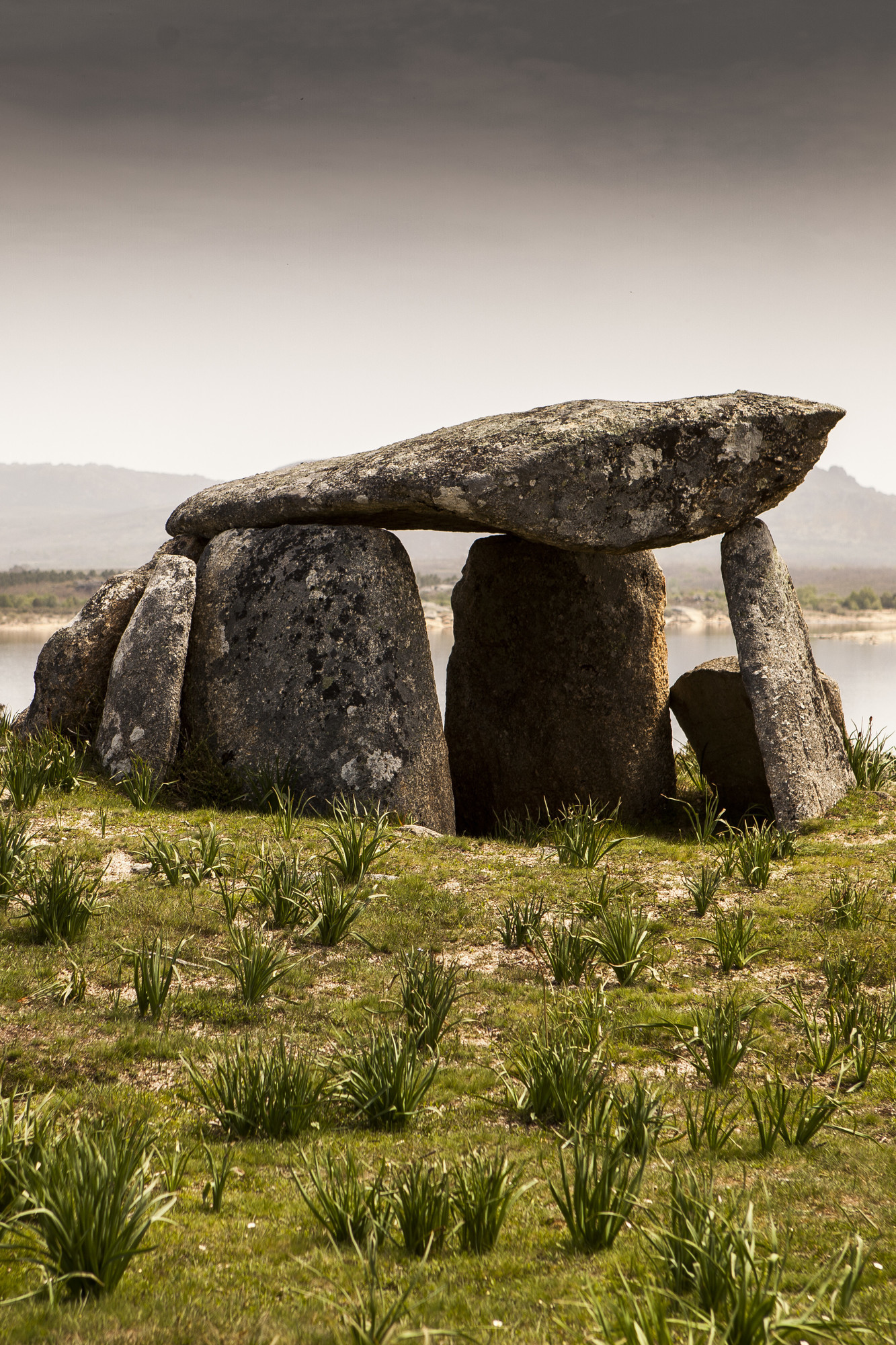 It is well worth visiting the Maus de Salas and Val do Salas dolmens
  Aquis Querquennis military camp, in Bande
 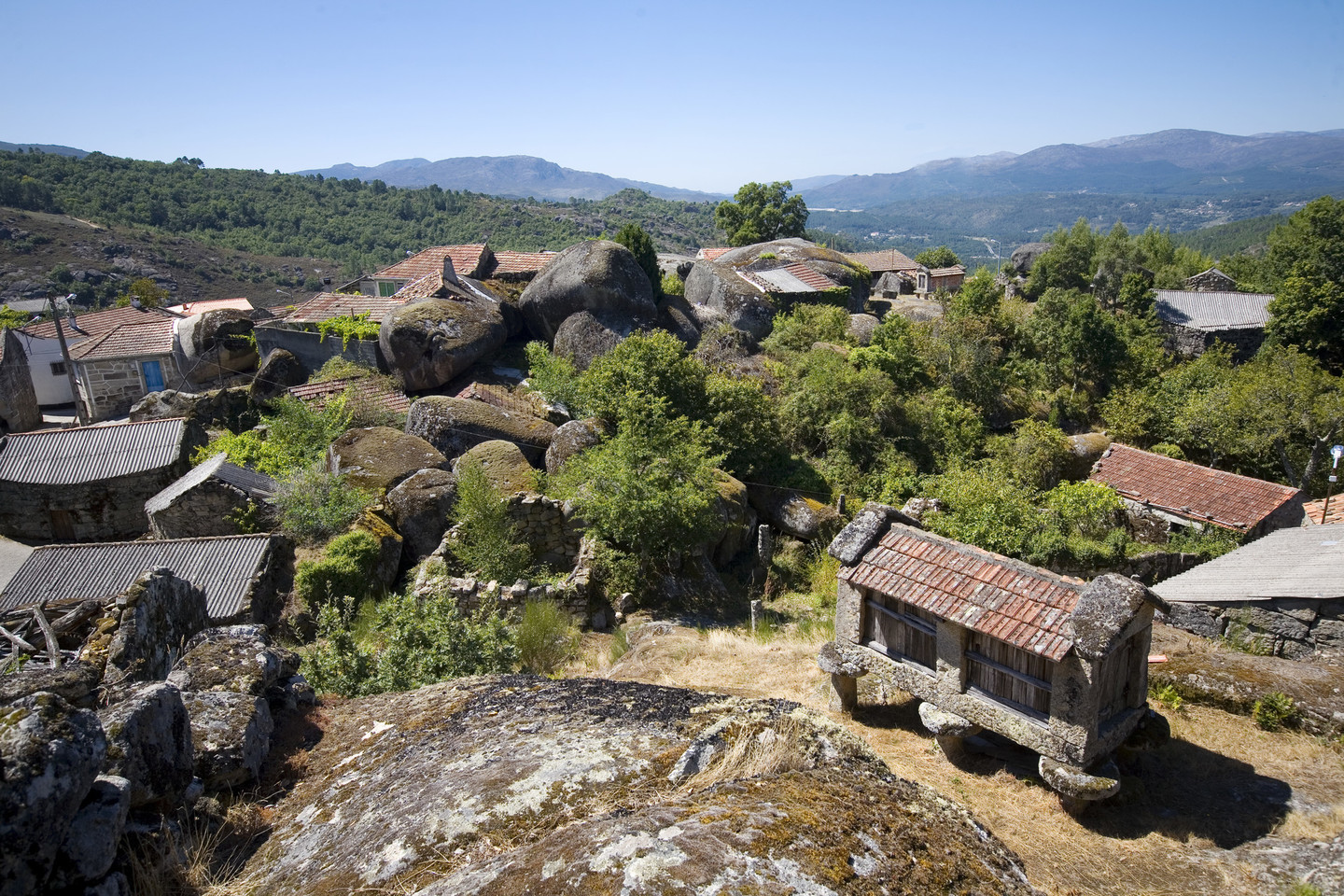 Village of Cela, in Lobios
We have to go back in time to the 1st Century A.D. in order to discover one of the best preserved Roman roads, also boasting the most milestones in Europe
The Via Nova, converted today into a trail that forms a part of the Camino Naturales State programme, can be followed on foot, by bicycle or on horseback. Also known as the Via XVIII of the Antoninus Itinerarium, it was built to link the towns of Bracara Augusta (Braga-Portugal) and Asturica Augusta (Astorga).
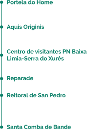
The first stage, almost 30 km, links Portela do Home, on the border with Portugal, and Santa Comba en Bande. Along the route there are many places of interest to visit, such as the spa in Lobios and the remains of the old Aquis Originis mansio. Recently, a second stage, linking Santa Comba, in Bande, and A Saínza de Abaixo, in Rairiz de Veiga, has been signposted.
 It was built to link the towns of Bracara Augusta and Asturica Augusta
 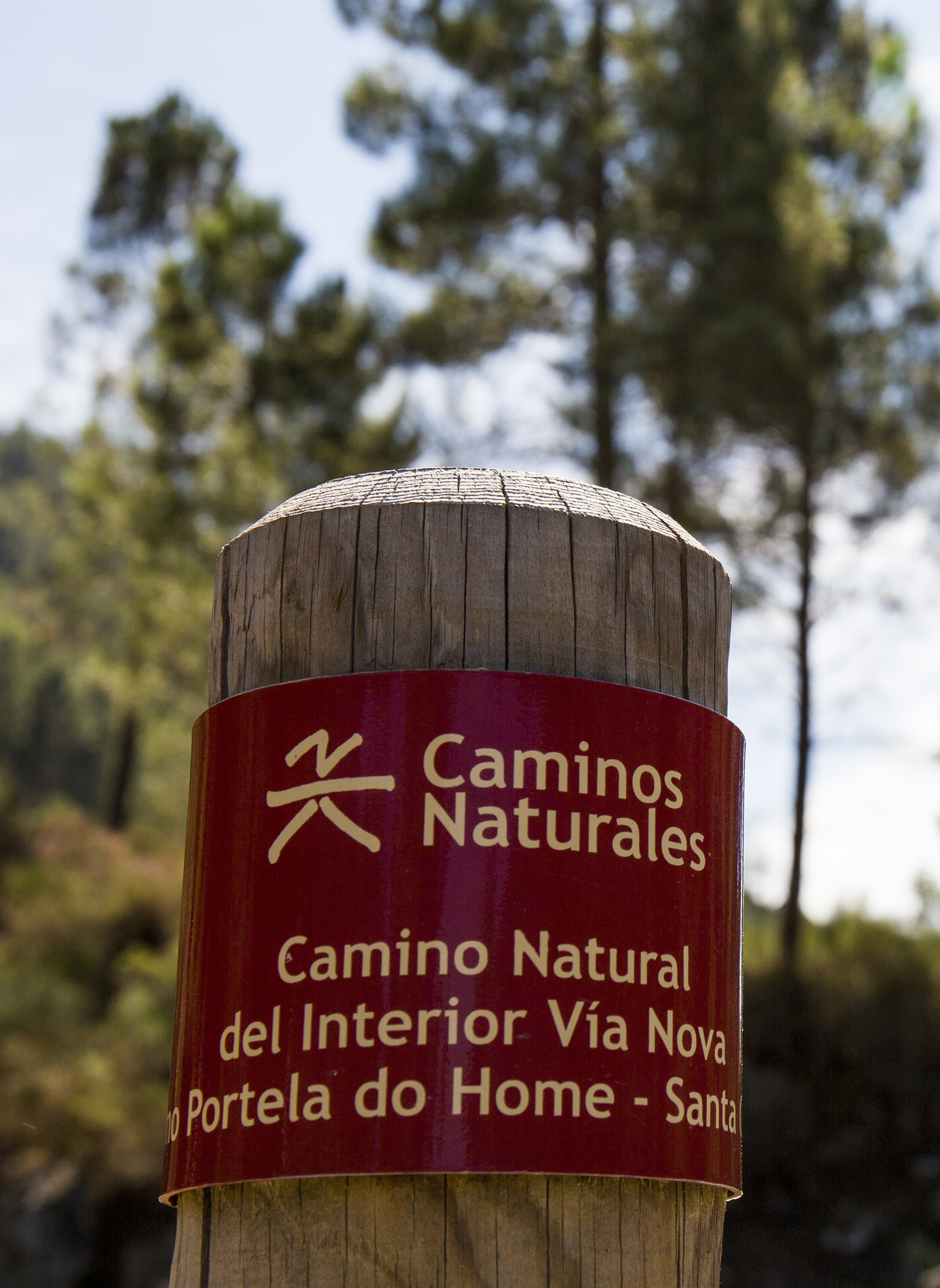 The Via Nova was converted into a trail that forms a part of the Camino Naturales State programme
 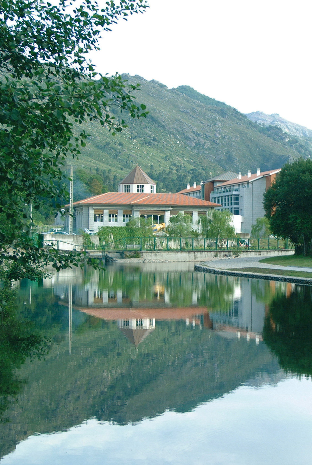 Spa in Lobios
 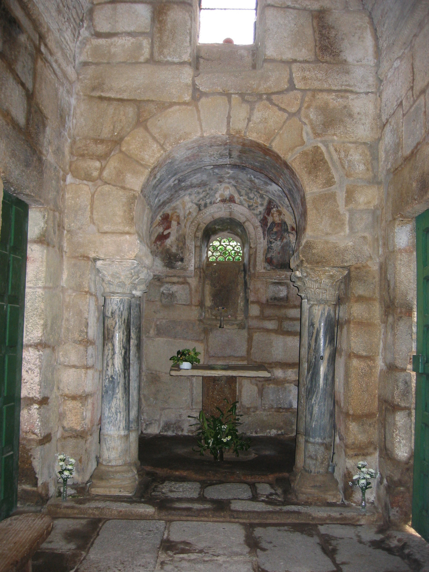 Santa Comba de Bande Church
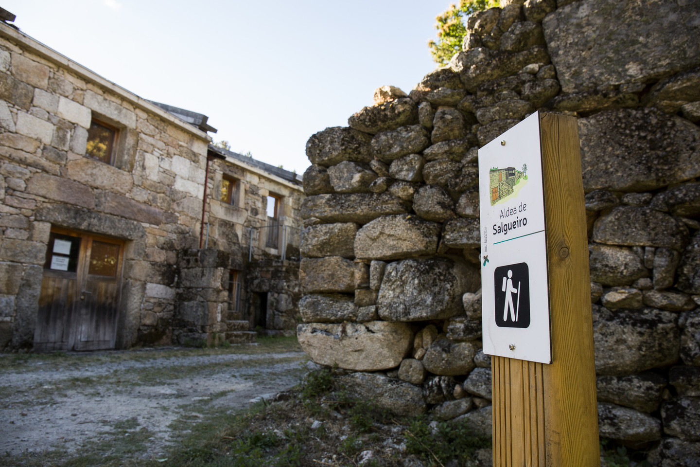
Discover the pleasure of losing yourself all the while knowing exactly where you are going
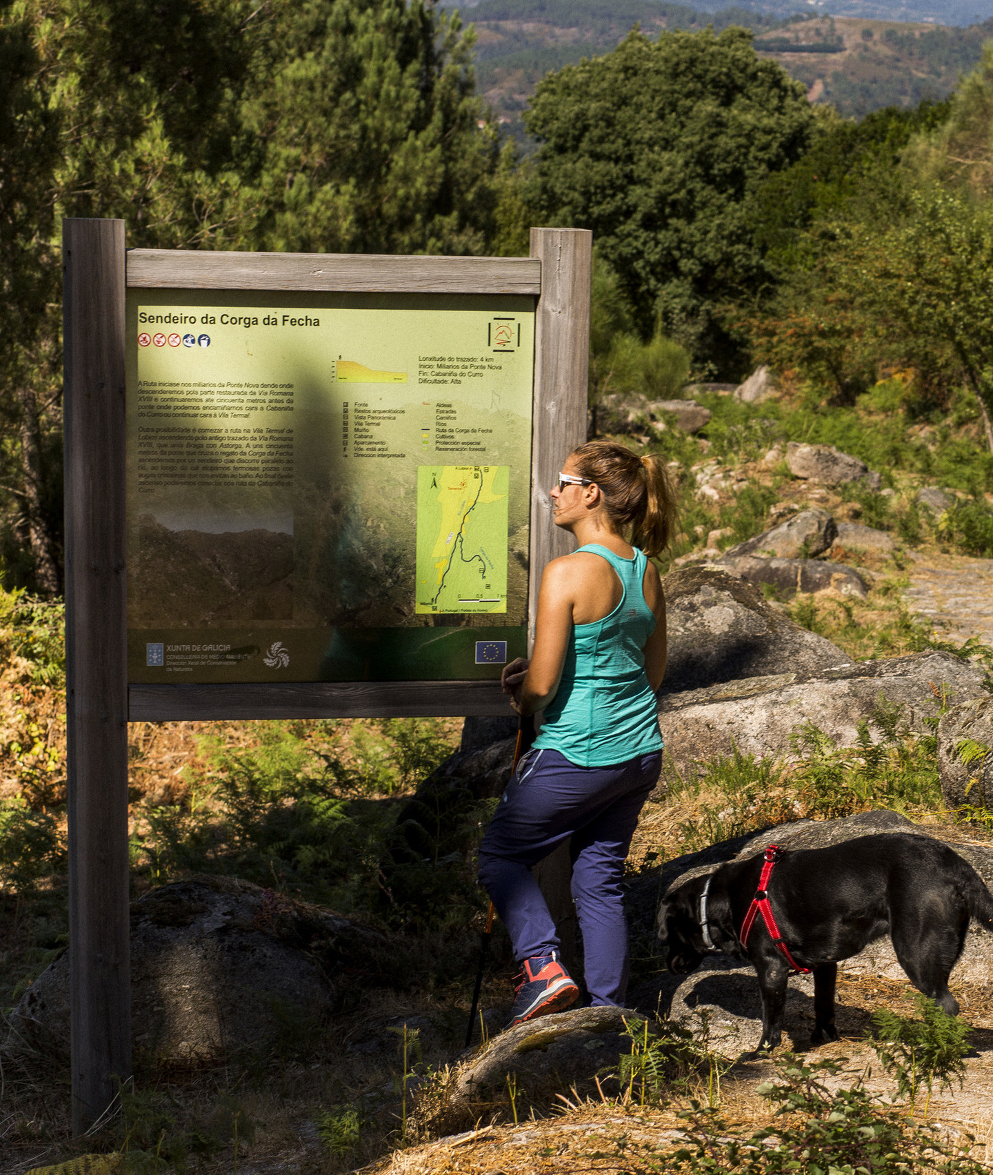
For those who love to don a pair of mountain boots and go in search of new places, O Xurés is the perfect destination for walkers, with signposted trails leading to the Park’s most representative natural resources.
From the Spa in Lobios, you can join the Corga da Fecha Route and discover one of the highest waterfalls in Galicia, whose waters flow into the River Caldo.
If you want to take an overall view of the Park’s most outstanding natural resources home with you, then you can head from the village of A Cela towards Pitões, on the border with Portugal, enjoying one of the most demanding yet spectacular routes that exist.
 |  |  |  | |
|---|---|---|---|---|
| Ruta da Corga da Fecha | HIGH | 3,6 Km | 3 h | LINEAR |
| Ruta de Padrendo | MEDIUM / HIGH | 11 Km | 4 h | CIRCULAR |
| Ruta de Queguas | MEDIUM | 8,5 Km | 3 h | CIRCULAR |
| Ruta da Ermita do Xurés | MEDIUM | 4 Km | 2,30 h | CIRCULAR |
| Ruta Minas das Sombras | HIGH | 14 Km | 8 h | LINEAR |
| Ruta do Río Agro | MEDIUM / HIGH | 16,5 Km | 4-5 h | CIRCULAR |
| Ruta do Río Mao | LOW / MEDIUM | 3,4 Km | 2 h | CIRCULAR |
| Ruta do Río Vilameá | LOW / MEDIUM | 1,7 Km | 45 min | CIRCULAR |
| Ruta Torrente-Salgueiro | MEDIUM / HIGH | 22 Km | 12 h | LINEAR |
| Ruta A Cela-Pitoes | HIGH | 28 Km | 10 h | LINEAR |
| Viveiro das Mámoas | MEDIUM | 49 Km | 22 h | CIRCULAR |
 O Xurés is the perfect destination for walkers, with signposted trails leading to the Park’s most representative natural resources
 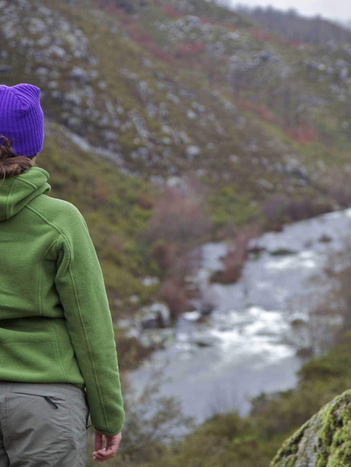 11 routes for all tastes and levels
  Oulelas village
 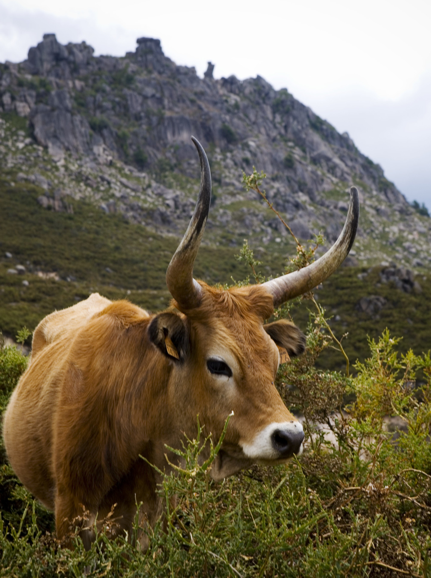 "Cachena" cow in O Xurés
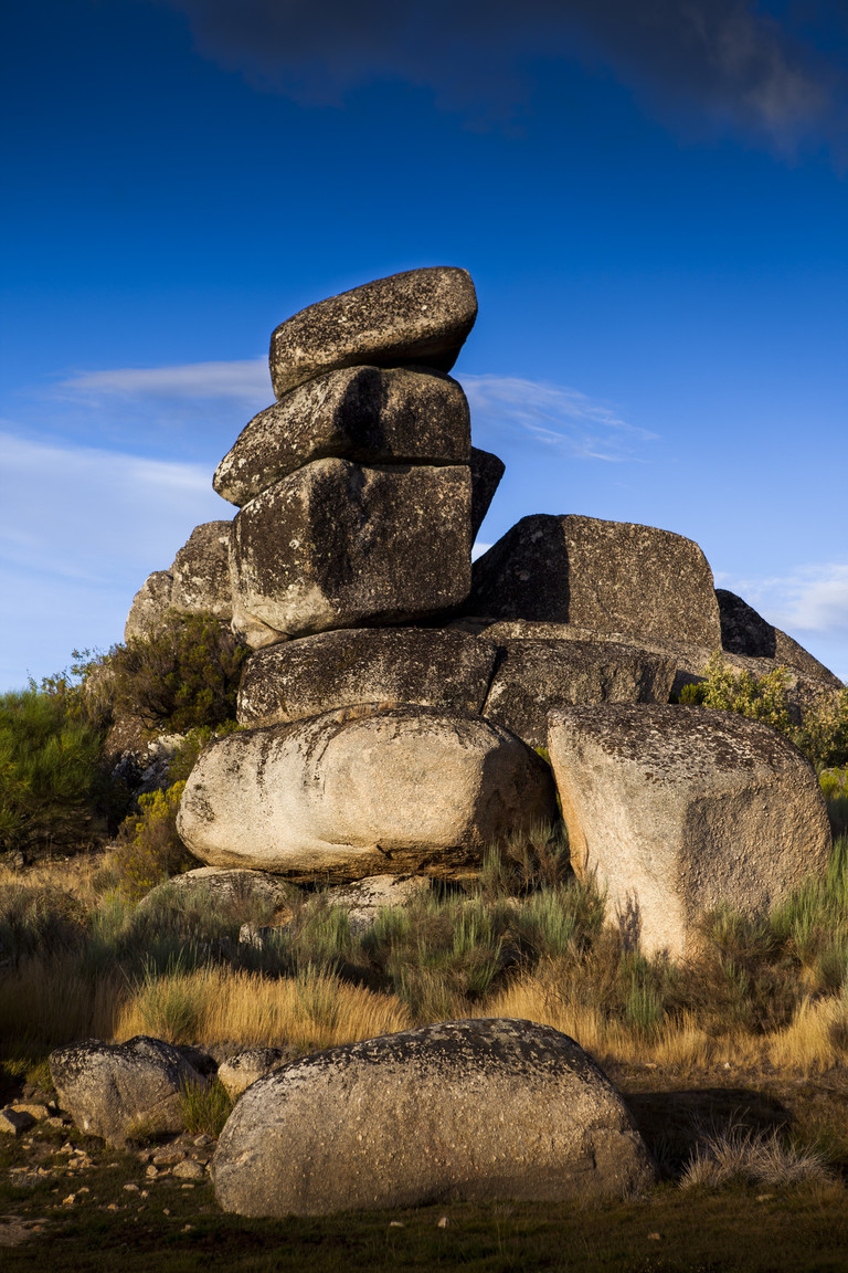
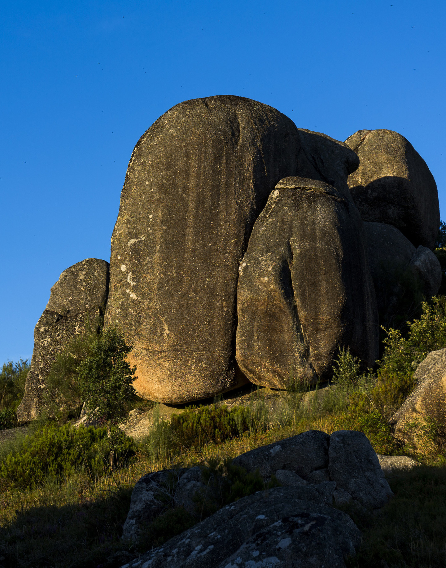
Look for surprising shapes in the large granite boulders known here as bolos and scattered throughout the Park. In the village of A Cela they even form a part of the structure of the buildings.
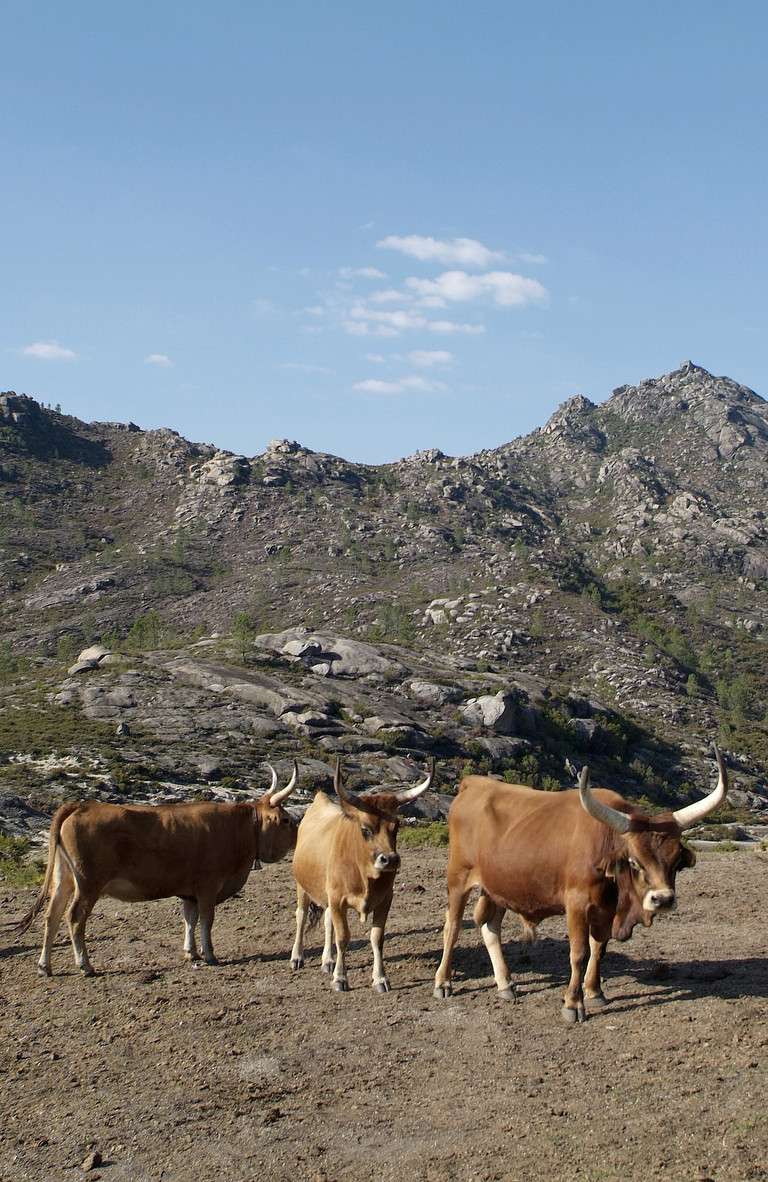
Do not miss the opportunity to see some of the Park’s most characteristic animals, such as roe deer, deer, mountain goats, Galician and Portuguese horse breeds or the autochthonous cattle breed known as the cachena cow.
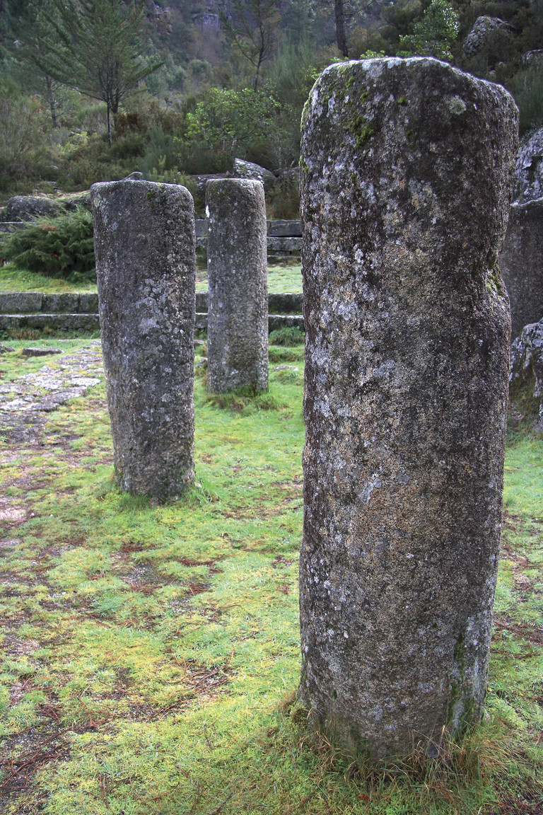
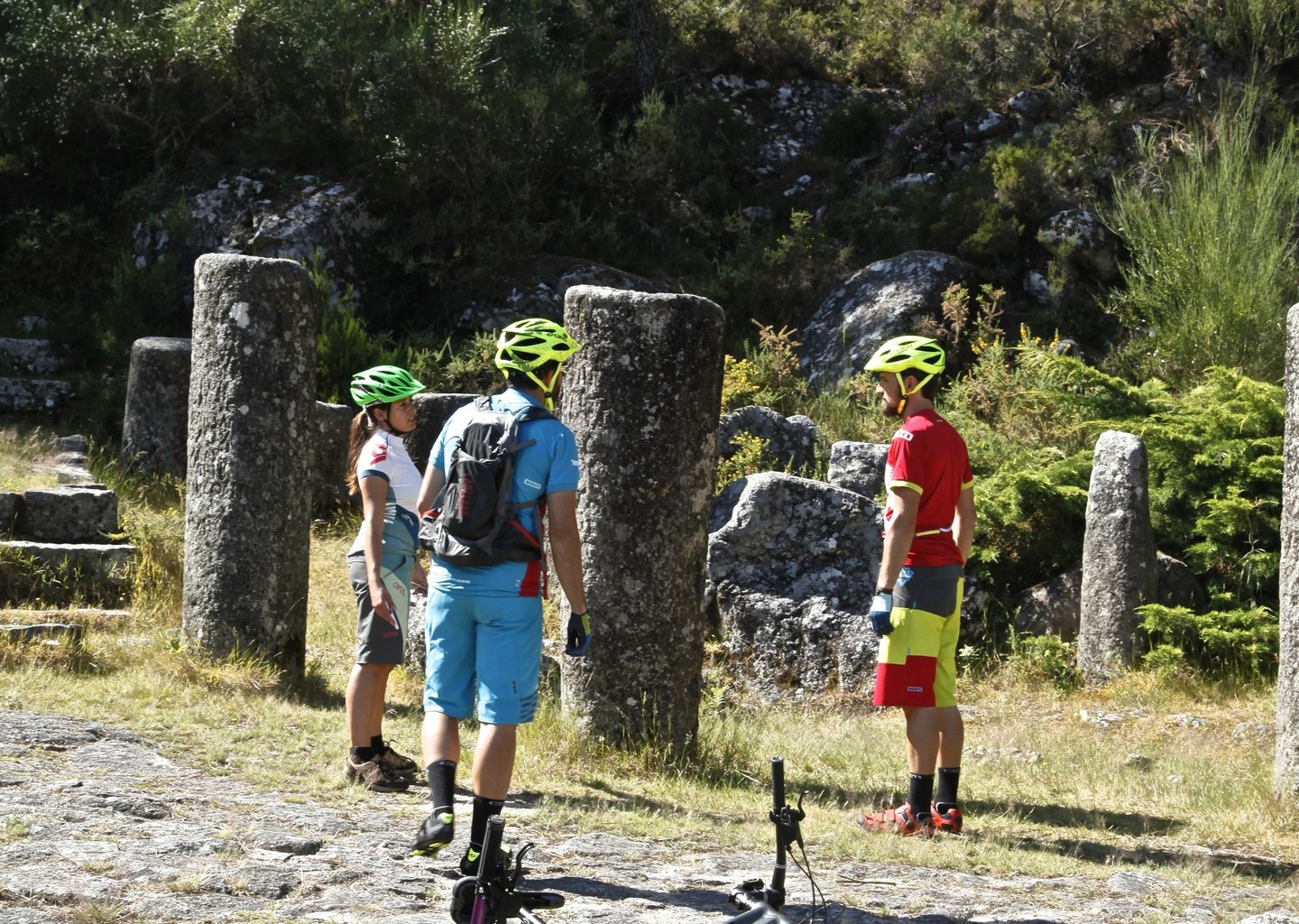
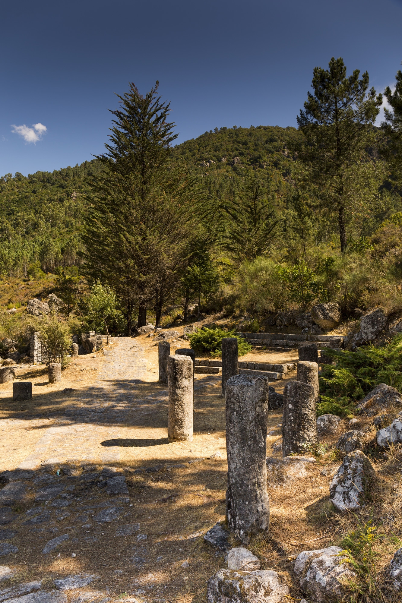
These large stone posts signalled the distances that existed on the Roman roads. Near Portela do Home (Lobios), several of them are preserved, having been moved from their original locations.
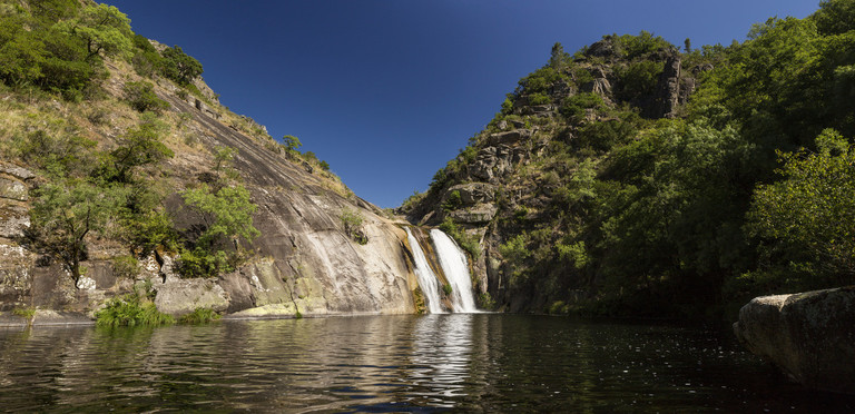
A signposted trail from the village of A Cela leads here, where we can enjoy the 15-metre high waterfall with its wide stone backdrop and sizeable pool.