Turismo de Galicia


-
Things to do
Way of St. James
Nature
Culture and heritage
Beaches and coast
Tourist trails
- Top ten: Ten unrivalled destinations
- The route of the camellia
- Tourist routes
- Pathways for discovering a country
- Walks to fall in love with
- Greenways
- Scenery at the wheel
- EuroVelo Galicia
- Beyond the Sunset
Gastronomy
Health tourism
PROMOTIONS TO ENJOY NOW
Cultural agenda
Will happen... View all
- Places to visit
-
Plan your trip
Build your journey
Practical information


-
A miña viaxe
A MIÑA VIAXE
- Compartir
- Correo
- Imprimir
mailto:?subject=Content from Tourism of Galicia: FERVENZA DA OLA DO CENZA E POZA MOURA&body=I recommend you read the information FERVENZA DA OLA DO CENZA E POZA MOURA extracted from the Tourism of Galicia site on page https://www.turismo.gal/recurso/-/detalle/211007000103/fervenza-da-ola-do-cenza-e-poza-moura?langId=en_US%26tp=40004330

Datos do recursos turístico
Description
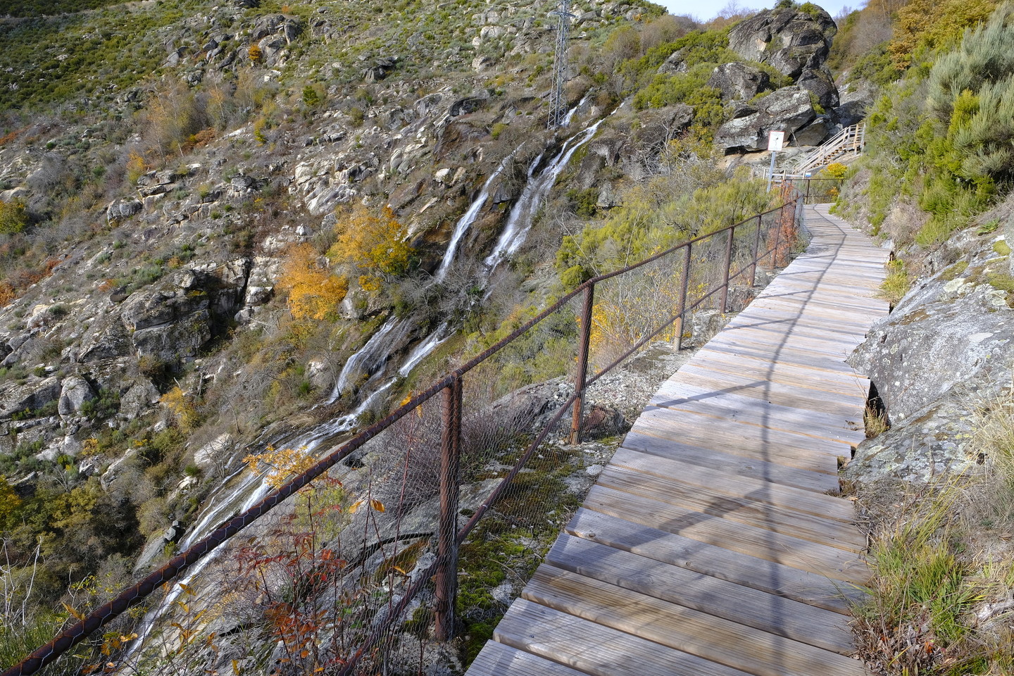
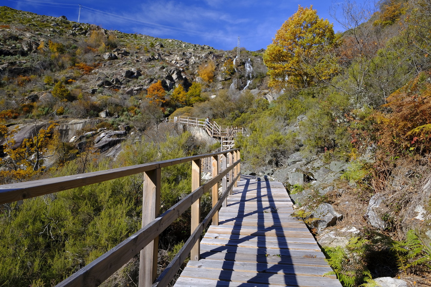
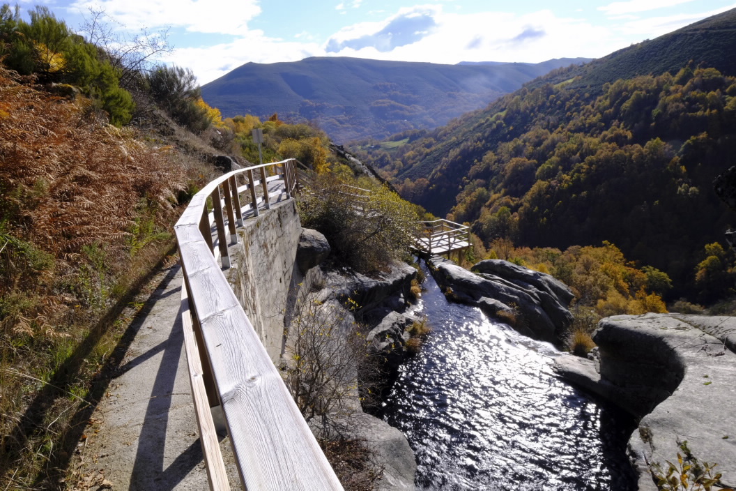
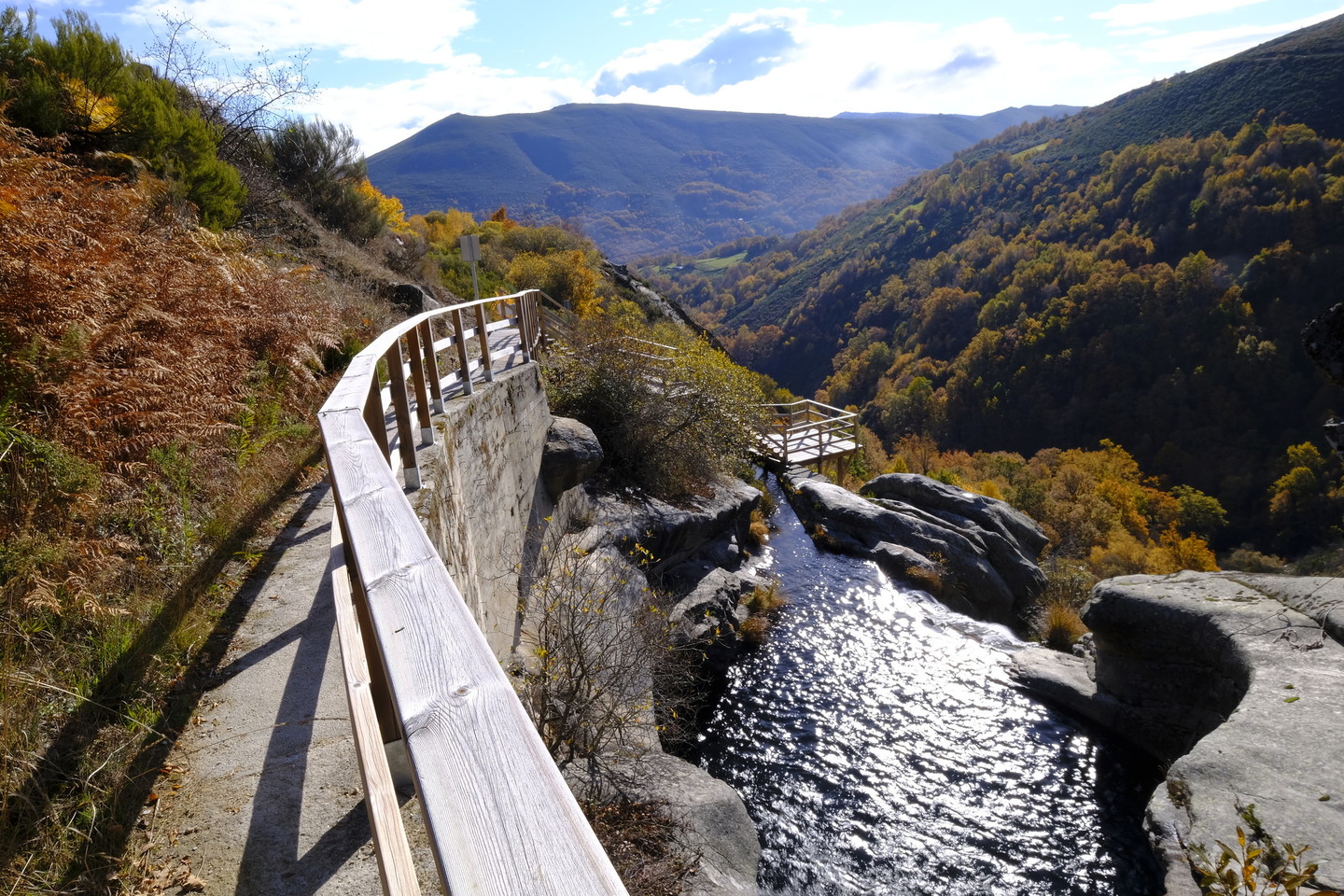
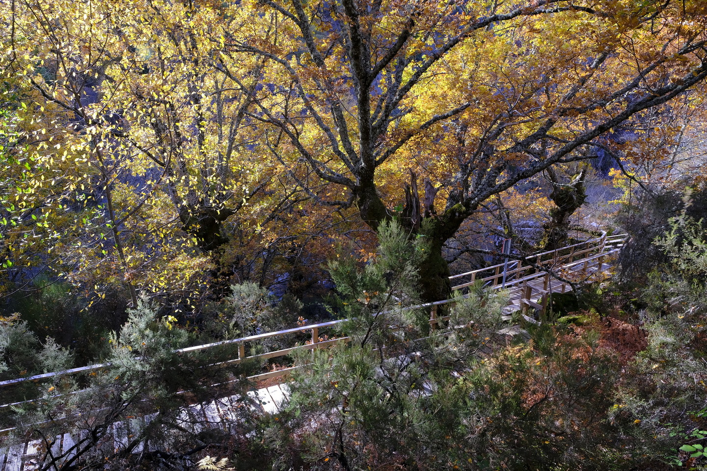
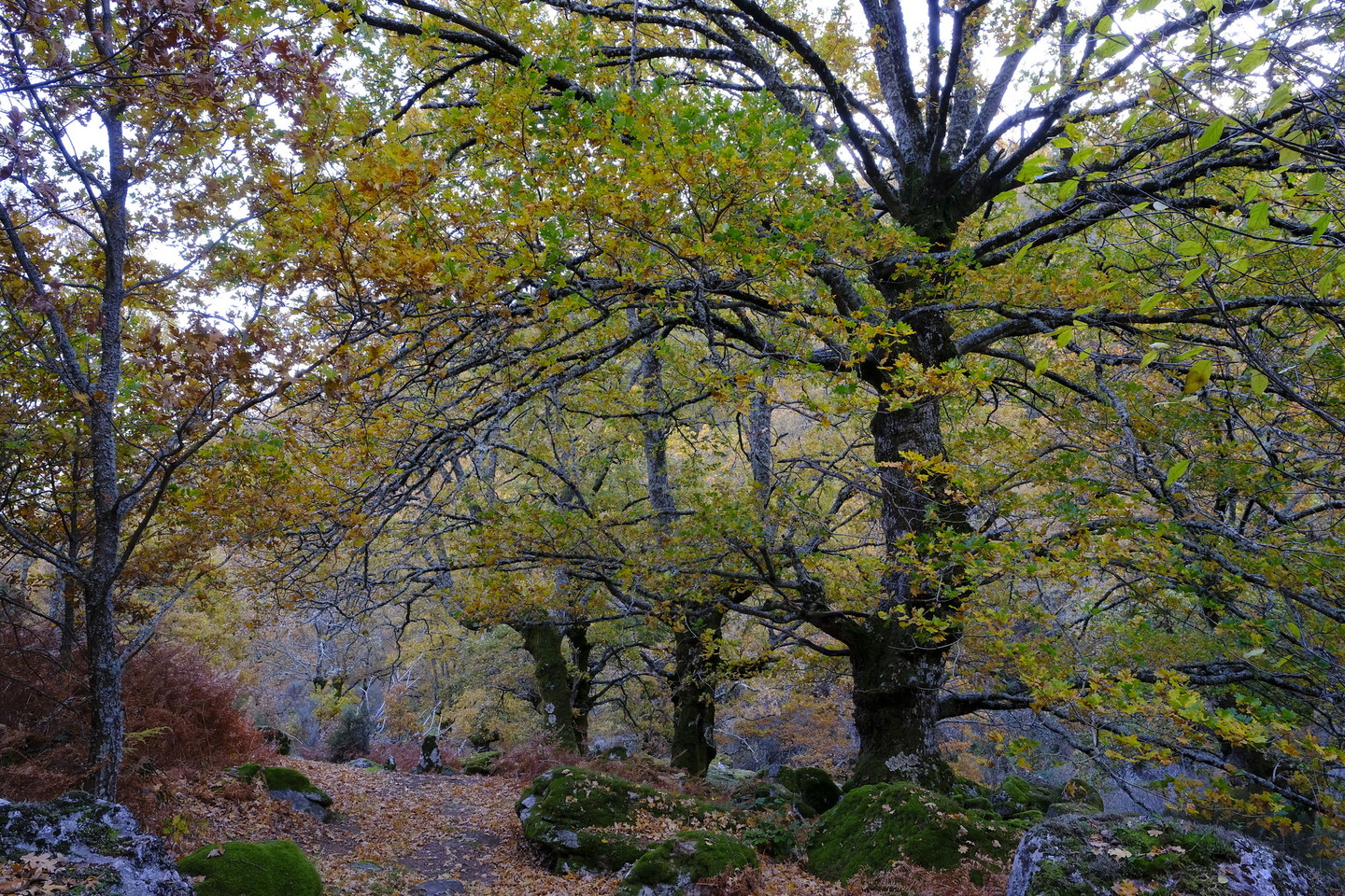
The River Cenza rises in the Serra da Queixa mountains and near Castiñeira (Vilariño de Conso municipality) it flows over a 100-metre drop onto granite rocks. To get to it, head to the village of Vilariño de Conso. In the centre of the village, you will see two signs, one pointing to the right which takes you to a wooden walkway leading to a viewpoint at the top of the waterfall where you can also take in the Ola de Cenza and the various waterfalls, pools, and rapids formed by the river.
If you take the path to the left, you come to an area of
wooden walkways and viewpoints offering views over different stretches of the
river and several waterfalls. The first is the Poza Moura viewpoint and from
there carry on to the Penedo Redondo viewpoint.
