


EUROVELO 3 AND THE GALICIAN SECTION
Pilgrims Route
The EuroVelo 3 “Pilgrims Route” mainly follows the French Way branch of the Way of Saint James through the regions of Navarre, La Rioja, Castilla y León and Galicia. It is a very varied route that begins in the leafy Navarrese Pyrenees, descends to the Ebro river and then enters the extensive agricultural plains of the so-called “Tierra de Campos” de Castilla y León region. Before entering Galicia, it climbs through the attractive mountains of the Bierzo region of León and continues through the Galician forests to Santiago de Compostela and, The Fisterra and Muxía Way reaching Cape Fisterra.
With a length of 5,600 km, the EuroVelo 3 “Pilgrims Route” allows you to travel through seven European countries: Norway, Sweden, Denmark, Germany, Belgium, France and Spain. Along the way, you can visit up to 21 places recognised by UNESCO as World Heritage Sites.
In addition to travelling in the most sustainable way possible, you can visit some of the continent’s most important cathedrals, such as those of Cologne, Aachen and Santiago de Compostela, while you can also enjoy the attractions of large cities such as Oslo, Gothenburg, Hamburg, Liège and Paris.
The route connects several pilgrimage routes, including St. Olav Ways between Trondheim and Oslo in Norway; the Oxen Way in Denmark; the Via Baltic, the Osnabrück Path and the North Rhine Route in Germany; the Via Mosana between Maastricht and Namur in Belgium; the Via Monastica that connects Belgium with France; the Estelle Path that reaches Paris; the Via Turonensis that connects the French capital with Saint Jean Pied de Port; and finally, the French Way that leads to Santiago de Compostela.
We suggest you get to know the EuroVelo 3 route in Galicia through its three stages or sections (17, 18 and 19). A new way to discover the most prominent places on this pilgrimage route that will take you to the Cathedral of Santiago de Compostela. The stages are structured in such a way that at the beginning and end of each one you will find accommodation, catering and transport services, among others.
| Altitude difference+ | Altitude difference- | Maximum height | Minimun height | Departure altitude | Arrival altitude | |
|---|---|---|---|---|---|---|
Distancia 287,8 Km | 5.064 m | 6.044 m | 1.338 m | 3 m | 1.109 m | 130 m |
Eurovelo 3
From Pedrafita do Cebreiro to Sarria
The EuroVelo 3 “Galician” route begins in Pedrafita do Cebreiro and then ascends to the village of O Cebreiro, located at 1,300 m above sea level, between the O Courel and Os Ancares mountain ranges. O Cebreiro is of pre-Roman origin and is famous for its typical pallozas dwellings with rye thatched roofs. This first stage allows you to visit other important places on the route, such as Triacastela village, the surprising monastery of Samos and the town of Sarria. The route also offers beautiful midmountain landscapes and numerous examples of popular Galician architecture.
 O Cebreiro
 Map and Altimetric Profile of Section 17
Distance 61,1 Km
| Altitude difference+ | Altitude difference- | Maximum height | Minimun height | Departure altitude | Arrival altitude |
|---|---|---|---|---|---|
| 1.187 m | 1.876 m | 1.338 m | 419 m | 1.110 m | 420 m |
 Samos
Samos Services in the towns of: Pedrafita do Cebreiro, O Cebreiro, Triacastela, Samos and Sarria
Eurovelo 3
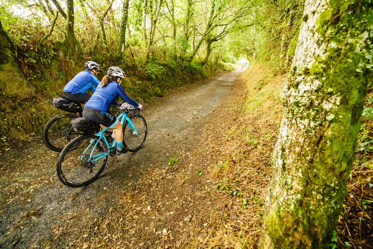
From Sarria to Melide
The second stage crosses large areas of meadows and oak groves towards the banks of the river Miño, and then crosses the bridge that leads to Portomarín, a village rescued from the waters after the construction of a dam and relocated to this new area. Palas de Rei is a good place to stock up before continuing to Melide, where this section ends. In Melide, you will find what probably is the oldest stone cross in Galicia. You should also try the traditional pulpo (octopus) á feira in one of Galicia’s famous pulperías (traditional octopus restaurants).
 The way of Saint James
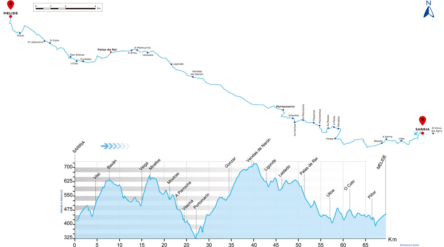 Map and Altimetric Profile of Section 18
Distance 69,5 Km
| Altitude difference+ | Altitude difference- | Maximum height | Minimun height | Departure altitude | Arrival altitude |
|---|---|---|---|---|---|
| 1.458 m | 1.424 m | 723 m | 350 m | 420 m | 453 m |
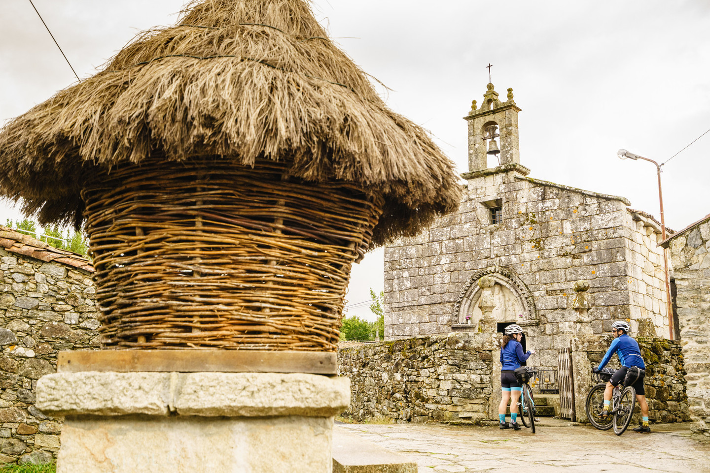 O Leboreiro
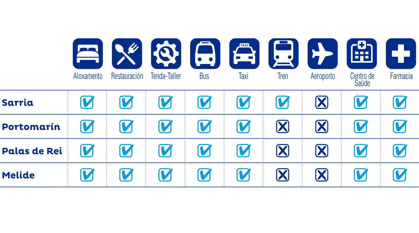 Services in the towns of: Sarria, Portomarín, Palas de Rei and Melide
Eurovelo 3
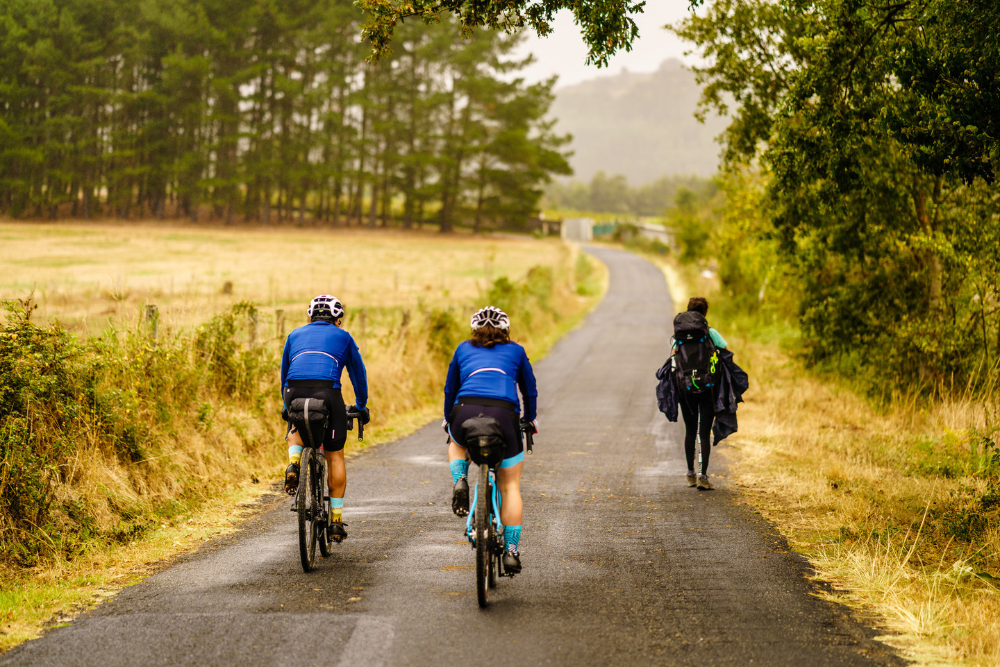
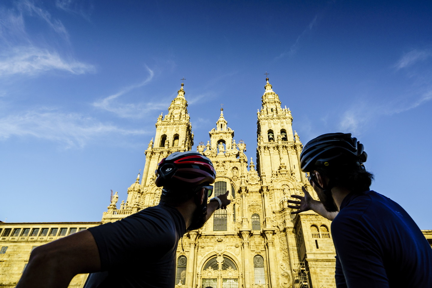
From Melide to Santiago de Compostela
The last stage visits the town of Arzúa, one of the cheese capitals of Galicia. Through the so-called “Dutch Route”, along the AC- 240 regional road, you will visit the municipalities of Touro and Boqueixón before you reach the City of Culture, which welcomes us to Santiago de Compostela. The capital of Galicia is a city full of attractions of all kinds, with a historic centre so well preserved that it has been declared a World Heritage Site by Unesco.
 The way of Saint James
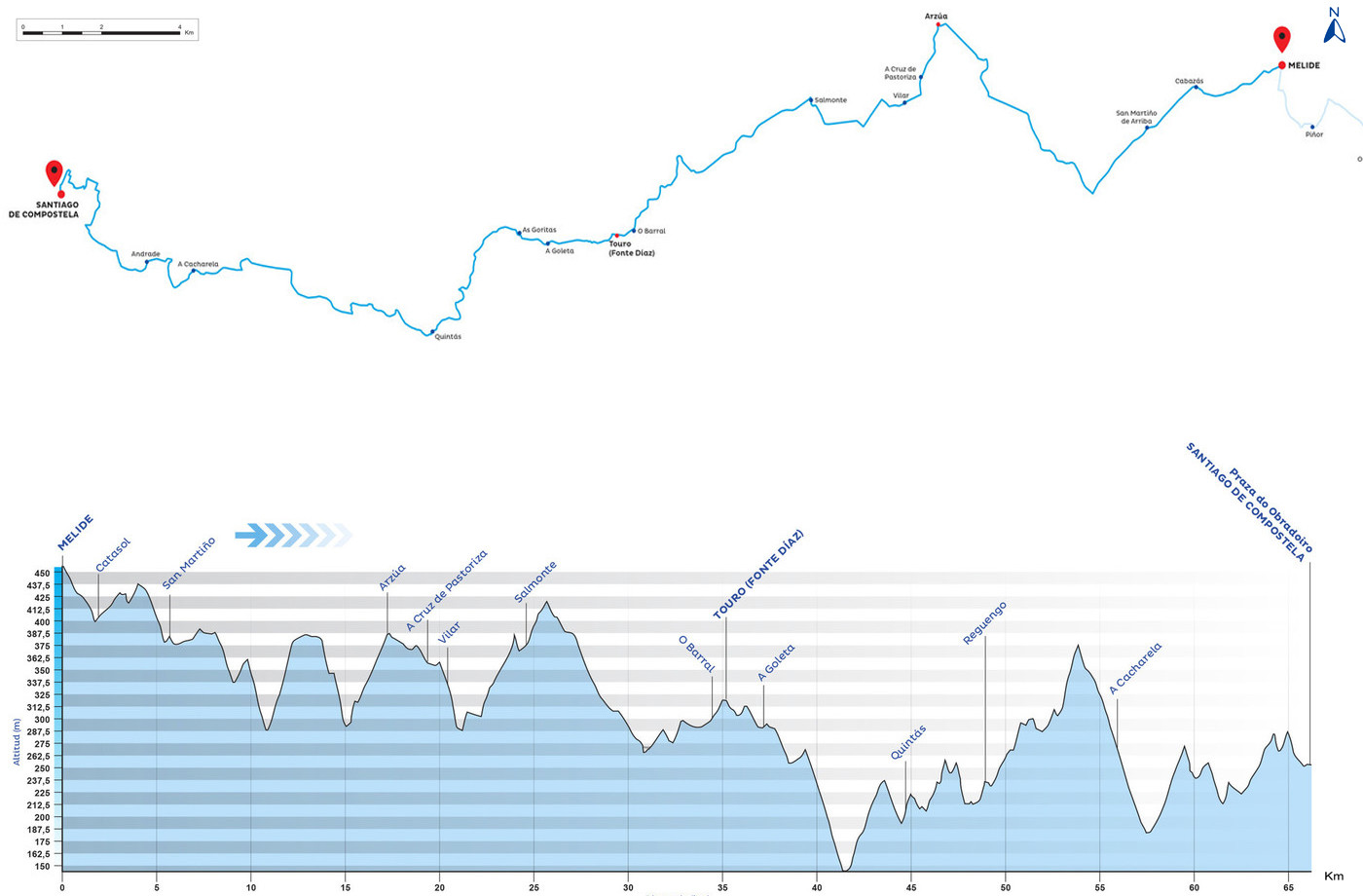 Map and Altimetric profile section 19
Distance 66,2 Km
| Altitude difference+ | Altitude difference- | Maximum height | Minimun height | Departure altitude | Arrival altitude |
|---|---|---|---|---|---|
| 1.159 m | 1.361 m | 455 m | 144 m | 453 m | 252 m |
 Praza do Obradoiro. Santiago de Compostela
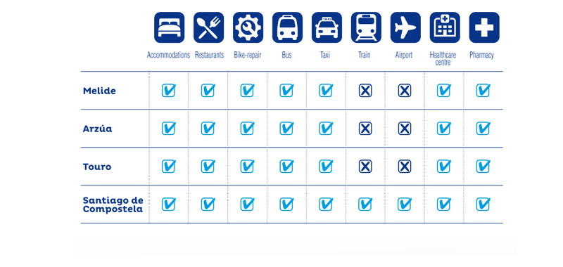 Services in the towns of: Melide, Arzúa, Touro and Santiago de Compostela
Eurovelo 3
De Santiago de Compostela a Olveiroa
This stage starts in the Plaza del Obradoiro in Santiago de Compostela, the goal of all Jacobean routes. It crosses the river Tambre over the most significant bridge on this route, Ponte Maceira, until it reaches the medieval town of Negreira. The cycle route shares several sections with the old Royal Road to Finisterre, where the Xallas region offers us the beauty of its landscapes and its genuine popular architecture. Passing the villageof Mollón, we reach the Olveira bridge that crosses the river Xallas, which divides the municipalities of Mazaricos and Dumbría. Bringing us to the centre of Olveiroa, the end of the stage.
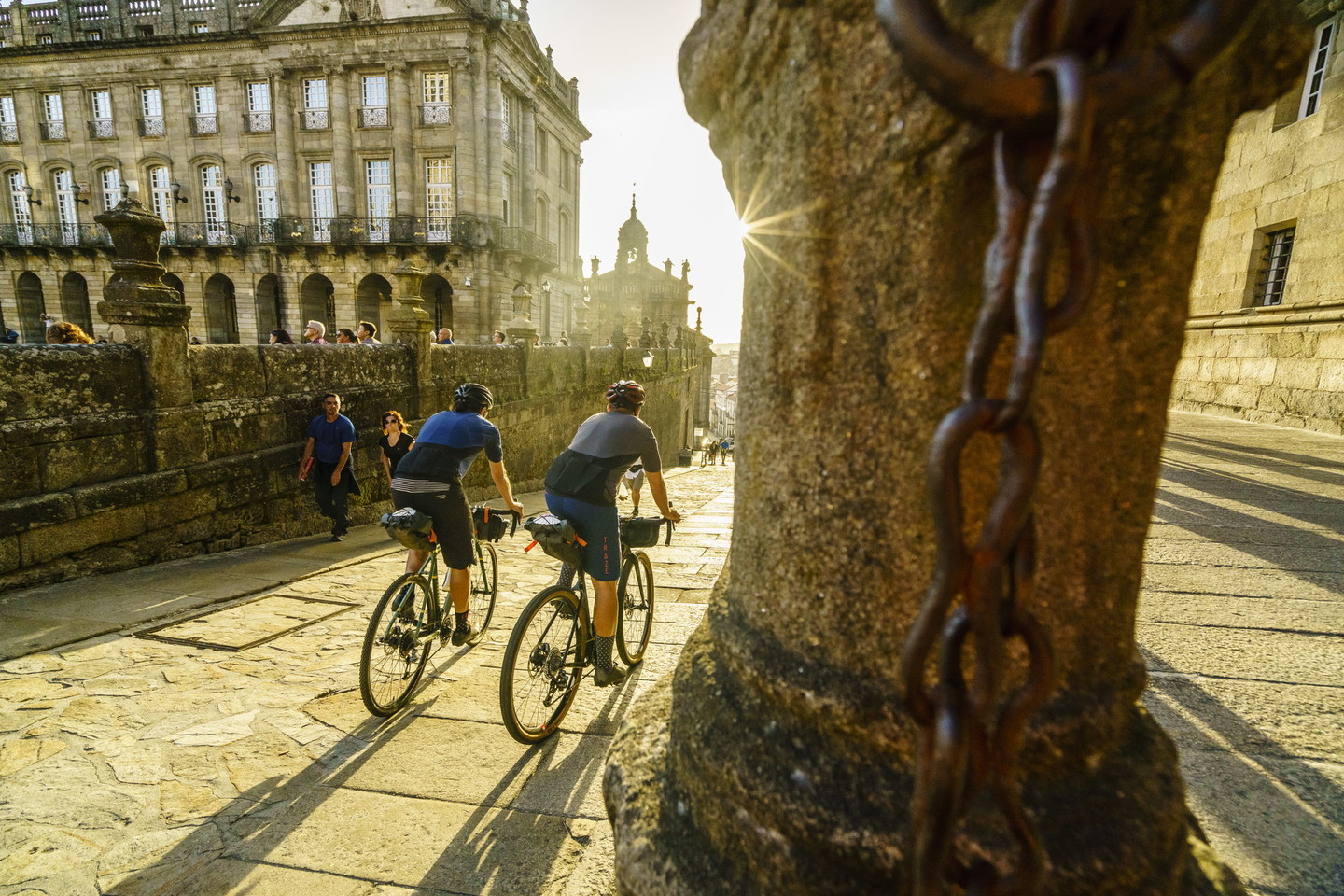 Santiago de Compostela
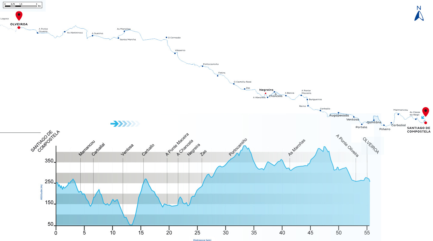 Map and Altimetric Profile of Section 20
Distance 55,45 Km
| Altitude difference+ | Altitude difference- | Maximum height | Minimun height | Departure altitude | Arrival altitude |
|---|---|---|---|---|---|
| 946 m | 955 m | 427 m | 51 m | 252 m | 260 m |
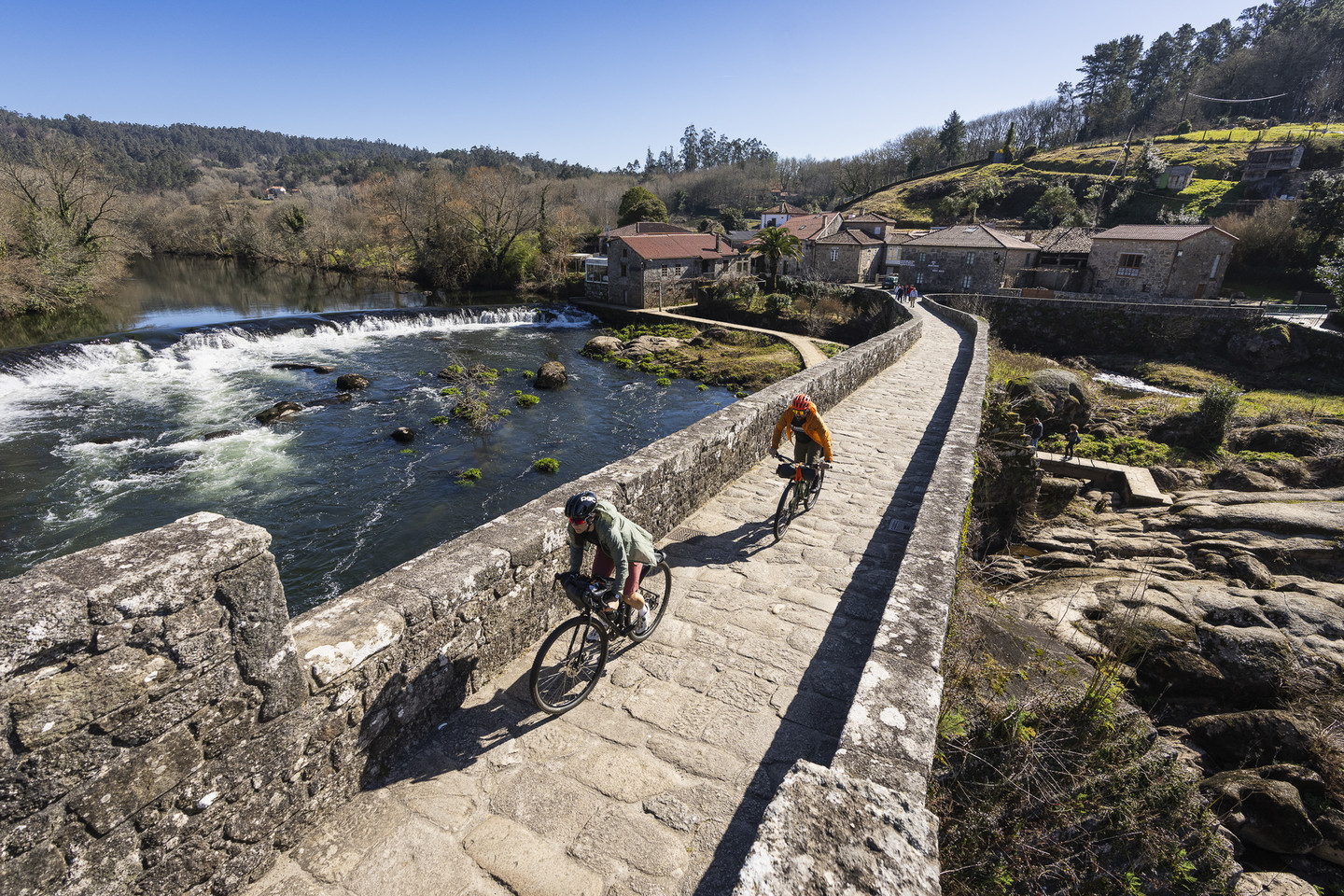 Ponte Maceira
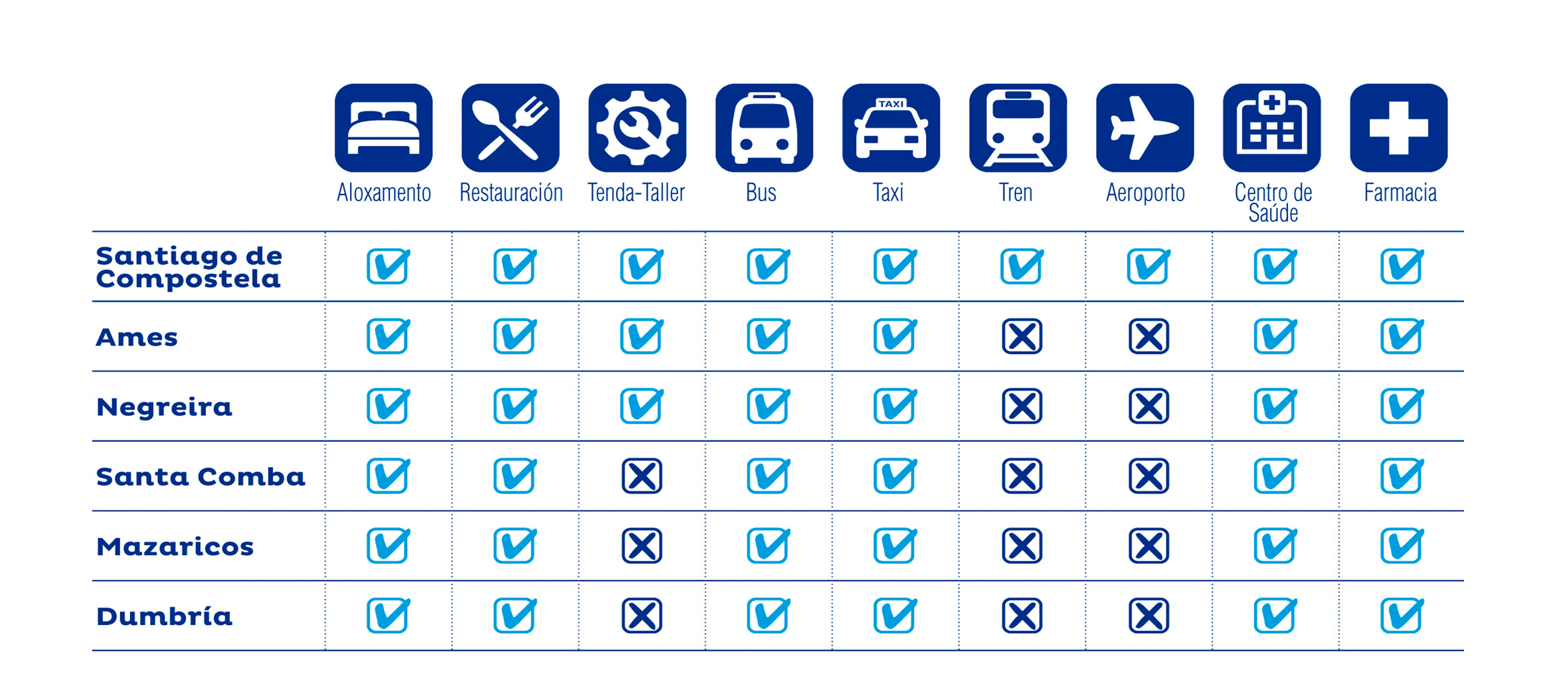 Services in the towns of: Santiago de Compostela, Ames, Negreira, Santa Comba, Mazaricos e Dumbria
Eurovelo 3
Olveiroa - Cabo Fisterra
This second stage begins in Olveiroa. By crossing the river Hospital, we reach the village of the same name, a place that once boasted a modest hospital for pilgrims, which unfortunately no longer exists. The cyclist route reaches the top of O Cruceiro da Armada followed by a marked descent, with views of the Corcubión estuary, that ends in the town of Cee, the junction point with the EuroVelo 1, “Route of the Atlantic Coast”. This route originates, in the Galician territory, at the International Bridge of the Miño River in Tui and runs along the entire Atlantic coast of the province of Pontevedra and the south of the province of A Coruña. From this point onwards, these two routes share a final stretch that crosses a region with one of the most beautiful coastlines of the Iberian Peninsula. We arrive at Finisterre through the district of San Roque and continue along the road up to the lighthouse to reach the mythical “km 0” of the Way of Saint James, at the cape at the end of the world.
 The Fisterra Way
 Map and Altimetric Profile of Section 21
Distance 35 Km
| Altitude difference+ | Altitude difference- | Maximum height | Minimun height | Departure altitude | Arrival altitude |
|---|---|---|---|---|---|
| 721 m | 591 m | 377 m | 3 m | 260 m | 130 m |
 View of the town and the lighthouse of Fisterra
 Services in the towns of: Dumbría, Cee, Corcubión e Fisterra
Recommendations
- It is recommended to wear a helmet.
- Don’t forget to check the bike’s condition.
- Find out about the route’s technical aspects and the day’s weather forecast.
- Always carry water, warm clothes, a repair kit and a properly charged mobile phone.
- You must obey the signs along the route, give priority to pedestrians and comply with the general traffic rules.
- In shared segments with The Way of St James, follow the road signs for The Way of St James.
- You can maintain the route notifying of any incidents regarding the conditions of and signs along the paths using the email eurovelo.turismo@xunta.gal
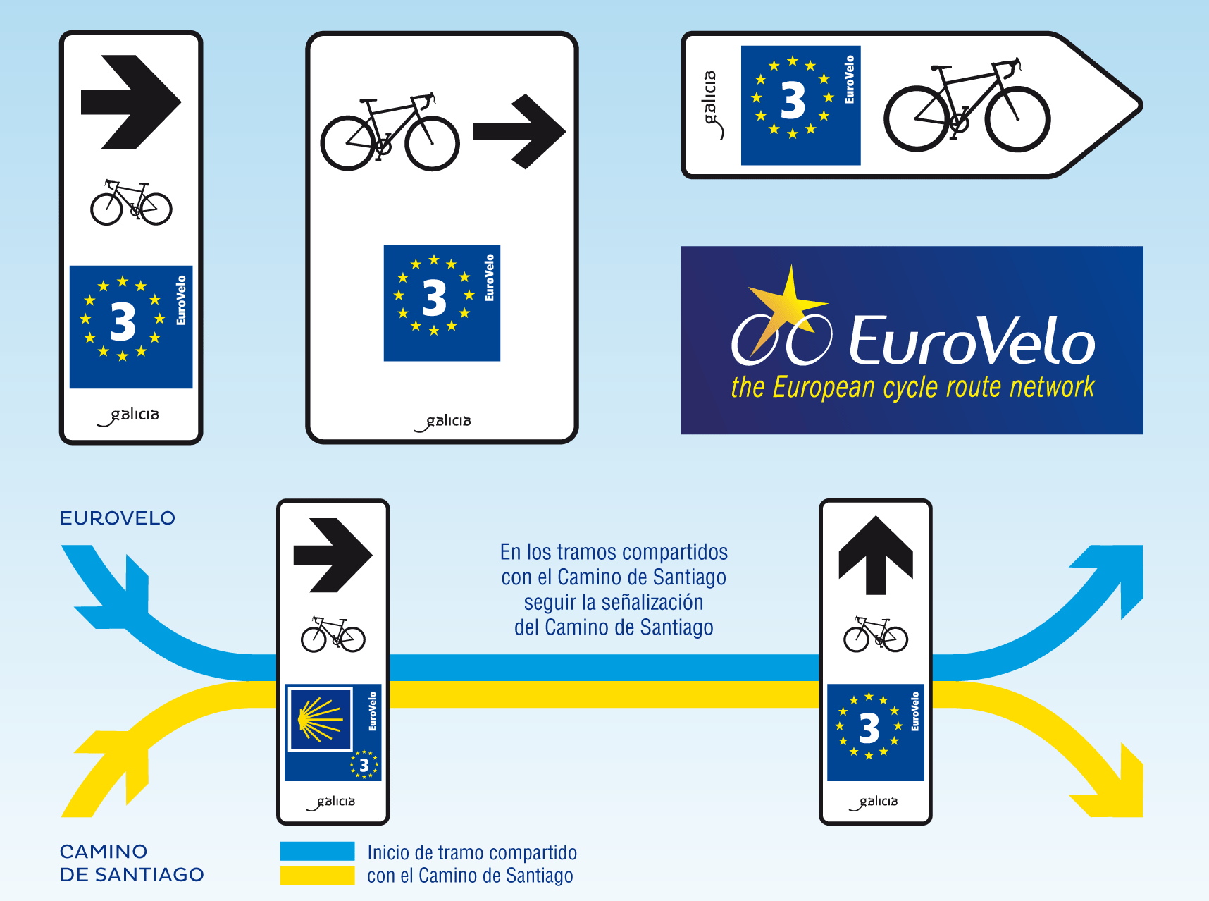 Signaling