Turismo de Galicia


-
Things to do
Way of St. James
Nature
Culture and heritage
Beaches and coast
Tourist trails
- Top ten: Ten unrivalled destinations
- The route of the camellia
- Tourist routes
- Pathways for discovering a country
- Walks to fall in love with
- Greenways
- Scenery at the wheel
- EuroVelo Galicia
- Beyond the Sunset
Gastronomy
Health tourism
PROMOTIONS TO ENJOY NOW
Cultural agenda
Will happen... View all
- Places to visit
-
Plan your trip
Build your journey
Practical information


- Start
- Things to do
-
Scenery at the wheel
- Way of St. James
- Galician Woodlands
- Experiencies in the midst of nature
- Magical Shrines
- Lighthouses and Wild Beaches
- Galicia Birding
- EuroVelo Galicia
- Hidden Heritage
- Marine Tourism
- Galicia Water Society
- Tourist routes
- The route of the camellia
- Scenery at the wheel
- Top ten: Ten unrivalled destinations
- Strolling Through Vineyards
- Pathways for discovering a country
- Walks to fall in love with
- Greenways
- Beyond the Sunset
- Galician springs
- Promotions to enjoy
- Cultural agenda
- Total Solar Eclipse
- 25 unusual routes through the best landscapes in Galicia
- Valleys, rivers and mountains
-
From Montederramo to Manzaneda
- From Fonsagrada to Negueira de Muñiz
- From Navia de Suarna to As Pontes de Gatín
- From Pedrafita do Cebreiro to Samos
- From A Cruz do Incio to the viewpoint at A Pena do Teso Grande
- From Chantada to Os Peares
- From Monforte de Lemos to Santo Estevo de Ribas de Sil
- From A Veiga to the Penedos de Oulego
- From A Pobra de Trives to As Ermidas
- From Montederramo to Manzaneda
- From A Gudiña to Pradoalbar
- From Aquis Querquennis to A Portela do Home
- From Ourense to Ribadavia
- From Avión to the Tres Rías lookout point
- From Aciveiro to Carboeiro
-
A miña viaxe
A MIÑA VIAXE
- Compartir
- Correo
- Imprimir
Valleys, Rivers and mountains
From Montederramo to Manzaneda...across Ourense’s central massifCabeza de Manzaneda.
Miña Galicia querida.
That is heaven on earth.
Popular song
A journey across Ourense’s central massif is a rich sensory experience. The impressive mountain views, the rich colours of the vegetation and the silence make for a relaxing journey through some of Galicia’s best conserved landscapes, with small villages scattered over an area of extraordinary natural beauty. The area is also home to Galicia’s only mountain ski resort: Manzaneda.
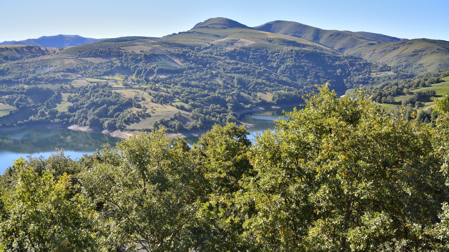
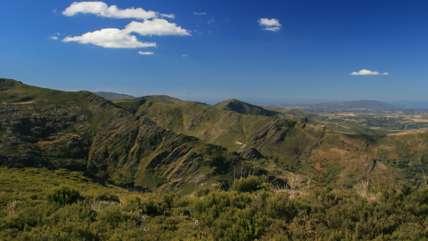 View of central massif
The central massif comprises a series of mountain ranges that run across the province of Ourense. The valleys on the northern side offer delightful routes among meadows and the holly bushes, oaks and birch trees that cover the slopes of the mountains up to the rocky peaks of the San Mamede, Burgo, Queixa and Cabeza de Manzaneda ranges. They are not the highest mountains in Galicia but their beauty is undeniable.
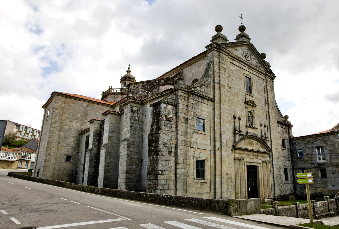
Montederramo is the ideal starting point for this route. Its welcoming central square adjoins the Santa María Monastery, an architectural jewel that combines various styles. Shortly after leaving Montederramo there is a turning towards O Bidueiral, a stand of birch trees (Betula alba) reminiscent of a Scandinavian wood, but in the south of Galicia.
Santa María de Montederramo is a monastery that dates back to the tenth century. Most of the current buildings were constructed in the sixteenth and seventeenth centuries, the Herrerian Renaissance façade being a feature of special interest. It became a Benedictine monastery in the twelfth century, subsequently passing to the Cistercians, who had a preference for peaceful, isolated locations for their monasteries. Santa María de Montederramo stands beside the River Mao, on a strip of rich farmland at the foot of the San Mamede mountains.
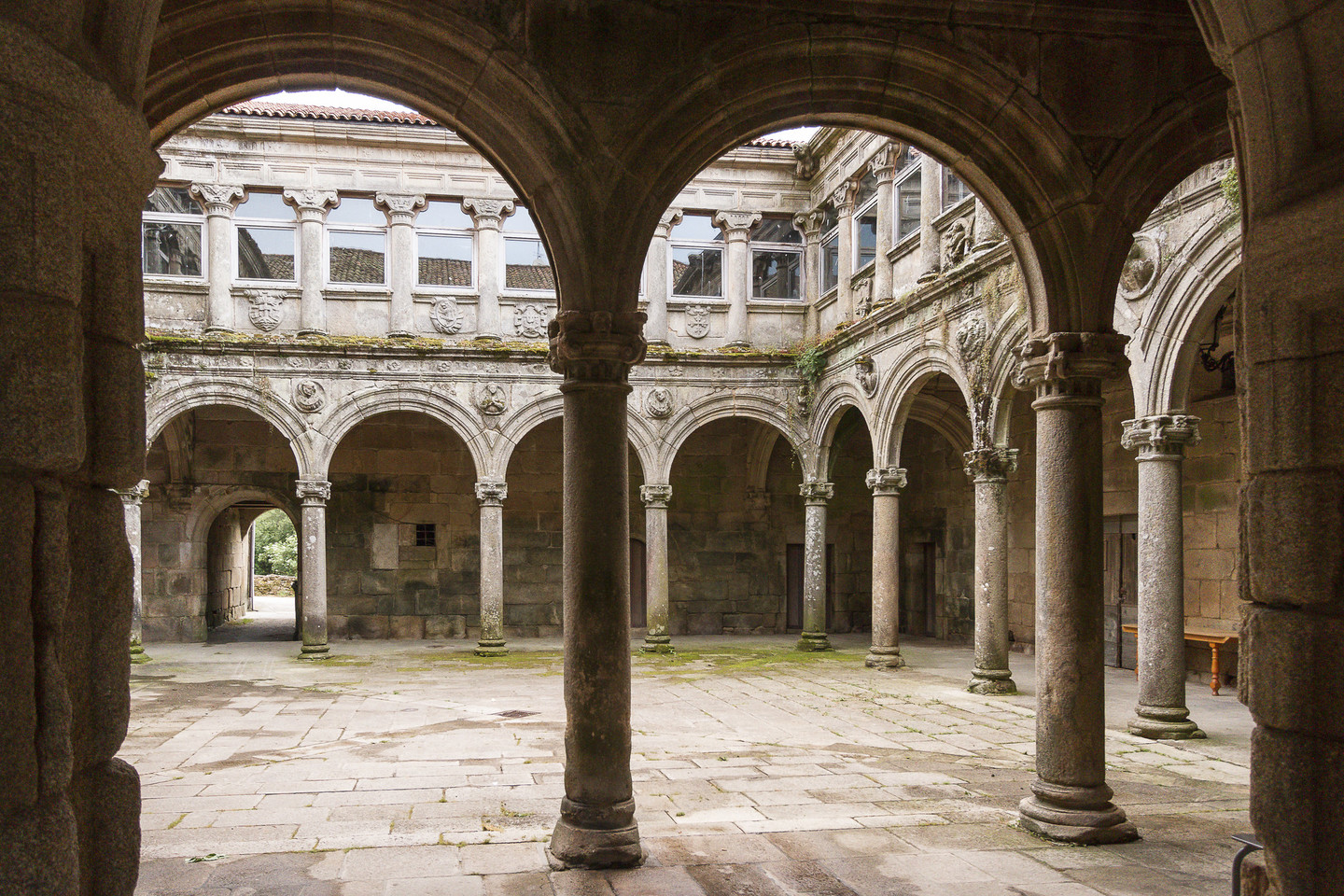
It boast two outstanding cloisters, the Claustro das Procesións (Procession cloister) (sixteenth-century with Gothic and Renaissance features) and the Claustro da Hospedería (Hostel cloister) (seventeenth-century Renaissance).
The monastery’s origins may be related to a priory in Seoane Vello. It was refounded in its current location in the twelfth century, according to a document drawn up in Allariz in 1124. This is the first recorded case of the use of the expression Roboira Sacrata, the origin of today’s Ribeira Sacra, possibly alluding to the numerous oak trees (Quercus robur) in the area, although the large number of religious buildings on the banks of the Sil may also may also be related to its etymology.
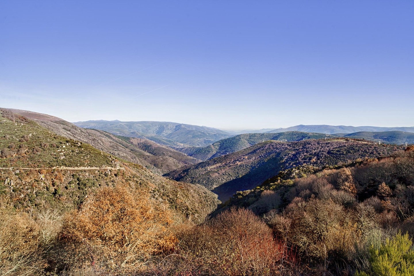
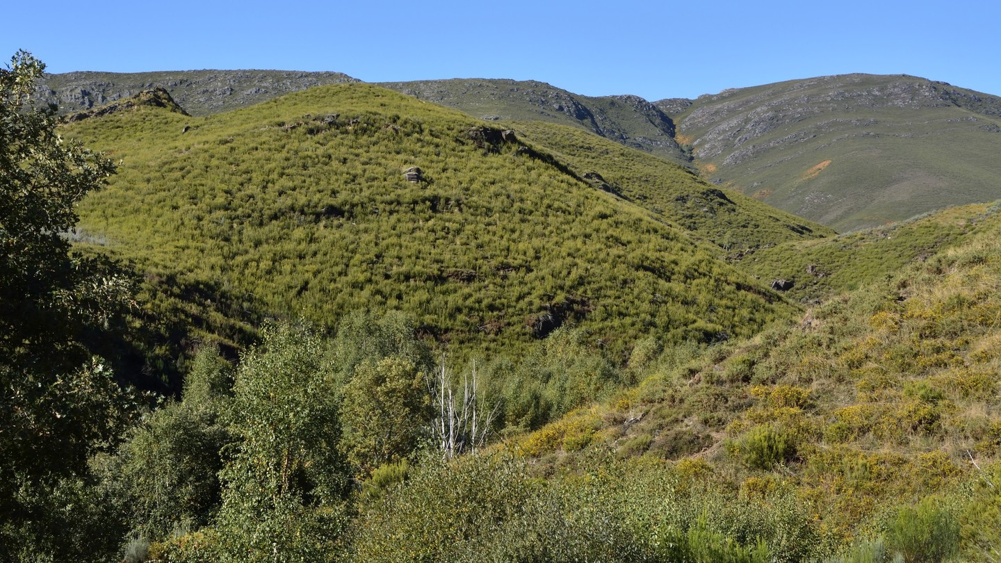 Queixa valley
Following the course of the River Mao, the route passes through a series of villages which blend perfectly into a landscape of bocage, small plots of farmland with their old stone enclosures and hedges. In the distance the Serra de San Mamede can be seen, changing according to the time of year.
After San Fiz, the route turns to reveal the broad Queixa valley, with the mountain range of the same name providing a picturesque backdrop. The road then runs along the side of the Queixa reservoir, going over the dam to cross it.
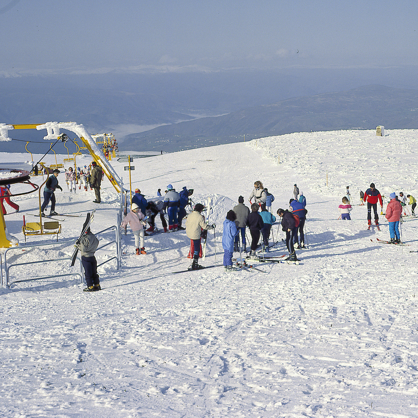 Mountain ski resort in Cabeza de Manzaneda
The route through Chandrexa de Queixa heads towards Manzaneda, the only mountain ski resort in Galicia.
Cabeza Grande de Manzaneda (1,781 metres) is a major landmark, as it is the highest mountain in Ourense’s central massif and forms part of a chain bordering the Bibei valley.
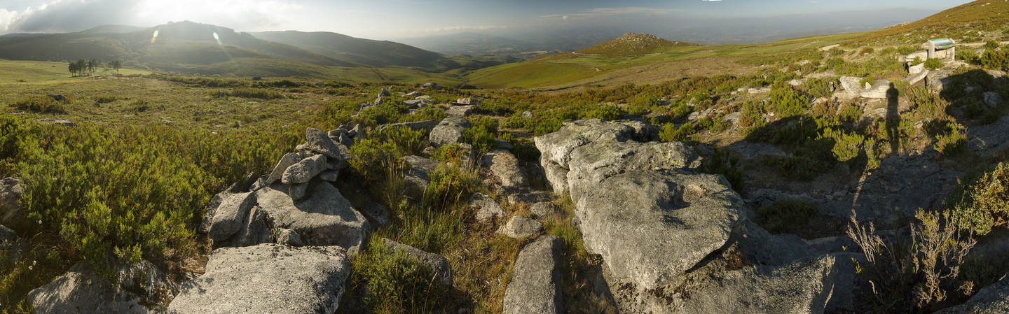 Lookout point at Chaira das Lamas
The descent to the town of Manzaneda offers views from a different side of the mountains, those from the lookout point at Chaira das Lamas being particularly impressive. Against the backdrop of the mountains, the landscape is characterised by scrubland and extensive pastures, testifying to the historical importance of livestock in the area. As the road descends the first groves of trees appear, including legendary examples such as the Castiñeiro de Pumbariños, an enormous chestnut tree in Rozavales.
The town stands on a plain and retains its mediaeval layout with part of the walls intact. The Porta da Vila gate (twelfth century) is the most important vestige of this defensive structure, which was originally over 400 metres long. From here Rúa da Igrexa (also known as Rúa do Medio) leads through the mediaeval centre with its carefully conserved narrow streets to San Martiño Church.
The town’s defences were completed with the castle, parts of which remain and have been turned into a lookout point. The Irmandiño revolts led to the destruction of the mediaeval tower and the castle was rebuilt in the sixteenth century on the orders of the Counts of Ribadavia. The new building included a prison known as the Cárcere dos Sarmiento, reflecting the lineage of the counts. Today it is used as a cultural centre.
Don't Miss
 Reservoir of Chandrexa de Queixa
The route’s leisurely passage through the municipality of Montederramo takes it to San Fiz, approaching the slopes of the Serra de Queixa. But this little village has a surprise in store for the traveller: with no prior warning, after a number of bends in the road, the River Queixa valley opens up before us, with an impressive view of the mountains in the background from the San Fiz lookout point.
The Manzaneda massif dominates this sector with its complex relief. The Queixa range includes peaks rising above 1,700 metres (Seixo and Sistil Branco) in line with Cabeza Grande de Manzaneda and alternating with the River Queixa valley, a depression that was used to create a reservoir, inaugurated in 1953.
From this point it can be seen how the action of the rivers has worn furrows in the granite surface of the Serra de Queixa. The steep slopes and climate conditions drove people to settle in the river valleys, as has happened around the Queixa reservoir, where extensive livestock grazing has resulted in a very well conserved landscape.
