Turismo de Galicia


-
Things to do
Way of St. James
Nature
Culture and heritage
Beaches and coast
Tourist trails
- Top ten: Ten unrivalled destinations
- The route of the camellia
- Tourist routes
- Pathways for discovering a country
- Walks to fall in love with
- Greenways
- Scenery at the wheel
- EuroVelo Galicia
- Beyond the Sunset
Gastronomy
Health tourism
PROMOTIONS TO ENJOY NOW
Cultural agenda
Will happen... View all
- Places to visit
-
Plan your trip
Build your journey
Practical information


- Start
- Things to do
-
Scenery at the wheel
- Way of St. James
- Galician Woodlands
- Experiencies in the midst of nature
- Magical Shrines
- Lighthouses and Wild Beaches
- Galicia Birding
- EuroVelo Galicia
- Hidden Heritage
- Marine Tourism
- Galicia Water Society
- Tourist routes
- The route of the camellia
- Scenery at the wheel
- Top ten: Ten unrivalled destinations
- Strolling Through Vineyards
- Pathways for discovering a country
- Walks to fall in love with
- Greenways
- Beyond the Sunset
- Galician springs
- Promotions to enjoy
- Cultural agenda
- Total Solar Eclipse
- 25 unusual routes through the best landscapes in Galicia
- Valleys, rivers and mountains
-
From Navia de Suarna to As Pontes de Gatín
- From Fonsagrada to Negueira de Muñiz
- From Navia de Suarna to As Pontes de Gatín
- From Pedrafita do Cebreiro to Samos
- From A Cruz do Incio to the viewpoint at A Pena do Teso Grande
- From Chantada to Os Peares
- From Monforte de Lemos to Santo Estevo de Ribas de Sil
- From A Veiga to the Penedos de Oulego
- From A Pobra de Trives to As Ermidas
- From Montederramo to Manzaneda
- From A Gudiña to Pradoalbar
- From Aquis Querquennis to A Portela do Home
- From Ourense to Ribadavia
- From Avión to the Tres Rías lookout point
- From Aciveiro to Carboeiro
-
A miña viaxe
A MIÑA VIAXE
- Compartir
- Correo
- Imprimir
Valleys, Rivers and mountains
From Navia de Suarna to As Pontes de Gatín... Ancares passesPopular saying
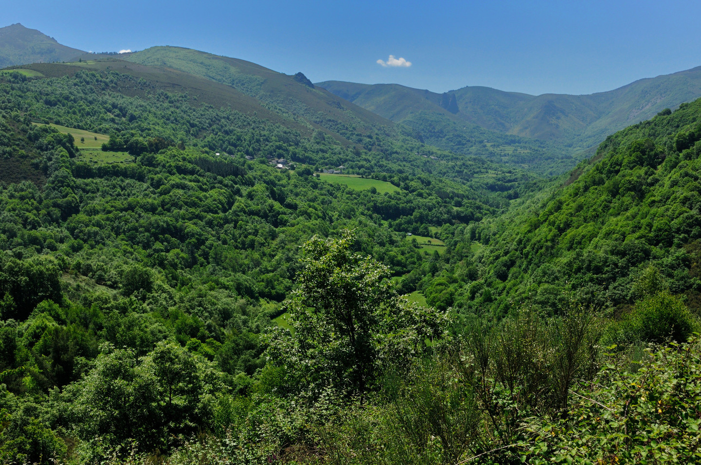
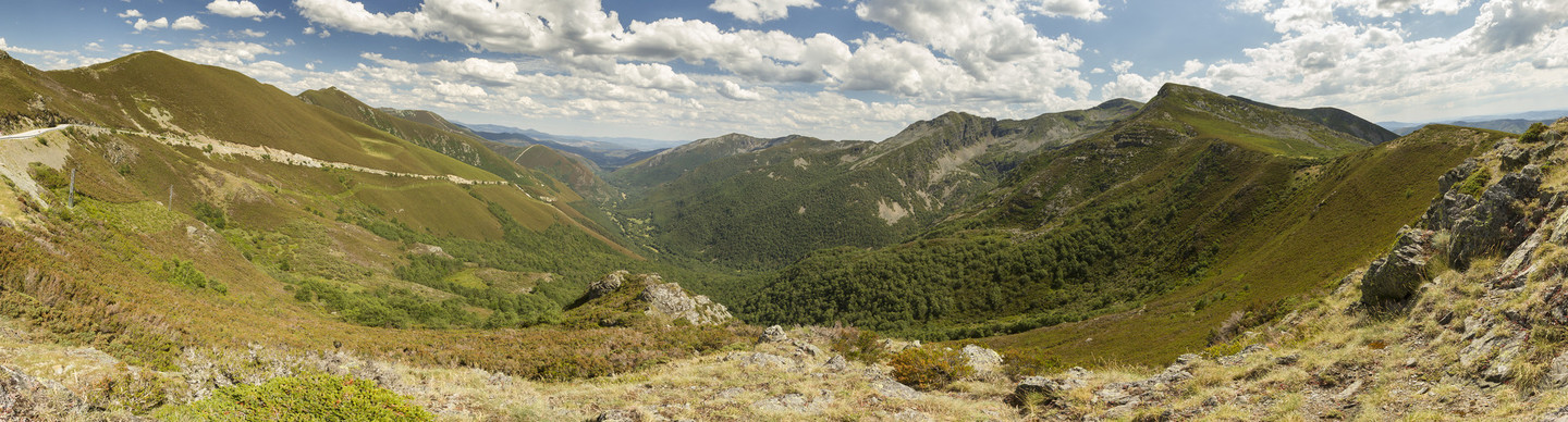
The broad expanses of Os Ancares allow a complete tour of its passes and valleys. A mythical location in the Galician mountains, with its splendid natural resources, rugged relief and rich ethnographical heritage, the county is an essential part of any visit to eastern Galicia.
 A Proba de Navia, capital of the municipality of Navia de Suarna
Os Ancares is one of Galicia’s main mountain systems. Comprising various ranges, its grandiose mountain scenery contrasts with its secluded villages. It is an isolated area whose mountains extend into the further corners of Asturias and León, making it one of the least densely populated areas in the Iberian peninsula.
Navia de Suarna is the point chosen to begin our route. A Proba de Navia is the capital of this extensive municipality and the area’s main centre of population. It grew up around the Ponte Vella, an early mediaeval bridge which for many years was the only point at which the River Navia could be crossed for many miles in either direction.
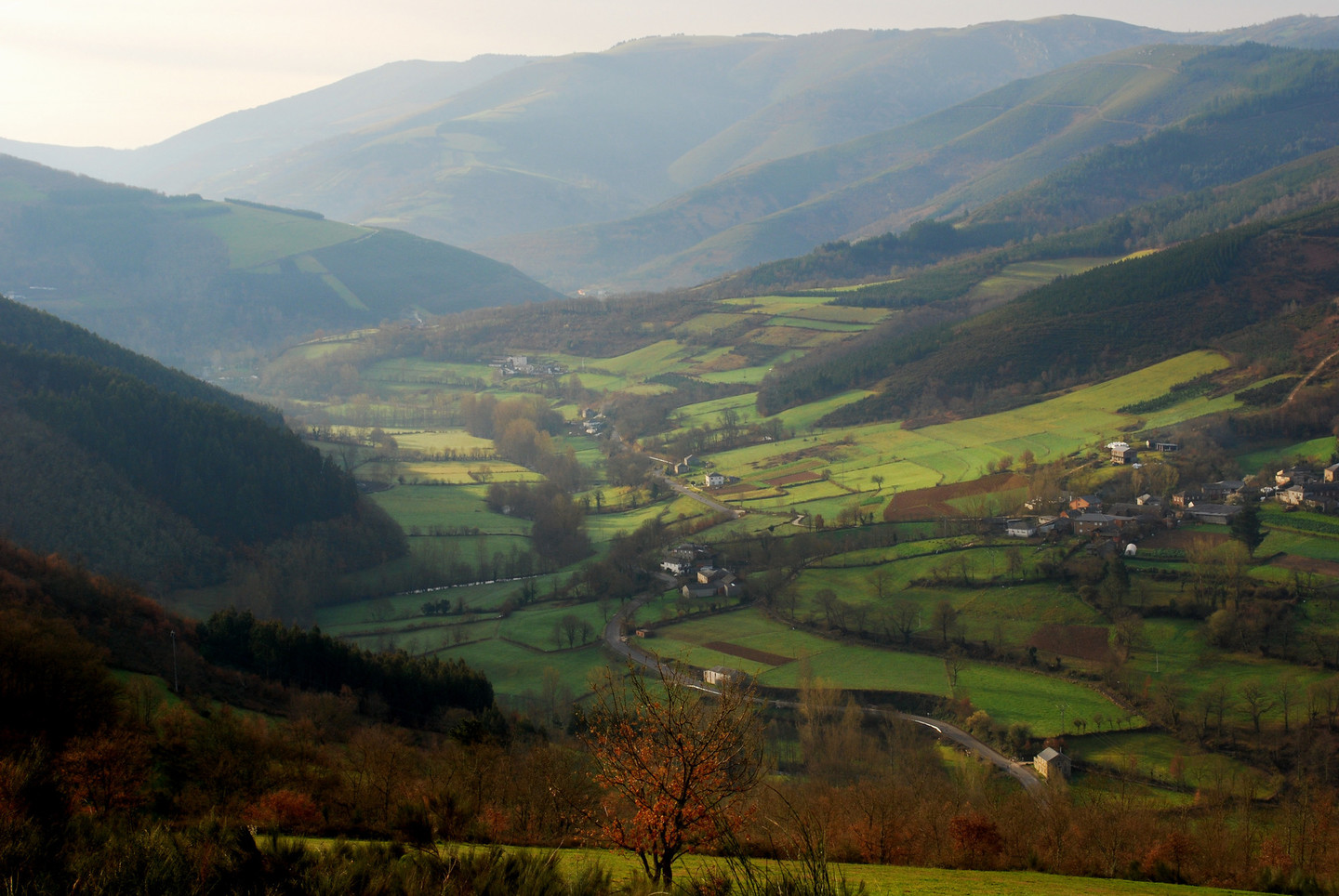
 Rao valley
Following the riverbank vegetation along the course of the Navia, the route comes to a turning to Murias and Balouta, leading out of the valley. The first serious climb is to the pass at Folgueiras de Aigas. As we leave the village of Munís, the Larxentes range rises steeply and the well-surfaced road begins to climb and drop dramatically.
Heading towards Rao, the variations in altitude provide beautiful views of the sierra. The Rao valley is a place that is lost in time. Little villages nestle among green fields and dense vegetation between mountains rising to more than 1,000 metres. Windbreaks and coppices remind us of the importance of agriculture and livestock in the area’s economy. There will be no lack of invitations to buy honey and other local produce.
Murias is the largest village in the area. With its distinctive architecture, the village closely follows the contours of the mountainside. Shortly after leaving it, an attractive recreation area allows the traveller to rest and enjoy the views of the River Rao in the valley far below.
 The Ancares Pass
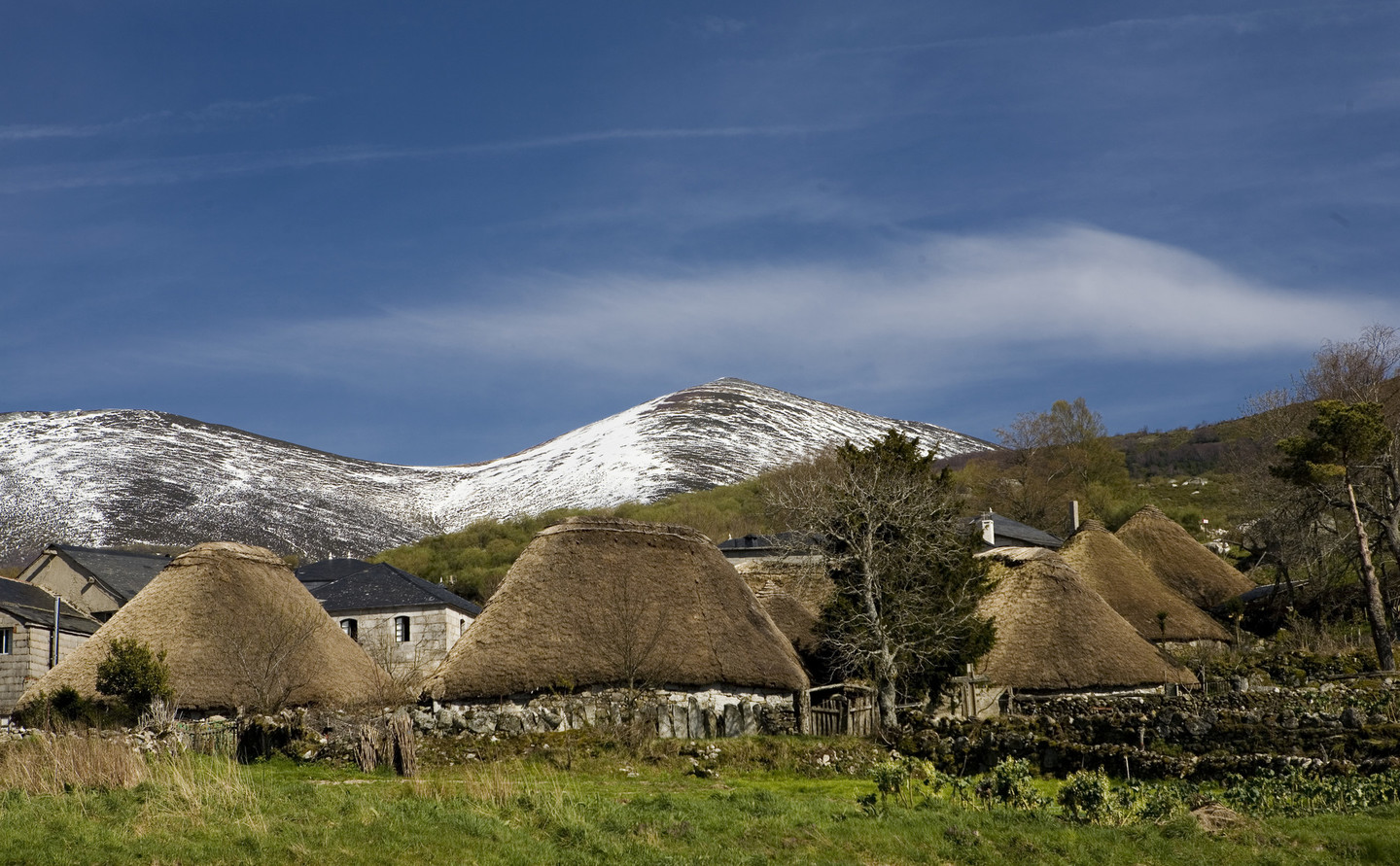
Going on towards Balouta we enter the region of Castilla y León. But borders mean nothing in these mountains and the landscape is as impressive as ever. Balouta is an old village. Its round thatched houses are similar to those of Piornedo but may be less well known. There is always something new to be seen in the extensive Ancares mountains.
The last houses in Balouta mark the point where the ascent to the Ancares Pass begins. The uneven road climbs steadily to the border between Galicia and Castilla y León, at a height of 1,648 metres. The views from the peaceful, silent Balouta lookout point should not be missed.
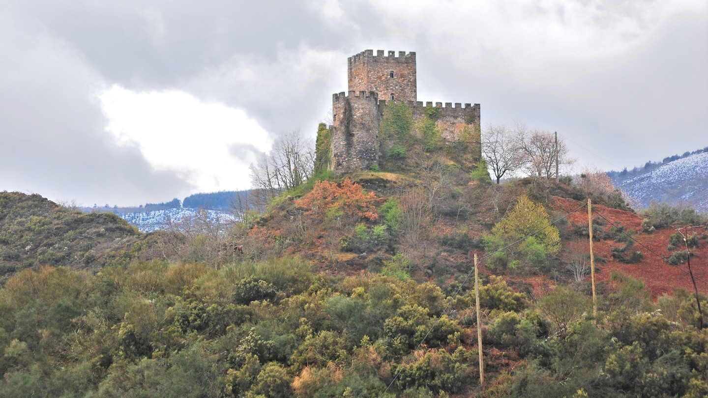 Castle of Doiras or Torre da Ferrería
The route requires us to retrace our steps (briefly) as far as the turning to Suárbol and Piornedo. Piornedo is a living monument to the traditional architecture of the Galician mountains and deserves an unhurried visit.
Some of the greatest concentrations of hardwoods in Galicia, a veritable spectacle of texture and colour are found in Cervantes, Donís and Vilarello. The route then goes on to Campa da Braña, a key spot for lovers of hiking and climbing, as it is the departure point for such beautiful routes as the climb to Pico Tres Bispos (1,794 metres).
Doiras is an important junction on the route. A short walk takes visitors to its late mediaeval castle, also known as the Torre da Ferrería.
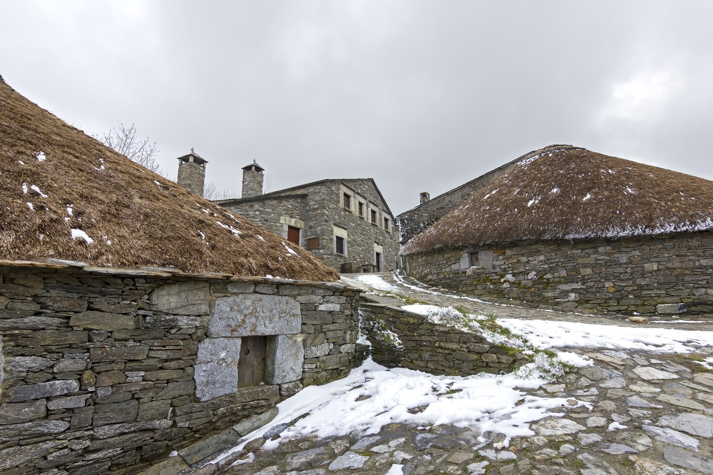
The village of Piornedo (Donís, Cervantes) is one of the best conserved examples of the popular architecture of the Galician mountains, especially its traditional pallozas, typical of Ancares, round houses with stone walls and thatched roofs.
Some of them were used for storage, in which case they were known as palleiros. The hórreos (raised granaries) in this area also have their own characteristic design. One of the pallozas had been turned into an ethnographical museum where visitors can learn more about the area.
The village’s position on the side of the mountain protects it from inclement weather and allows its buildings to blend into the natural landscape.
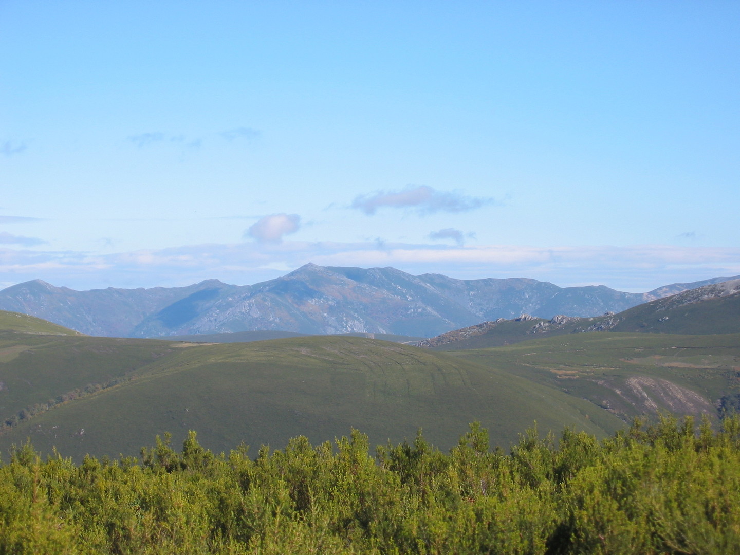 View of Ancares
As Pontes de Gatín, in Becerreá, marks the end of this journey into the mountains of eastern Galicia. Its ancient bridge was part of Roman Road XIX and there is a milestone on one of its walls. Today it is only used by pedestrians and vehicles use a newer bridge over a pleasant stretch of the Navia, where we conclude our visit to Ancares.
The Gatín Bridge legend says that two lovers lived on opposite sides of the Navia, separated by the waters of the river. The devil made a pact with the man to create a bridge in exchange for the life of the next child to be born in the village. The man tricked the devil, offering him some new-born kittens, saving the child he and his lover were expecting but condemning the kittens to death. Since then the bridge has been known as the Gatín (kitten) bridge.
Don't Miss
 The Ancares Pass
Ancares is the common designation for a series of mountain ranges. In such cases it is common for the most widely known name to be extended to the whole mountain system. Os Ancares is a mountain range and also a valley in Candín (León), adjacent to the Balouta valley, the two being linked by the Ancares pass.
From the highest point we have views on both sides: To the north the Balouta lookout point looks down on the village of that name, with its thatched houses and carefully tended fields. In the distance, in Asturias, we can see mountains that rise to over 1,700 metres. To the south runs the long Ancares valley, beside the mountain range that contains O Mostallar (1,934 metres).
The Ancares pass has featured several times in the “Vuelta a España” cycling race.
