Turismo de Galicia


-
Things to do
Way of St. James
Nature
Culture and heritage
Beaches and coast
Tourist trails
- Top ten: Ten unrivalled destinations
- The route of the camellia
- Tourist routes
- Pathways for discovering a country
- Walks to fall in love with
- Greenways
- Scenery at the wheel
- EuroVelo Galicia
- Beyond the Sunset
Gastronomy
Health tourism
PROMOTIONS TO ENJOY NOW
Cultural agenda
Will happen... View all
- Places to visit
-
Plan your trip
Build your journey
Practical information


- Start
- Things to do
-
Scenery at the wheel
- Way of St. James
- Galician Woodlands
- Experiencies in the midst of nature
- Magical Shrines
- Lighthouses and Wild Beaches
- Galicia Birding
- EuroVelo Galicia
- Hidden Heritage
- Marine Tourism
- Galicia Water Society
- Tourist routes
- The route of the camellia
- Scenery at the wheel
- Top ten: Ten unrivalled destinations
- Strolling Through Vineyards
- Pathways for discovering a country
- Walks to fall in love with
- Greenways
- Beyond the Sunset
- Galician springs
- Promotions to enjoy
- Cultural agenda
- Total Solar Eclipse
- 25 unusual routes through the best landscapes in Galicia
- Valleys, rivers and mountains
-
From A Gudiña to Pradoalbar
- From Fonsagrada to Negueira de Muñiz
- From Navia de Suarna to As Pontes de Gatín
- From Pedrafita do Cebreiro to Samos
- From A Cruz do Incio to the viewpoint at A Pena do Teso Grande
- From Chantada to Os Peares
- From Monforte de Lemos to Santo Estevo de Ribas de Sil
- From A Veiga to the Penedos de Oulego
- From A Pobra de Trives to As Ermidas
- From Montederramo to Manzaneda
- From A Gudiña to Pradoalbar
- From Aquis Querquennis to A Portela do Home
- From Ourense to Ribadavia
- From Avión to the Tres Rías lookout point
- From Aciveiro to Carboeiro
-
A miña viaxe
A MIÑA VIAXE
- Compartir
- Correo
- Imprimir
Valleys, Rivers and mountains
From A Gudiña to Pradoalbar...Serra Seca and the O Conso valleyand even more the piper from A Martiñá
are feuding with the wind
and I don’t know who will win
Popular song
The area round A Gudiña is harsh and sparsely populated, a surprising landscape where visitors can follow the old routes along which people entered and left Galicia. Part of the route coincides with the Vía da Prata pilgrimage route to Santiago, where it ascends to the Serra Seca, looking towards the hills of O Invernadeiro. The last section, going up the River Conso, offers views of streams and waterfalls until we reach our final destination: the hidden village of Pradoalbar.
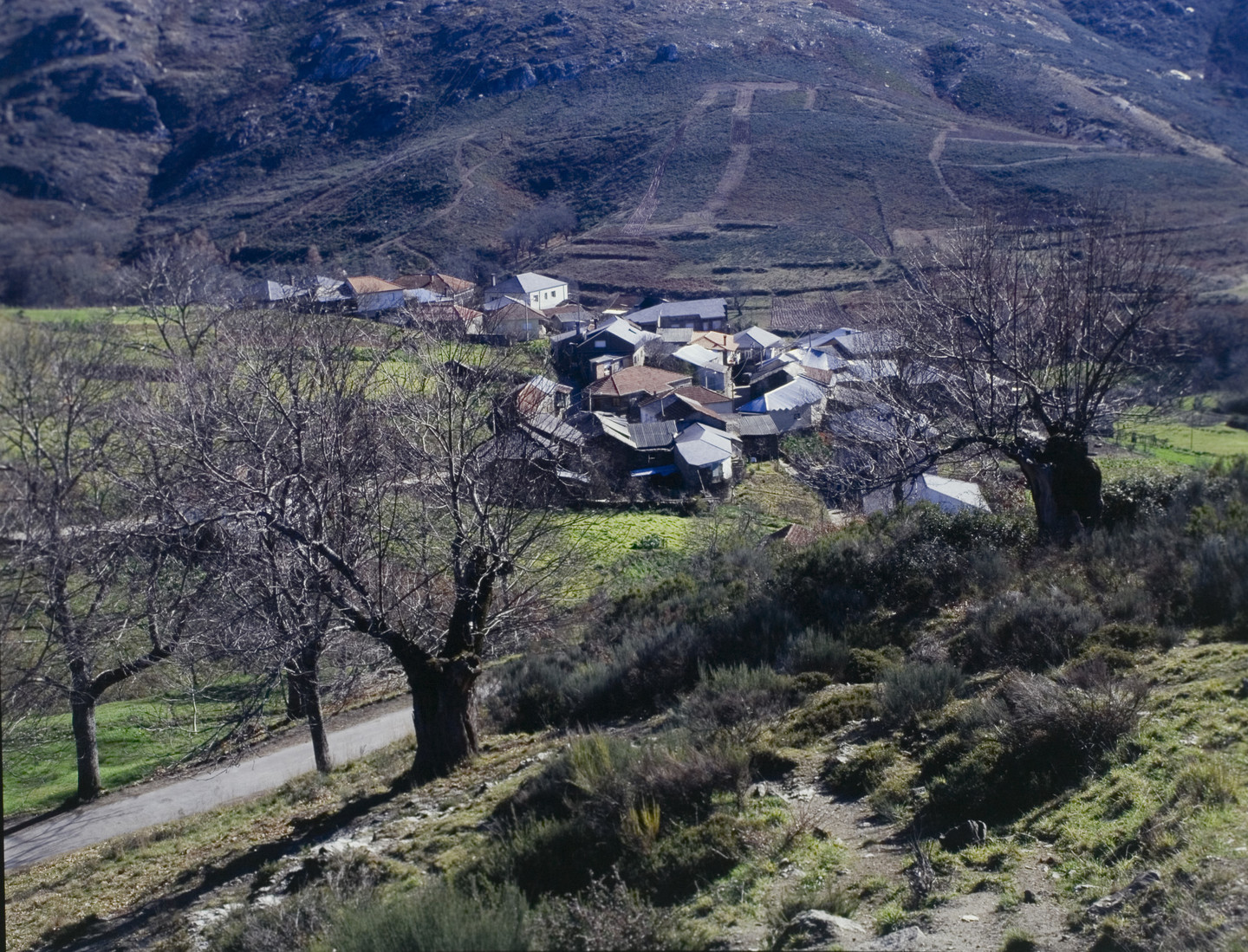 Landscape in A Gudiña
A Gudiña is the south-eastern gateway into Galicia from Sanabria via A Mezquita and A Portela da Canda. Historically it was a transit point through which mule drivers, harvest workers and pilgrims had to pass. A Gudiña, close to the Portuguese border, thus became a dynamic town which welcomed travellers. With modern transport infrastructures, this is still true today.
The upper part of A Gudiña, retains its old layout of small streets centring on the Rúa Maior, along which the Vía da Prata passes. In the main square, beside the church of San Martiño and San Pedro, the Way divides: the southern route heading to Verín and the northern route towards Laza, along the Old Route or Verea dos Galegos.
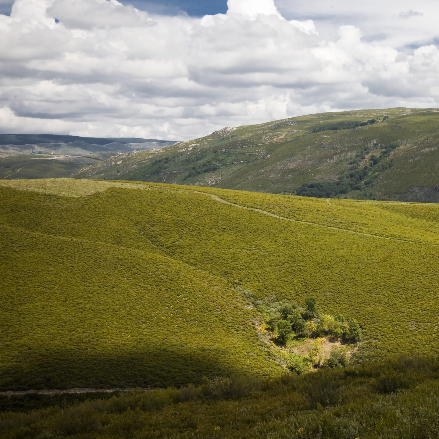 Seca mountains in A Gudiña
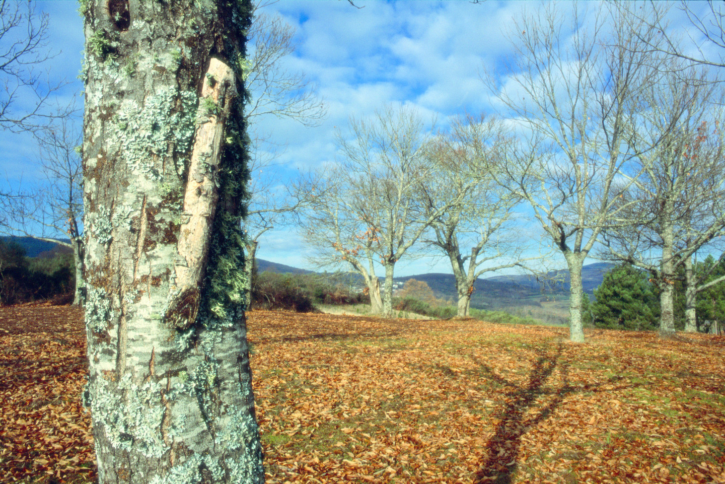
After leaving A Gudiña the route runs through the Seca mountains, an isolated, windy spot with sweeping views of the valleys. The area contains fields, scrubland and a few chestnut trees, whose colours delight travellers in autumn. The route gradually ascends to Alto do Espiño, a pass situated at an altitude of around 1,000 metres.
Along the way there are a number of old inns in strategically placed small villages that grew up to serve the mule drivers and reapers travelling to the harvest in Castile. After passing Venda do Espiño, the route takes us to Venda da Teresa, where it leaves the Vía da Prata and turns towards Vilariño de Conso.
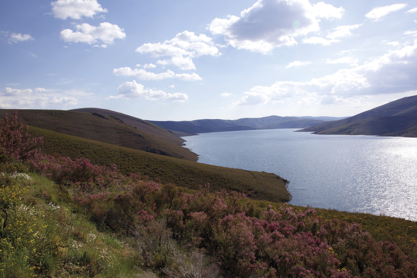 Invernadeiro Natural Park
The Invernadeiro Natural Park’s fine green slopes contrast with the rocks on the mountain tops and the snow seen in the area’s harsh winters. The landscape is shaped by a series of furrows formed by the streams that run down to the River Camba, which flows into the As Portas reservoir here.
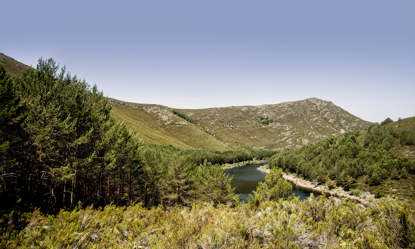
The River Conso (or Cerveira) is at the heart of an exceptionally beautiful area. The narrow valley is extraordinarily lovely, and also contains numerous relics of its cultural heritage.
On the sheer sides of the O Invernadeiro buttresses, overlooking the Conso valley, runs a Roman road, a secondary branch of the Via Nova, showing the strategic importance of the area. The stone road crosses the mountainside half way above the river, between Edrada and San Mamede.
At Pradoalbar, a bridge known as the Pontón de Pedra (or Ponte Romana, although the historical connection is questionable) crosses the Conso and the path leads on to the remains of the Castelo da Cerveira, a fortified stronghold in the heart of the Serra de Queixa.
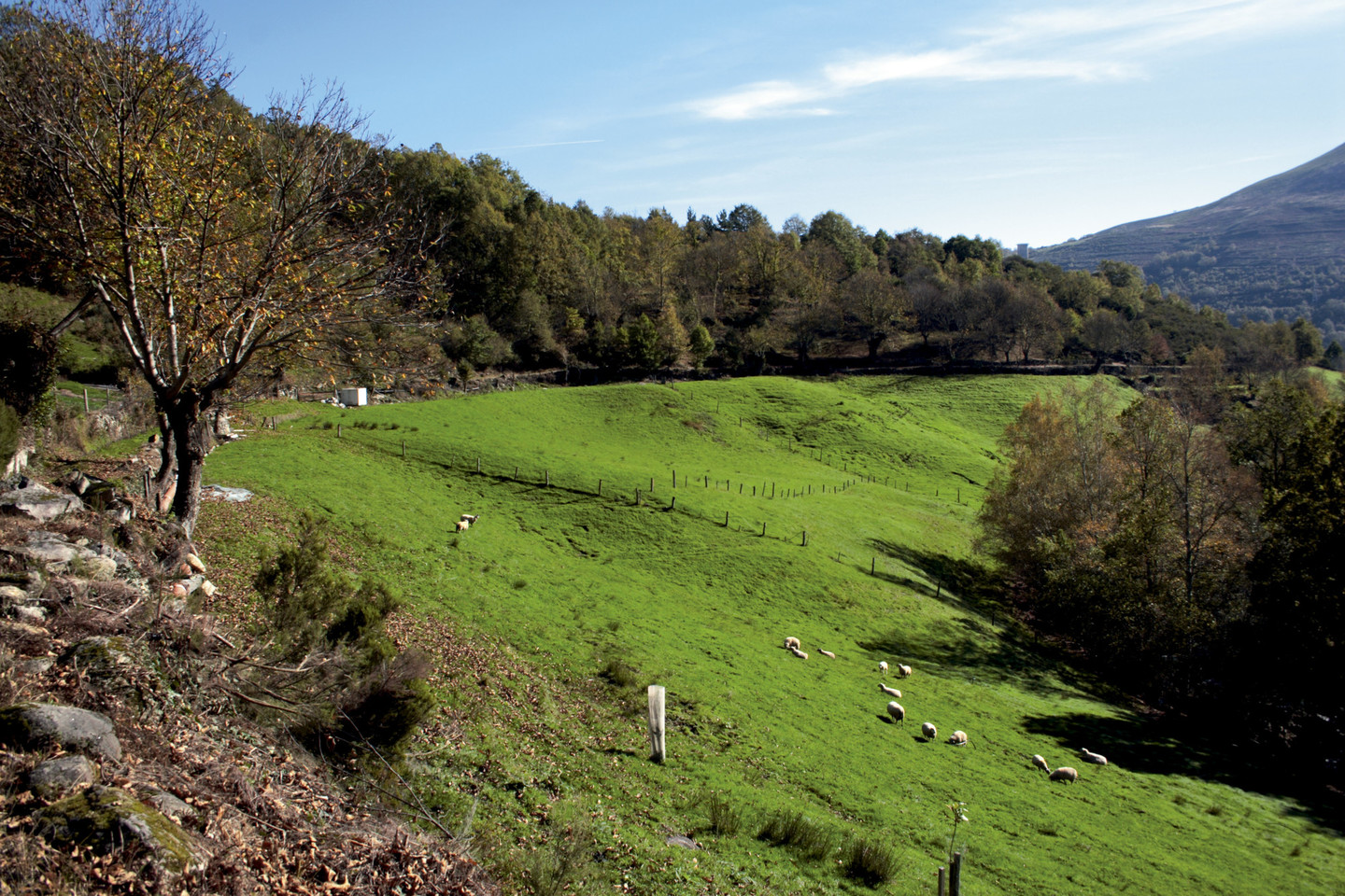 Green fields and dense groves of trees at River Conso
The turning to Pradoalbar leads into an idyllic world of groves and meadows at the entrance to the Conso valley. The streams and rivulets that flow down from O Invernadeiro form waterfalls (known locally as corgos) where they reach the river. The waterfalls at Gorbias, Val do Cenza and Suafraga are a magnificent sight in the distance.
Edrada, a small village perched on a slope by the River Conso, can justly claim to have one of the best conserved settings in Galicia, its buildings perfectly in balance with its natural surroundings of waterfalls, green fields and dense groves of trees.
Pradoalbar marks the end of the route, in a peaceful valley in the upper reaches of the river. It is notable for its church and the old stone enclosures on the irregularly shaped plots of farmland. It is the entry point to O Invernadeiro and its most secluded point.
According to popular tradition, there was once a werewolf in the county of Viana. He is said to have been killed at a bridge, which could well be the bridge at Pradoalbar. There are numerous stories associated with the region, some true and others, like this one, merely legends.
Don't Miss
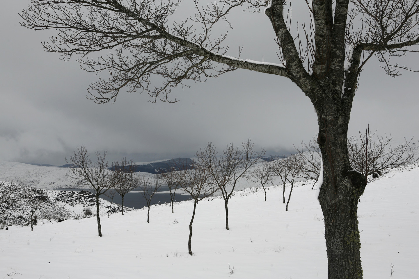 Portas Reservoir in winter
The As Portas lookout point offers spectacular panoramas of the O Invernadeiro Natural Park and the River Camba, which flows here into the As Portas reservoir (completed in 1974). Located very close to the dam, looking over its inner wall, the As Portas lookout point is like a balcony above the water, with a dramatic drop to the river below.
Opposite, rising above the waters, streams flow down from O Invernadeiro, some from heights greater than 1,500 metres (the A Pereisada pass, for example, at 1,501 metres).
The O Invernadeiro Natural Park forms part of Ourense’s central massif, a mountain range that runs across the province from east to west forming its backbone. The Queixa and Fial das Cordas mountain ranges define an area of nearly 6,000 hectares which was declared a Natural Park in 1997.
O Invernadeiro is a mountainous area where snow is frequent. Its granite rocks are covered by scrubland with heather, whose colour changes with the seasons. To protect the park’s unique natural character visitors must obtain a permit to enter it. It is the only uninhabited natural park in Galicia, as there are no centres of population within it.
At the windswept lookout point at As Portas, enjoy the silence in a place where time has stopped, where the winters are long and the summers hot.
