


EUROVELO 1 IN THE IBERIAN PENINSULA AND GALICIA
Atlantic Coast Route
In the Iberian Peninsula, EuroVelo 1 travels 1,685 km from Irún to Ayamonte at the Portuguese border, passing through diverse landscapes in Navarra, La Rioja, Castilla y León, Extremadura, and Andalucía. It crosses the Atlantic Pyrenees from France, into the lush lands of Navarra, past Pamplona, and along part of the Camino de Santiago before reaching La Rioja, where cyclists can visit the historic monasteries of Yuso and Suso in San Millán de la Cogolla.
In Castilla y León, the route intersects four historic trails: the Camino de Santiago, the Canal de Castilla, the Duero Route, and the ancient Roman road of the Vía de la Plata. The Vía de la Plata guides cyclists into Extremadura, across the Béjar Pass and through the region’s landscapes to the Andalusian mountains in Huelva. Highlights include the historic cities of Cáceres and Mérida, both UNESCO World Heritage Sites, and the beautiful dehesa landscape.
The final stretch before Portugal passes through the mining region of the River Tinto, then continues via the Columbian sites and the city of Huelva, ending on the Atlantic coast with its sweeping sandy beaches.
Stretching over 11,704 km, the EuroVelo 1 “Atlantic Coast Route” runs north to south along Europe’s Atlantic coast. Beginning in Norway among its majestic fjords, the route crosses the North Sea to the British Isles, travels along the Irish coast, and returns to Great Britain along the coasts of Wales and Cornwall. It then heads back to mainland Europe, following France’s Atlantic coast before cutting through inland Spain from the Pyrenees to the Portuguese border. From there, it rejoins the Atlantic coast and heads north to the Galician border at the international bridge over the River Miño. In Galicia, the route follows the Atlantic coast through the provinces of Pontevedra and A Coruña, where it connects with EuroVelo 3, the “Pilgrims Route”, in the town of Cee, and continues with it to Cape Fisterra.
Discover the EuroVelo 1 route in Galicia through its stages or sections. A new way to explore the most representative places along this Atlantic route, which will take you along the coast of the provinces of Pontevedra and A Coruña. The stages are structured so that at the beginning and end of each one you will find services such as accommodation, food, and transport, among others.
| Altitude difference + | Altitude difference - | Maximum height | Minimun height | Departure altitude | Arrival altitude | |
|---|---|---|---|---|---|---|
Distance 536,7 Km | 6.495 m | 6.383 m | 197 m | 0 m | 17 m | 131 m |


Eurovelo 1
(TUI - BAIONA) • 74,04 km
This stage begins along the River Miño, passing through Tui, Tomiño, and O Rosal before reaching the dramatic river mouth at A Guarda, with monte de Santa Trega rising in the background, one of Galicia’s most iconic landscapes.
From the fishing village of A Guarda, the route follows a coastal cycle lane northward along a rugged shoreline, sharing parts of the path with the Portuguese Coastal Camino. It continues through Oia, known for its Cistercian monastery, before reaching the seaside town and tourist hub of Baiona.
Baiona was the first place in Europe to hear of Columbus’ successful voyage to America, when the caravel Pinta arrived on 28 February 1493.
 Miño International Bridge (Tui)
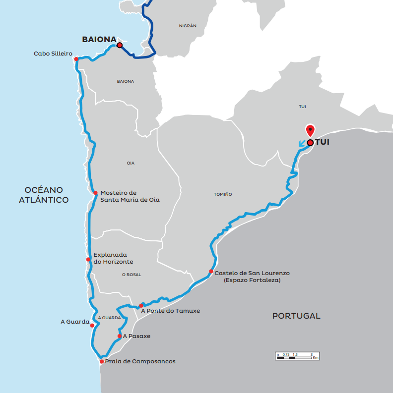 Mapa Section 1
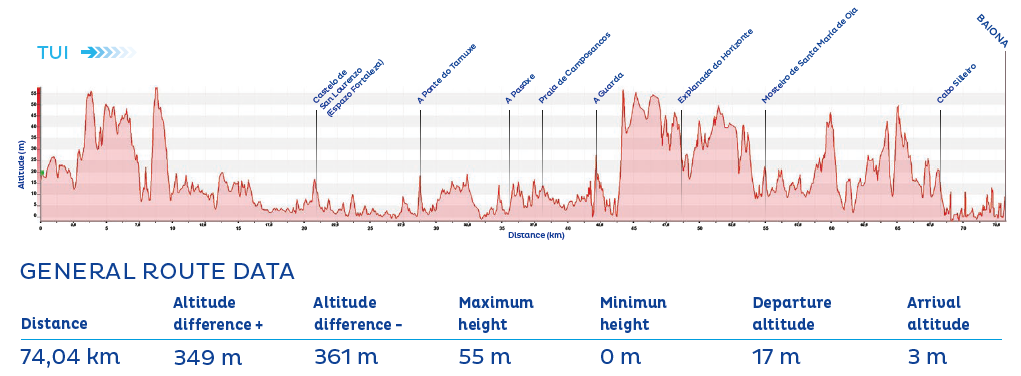 Perfil Section 1
Eurovelo 1
(BAIONA - REDONDELA) • 42,27 km
From Baiona, the route follows the cycle path towards the Foz do Miñor estuary, a wonderful spot for observing the rich birdlife of the marshlands. Passing near the medieval bridge of Ramallosa, it continues to the popular and extensive beach of Praia América, which stretches as far as the port of Panxón. From here, cyclists head north to the inlet of Samil and pedal through the city of Vigo on its cycle paths. The route then follows the “Senda da Auga” (Water Path), offering stunning panoramic views of the Vigo estuary and the Rande Bridge.
In Redondela, the impressive railway viaducts, built between the 1870s and 1880s, stand out as major landmarks.
 Senda da Auga (Vigo)
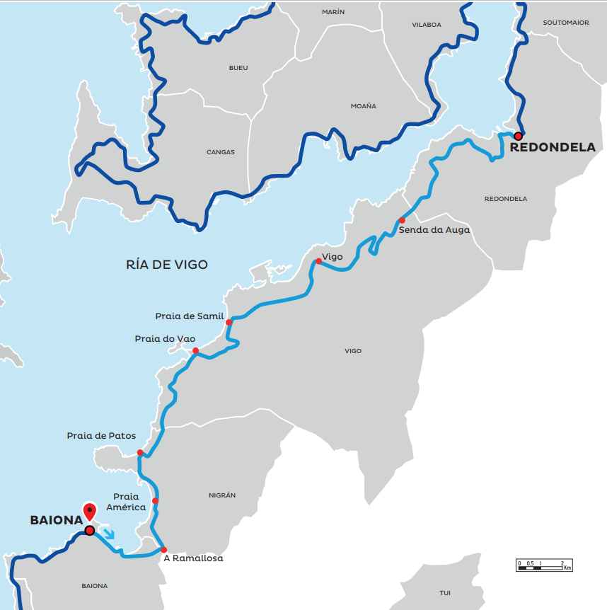 Map of Section 2
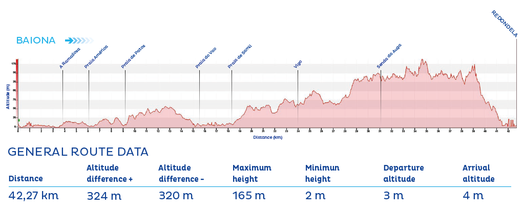 Profile of Section 2
Eurovelo 1
(REDONDELA - MOAÑA) • 35,73 km
The route skirts Praia de Cesantes and climbs to connect with the Portuguese Camino at the Ponte Sampaio, a medieval bridge built on Roman foundations. It then passes the ancient Ulló Salt Pans in Vilaboa and continues towards the modern Rande Bridge, following the inlet of San Simón in the Vigo estuary. At low tide, a green plain is revealed, rich in shellfish such as Arcade oysters, and a haven for aquatic birds.
Culturally, the inlet is anchored by the islands of San Simón and Santo Antón, which served variously as a monastic site, quarantine station, and concentration camp during the Spanish Civil War. A visitor centre explains the islands’ long history. They can be visited in high season from the ports of Cesantes (Redondela) and Santo Adrán de Cobres (Vilaboa).
 Ponte Sampaio (Soutomaior)
 Map of Section 3
 Profile of Section 3
Eurovelo 1
(MOAÑA - BUEU) • 43,17 km
The undisputed stars of this stage are the Cíes Islands, which cyclists can view while exploring the O Morrazo Peninsula. The islands form part of the Atlantic Islands of Galicia National Park, created in 2002, along with Ons, Sálvora, and Cortegada islands. Several stretches of the route offer breathtaking views of this natural paradise, especially from the cliffs at Donón along the Costa da Vela.
The final part of the stage follows the contour of the Ría de Aldán and passes numerous beaches such as Menduíña, Area de Bon, Lagos, and Ancoradouro before arriving in the coastal town of Bueu.
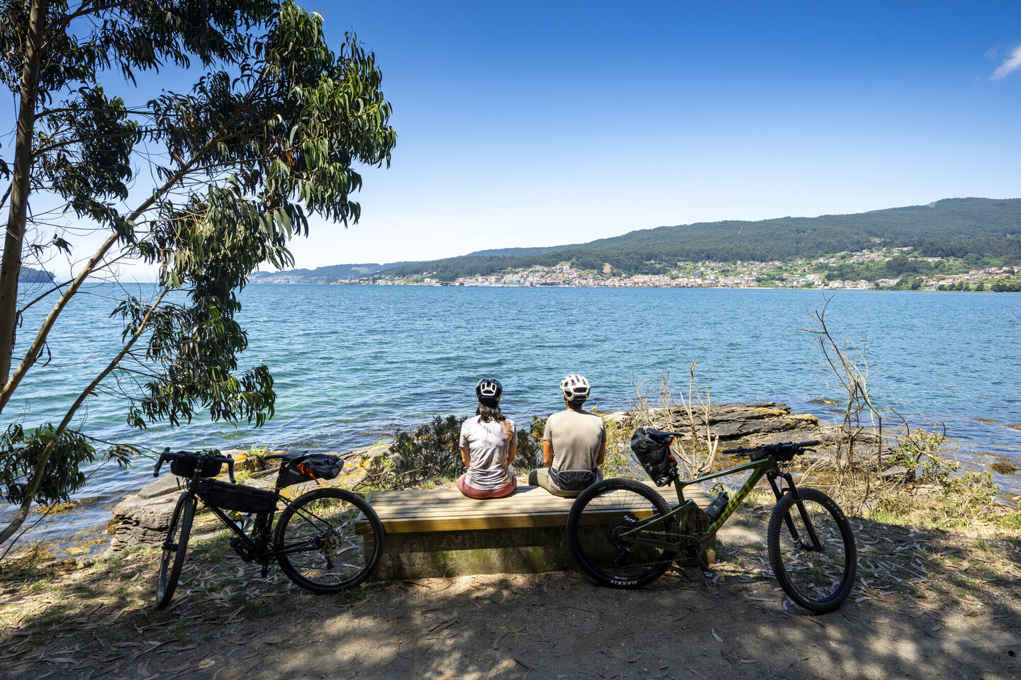
 Costa da Vela (Cangas)
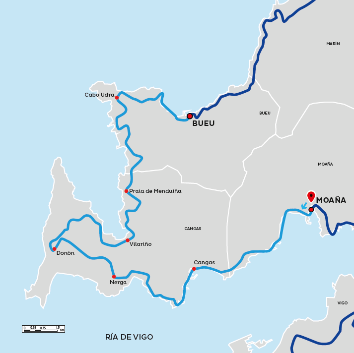 Map of Section 4
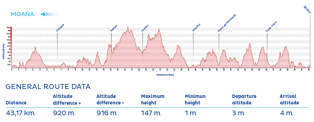 Profile of Section 4
Eurovelo 1
(BUEU - PORTONOVO) • 46,96 km
From Bueu, the route follows nearly the entire perimeter of the Ría de Pontevedra. At the heart of the Rías Baixas, cyclists will discover a scenic coastal setting with numerous beaches perfect for swimming and enchanting coastal paths.
The city of Pontevedra warrants a stop: noble, vibrant, full of café terraces, with a beautifully preserved historic centre and pedestrian-friendly urban design that led the UN to name it “Europe’s most comfortable city to live in” in 2014.
Don’t miss Combarro, listed as a Historic-Artistic Site and a perfect example of traditional Galician architecture, where fishermen’s houses are flanked by hórreos (stone granaries) and cruceiros (stone crosses). This stage ends in Sanxenxo, a major tourist destination known for its high-quality beaches and lively summer atmosphere.
 Senda litoral (Poio)
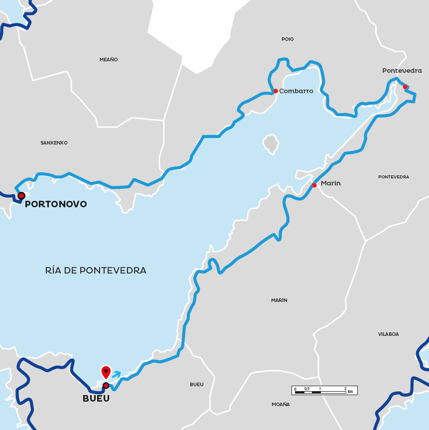 Map of Section 5
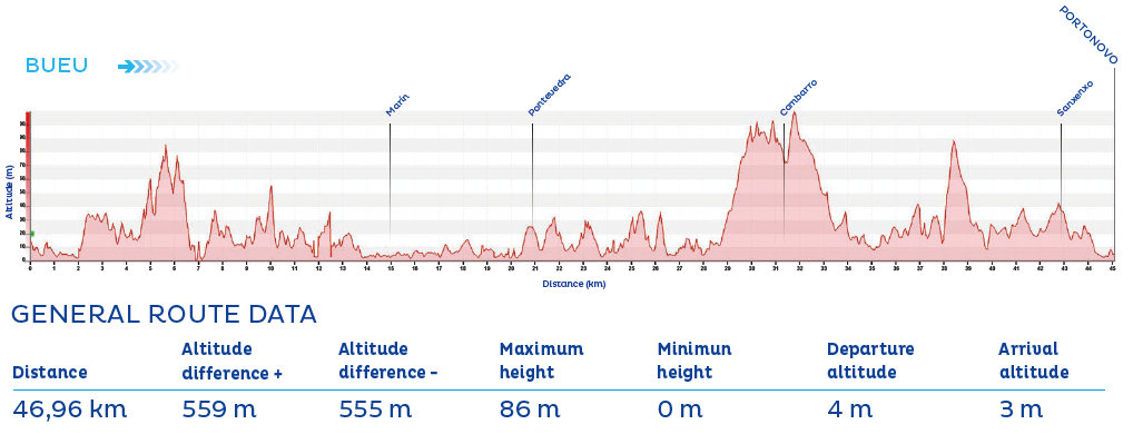 Profile of Section 5
Eurovelo 1
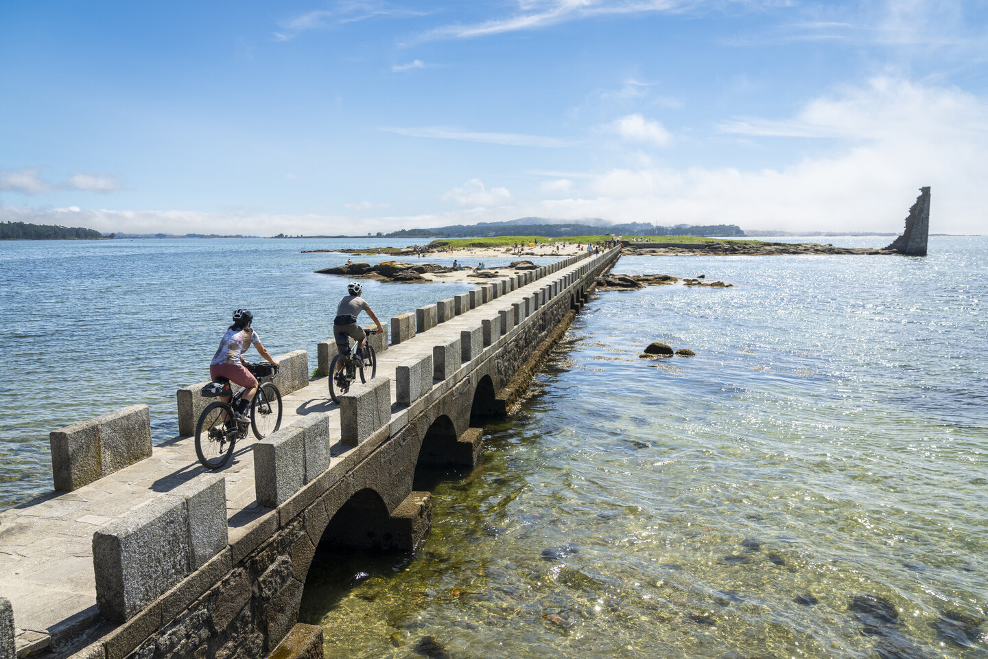
(PORTONOVO - TORRES DE OESTE) • 60,55 km
The route leads to A Lanzada beach, a 2.5 km stretch of sand forming the isthmus of the O Grove peninsula. This stage offers superb views of the island of Ons.
Entering the Ría de Arousa via the O Grove inlet, the route passes through Cambados and continues towards the bridge linking to A Illa de Arousa. At this point, the route follows the “O Terrón” trail, part of the Vilanova de Arousa hiking network, before entering the urban centre of Vilagarcía de Arousa via a cycle lane.
The route then turns inland along the River Ulla, towards the Catoira marshes, to reach the Torres de Oeste, a defensive complex built to repel Viking attacks. On the first Sunday of August, a festival commemorates Galicia’s defence against the Norse incursions.
 Ponte da Torre de San Sadurniño (Cambados)
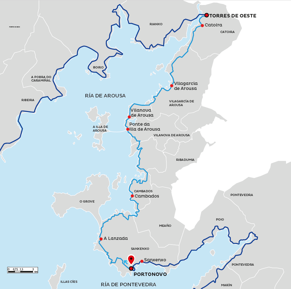 Map of Section 6
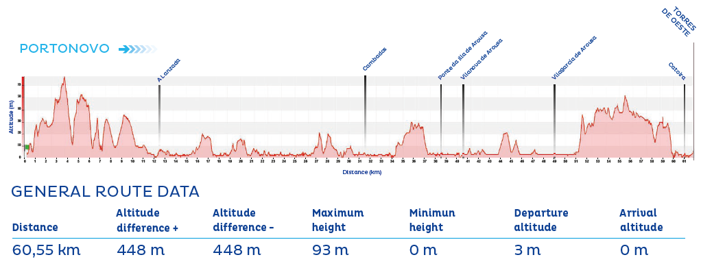 Profile of Section 6
Eurovelo 1
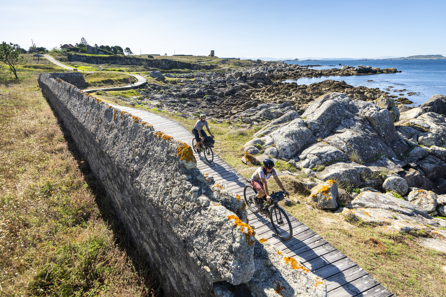
(TORRES DE OESTE - SANTA UXÍA DE RIBEIRA) • 62,31 km
This stage runs along the northern side of the Ría de Arousa, crossing the O Barbanza Peninsula. It is a route packed with highlights: a coastline dotted with countless beaches and viewpoints, and a rich heritage of seafaring and monumental landmarks. Among the cultural offerings are several museums, such as the one dedicated to the Galician writer Valle-Inclán in A Pobra do Caramiñal; prehistoric sites like the castro of Neixón in Boiro; stately homes such as the Pazo de Martelo in Rianxo; and the bustling fishing port of Santa Uxía de Ribeira.
A wide range of routes - provincial roads, cycle lanes, coastal paths and promenades - pass through numerous villages, making this a varied and engaging section of the journey.
 Camiño do Barbanza (Ribeira)
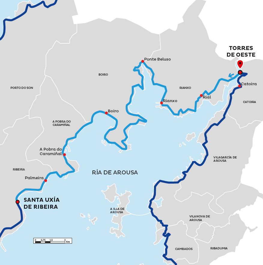 Map of Section 7
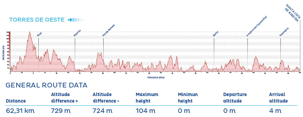 Profile of Section 7
Eurovelo 1
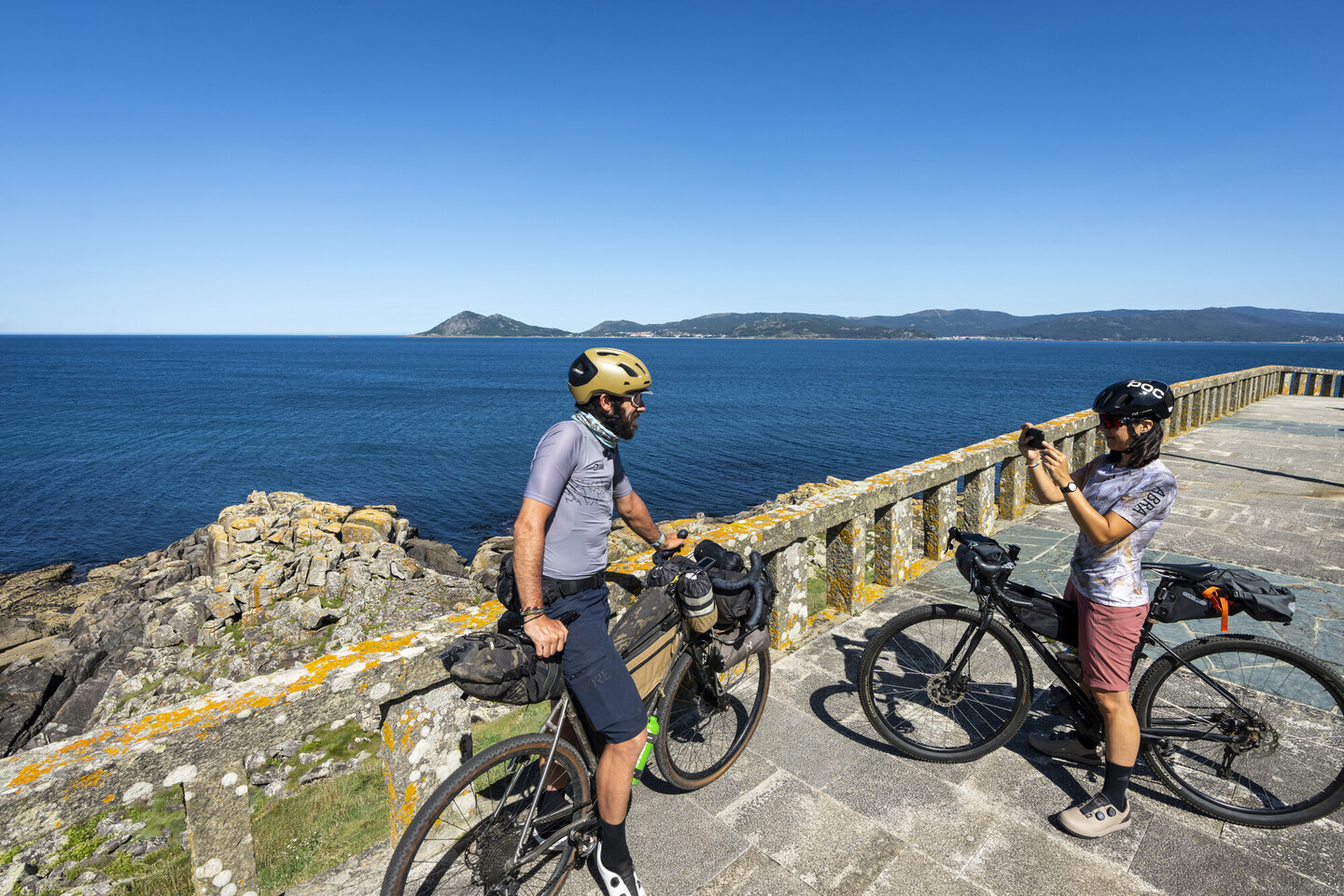
(SANTA UXÍA DE RIBEIRA - NOIA) • 66,11 km
At the western tip of the O Barbanza Peninsula lies the Corrubedo Natural Park and the Carregal and Vixán lagoons, home to the largest mobile dune in Galicia. This natural landmark marks the transition between the Rías of Arousa and Muros e Noia.
Before reaching the fishing village of Porto do Son, cyclists are encouraged to visit the Castro de Baroña, a well-preserved archaeological site that offers insight into the lives of the Gallaecian people before the arrival of the Romans. It is also one of the most photographed sites on the Galician coast.
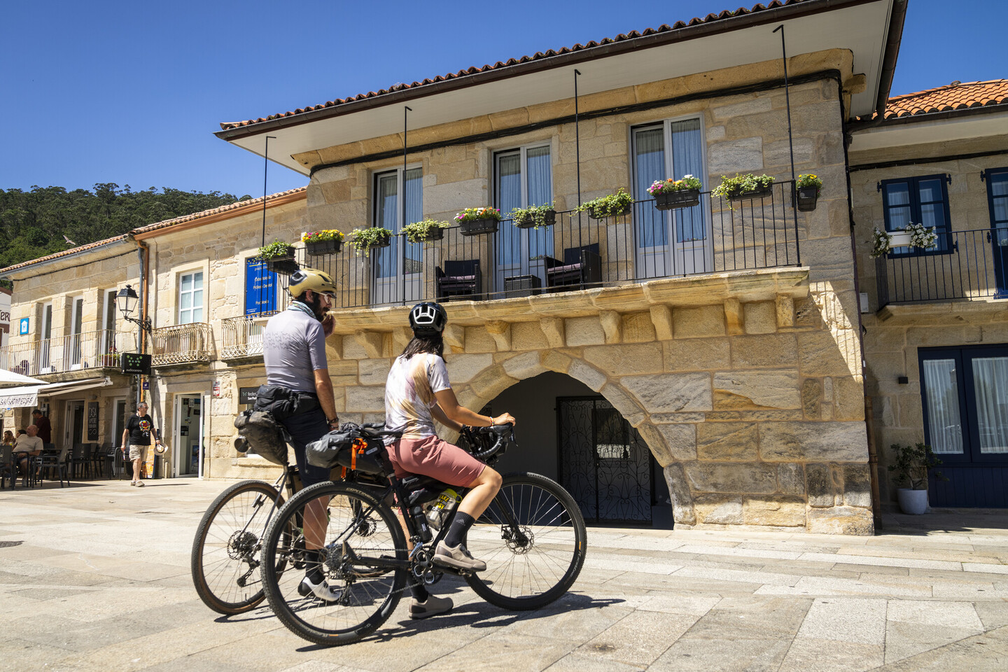
After passing through the village of Portosín, this stage ends in Noia—a town with medieval origins, whose historic centre reflects its noble past and deep ties to the sea and to stone.
 Miradoiro da Atalaia (Porto do Son)
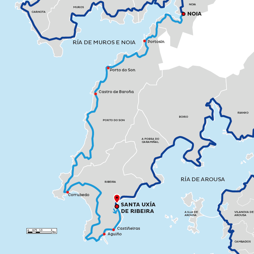 Map of Section 8
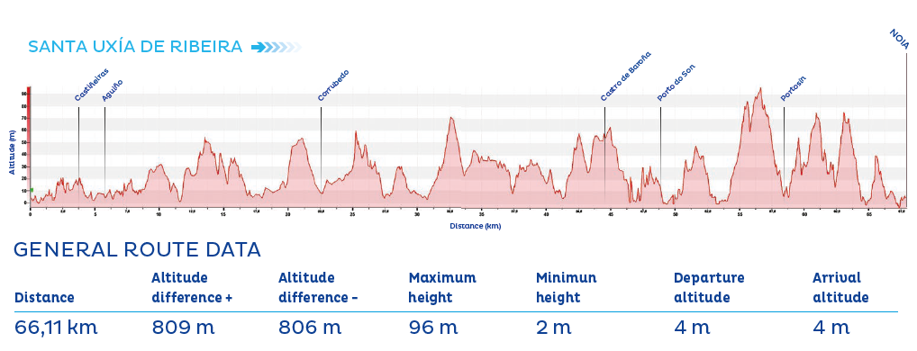 Profile of Section 8
Eurovelo 1
(NOIA - MUROS) • 45,78 km
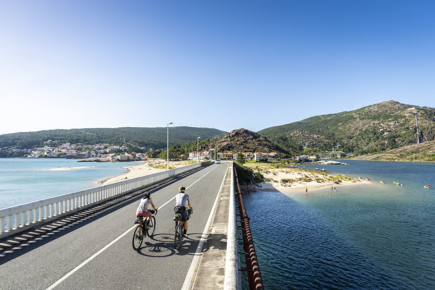
This section follows the northern coast of the Ría de Muros e Noia. Although the sea is less visible in the early parts compared to previous stages, the route still holds great appeal. In the municipality of Outes, the route runs between mountains close to the sea and gentle coastal valleys with beaches. As it progresses, it opens up to broader coastal views, passing through trails and old shipyards, reminders of the area’s important maritime heritage.
The stage concludes in the town of Muros, which boasts one of Galicia’s most beautiful historic quarters. Of medieval origin, it was declared a Historic-Artistic Site in 1970.
 Curro da Praza (Muros)
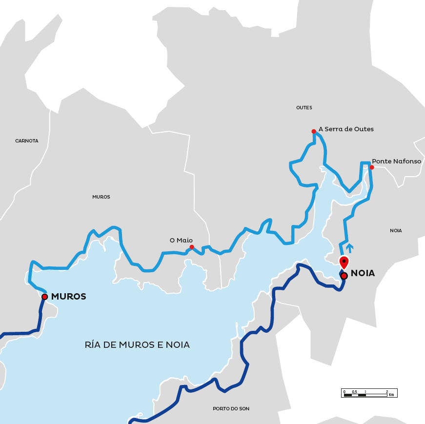 Map of Section 9
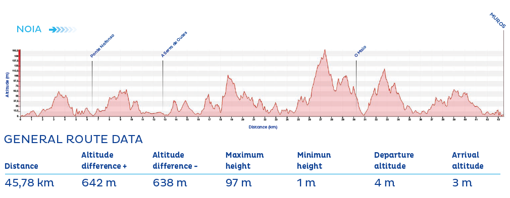 Profile of Section 9
Eurovelo 1
(MUROS - CABO FISTERRA) • 59,77 km
From Muros, the path opens once again to the Atlantic Ocean. This final stage offers a wealth of natural, scenic, and cultural treasures. Notable sights include the As Xarfas (or Louro) lagoon at Area Maior beach; the hórreos of Lira and Carnota, among the longest in Galicia; and the wild, spectacular beaches of Lariño, Carnota, and Langosteira. Also unmissable is the Ézaro Waterfall, formed by the River Xallas, which is said to be the only waterfall in Europe that flows directly into the sea.
From Cee, EuroVelo 1 and EuroVelo 3 share their final stretch, climbing together towards the Fisterra lighthouse and ending at the legendary Km 0 of the Camino de Santiago, at the cape at the end of the world.
 Ponte de Ézaro (Dumbría)
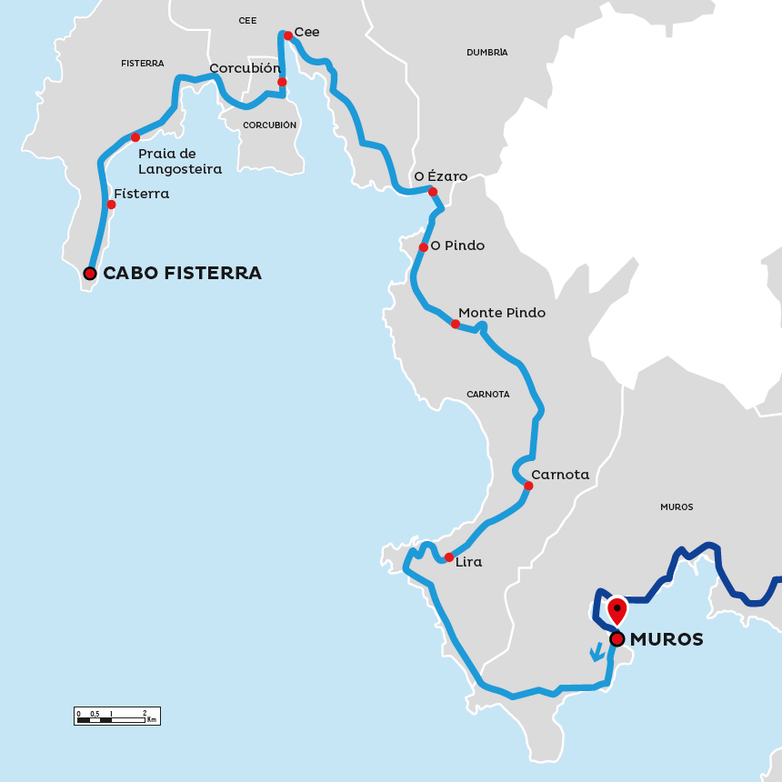 Map of Section 10
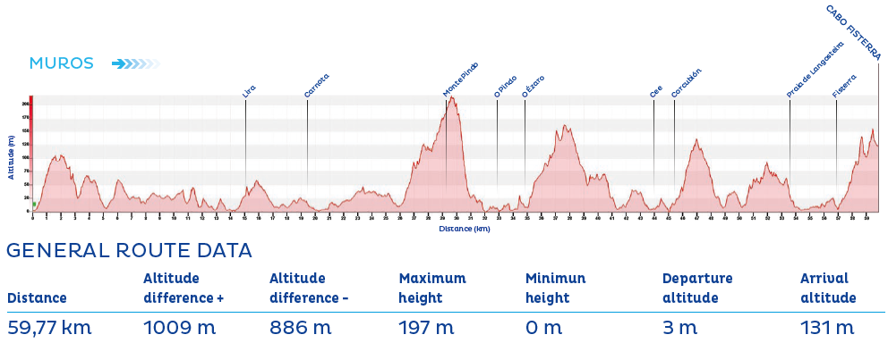 Profile of Section 10
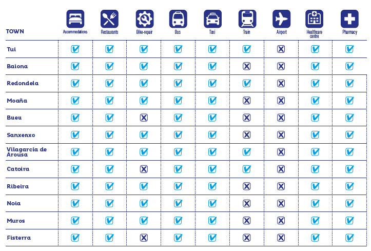 Services in the towns
Recommendations
- It is recommended to wear a helmet.
- Don’t forget to check the bike’s condition.
- Find out about the route’s technical aspects and the day’s weather forecast.
- Always carry water, warm clothes, a repair kit and a properly charged mobile phone.
- You must obey the signs along the route, give priority to pedestrians and comply with the general traffic rules.
- You can download the routes’ tracks on the website www.turismo.gal
- You can maintain the route notifying of any incidents regarding the conditions of and signs along the paths using the email eurovelo.turismo@xunta.gal
 Signals